![](/images/other/stat-length.png)
![Excursión Senderismo Vitrolles - Pic de Crigne - Photo](https://media.geolcdn.com/t/1900/400/c57ec1d9-7b0a-459e-886f-cd7864baade1.jpg&format=pjpeg&maxdim=2)
Pic de Crigne
PapouBertrand
Usuario
![Longitud](/images/other/stat-length.png)
![Altitud máxima](https://static1.geolcdn.com/siteimages/upload/files/1508320355ic_sort_altitude_max_24dp.png)
![Desnivel positivo](https://static1.geolcdn.com/siteimages/upload/files/1508320355ic_sort_den_pos_24dp.png)
![Km-Effort](/images/other/stat-length.png)
![Altitud mínima](https://static1.geolcdn.com/siteimages/upload/files/1508320355ic_sort_altitude_min_24dp.png)
![Desnivel negativo](https://static1.geolcdn.com/siteimages/upload/files/1508320355ic_sort_den_neg_24dp.png)
![Boucle](https://static1.geolcdn.com/siteimages/upload/files/16400158638029165_repeat_loop_refresh_sync_direction_icon.png)
![Senderismo](https://static1.geolcdn.com/sitytour/trail-icons/101.png)
5h33
Dificultad : Muy difícil
![Escanee este código QR para abrir la excursión en la aplicación SityTrail](https://capi.geolives.com/qq0zvz2zws4bq2lad0pu/sitytour/trails/2959401/qr.png?size=200)
Aplicación GPS de excursión GRATIS
A propósito
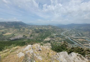
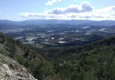
Ruta Senderismo de 11,6 km a descubrir en Provenza-Alpes-Costa Azul, Altos Alpes, Vitrolles. Esta ruta ha sido propuesta por PapouBertrand.
Descripción
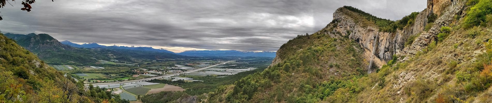
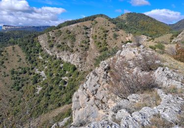
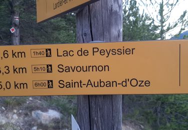
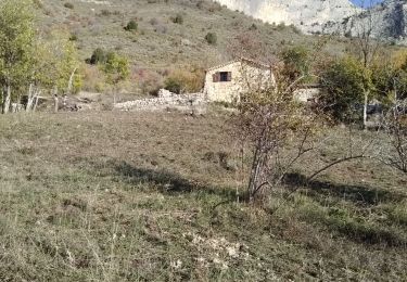
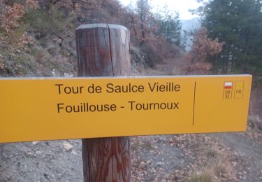
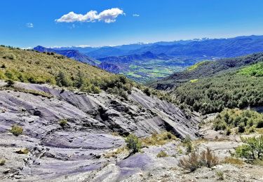
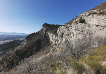
Jolie Rando au Pic de Crigne par la face Nord avec un départ différent de l'arrivée (2 voitures). Sous l'arrête finale il faut y mettre les mains sur un ou deux courts passage.
Le cheminement en terrasse sur la face sud est toujours équipé d'une corde.
Localización
Comentarios
Excursiones cerca
![Excursión Senderismo Monêtier-Allemont - le pic de Crigne - Photo](https://media.geolcdn.com/t/375/260/3216e3ac-fa23-434c-aac1-d06a9982e5b1.jpg&format=jpg&maxdim=2)
![Senderismo Senderismo](https://static1.geolcdn.com/sitytour/trail-icons/101.png)
Senderismo
![](/images/other/stat-length.png)
![](https://static1.geolcdn.com/siteimages/upload/files/16400158638029165_repeat_loop_refresh_sync_direction_icon.png)
![Excursión Senderismo Vitrolles - Pic de Crigne - Photo](https://media.geolcdn.com/t/375/260/8de24f96-abb9-4a59-92c3-86b70c658bb0.jpg&format=jpg&maxdim=2)
![Senderismo Senderismo](https://static1.geolcdn.com/sitytour/trail-icons/101.png)
Senderismo
![](/images/other/stat-length.png)
![](https://static1.geolcdn.com/siteimages/upload/files/16400158638029165_repeat_loop_refresh_sync_direction_icon.png)
![Excursión Senderismo Ventavon - col des selles vers pic de crigne - Photo](https://media.geolcdn.com/t/375/260/e38de5f2-bcbf-465e-9709-6640d810ac1b.jpg&format=jpg&maxdim=2)
![Senderismo Senderismo](https://static1.geolcdn.com/sitytour/trail-icons/101.png)
Senderismo
![](/images/other/stat-length.png)
![](https://static1.geolcdn.com/siteimages/upload/files/16400158638029165_repeat_loop_refresh_sync_direction_icon.png)
![Excursión Senderismo Esparron - ESPARON 05 . Lac de Peyssier . Col de Peyssier o s - Photo](https://media.geolcdn.com/t/375/260/0f9bb5cb-cbd8-4244-8a0b-6a9c6c8c6e0b.jpg&format=jpg&maxdim=2)
![Senderismo Senderismo](https://static1.geolcdn.com/sitytour/trail-icons/101.png)
Senderismo
![](/images/other/stat-length.png)
![](https://static1.geolcdn.com/siteimages/upload/files/16400158638029165_repeat_loop_refresh_sync_direction_icon.png)
![Excursión Senderismo Monêtier-Allemont - pic de Crigne - Photo](https://media.geolcdn.com/t/375/260/4385029e-383e-41cf-87d5-306f1333b6ec.jpg&format=jpg&maxdim=2)
![Senderismo Senderismo](https://static1.geolcdn.com/sitytour/trail-icons/101.png)
Senderismo
![](/images/other/stat-length.png)
![](https://static1.geolcdn.com/siteimages/upload/files/16400158638029165_repeat_loop_refresh_sync_direction_icon.png)
![Excursión Senderismo La Saulce - LA SAULCE . BOUCLE DE SERRE SOLEILLE O M - Photo](https://media.geolcdn.com/t/375/260/d0086269-db58-459a-b019-0f7f1d8312a2.jpg&format=jpg&maxdim=2)
![Senderismo Senderismo](https://static1.geolcdn.com/sitytour/trail-icons/101.png)
Senderismo
![](/images/other/stat-length.png)
![](https://static1.geolcdn.com/siteimages/upload/files/16400158638029165_repeat_loop_refresh_sync_direction_icon.png)
![Excursión Senderismo Esparron - Montagne de Rochefort via Esparron - Photo](https://media.geolcdn.com/t/375/260/a9afae64-dc46-4a24-9d5a-88e4f626d203.jpg&format=jpg&maxdim=2)
![Senderismo Senderismo](https://static1.geolcdn.com/sitytour/trail-icons/101.png)
Senderismo
![](/images/other/stat-length.png)
![](https://static1.geolcdn.com/siteimages/upload/files/16400158638029165_repeat_loop_refresh_sync_direction_icon.png)
![Excursión Senderismo Monêtier-Allemont - SityTrail - Pic de Crigne. - Photo](https://media.geolcdn.com/t/375/260/e57e7c6e-7b24-471d-a732-1162a0342581.jpg&format=jpg&maxdim=2)
![Senderismo Senderismo](https://static1.geolcdn.com/sitytour/trail-icons/101.png)
Senderismo
![](/images/other/stat-length.png)
![](https://static1.geolcdn.com/siteimages/upload/files/16400158638029165_repeat_loop_refresh_sync_direction_icon.png)
![Excursión Senderismo Claret - Tete de Boursier depart Claret - Photo](https://media.geolcdn.com/t/375/260/c93a942b-9518-4b3c-80a9-c6f6ef8e8c48.jpg&format=jpg&maxdim=2)
![Senderismo Senderismo](https://static1.geolcdn.com/sitytour/trail-icons/101.png)
Senderismo
![](/images/other/stat-length.png)
![](https://static1.geolcdn.com/siteimages/upload/files/16400158638029165_repeat_loop_refresh_sync_direction_icon.png)