


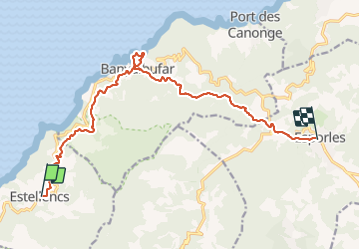


4,5 km | 6,2 km-effort

Usuario


Aplicación GPS de excursión GRATIS
 SityTrail
IGN / Institutos geográficos
SityTrail World
El mundo es suyo
Ruta Senderismo de 16,1 km a descubrir en Islas Baleares, Desconocido, Estellenchs. Esta ruta ha sido propuesta por dauzata.
GR221 La Ruta de Pedra en Sec
Bien balisé
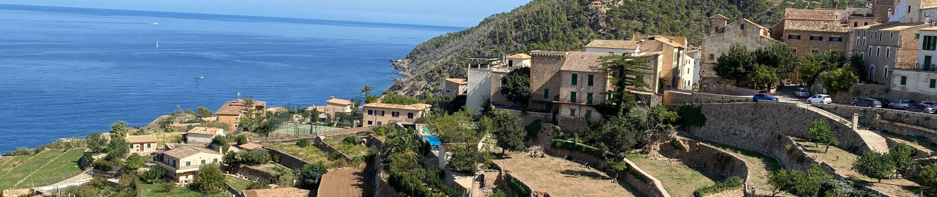
Petite boucle vers la plage (pas de sable) à Banyalbufar
Logements à Esporles: refuge Son Trias ou S'Hostal d'esporles (je recommande, hôtel centenaire)


23 fotos en total. Haga clic en una foto para mostrarlas todas en la galería.
A pie

Senderismo
Senderismo
Senderismo
Senderismo
superbe