![](/images/other/stat-length.png)
![Excursión Senderismo Argol - Argol en rose - Photo](https://media.geolcdn.com/t/1900/400/ext.pjpeg?maxdim=2&url=https%3A%2F%2Fstatic1.geolcdn.com%2Fsiteimages%2Fupload%2Ffiles%2F1553511878bg_sport_marche.png)
Argol en rose
Bobzebob
Usuario
![Longitud](/images/other/stat-length.png)
Longitud
11,8 km
![Altitud máxima](https://static1.geolcdn.com/siteimages/upload/files/1508320355ic_sort_altitude_max_24dp.png)
Altitud máxima
167 m
![Desnivel positivo](https://static1.geolcdn.com/siteimages/upload/files/1508320355ic_sort_den_pos_24dp.png)
Desnivel positivo
226 m
![Km-Effort](/images/other/stat-length.png)
Km-Effort
14,8 km
![Altitud mínima](https://static1.geolcdn.com/siteimages/upload/files/1508320355ic_sort_altitude_min_24dp.png)
Altitud mínima
34 m
![Desnivel negativo](https://static1.geolcdn.com/siteimages/upload/files/1508320355ic_sort_den_neg_24dp.png)
Desnivel negativo
227 m
![Boucle](https://static1.geolcdn.com/siteimages/upload/files/16400158638029165_repeat_loop_refresh_sync_direction_icon.png)
Boucle
Sí
Fecha de creación :
2021-09-19 07:18:46.923
Última modificación :
2021-09-19 10:25:31.666
![Senderismo](https://static1.geolcdn.com/sitytour/trail-icons/101.png)
3h22
Dificultad : Fácil
![Escanee este código QR para abrir la excursión en la aplicación SityTrail](https://capi.geolives.com/qq0zvz2zws4bq2lad0pu/sitytour/trails/2941270/qr.png?size=200)
Aplicación GPS de excursión GRATIS
A propósito
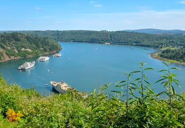
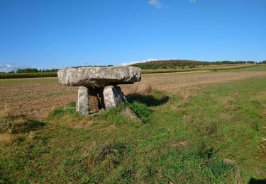
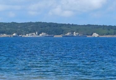
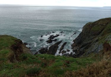
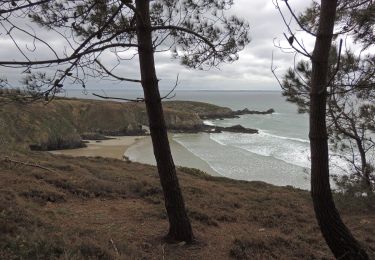
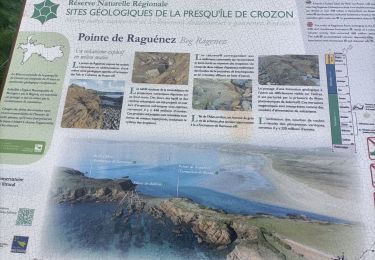
Ruta Senderismo de 11,8 km a descubrir en Bretaña, Finisterre, Argol. Esta ruta ha sido propuesta por Bobzebob.
Descripción
Randonnée organisée par Argol en rose, pour une bonne cause ; la lutte contre le cancer du sein. Unichons nous !
Localización
País:
France
Región :
Bretaña
Departamento/provincia :
Finisterre
Municipio :
Argol
Localidad:
Unknown
Salida:(Dec)
Salida:(UTM)
402272 ; 5344502 (30U) N.
Comentarios
Excursiones cerca
![Excursión Senderismo Landévennec - Le tour de Landévennec Boucle 21 km - Photo](https://media.geolcdn.com/t/375/260/b342935f-f644-482b-a93d-00e8e9a2fff9.jpg&format=jpg&maxdim=2)
![Senderismo Senderismo](https://static1.geolcdn.com/sitytour/trail-icons/101.png)
Le tour de Landévennec Boucle 21 km
Senderismo
Muy difícil
Landévennec,
Bretaña,
Finisterre,
France
![](/images/other/stat-length.png)
21 km | 28 km-effort
5h 10min
![](https://static1.geolcdn.com/siteimages/upload/files/16400158638029165_repeat_loop_refresh_sync_direction_icon.png)
Sí
![Excursión A pie Telgruc-sur-Mer - Du Ménez-Luz à la mer - Photo](https://media.geolcdn.com/t/375/260/ext.jpg?maxdim=2&url=https%3A%2F%2Fstatic1.geolcdn.com%2Fsiteimages%2Fupload%2Ffiles%2F1545311037marcheuse_200dpi.jpg)
![A pie A pie](https://static1.geolcdn.com/sitytour/trail-icons/100.png)
Du Ménez-Luz à la mer
A pie
Fácil
(1)
Telgruc-sur-Mer,
Bretaña,
Finisterre,
France
![](/images/other/stat-length.png)
12,2 km | 15 km-effort
3h 0min
![](https://static1.geolcdn.com/siteimages/upload/files/16400158638029165_repeat_loop_refresh_sync_direction_icon.png)
Sí
![Excursión Senderismo Saint-Nic - Saint Nic - boucle Ménez Hom et Dolmen de Ménez Lié - 11.1km 305m 3h10 - 2019 09 07 - Photo](https://media.geolcdn.com/t/375/260/f8f13a6f-f2d0-45cb-84dc-d3b1b35f6896.jpg&format=jpg&maxdim=2)
![Senderismo Senderismo](https://static1.geolcdn.com/sitytour/trail-icons/101.png)
Saint Nic - boucle Ménez Hom et Dolmen de Ménez Lié - 11.1km 305m 3h10 - 2019...
Senderismo
Fácil
Saint-Nic,
Bretaña,
Finisterre,
France
![](/images/other/stat-length.png)
11,1 km | 15,2 km-effort
3h 10min
![](https://static1.geolcdn.com/siteimages/upload/files/16400158638029165_repeat_loop_refresh_sync_direction_icon.png)
Sí
![Excursión Senderismo Landévennec - GR34 Rangoulic -- Lanvéoc - Photo](https://media.geolcdn.com/t/375/260/daf82018-5a85-440e-a8c3-587f360996b8.jpg&format=jpg&maxdim=2)
![Senderismo Senderismo](https://static1.geolcdn.com/sitytour/trail-icons/101.png)
GR34 Rangoulic -- Lanvéoc
Senderismo
Muy difícil
Landévennec,
Bretaña,
Finisterre,
France
![](/images/other/stat-length.png)
25 km | 33 km-effort
7h 26min
![](https://static1.geolcdn.com/siteimages/upload/files/16400158638029165_repeat_loop_refresh_sync_direction_icon.png)
No
![Excursión Senderismo Telgruc-sur-Mer - TELGRUC - Photo](https://media.geolcdn.com/t/375/260/608febd5-d174-42e3-8862-bb6190cd7fdb.jpg&format=jpg&maxdim=2)
![Senderismo Senderismo](https://static1.geolcdn.com/sitytour/trail-icons/101.png)
TELGRUC
Senderismo
Fácil
Telgruc-sur-Mer,
Bretaña,
Finisterre,
France
![](/images/other/stat-length.png)
13,2 km | 16,2 km-effort
3h 40min
![](https://static1.geolcdn.com/siteimages/upload/files/16400158638029165_repeat_loop_refresh_sync_direction_icon.png)
Sí
![Senderismo Senderismo](https://static1.geolcdn.com/sitytour/trail-icons/101.png)
TELGRUC
Senderismo
Difícil
Telgruc-sur-Mer,
Bretaña,
Finisterre,
France
![](/images/other/stat-length.png)
10,6 km | 13,8 km-effort
3h 8min
![](https://static1.geolcdn.com/siteimages/upload/files/16400158638029165_repeat_loop_refresh_sync_direction_icon.png)
Sí
![Excursión Marcha nórdica Telgruc-sur-Mer - teldruc yrez,_bellec - Photo](https://media.geolcdn.com/t/375/260/bb28c706-e2a1-4df6-a83c-a1e197a15e49.jpg&format=jpg&maxdim=2)
![Marcha nórdica Marcha nórdica](https://static1.geolcdn.com/sitytour/trail-icons/102.png)
teldruc yrez,_bellec
Marcha nórdica
Muy fácil
Telgruc-sur-Mer,
Bretaña,
Finisterre,
France
![](/images/other/stat-length.png)
13,6 km | 17,6 km-effort
3h 5min
![](https://static1.geolcdn.com/siteimages/upload/files/16400158638029165_repeat_loop_refresh_sync_direction_icon.png)
Sí
![Excursión Senderismo Telgruc-sur-Mer - TELGRUC - Photo](https://media.geolcdn.com/t/375/260/ext.jpg?maxdim=2&url=https%3A%2F%2Fservices.sitytrail.com%2FGeolivesWS%2FDownloadMedia.ashx%3FTrailID%3D1136416%26Media%3Dfix__20190418161058.jpg)
![Senderismo Senderismo](https://static1.geolcdn.com/sitytour/trail-icons/101.png)
TELGRUC
Senderismo
Fácil
Telgruc-sur-Mer,
Bretaña,
Finisterre,
France
![](/images/other/stat-length.png)
12,7 km | 15,7 km-effort
3h 16min
![](https://static1.geolcdn.com/siteimages/upload/files/16400158638029165_repeat_loop_refresh_sync_direction_icon.png)
Sí
![Excursión Senderismo Telgruc-sur-Mer - les chemins de Telgruc - Photo](https://media.geolcdn.com/t/375/260/ext.jpg?maxdim=2&url=https%3A%2F%2Fstatic1.geolcdn.com%2Fsiteimages%2Fupload%2Ffiles%2F1553511878bg_sport_marche.png)
![Senderismo Senderismo](https://static1.geolcdn.com/sitytour/trail-icons/101.png)
les chemins de Telgruc
Senderismo
Fácil
(1)
Telgruc-sur-Mer,
Bretaña,
Finisterre,
France
![](/images/other/stat-length.png)
13,2 km | 16,1 km-effort
3h 45min
![](https://static1.geolcdn.com/siteimages/upload/files/16400158638029165_repeat_loop_refresh_sync_direction_icon.png)
Sí