


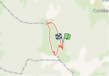

10,3 km | 24 km-effort


Usuario


Aplicación GPS de excursión GRATIS
 SityTrail
IGN / Institutos geográficos
SityTrail World
El mundo es suyo
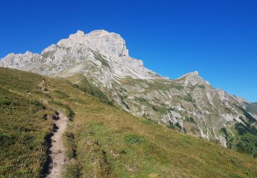
Ruta Senderismo de 5,6 km a descubrir en Auvergne-Rhône-Alpes, Isère, Châtel-en-Trièves. Esta ruta ha sido propuesta por rapako.
5km de route forestière non bitumée pour rejoindre la place de parking : prévoir un véhicule adéquat. Mais cela permet de faire une balade plus courte. 3 passages délicats en montant, dont un avec câble, , mais passage sans problème.

Senderismo

Senderismo

Senderismo

Senderismo
A pie

Senderismo

Senderismo

Senderismo

Senderismo