


13,6 km | 23 km-effort


Usuario


Aplicación GPS de excursión GRATIS
 SityTrail
IGN / Institutos geográficos
SityTrail World
El mundo es suyo
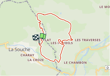
Ruta Senderismo de 8,8 km a descubrir en Auvergne-Rhône-Alpes, Ardecha, La Souche. Esta ruta ha sido propuesta por Odile Guillot.
Des Lioures au rocher du Midi puis aux Roudils pour revenir (boucle)
Très belle vue et notamment sur le volcan de Jaijac

Senderismo

Senderismo

Senderismo

Senderismo

sport

Senderismo
Senderismo
Senderismo
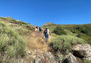
Senderismo