![](/images/other/stat-length.png)
![Excursión Senderismo Saumane - Bergeries du Contras depuis Saumane - Photo](https://media.geolcdn.com/t/1900/400/da4e74f4-8c5a-4948-a361-f265a8163503.jpg&format=pjpeg&maxdim=2)
Bergeries du Contras depuis Saumane
Daniel.BRUN-PICARD
Usuario
![Longitud](/images/other/stat-length.png)
![Altitud máxima](https://static1.geolcdn.com/siteimages/upload/files/1508320355ic_sort_altitude_max_24dp.png)
![Desnivel positivo](https://static1.geolcdn.com/siteimages/upload/files/1508320355ic_sort_den_pos_24dp.png)
![Km-Effort](/images/other/stat-length.png)
![Altitud mínima](https://static1.geolcdn.com/siteimages/upload/files/1508320355ic_sort_altitude_min_24dp.png)
![Desnivel negativo](https://static1.geolcdn.com/siteimages/upload/files/1508320355ic_sort_den_neg_24dp.png)
![Boucle](https://static1.geolcdn.com/siteimages/upload/files/16400158638029165_repeat_loop_refresh_sync_direction_icon.png)
![Senderismo](https://static1.geolcdn.com/sitytour/trail-icons/101.png)
3h23
Dificultad : Medio
![Escanee este código QR para abrir la excursión en la aplicación SityTrail](https://capi.geolives.com/qq0zvz2zws4bq2lad0pu/sitytour/trails/2890096/qr.png?size=200)
Aplicación GPS de excursión GRATIS
A propósito
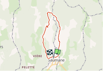
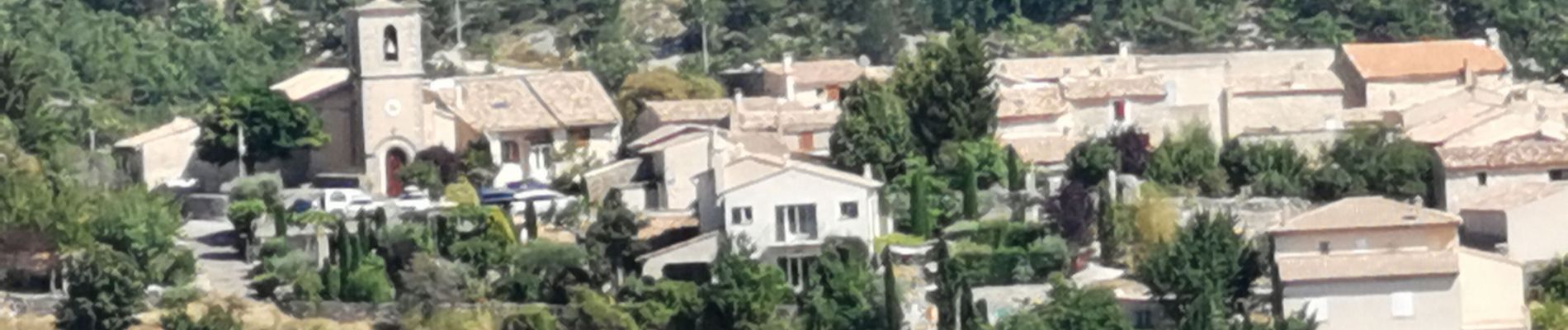
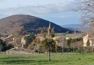
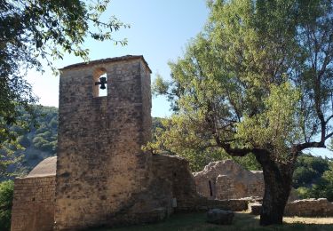
Ruta Senderismo de 12,1 km a descubrir en Provenza-Alpes-Costa Azul, Alpes de Alta Provenza, Saumane. Esta ruta ha sido propuesta por Daniel.BRUN-PICARD.
Descripción
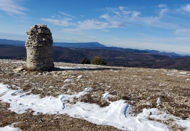
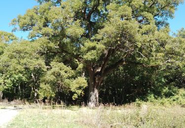
Très belle randonnée. La descente par un sentier ombragé est longue et assez raide. Attention, les troupeaux sont gardés par des patous très impressionnants. Il ne faut surtout pas paniquer, ni élever la voix, ni les menacer avec vos bâtons. Arrêtez-vous, laissez les vous renifler et repartez lentement, il vous suivront sur quelques dizaines de mètres puis vous regarderons vous éloigner et aboieront une dernière fois, comme pour vous saluer !
Localización
Comentarios
Excursiones cerca
![Excursión Senderismo Saumane - SAUMANE JAS DE LA CHAPELAINE O N ** - Photo](https://media.geolcdn.com/t/375/260/73ef4b4f-439c-401e-b91d-8b58dc5ccfd3.jpg&format=jpg&maxdim=2)
![Senderismo Senderismo](https://static1.geolcdn.com/sitytour/trail-icons/101.png)
Senderismo
![](/images/other/stat-length.png)
![](https://static1.geolcdn.com/siteimages/upload/files/16400158638029165_repeat_loop_refresh_sync_direction_icon.png)
![Excursión Senderismo Saumane - saumane goi contras 17.84kms 1090m - Photo](https://media.geolcdn.com/t/375/260/20c3a9ba-a0f5-4413-9bd6-d5e992059cd1.jpg&format=jpg&maxdim=2)
![Senderismo Senderismo](https://static1.geolcdn.com/sitytour/trail-icons/101.png)
Senderismo
![](/images/other/stat-length.png)
![](https://static1.geolcdn.com/siteimages/upload/files/16400158638029165_repeat_loop_refresh_sync_direction_icon.png)
![Excursión Senderismo Lardiers - lardiers.le jas du grand chêne - Photo](https://media.geolcdn.com/t/375/260/a20a7e86-9075-402d-9419-9da41fb93e79.jpg&format=jpg&maxdim=2)
![Senderismo Senderismo](https://static1.geolcdn.com/sitytour/trail-icons/101.png)
Senderismo
![](/images/other/stat-length.png)
![](https://static1.geolcdn.com/siteimages/upload/files/16400158638029165_repeat_loop_refresh_sync_direction_icon.png)
![Excursión Senderismo Lardiers - lardiers. du grand chêne à la bergerie inconnue - Photo](https://media.geolcdn.com/t/375/260/e56507b0-667f-45e8-a4de-a1d444c78beb.jpg&format=jpg&maxdim=2)
![Senderismo Senderismo](https://static1.geolcdn.com/sitytour/trail-icons/101.png)
Senderismo
![](/images/other/stat-length.png)
![](https://static1.geolcdn.com/siteimages/upload/files/16400158638029165_repeat_loop_refresh_sync_direction_icon.png)
![Excursión Senderismo La Rochegiron - larochegiron.fon martine - Photo](https://media.geolcdn.com/t/375/260/930a888f-876d-4f7e-b713-2559d56cf7a6.jpg&format=jpg&maxdim=2)
![Senderismo Senderismo](https://static1.geolcdn.com/sitytour/trail-icons/101.png)
Senderismo
![](/images/other/stat-length.png)
![](https://static1.geolcdn.com/siteimages/upload/files/16400158638029165_repeat_loop_refresh_sync_direction_icon.png)
![Excursión Senderismo L'Hospitalet - les bergeries de saumane. 1 - Photo](https://media.geolcdn.com/t/375/260/51fa219d-c840-498f-b20a-c82c3d653a33.jpg&format=jpg&maxdim=2)
![Senderismo Senderismo](https://static1.geolcdn.com/sitytour/trail-icons/101.png)
Senderismo
![](/images/other/stat-length.png)
![](https://static1.geolcdn.com/siteimages/upload/files/16400158638029165_repeat_loop_refresh_sync_direction_icon.png)
![Excursión Senderismo L'Hospitalet - saumane . les girons, clos guilhen, foureynard, la tour - Photo](https://media.geolcdn.com/t/375/260/ba947679-c7d3-47dc-86a0-f24c413ba15a.jpg&format=jpg&maxdim=2)
![Senderismo Senderismo](https://static1.geolcdn.com/sitytour/trail-icons/101.png)
Senderismo
![](/images/other/stat-length.png)
![](https://static1.geolcdn.com/siteimages/upload/files/16400158638029165_repeat_loop_refresh_sync_direction_icon.png)
![Excursión Senderismo La Rochegiron - la rochegiron 04.fon Martine, la blanchere, veire - Photo](https://media.geolcdn.com/t/375/260/1cfdc527-2f27-4eb2-bfbb-ee96eaef5c73.jpg&format=jpg&maxdim=2)
![Senderismo Senderismo](https://static1.geolcdn.com/sitytour/trail-icons/101.png)
Senderismo
![](/images/other/stat-length.png)
![](https://static1.geolcdn.com/siteimages/upload/files/16400158638029165_repeat_loop_refresh_sync_direction_icon.png)
![Excursión Senderismo L'Hospitalet - l hospitalet. les anglais.la plus haute grange.la bergerie sans nom - Photo](https://media.geolcdn.com/t/375/260/6910d221-eaf9-474a-baa1-e91b527643b8.jpg&format=jpg&maxdim=2)
![Senderismo Senderismo](https://static1.geolcdn.com/sitytour/trail-icons/101.png)
Senderismo
![](/images/other/stat-length.png)
![](https://static1.geolcdn.com/siteimages/upload/files/16400158638029165_repeat_loop_refresh_sync_direction_icon.png)
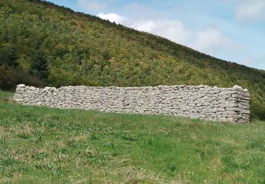
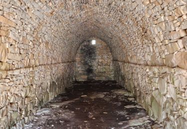
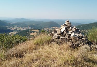
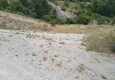
Certains passages difficiles (terre et cailloux complètement retournés sur une partie de l’aller, hautes herbes par endroits, zones de pâturage des moutons…) mais très belle randonnée ! Superbe point de vue en haut et très belles bergeries !
très belle randonnée