![](/images/other/stat-length.png)
![Excursión Senderismo Campestre-et-Luc - Campestre - Photo](https://media.geolcdn.com/t/1900/400/efbf11fd-a04d-4fac-a4bc-0e49cb208a80.jpg&format=pjpeg&maxdim=2)
Campestre
LBarel
Usuario
![Longitud](/images/other/stat-length.png)
![Altitud máxima](https://static1.geolcdn.com/siteimages/upload/files/1508320355ic_sort_altitude_max_24dp.png)
![Desnivel positivo](https://static1.geolcdn.com/siteimages/upload/files/1508320355ic_sort_den_pos_24dp.png)
![Km-Effort](/images/other/stat-length.png)
![Altitud mínima](https://static1.geolcdn.com/siteimages/upload/files/1508320355ic_sort_altitude_min_24dp.png)
![Desnivel negativo](https://static1.geolcdn.com/siteimages/upload/files/1508320355ic_sort_den_neg_24dp.png)
![Boucle](https://static1.geolcdn.com/siteimages/upload/files/16400158638029165_repeat_loop_refresh_sync_direction_icon.png)
![Senderismo](https://static1.geolcdn.com/sitytour/trail-icons/101.png)
1h55
Dificultad : Medio
![Escanee este código QR para abrir la excursión en la aplicación SityTrail](https://capi.geolives.com/qq0zvz2zws4bq2lad0pu/sitytour/trails/2874625/qr.png?size=200)
Aplicación GPS de excursión GRATIS
A propósito
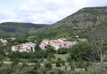
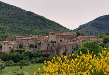
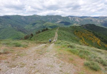
Ruta Senderismo de 7,3 km a descubrir en Occitania, Gard, Campestre-et-Luc. Esta ruta ha sido propuesta por LBarel.
Descripción
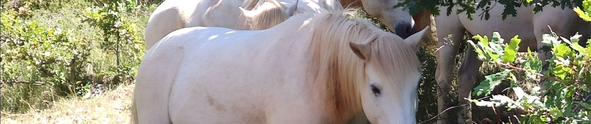
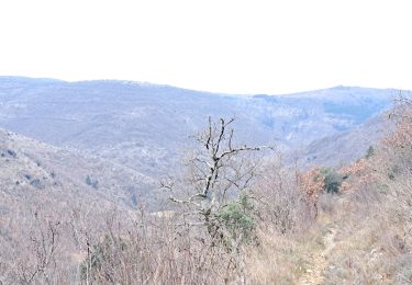
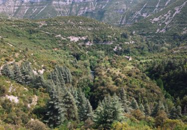
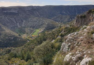
Nous étions partis pour faire la boucle proposée par CAMBON en 2014. Après 1,7 km, barrage. Le circuit est fini. Marche arrière toute, aucune issue. Dommage car la proposition était chouette : beau sentier, superbes paysages. In fine nous avons improvisé et fait une autre boucle très sympa et très facile.
Localización
Comentarios
Excursiones cerca
![Excursión Senderismo Vissec - sentier du Regagnas - Photo](https://media.geolcdn.com/t/375/260/da6617d7-2a0d-4d03-9eaa-131f37014f58.jpg&format=jpg&maxdim=2)
![Senderismo Senderismo](https://static1.geolcdn.com/sitytour/trail-icons/101.png)
Senderismo
![](/images/other/stat-length.png)
![](https://static1.geolcdn.com/siteimages/upload/files/16400158638029165_repeat_loop_refresh_sync_direction_icon.png)
![Excursión A pie Blandas - Randonnée Cirque de Navacelles - Causse de Blandas - Vissec - Moulin de la Foux - Photo](https://media.geolcdn.com/t/375/260/8ddb3d2c-f886-47a1-a994-79ae500f0ce8.jpeg&format=jpg&maxdim=2)
![A pie A pie](https://static1.geolcdn.com/sitytour/trail-icons/100.png)
A pie
![](/images/other/stat-length.png)
![](https://static1.geolcdn.com/siteimages/upload/files/16400158638029165_repeat_loop_refresh_sync_direction_icon.png)
![Excursión Senderismo Blandas - Vissec / Moulin de la Foux - Photo](https://media.geolcdn.com/t/375/260/10a13c13-90e1-488e-8e53-bc3d65b1bc36.jpg&format=jpg&maxdim=2)
![Senderismo Senderismo](https://static1.geolcdn.com/sitytour/trail-icons/101.png)
Senderismo
![](/images/other/stat-length.png)
![](https://static1.geolcdn.com/siteimages/upload/files/16400158638029165_repeat_loop_refresh_sync_direction_icon.png)
![Excursión Senderismo Vissec - Vissec à Navacelle - Photo](https://media.geolcdn.com/t/375/260/537f5131-f938-4853-a1e4-0c864f3197d3.jpg&format=jpg&maxdim=2)
![Senderismo Senderismo](https://static1.geolcdn.com/sitytour/trail-icons/101.png)
Senderismo
![](/images/other/stat-length.png)
![](https://static1.geolcdn.com/siteimages/upload/files/16400158638029165_repeat_loop_refresh_sync_direction_icon.png)
![Excursión Senderismo Vissec - Visser - Photo](https://media.geolcdn.com/t/375/260/c327f970-fea4-4165-9f87-c23536fb135b.jpg&format=jpg&maxdim=2)
![Senderismo Senderismo](https://static1.geolcdn.com/sitytour/trail-icons/101.png)
![Excursión Senderismo Vissec - Cirque de navacelles - Photo](https://media.geolcdn.com/t/375/260/c21c87bc-6447-4989-a4ec-806821395d63.jpg&format=jpg&maxdim=2)
![Senderismo Senderismo](https://static1.geolcdn.com/sitytour/trail-icons/101.png)
Senderismo
![](/images/other/stat-length.png)
![](https://static1.geolcdn.com/siteimages/upload/files/16400158638029165_repeat_loop_refresh_sync_direction_icon.png)
![Excursión Senderismo Vissec - vissec-navacelles-vissec - Photo](https://media.geolcdn.com/t/375/260/4b34e260-d3e8-4436-a2ce-e9a828910832.jpg&format=jpg&maxdim=2)
![Senderismo Senderismo](https://static1.geolcdn.com/sitytour/trail-icons/101.png)
Senderismo
![](/images/other/stat-length.png)
![](https://static1.geolcdn.com/siteimages/upload/files/16400158638029165_repeat_loop_refresh_sync_direction_icon.png)
![Excursión Senderismo Alzon - Alzon - Photo](https://media.geolcdn.com/t/375/260/bed55352-0ab2-4a5d-b760-65258f414d00.jpg&format=jpg&maxdim=2)
![Senderismo Senderismo](https://static1.geolcdn.com/sitytour/trail-icons/101.png)
![Excursión Senderismo Alzon - vers le St guiral puis le rocher de l'aigle - Photo](https://media.geolcdn.com/t/375/260/f78318b9-9f52-40d1-b483-cd5ef15a47bd.jpg&format=jpg&maxdim=2)
![Senderismo Senderismo](https://static1.geolcdn.com/sitytour/trail-icons/101.png)
Senderismo
![](/images/other/stat-length.png)
![](https://static1.geolcdn.com/siteimages/upload/files/16400158638029165_repeat_loop_refresh_sync_direction_icon.png)