![](/images/other/stat-length.png)
![Excursión Senderismo Zoutleeuw - De Hond van Dormaal - Photo](https://media.geolcdn.com/t/1900/400/ext.pjpeg?maxdim=2&url=https%3A%2F%2Fstatic1.geolcdn.com%2Fsiteimages%2Fupload%2Ffiles%2F1553511878bg_sport_marche.png)
De Hond van Dormaal
Thierry0032
Usuario
![Longitud](/images/other/stat-length.png)
Longitud
14,9 km
![Altitud máxima](https://static1.geolcdn.com/siteimages/upload/files/1508320355ic_sort_altitude_max_24dp.png)
Altitud máxima
61 m
![Desnivel positivo](https://static1.geolcdn.com/siteimages/upload/files/1508320355ic_sort_den_pos_24dp.png)
Desnivel positivo
78 m
![Km-Effort](/images/other/stat-length.png)
Km-Effort
15,9 km
![Altitud mínima](https://static1.geolcdn.com/siteimages/upload/files/1508320355ic_sort_altitude_min_24dp.png)
Altitud mínima
26 m
![Desnivel negativo](https://static1.geolcdn.com/siteimages/upload/files/1508320355ic_sort_den_neg_24dp.png)
Desnivel negativo
78 m
![Boucle](https://static1.geolcdn.com/siteimages/upload/files/16400158638029165_repeat_loop_refresh_sync_direction_icon.png)
Boucle
Sí
Fecha de creación :
2021-07-25 09:50:48.097
Última modificación :
2021-07-25 09:56:31.839
![Senderismo](https://static1.geolcdn.com/sitytour/trail-icons/101.png)
3h36
Dificultad : Medio
![Escanee este código QR para abrir la excursión en la aplicación SityTrail](https://capi.geolives.com/qq0zvz2zws4bq2lad0pu/sitytour/trails/2873131/qr.png?size=200)
Aplicación GPS de excursión GRATIS
A propósito
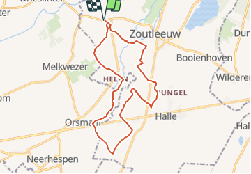
Ruta Senderismo de 14,9 km a descubrir en Flandes, Brabante Flamenco, Zoutleeuw. Esta ruta ha sido propuesta por Thierry0032.
Descripción
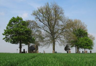
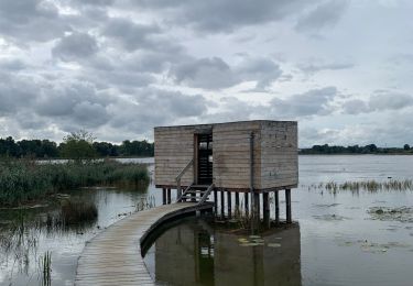
Promenade jusqu'au lieu de découverte d'un "chien" vivant il y a 56 millions d'années.
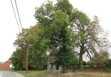
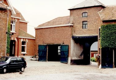
Il est possible de se garer facilement.
Au retour pour récompense, à 200 mètres, une glace artisanale chez "Omata", glace réalisée "comme avant". Délicieux.
Localización
País:
Belgium
Región :
Flandes
Departamento/provincia :
Brabante Flamenco
Municipio :
Zoutleeuw
Localidad:
Helen-Bos
Salida:(Dec)
Salida:(UTM)
646325 ; 5633788 (31U) N.
Comentarios
Excursiones cerca
![Excursión Senderismo Zoutleeuw - Zoutleeuw 16 km - Photo](https://media.geolcdn.com/t/375/260/b3a37ac3-8fca-4eba-bd9d-831054990cdb.jpg&format=jpg&maxdim=2)
![Senderismo Senderismo](https://static1.geolcdn.com/sitytour/trail-icons/101.png)
Zoutleeuw 16 km
Senderismo
Muy fácil
(1)
Zoutleeuw,
Flandes,
Brabante Flamenco,
Belgium
![](/images/other/stat-length.png)
15,6 km | 16,5 km-effort
3h 59min
![](https://static1.geolcdn.com/siteimages/upload/files/16400158638029165_repeat_loop_refresh_sync_direction_icon.png)
Sí
![Excursión A pie Kortenaken - A Speculowandelpad - Photo](https://media.geolcdn.com/t/375/260/e8a891a7-8e5d-4d65-ada1-9dd128a1791b.jpeg&format=jpg&maxdim=2)
![A pie A pie](https://static1.geolcdn.com/sitytour/trail-icons/100.png)
A Speculowandelpad
A pie
Fácil
Kortenaken,
Flandes,
Brabante Flamenco,
Belgium
![](/images/other/stat-length.png)
6 km | 7 km-effort
1h 35min
![](https://static1.geolcdn.com/siteimages/upload/files/16400158638029165_repeat_loop_refresh_sync_direction_icon.png)
Sí
![Excursión A pie Zoutleeuw - Kempinnewandeling - Photo](https://media.geolcdn.com/t/375/260/fc67a971-5072-4fc1-b052-2b5bd59bf268.jpeg&format=jpg&maxdim=2)
![A pie A pie](https://static1.geolcdn.com/sitytour/trail-icons/100.png)
Kempinnewandeling
A pie
Fácil
Zoutleeuw,
Flandes,
Brabante Flamenco,
Belgium
![](/images/other/stat-length.png)
12,2 km | 13,4 km-effort
3h 2min
![](https://static1.geolcdn.com/siteimages/upload/files/16400158638029165_repeat_loop_refresh_sync_direction_icon.png)
No
![Excursión A pie Zoutleeuw - Panbruggewandeling - Photo](https://media.geolcdn.com/t/375/260/96714c06-dac1-4b7c-b690-c79a4c973766.jpeg&format=jpg&maxdim=2)
![A pie A pie](https://static1.geolcdn.com/sitytour/trail-icons/100.png)
Panbruggewandeling
A pie
Fácil
(1)
Zoutleeuw,
Flandes,
Brabante Flamenco,
Belgium
![](/images/other/stat-length.png)
8,9 km | 9,7 km-effort
2h 12min
![](https://static1.geolcdn.com/siteimages/upload/files/16400158638029165_repeat_loop_refresh_sync_direction_icon.png)
Sí
![Excursión Senderismo Linter - Melkwezer Haspengouw GroteGetewandeling - 11 km RT - Photo](https://media.geolcdn.com/t/375/260/ext.jpg?maxdim=2&url=https%3A%2F%2Fstatic1.geolcdn.com%2Fsiteimages%2Fupload%2Ffiles%2F1553511878bg_sport_marche.png)
![Senderismo Senderismo](https://static1.geolcdn.com/sitytour/trail-icons/101.png)
Melkwezer Haspengouw GroteGetewandeling - 11 km RT
Senderismo
Muy fácil
(1)
Linter,
Flandes,
Brabante Flamenco,
Belgium
![](/images/other/stat-length.png)
10,9 km | 11,8 km-effort
Desconocido
![](https://static1.geolcdn.com/siteimages/upload/files/16400158638029165_repeat_loop_refresh_sync_direction_icon.png)
Sí
![Excursión Senderismo Zoutleeuw - S-GR Hageland : Terhagen - Diest - Photo](https://media.geolcdn.com/t/375/260/0bcaa454-b723-4dae-8870-b6599e62c5b1.jpeg&format=jpg&maxdim=2)
![Senderismo Senderismo](https://static1.geolcdn.com/sitytour/trail-icons/101.png)
S-GR Hageland : Terhagen - Diest
Senderismo
Medio
Zoutleeuw,
Flandes,
Brabante Flamenco,
Belgium
![](/images/other/stat-length.png)
25 km | 28 km-effort
6h 18min
![](https://static1.geolcdn.com/siteimages/upload/files/16400158638029165_repeat_loop_refresh_sync_direction_icon.png)
No
![Excursión Senderismo Zoutleeuw - Promenade romantique dans la Vallée de la Gette - Photo](https://media.geolcdn.com/t/375/260/057fed0c-a346-40f4-a8e3-ef5b6be90d5d.jpg&format=jpg&maxdim=2)
![Senderismo Senderismo](https://static1.geolcdn.com/sitytour/trail-icons/101.png)
Promenade romantique dans la Vallée de la Gette
Senderismo
Fácil
Zoutleeuw,
Flandes,
Brabante Flamenco,
Belgium
![](/images/other/stat-length.png)
4,3 km | 4,7 km-effort
1h 4min
![](https://static1.geolcdn.com/siteimages/upload/files/16400158638029165_repeat_loop_refresh_sync_direction_icon.png)
Sí
![Excursión Senderismo Linter - Grote Getewandeling - Photo](https://media.geolcdn.com/t/375/260/9b851dcd-e027-4a6a-843b-be3f9a9298b6.jpeg&format=jpg&maxdim=2)
![Senderismo Senderismo](https://static1.geolcdn.com/sitytour/trail-icons/101.png)
Grote Getewandeling
Senderismo
Medio
Linter,
Flandes,
Brabante Flamenco,
Belgium
![](/images/other/stat-length.png)
9,5 km | 10,3 km-effort
2h 19min
![](https://static1.geolcdn.com/siteimages/upload/files/16400158638029165_repeat_loop_refresh_sync_direction_icon.png)
Sí
![Excursión Senderismo Zoutleeuw - Halewijnwandeling - Photo](https://media.geolcdn.com/t/375/260/6ee29448-3192-46b9-b894-a219985a66b2.jpeg&format=jpg&maxdim=2)
![Senderismo Senderismo](https://static1.geolcdn.com/sitytour/trail-icons/101.png)
Halewijnwandeling
Senderismo
Medio
(1)
Zoutleeuw,
Flandes,
Brabante Flamenco,
Belgium
![](/images/other/stat-length.png)
10 km | 10,7 km-effort
2h 25min
![](https://static1.geolcdn.com/siteimages/upload/files/16400158638029165_repeat_loop_refresh_sync_direction_icon.png)
Sí