![](/images/other/stat-length.png)
![Excursión Senderismo Villarembert - Le grand Truc - Photo](https://media.geolcdn.com/t/1900/400/2a22c800-6a5d-41a2-9fe8-aa0f95c25432.jpg&format=pjpeg&maxdim=2)
Le grand Truc
fredmig67
Usuario
![Longitud](/images/other/stat-length.png)
Longitud
9,8 km
![Altitud máxima](https://static1.geolcdn.com/siteimages/upload/files/1508320355ic_sort_altitude_max_24dp.png)
Altitud máxima
2195 m
![Desnivel positivo](https://static1.geolcdn.com/siteimages/upload/files/1508320355ic_sort_den_pos_24dp.png)
Desnivel positivo
578 m
![Km-Effort](/images/other/stat-length.png)
Km-Effort
17,5 km
![Altitud mínima](https://static1.geolcdn.com/siteimages/upload/files/1508320355ic_sort_altitude_min_24dp.png)
Altitud mínima
1677 m
![Desnivel negativo](https://static1.geolcdn.com/siteimages/upload/files/1508320355ic_sort_den_neg_24dp.png)
Desnivel negativo
576 m
![Boucle](https://static1.geolcdn.com/siteimages/upload/files/16400158638029165_repeat_loop_refresh_sync_direction_icon.png)
Boucle
Sí
Fecha de creación :
2021-07-16 07:39:55.811
Última modificación :
2021-07-17 13:25:28.179
![Senderismo](https://static1.geolcdn.com/sitytour/trail-icons/101.png)
3h28
Dificultad : Medio
![Escanee este código QR para abrir la excursión en la aplicación SityTrail](https://capi.geolives.com/qq0zvz2zws4bq2lad0pu/sitytour/trails/2863840/qr.png?size=200)
Aplicación GPS de excursión GRATIS
A propósito
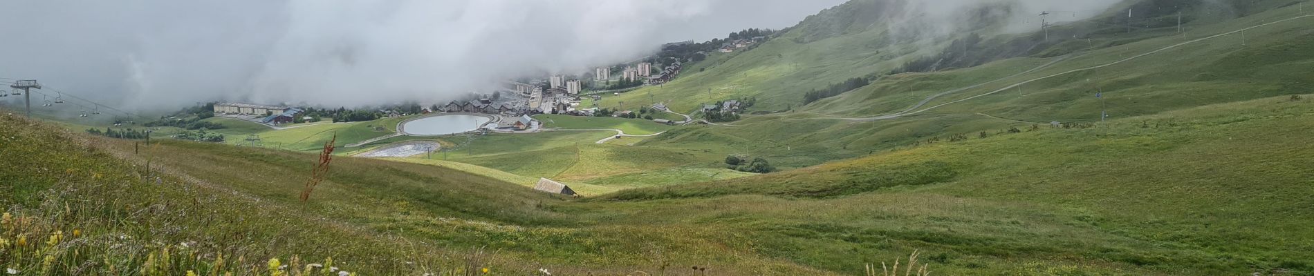
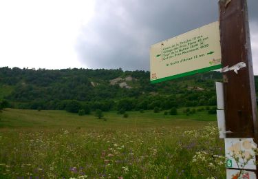
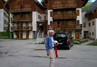
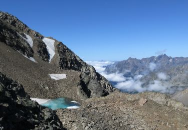
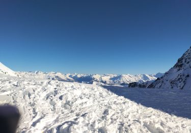
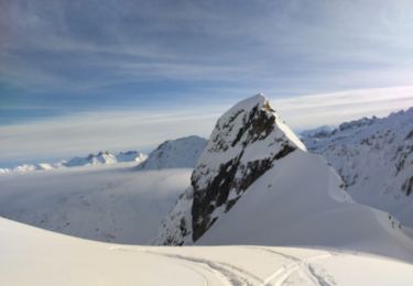
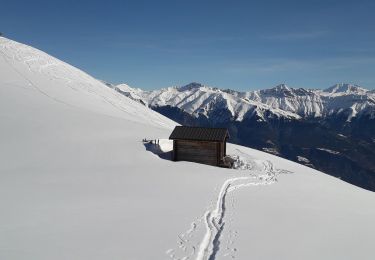
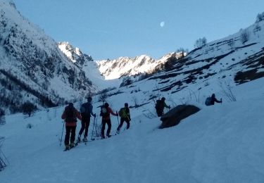
Ruta Senderismo de 9,8 km a descubrir en Auvergne-Rhône-Alpes, Saboya, Villarembert. Esta ruta ha sido propuesta por fredmig67.
Descripción
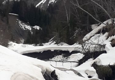
Randonnée faite par temps humide. Passages boueux et glissants.
Localización
País:
France
Región :
Auvergne-Rhône-Alpes
Departamento/provincia :
Saboya
Municipio :
Villarembert
Localidad:
Unknown
Salida:(Dec)
Salida:(UTM)
284862 ; 5014466 (32T) N.
Comentarios
Excursiones cerca
![Excursión Senderismo Saint-Sorlin-d'Arves - Les Prés Plans - Photo](https://media.geolcdn.com/t/375/260/ext.jpg?maxdim=2&url=https%3A%2F%2Fservices.sitytrail.com%2FGeolivesWS%2FDownloadMedia.ashx%3FTrailID%3D319006%26Media%3Dfix__20140626140927.jpg)
![Senderismo Senderismo](https://static1.geolcdn.com/sitytour/trail-icons/101.png)
Les Prés Plans
Senderismo
Fácil
(1)
Saint-Sorlin-d'Arves,
Auvergne-Rhône-Alpes,
Saboya,
France
![](/images/other/stat-length.png)
9,4 km | 13,1 km-effort
2h 52min
![](https://static1.geolcdn.com/siteimages/upload/files/16400158638029165_repeat_loop_refresh_sync_direction_icon.png)
Sí
![Excursión Marcha nórdica Saint-Sorlin-d'Arves - La Balme - Photo](https://media.geolcdn.com/t/375/260/ext.jpg?maxdim=2&url=https%3A%2F%2Fservices.sitytrail.com%2FGeolivesWS%2FDownloadMedia.ashx%3FTrailID%3D319005%26Media%3Dfix__20140624124356.jpg)
![Marcha nórdica Marcha nórdica](https://static1.geolcdn.com/sitytour/trail-icons/102.png)
La Balme
Marcha nórdica
Medio
(1)
Saint-Sorlin-d'Arves,
Auvergne-Rhône-Alpes,
Saboya,
France
![](/images/other/stat-length.png)
6,9 km | 12,9 km-effort
3h 18min
![](https://static1.geolcdn.com/siteimages/upload/files/16400158638029165_repeat_loop_refresh_sync_direction_icon.png)
Sí
![Senderismo Senderismo](https://static1.geolcdn.com/sitytour/trail-icons/101.png)
dome de la cochette
Senderismo
Muy difícil
(1)
Saint-Sorlin-d'Arves,
Auvergne-Rhône-Alpes,
Saboya,
France
![](/images/other/stat-length.png)
15,6 km | 32 km-effort
5h 0min
![](https://static1.geolcdn.com/siteimages/upload/files/16400158638029165_repeat_loop_refresh_sync_direction_icon.png)
Sí
![Excursión Esquí de fondo Saint-Colomban-des-Villards - col de Gleyzin - Photo](https://media.geolcdn.com/t/375/260/dbe338f2-2bbf-4b85-967f-ffc3c8155883.jpg&format=jpg&maxdim=2)
![Esquí de fondo Esquí de fondo](https://static1.geolcdn.com/sitytour/trail-icons/503.png)
col de Gleyzin
Esquí de fondo
Medio
Saint-Colomban-des-Villards,
Auvergne-Rhône-Alpes,
Saboya,
France
![](/images/other/stat-length.png)
13,3 km | 32 km-effort
4h 7min
![](https://static1.geolcdn.com/siteimages/upload/files/16400158638029165_repeat_loop_refresh_sync_direction_icon.png)
Sí
![Excursión Esquí de fondo Saint-Colomban-des-Villards - Sous la selle du Puy gris - Photo](https://media.geolcdn.com/t/375/260/baabb621-fdb8-4d11-983c-fff2e275ca53.jpg&format=jpg&maxdim=2)
![Esquí de fondo Esquí de fondo](https://static1.geolcdn.com/sitytour/trail-icons/503.png)
Sous la selle du Puy gris
Esquí de fondo
Fácil
Saint-Colomban-des-Villards,
Auvergne-Rhône-Alpes,
Saboya,
France
![](/images/other/stat-length.png)
13,6 km | 30 km-effort
4h 12min
![](https://static1.geolcdn.com/siteimages/upload/files/16400158638029165_repeat_loop_refresh_sync_direction_icon.png)
Sí
![Excursión Raquetas de nieve Saint-Colomban-des-Villards - boucle st Colomban des Villards - Photo](https://media.geolcdn.com/t/375/260/be45307b-8118-49fa-a825-1d585ab0160f.jpg&format=jpg&maxdim=2)
![Raquetas de nieve Raquetas de nieve](https://static1.geolcdn.com/sitytour/trail-icons/504.png)
boucle st Colomban des Villards
Raquetas de nieve
Fácil
Saint-Colomban-des-Villards,
Auvergne-Rhône-Alpes,
Saboya,
France
![](/images/other/stat-length.png)
7,8 km | 12,5 km-effort
3h 1min
![](https://static1.geolcdn.com/siteimages/upload/files/16400158638029165_repeat_loop_refresh_sync_direction_icon.png)
Sí
![Excursión Raquetas de nieve Fontcouverte-la-Toussuire - la Toussuire - cret Morandet -le grand Truc - Photo](https://media.geolcdn.com/t/375/260/fee9ac41-4d71-474f-9f58-d2d69fce61ea.jpg&format=jpg&maxdim=2)
![Raquetas de nieve Raquetas de nieve](https://static1.geolcdn.com/sitytour/trail-icons/504.png)
la Toussuire - cret Morandet -le grand Truc
Raquetas de nieve
Muy fácil
Fontcouverte-la-Toussuire,
Auvergne-Rhône-Alpes,
Saboya,
France
![](/images/other/stat-length.png)
6,4 km | 13,2 km-effort
2h 53min
![](https://static1.geolcdn.com/siteimages/upload/files/16400158638029165_repeat_loop_refresh_sync_direction_icon.png)
Sí
![Excursión Esquí de fondo Saint-Colomban-des-Villards - Selle du Puy gris - Photo](https://media.geolcdn.com/t/375/260/ccb005d4-4281-4e68-85c9-cdde91be7859.jpg&format=jpg&maxdim=2)
![Esquí de fondo Esquí de fondo](https://static1.geolcdn.com/sitytour/trail-icons/503.png)
Selle du Puy gris
Esquí de fondo
Medio
Saint-Colomban-des-Villards,
Auvergne-Rhône-Alpes,
Saboya,
France
![](/images/other/stat-length.png)
15,7 km | 36 km-effort
7h 23min
![](https://static1.geolcdn.com/siteimages/upload/files/16400158638029165_repeat_loop_refresh_sync_direction_icon.png)
Sí
![Excursión Bici de montaña Saint-Jean-d'Arves - 15-08-2017 - Photo](https://media.geolcdn.com/t/375/260/ext.jpg?maxdim=2&url=https%3A%2F%2Fstatic1.geolcdn.com%2Fsiteimages%2Fupload%2Ffiles%2F1524743154velo.jpg)
![Bici de montaña Bici de montaña](https://static1.geolcdn.com/sitytour/trail-icons/202.png)
15-08-2017
Bici de montaña
Medio
(1)
Saint-Jean-d'Arves,
Auvergne-Rhône-Alpes,
Saboya,
France
![](/images/other/stat-length.png)
11,1 km | 21 km-effort
1h 47min
![](https://static1.geolcdn.com/siteimages/upload/files/16400158638029165_repeat_loop_refresh_sync_direction_icon.png)
No