![](/images/other/stat-length.png)
![Excursión Carrera Saint-Genest-Malifaux - chez ma mère - Photo](https://media.geolcdn.com/t/1900/400/ext.pjpeg?maxdim=2&url=https%3A%2F%2Fstatic1.geolcdn.com%2Fsiteimages%2Fupload%2Ffiles%2F1524743154running.jpg)
chez ma mère
Mathieu Chagneau
Usuario
![Longitud](/images/other/stat-length.png)
Longitud
10,7 km
![Altitud máxima](https://static1.geolcdn.com/siteimages/upload/files/1508320355ic_sort_altitude_max_24dp.png)
Altitud máxima
1066 m
![Desnivel positivo](https://static1.geolcdn.com/siteimages/upload/files/1508320355ic_sort_den_pos_24dp.png)
Desnivel positivo
270 m
![Km-Effort](/images/other/stat-length.png)
Km-Effort
14,2 km
![Altitud mínima](https://static1.geolcdn.com/siteimages/upload/files/1508320355ic_sort_altitude_min_24dp.png)
Altitud mínima
934 m
![Desnivel negativo](https://static1.geolcdn.com/siteimages/upload/files/1508320355ic_sort_den_neg_24dp.png)
Desnivel negativo
270 m
![Boucle](https://static1.geolcdn.com/siteimages/upload/files/16400158638029165_repeat_loop_refresh_sync_direction_icon.png)
Boucle
Sí
Fecha de creación :
2021-07-11 06:18:42.498
Última modificación :
2021-07-11 07:30:22.304
![Carrera](https://static1.geolcdn.com/sitytour/trail-icons/103.png)
1h11
Dificultad : Muy fácil
![Escanee este código QR para abrir la excursión en la aplicación SityTrail](https://capi.geolives.com/qq0zvz2zws4bq2lad0pu/sitytour/trails/2856700/qr.png?size=200)
Aplicación GPS de excursión GRATIS
A propósito
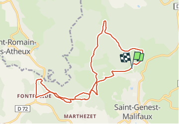
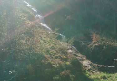
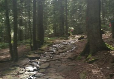
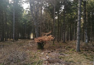
Ruta Carrera de 10,7 km a descubrir en Auvergne-Rhône-Alpes, Loira, Saint-Genest-Malifaux. Esta ruta ha sido propuesta por Mathieu Chagneau.
Descripción
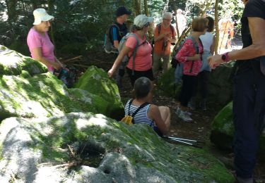
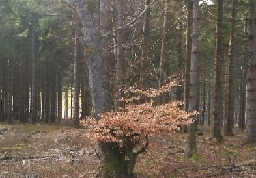
dans les bois, puis sur la route.
grosse descente et très longue montée pour finir
Localización
País:
France
Región :
Auvergne-Rhône-Alpes
Departamento/provincia :
Loira
Municipio :
Saint-Genest-Malifaux
Localidad:
Unknown
Salida:(Dec)
Salida:(UTM)
611104 ; 5022913 (31T) N.
Comentarios
Excursiones cerca
![Excursión Senderismo Jonzieux - jonzieux 10719 - Photo](https://media.geolcdn.com/t/375/260/c087c43f-6ec3-4527-8f35-03c2cc2c003c.jpg&format=jpg&maxdim=2)
![Senderismo Senderismo](https://static1.geolcdn.com/sitytour/trail-icons/101.png)
jonzieux 10719
Senderismo
Muy fácil
(1)
Jonzieux,
Auvergne-Rhône-Alpes,
Loira,
France
![](/images/other/stat-length.png)
9,8 km | 13 km-effort
3h 18min
![](https://static1.geolcdn.com/siteimages/upload/files/16400158638029165_repeat_loop_refresh_sync_direction_icon.png)
No
![Excursión Senderismo Saint-Genest-Malifaux - 42 chaussitre pierre st martin 27.08.22 - Photo](https://media.geolcdn.com/t/375/260/e8cdd929-dc0a-47e2-88f8-07bb8575eb84.jpg&format=jpg&maxdim=2)
![Senderismo Senderismo](https://static1.geolcdn.com/sitytour/trail-icons/101.png)
42 chaussitre pierre st martin 27.08.22
Senderismo
Medio
Saint-Genest-Malifaux,
Auvergne-Rhône-Alpes,
Loira,
France
![](/images/other/stat-length.png)
19,8 km | 0 m-effort
6h 22min
![](https://static1.geolcdn.com/siteimages/upload/files/16400158638029165_repeat_loop_refresh_sync_direction_icon.png)
Sí
![Excursión Bici de carretera Saint-Genest-Malifaux - 42 st genest jonzieux - Photo](https://media.geolcdn.com/t/375/260/45053087-c13b-4870-9502-81169344b6e9.jpg&format=jpg&maxdim=2)
![Bici de carretera Bici de carretera](https://static1.geolcdn.com/sitytour/trail-icons/201.png)
42 st genest jonzieux
Bici de carretera
Medio
Saint-Genest-Malifaux,
Auvergne-Rhône-Alpes,
Loira,
France
![](/images/other/stat-length.png)
59 km | 77 km-effort
4h 28min
![](https://static1.geolcdn.com/siteimages/upload/files/16400158638029165_repeat_loop_refresh_sync_direction_icon.png)
Sí
![Excursión Senderismo Saint-Romain-les-Atheux - tour du barrage de Cotatay - Photo](https://media.geolcdn.com/t/375/260/d477c240-2edb-439c-95b3-d0438be9ee9c.jpg&format=jpg&maxdim=2)
![Senderismo Senderismo](https://static1.geolcdn.com/sitytour/trail-icons/101.png)
tour du barrage de Cotatay
Senderismo
Fácil
Saint-Romain-les-Atheux,
Auvergne-Rhône-Alpes,
Loira,
France
![](/images/other/stat-length.png)
5,3 km | 6,9 km-effort
1h 33min
![](https://static1.geolcdn.com/siteimages/upload/files/16400158638029165_repeat_loop_refresh_sync_direction_icon.png)
Sí
![Excursión Senderismo Saint-Régis-du-Coin - Présager bis - Photo](https://media.geolcdn.com/t/375/260/540e13f3-c40a-4af3-8cea-3ac9aa3f2f1a.jpg&format=jpg&maxdim=2)
![Senderismo Senderismo](https://static1.geolcdn.com/sitytour/trail-icons/101.png)
Présager bis
Senderismo
Difícil
Saint-Régis-du-Coin,
Auvergne-Rhône-Alpes,
Loira,
France
![](/images/other/stat-length.png)
3,9 km | 5,1 km-effort
2h 19min
![](https://static1.geolcdn.com/siteimages/upload/files/16400158638029165_repeat_loop_refresh_sync_direction_icon.png)
Sí
![Excursión Senderismo Saint-Genest-Malifaux - Marche de ST GENEST MALIFAUT - Photo](https://media.geolcdn.com/t/375/260/ext.jpg?maxdim=2&url=https%3A%2F%2Fservices.sitytrail.com%2FGeolivesWS%2FDownloadMedia.ashx%3FTrailID%3D733776%26Media%3Dfix__20160904115801.jpg)
![Senderismo Senderismo](https://static1.geolcdn.com/sitytour/trail-icons/101.png)
Marche de ST GENEST MALIFAUT
Senderismo
Medio
Saint-Genest-Malifaux,
Auvergne-Rhône-Alpes,
Loira,
France
![](/images/other/stat-length.png)
15,6 km | 21 km-effort
3h 29min
![](https://static1.geolcdn.com/siteimages/upload/files/16400158638029165_repeat_loop_refresh_sync_direction_icon.png)
No
![Excursión Senderismo La Versanne - mardi 14 mars - Photo](https://media.geolcdn.com/t/375/260/ext.jpg?maxdim=2&url=https%3A%2F%2Fservices.sitytrail.com%2FGeolivesWS%2FDownloadMedia.ashx%3FTrailID%3D721025%26Media%3Dfix__20170314172823.jpg)
![Senderismo Senderismo](https://static1.geolcdn.com/sitytour/trail-icons/101.png)
mardi 14 mars
Senderismo
Fácil
La Versanne,
Auvergne-Rhône-Alpes,
Loira,
France
![](/images/other/stat-length.png)
6 km | 8,3 km-effort
1h 1min
![](https://static1.geolcdn.com/siteimages/upload/files/16400158638029165_repeat_loop_refresh_sync_direction_icon.png)
No
![Excursión Senderismo La Versanne - mardi 14 mars - Photo](https://media.geolcdn.com/t/375/260/ext.jpg?maxdim=2&url=https%3A%2F%2Fservices.sitytrail.com%2FGeolivesWS%2FDownloadMedia.ashx%3FTrailID%3D716892%26Media%3Dfix__20170314172839.jpg)
![Senderismo Senderismo](https://static1.geolcdn.com/sitytour/trail-icons/101.png)
mardi 14 mars
Senderismo
Fácil
La Versanne,
Auvergne-Rhône-Alpes,
Loira,
France
![](/images/other/stat-length.png)
6 km | 8,3 km-effort
1h 1min
![](https://static1.geolcdn.com/siteimages/upload/files/16400158638029165_repeat_loop_refresh_sync_direction_icon.png)
No
![Excursión Senderismo Saint-Genest-Malifaux - Marche de ST GENEST MALIFAUT - Photo](https://media.geolcdn.com/t/375/260/ext.jpg?maxdim=2&url=https%3A%2F%2Fservices.sitytrail.com%2FGeolivesWS%2FDownloadMedia.ashx%3FTrailID%3D632217%26Media%3Dfix__20160904115801.jpg)
![Senderismo Senderismo](https://static1.geolcdn.com/sitytour/trail-icons/101.png)
Marche de ST GENEST MALIFAUT
Senderismo
Medio
Saint-Genest-Malifaux,
Auvergne-Rhône-Alpes,
Loira,
France
![](/images/other/stat-length.png)
15,6 km | 21 km-effort
3h 29min
![](https://static1.geolcdn.com/siteimages/upload/files/16400158638029165_repeat_loop_refresh_sync_direction_icon.png)
No