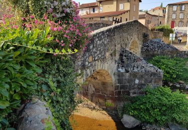
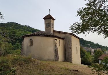
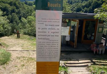
Excursión Senderismo Thiers - Le Chemin de Sainte-Agathe - Photo
 arleol63
arleol63

Usuario

© OpenStreetMap contributors
Longitud
Longitud
94 km
Altitud máxima
Altitud máxima
1104 m
Desnivel positivo
Desnivel positivo
3222 m
Km-Effort
Km-Effort  
137 km
Altitud mínima
Altitud mínima
310 m
Desnivel negativo
Desnivel negativo
3226 m
Boucle
Boucle
Fecha de creación :
2021-07-05 10:42:46.888
Última modificación :
2021-07-05 10:44:32.263

(0 Opinión)

Senderismo
Senderismo
31h05
Dificultad : Muy difícil

Escanee este código QR para abrir la excursión en la aplicación SityTrail

Aplicación GPS de excursión GRATIS

Logo SityTrail SityTrail

IGN / Institutos geográficos

Descargar SityTrail en App Store Descargar SityTrail en Google Play

Logo SityTrail SityTrail World

El mundo es suyo

Descargar SityTrail en App Store Descargar SityTrail en Google Play Descargar SityTrail en Huawei AppGallery

A propósito

Ruta Senderismo de 94 km a descubrir en Auvergne-Rhône-Alpes, Puy-de-Dôme, Thiers. Esta ruta ha sido propuesta por arleol63.

Descripción

Ballade agréable dans le Forez. Il faut aimer la nature, les forets et les montagnes à vache.

Perfil altimétrico

Puntos de interés

Punto de interés Thiers - Orangerie - Photo
arleol63
THIERS 
Punto de interés Thiers - Croisement en T - Photo
arleol63
Punto de interés Escoutoux - Prendre le chemin à gauche - Photo
arleol63
Punto de interés Escoutoux - Busset, prendre à gauche - Photo
arleol63
Punto de interés Escoutoux - D58 - Photo
arleol63
ESCOUTOUX 
Punto de interés Vollore-Ville - Croisement en T, prendre en face - Photo
arleol63
Punto de interés Vollore-Ville - Le Rouet, carrefour, prendre à gauche - Photo
arleol63
Punto de interés Vollore-Ville - Vollore-Ville, tourner à gauche - Photo
arleol63
Punto de interés Vollore-Ville - Carrefour de routes, à droite - Photo
arleol63
Punto de interés Vollore-Ville - Cote 484 - Photo
arleol63
VOLLORE-VILLE 
Punto de interés Aubusson-d'Auvergne - Les Thioulards - Photo
arleol63
AUBUSSON-D'AUVERGNE 
Punto de interés Aubusson-d'Auvergne - Gîte des 4 Vents - Photo
arleol63
AUBUSSON-D'AUVERGNE 
Punto de interés Courpière - Gîte des Quatre Vents - Photo
arleol63
Punto de interés Aubusson-d'Auvergne - Route de la Souche, prendre à gauche - Photo
arleol63
AUBUSSON-D'AUVERGNE 
Punto de interés Aubusson-d'Auvergne - Lac d'Aubusson - Photo
arleol63
AUBUSSON-D'AUVERGNE 
Punto de interés Augerolles - Augerolles - Photo
arleol63
AUGEROLLES 
Punto de interés Augerolles - Scierie, bifurquer à gauche - Photo
arleol63
Punto de interés Augerolles - Moulin du Clos - Photo
arleol63
AUGEROLLES 
Punto de interés Olmet - Croix de Chamaly - Photo
arleol63
Punto de interés Olliergues - Passerelle cote 512 - Photo
arleol63
Punto de interés Olliergues - Carrefour en T - Photo
arleol63
OLLIERGUES 
Punto de interés Olliergues - Prendre chemin à droite - Photo
arleol63
Punto de interés Olliergues - Olliergues - Photo
arleol63
OLLIERGUES 
Punto de interés Marat - Passerelle - Photo
arleol63
MARAT 
Punto de interés Saint-Pierre-la-Bourlhonne - Bauchaud - Photo
arleol63
SAINT-PIERRE-LA-BOURLHONNE 
Punto de interés La Renaudie - Le Clef, prendre à gauche - Photo
arleol63
Punto de interés La Renaudie - Croix de Sainte-Agathe - Photo
arleol63
Punto de interés La Renaudie - La Renaudie - Photo
arleol63
LA RENAUDIE 
Punto de interés La Renaudie - Gîte communal de la Renaudie - Photo
arleol63
Punto de interés La Renaudie - La Coudairie - Photo
arleol63
LA RENAUDIE 
Punto de interés Vollore-Montagne - D317 - Photo
arleol63
VOLLORE-MONTAGNE 
Punto de interés Vollore-Montagne - Rossias, scierie, prendre sentier à droite - Photo
arleol63
Punto de interés Vollore-Montagne - Montchoisy, bifurquer à droite - Photo
arleol63
Punto de interés Vollore-Montagne - Bellevue - Photo
arleol63
VOLLORE-MONTAGNE 
Punto de interés Vollore-Montagne - Croix de Sainte-Agathe - Photo
arleol63
VOLLORE-MONTAGNE 
Punto de interés Vollore-Montagne - Croix des Tuiles - Photo
arleol63
VOLLORE-MONTAGNE 
Punto de interés Vollore-Ville - Croisement en triangle, prendre à droite - Photo
arleol63
Punto de interés Vollore-Ville - Croisée de chemins - Photo
arleol63
VOLLORE-VILLE 
Punto de interés Sainte-Agathe - Rochemulet - Photo
arleol63
SAINTE-AGATHE 
Punto de interés Sainte-Agathe - Raffy, prendre chemin à gauche - Photo
arleol63
Punto de interés Sainte-Agathe - D7 - Photo
arleol63
SAINTE-AGATHE 
Punto de interés Sainte-Agathe - Sainte Agathe - Photo
arleol63
SAINTE-AGATHE 
Punto de interés Sainte-Agathe - Sainte-Agathe - Photo
arleol63
SAINTE-AGATHE 
Punto de interés Sainte-Agathe - Carrefour de sentiers, prendre à droite - Photo
arleol63
Punto de interés Sainte-Agathe - Route d'accès à Vaulx, prendre à gauche - Photo
arleol63
Punto de interés Sainte-Agathe - Croix des Quatre Chemins - Photo
arleol63
Punto de interés Celles-sur-Durolle - Croix de fer, continuer en face - Photo
arleol63
CELLES-SUR-DUROLLE 
Punto de interés Celles-sur-Durolle - Ruisseau du Bouchet - Photo
arleol63
CELLES-SUR-DUROLLE 
Punto de interés Thiers - Membrun - Photo
arleol63
THIERS 
Punto de interés Thiers - Passerelle - Photo
arleol63
THIERS 
Punto de interés Thiers - Passerelle - Photo
arleol63
THIERS 
Punto de interés Thiers - Conduite forcée - Photo
arleol63
Punto de interés Thiers - Eglise Saint-Jean - Photo
arleol63
Punto de interés Thiers - Orangerie - Photo
arleol63
THIERS 

Localización

País:
France
Región :
Auvergne-Rhône-Alpes
Departamento/provincia :
Puy-de-Dôme
Municipio :
Thiers
Localidad:
Unknown
Salida:(UTM)
542278 ; 5077625 (31T) N.

Excursiones cerca

Excursión Senderismo Thiers - Thiers_Enfer_Rouets - Photo
Senderismo
GUIDE
jagarnier

Senderismo

Medio
(1)
Thiers, Auvergne-Rhône-Alpes, Puy-de-Dôme, France
11,4 km | 18,3 km-effort
3h 30min
Excursión Senderismo Thiers - Thiers_Horts - Photo
Senderismo
GUIDE
jagarnier

Senderismo

Medio
(1)
Thiers, Auvergne-Rhône-Alpes, Puy-de-Dôme, France
11 km | 16,1 km-effort
3h 15min
Excursión Senderismo Saint-Rémy-sur-Durolle - 2016-1-26- Chabrol  - Photo
Senderismo
claudef

Senderismo

Medio
(2)
Saint-Rémy-sur-Durolle, Auvergne-Rhône-Alpes, Puy-de-Dôme, France
8,6 km | 12 km-effort
2h 32min
Excursión A pie Thiers - Thiers - Château de Vaulx - Photo
A pie
GUIDE+

A pie

Medio
Thiers, Auvergne-Rhône-Alpes, Puy-de-Dôme, France
16 km | 25 km-effort
5h 37min
No
Excursión A pie Thiers - Château de Vaulx - Thiers - Photo
A pie
GUIDE+

A pie

Medio
Thiers, Auvergne-Rhône-Alpes, Puy-de-Dôme, France
12,6 km | 20 km-effort
4h 39min
No
Excursión A pie Dorat - Le sentier de Néron - Photo
A pie
GUIDE+

A pie

Fácil
Dorat, Auvergne-Rhône-Alpes, Puy-de-Dôme, France
5,9 km | 7,6 km-effort
1h 42min
Excursión A pie Thiers - De l'Enfer aux Rouets - Photo
A pie
GUIDE+

A pie

Fácil
Thiers, Auvergne-Rhône-Alpes, Puy-de-Dôme, France
7,6 km | 12,2 km-effort
2h 46min
Excursión A pie Escoutoux - Les Terrasses de la Dore - Photo
A pie
GUIDE+

A pie

Fácil
(1)
Escoutoux, Auvergne-Rhône-Alpes, Puy-de-Dôme, France
13,3 km | 16,1 km-effort
3h 39min
Excursión Senderismo Thiers - Ballet des rouets  - Photo
Senderismo
joelinou

Senderismo

Difícil
Thiers, Auvergne-Rhône-Alpes, Puy-de-Dôme, France
13,2 km | 20 km-effort
5h 21min


Cerrar
Mis suscripciones