![](/images/other/stat-length.png)
![Excursión Senderismo Auris - 2021-06-12_08h00m51_6715300 - Photo](https://media.geolcdn.com/t/1900/400/ext.pjpeg?maxdim=2&url=https%3A%2F%2Fstatic1.geolcdn.com%2Fsiteimages%2Fupload%2Ffiles%2F1553511878bg_sport_marche.png)
2021-06-12_08h00m51_6715300
jpb83
Usuario
![Longitud](/images/other/stat-length.png)
![Altitud máxima](https://static1.geolcdn.com/siteimages/upload/files/1508320355ic_sort_altitude_max_24dp.png)
![Desnivel positivo](https://static1.geolcdn.com/siteimages/upload/files/1508320355ic_sort_den_pos_24dp.png)
![Km-Effort](/images/other/stat-length.png)
![Altitud mínima](https://static1.geolcdn.com/siteimages/upload/files/1508320355ic_sort_altitude_min_24dp.png)
![Desnivel negativo](https://static1.geolcdn.com/siteimages/upload/files/1508320355ic_sort_den_neg_24dp.png)
![Boucle](https://static1.geolcdn.com/siteimages/upload/files/16400158638029165_repeat_loop_refresh_sync_direction_icon.png)
![Senderismo](https://static1.geolcdn.com/sitytour/trail-icons/101.png)
4h32
Dificultad : Muy difícil
![Ruta](https://static1.geolcdn.com/sitytour/trail-icons/104.png)
--
Dificultad : Difícil
![Escanee este código QR para abrir la excursión en la aplicación SityTrail](https://capi.geolives.com/qq0zvz2zws4bq2lad0pu/sitytour/trails/2823480/qr.png?size=200)
Aplicación GPS de excursión GRATIS
A propósito
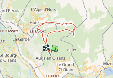
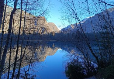
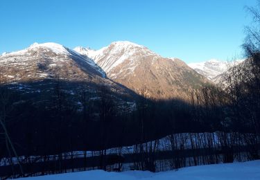
Ruta Senderismo de 12,4 km a descubrir en Auvergne-Rhône-Alpes, Isère, Auris. Esta ruta ha sido propuesta por jpb83.
Descripción
Très belle balade qui vous emmène dans les gorges de Sarenne et sur les pentes du Signal de l'Homme. Vous passerez aussi par le très charmant hameau du Rosai qui vaut le coup d’œil.
ITINÉRAIRE
Au départ de Auris, suivre le sentier en direction du col de Maronne. Au col de Maronne, descendre en direction du Rosay/Pont romain.
Au passage du Pont Romain, continuer vers le col de Sarenne.
Rejoindre Le Gua puis suivre le sentier 339 direction col de Cluy.
Pour le retour à la station d'Auris suivre le sentier 253. Au pied du Signal de l'Homme retour par le col de Maronne, puis suivre "Auris Station".
A VOIR SUR LE PARCOURS
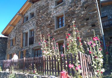
- Le hameau du Rosay a un charme tout montagnard avec ses maisons de pierres typiques de l'Oisans et également pour sa chapelle de la Ste Trinité datant du 15e siècle.
- Le pont Romain, porte bien son nom puisqu'il marque le passage d'une ancienne "voie romaine", qui permettait de relier Grenoble à l'Italie par le Col du Lautaret et la vallée de la Romanche.
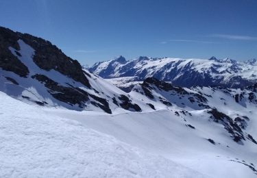
- L'ancien moulin de Sarenne, au bord du torrent du même nom, avec ses vestiges et des panneaux explicatifs.
A VOIR, A FAIRE À PROXIMITÉ
Découvrez le jardin botanique sur le sentier 252, en direction du Col de Sarenne.
A SAVOIR
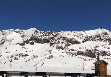
La Sarenne, "la piste noire la plus longue du monde". En effet, le sentier que vous empruntez est l'hiver la fin de cette mythique piste de ski.
Les chiens doivent être obligatoirement tenus en laisse en raison de la présence des chiens de troupeaux à certaines périodes de l'année.
Localización
Comentarios
Excursiones cerca
![Excursión Senderismo Le Bourg-d'Oisans - Lac de Buclet et cascade de la Pisse - Photo](https://media.geolcdn.com/t/375/260/ext.jpg?maxdim=2&url=https%3A%2F%2Fmedia.geolcdn.com%2Ff%2F7920e5ce-d45f-4ce3-8489-7c3261ef3795.jpg)
![Senderismo Senderismo](https://static1.geolcdn.com/sitytour/trail-icons/101.png)
Senderismo
![](/images/other/stat-length.png)
![](https://static1.geolcdn.com/siteimages/upload/files/16400158638029165_repeat_loop_refresh_sync_direction_icon.png)
![Excursión Bici eléctrica Les Deux Alpes - plateau d'Emparis - Photo](https://media.geolcdn.com/t/375/260/ext.jpg?maxdim=2&url=https%3A%2F%2Fmedia.geolcdn.com%2Ff%2Fe0e5c364-faf9-450f-8107-1f1f65fd8d5d.jpg)
![Bici eléctrica Bici eléctrica](https://static1.geolcdn.com/sitytour/trail-icons/205.png)
Bici eléctrica
![](/images/other/stat-length.png)
![](https://static1.geolcdn.com/siteimages/upload/files/16400158638029165_repeat_loop_refresh_sync_direction_icon.png)
![Excursión Senderismo Les Deux Alpes - Bons porte romaine - Photo](https://media.geolcdn.com/t/375/260/ext.jpg?maxdim=2&url=https%3A%2F%2Fmedia.geolcdn.com%2Ff%2Fe953dd9b-92c2-4085-b1ca-d9ed03ffa9de.jpg)
![Senderismo Senderismo](https://static1.geolcdn.com/sitytour/trail-icons/101.png)
Senderismo
![](/images/other/stat-length.png)
![](https://static1.geolcdn.com/siteimages/upload/files/16400158638029165_repeat_loop_refresh_sync_direction_icon.png)
![Excursión Esquí de fondo Huez - Pic de la Pyramide. - Photo](https://media.geolcdn.com/t/375/260/ext.jpg?maxdim=2&url=https%3A%2F%2Fmedia.geolcdn.com%2Ff%2Fd8f02114-cc43-41f4-8fcf-228e99c4af6c.jpg)
![Esquí de fondo Esquí de fondo](https://static1.geolcdn.com/sitytour/trail-icons/503.png)
Esquí de fondo
![](/images/other/stat-length.png)
![](https://static1.geolcdn.com/siteimages/upload/files/16400158638029165_repeat_loop_refresh_sync_direction_icon.png)
![Excursión Esquí de fondo Huez - Pic blanc par le tunnel - Photo](https://media.geolcdn.com/t/375/260/ext.jpg?maxdim=2&url=https%3A%2F%2Fmedia.geolcdn.com%2Ff%2F79c86d8d-1a1a-42e0-965d-518affa465c7.jpg)
![Esquí de fondo Esquí de fondo](https://static1.geolcdn.com/sitytour/trail-icons/503.png)
Esquí de fondo
![](/images/other/stat-length.png)
![](https://static1.geolcdn.com/siteimages/upload/files/16400158638029165_repeat_loop_refresh_sync_direction_icon.png)
![Excursión Esquí de fondo Auris - 220123 les Buffes - Photo](https://media.geolcdn.com/t/375/260/ext.jpg?maxdim=2&url=https%3A%2F%2Fmedia.geolcdn.com%2Ff%2F1f219626-40f4-4df5-bc13-28244765ba6f.jpg)
![Esquí de fondo Esquí de fondo](https://static1.geolcdn.com/sitytour/trail-icons/503.png)
Esquí de fondo
![](/images/other/stat-length.png)
![](https://static1.geolcdn.com/siteimages/upload/files/16400158638029165_repeat_loop_refresh_sync_direction_icon.png)
![Excursión Esquí de fondo Les Deux Alpes - 220122 Fioc. 2 alpes - Photo](https://media.geolcdn.com/t/375/260/ext.jpg?maxdim=2&url=https%3A%2F%2Fmedia.geolcdn.com%2Ff%2Fdd038ef8-b25c-40e5-a3b6-422f02e40feb.jpg)
![Esquí de fondo Esquí de fondo](https://static1.geolcdn.com/sitytour/trail-icons/503.png)
Esquí de fondo
![](/images/other/stat-length.png)
![](https://static1.geolcdn.com/siteimages/upload/files/16400158638029165_repeat_loop_refresh_sync_direction_icon.png)
![Excursión Senderismo Villard-Reymond - La Croix du Carrelet et la crête de Croix de La Garde - Photo](https://media.geolcdn.com/t/375/260/ext.jpg?maxdim=2&url=https%3A%2F%2Fmedia.geolcdn.com%2Ff%2F719f71c8-5764-4d7d-9547-f0e72ea0e1f5.jpg)
![Senderismo Senderismo](https://static1.geolcdn.com/sitytour/trail-icons/101.png)
Senderismo
![](/images/other/stat-length.png)
![](https://static1.geolcdn.com/siteimages/upload/files/16400158638029165_repeat_loop_refresh_sync_direction_icon.png)
![Excursión Senderismo Auris - Auris en Oizan- balade vers Placet - Photo](https://media.geolcdn.com/t/375/260/ext.jpg?maxdim=2&url=https%3A%2F%2Fmedia.geolcdn.com%2Ff%2F5a0f490f-c9f2-4b39-aad1-de8711b6f381.jpg)
![Senderismo Senderismo](https://static1.geolcdn.com/sitytour/trail-icons/101.png)
Senderismo
![](/images/other/stat-length.png)
![](https://static1.geolcdn.com/siteimages/upload/files/16400158638029165_repeat_loop_refresh_sync_direction_icon.png)