![](/images/other/stat-length.png)
![Excursión Senderismo Luzech - Lot - Luzech Albas 22km 318m - Photo](https://media.geolcdn.com/t/1900/400/ext.pjpeg?maxdim=2&url=https%3A%2F%2Fstatic1.geolcdn.com%2Fsiteimages%2Fupload%2Ffiles%2F1553511878bg_sport_marche.png)
Lot - Luzech Albas 22km 318m
RandoVal
Usuario
![Longitud](/images/other/stat-length.png)
Longitud
22 km
![Altitud máxima](https://static1.geolcdn.com/siteimages/upload/files/1508320355ic_sort_altitude_max_24dp.png)
Altitud máxima
287 m
![Desnivel positivo](https://static1.geolcdn.com/siteimages/upload/files/1508320355ic_sort_den_pos_24dp.png)
Desnivel positivo
516 m
![Km-Effort](/images/other/stat-length.png)
Km-Effort
29 km
![Altitud mínima](https://static1.geolcdn.com/siteimages/upload/files/1508320355ic_sort_altitude_min_24dp.png)
Altitud mínima
93 m
![Desnivel negativo](https://static1.geolcdn.com/siteimages/upload/files/1508320355ic_sort_den_neg_24dp.png)
Desnivel negativo
517 m
![Boucle](https://static1.geolcdn.com/siteimages/upload/files/16400158638029165_repeat_loop_refresh_sync_direction_icon.png)
Boucle
Sí
Fecha de creación :
2021-06-03 16:42:44.413
Última modificación :
2021-06-03 16:43:21.217
![Senderismo](https://static1.geolcdn.com/sitytour/trail-icons/101.png)
--
Dificultad : Desconocido
![Escanee este código QR para abrir la excursión en la aplicación SityTrail](https://capi.geolives.com/qq0zvz2zws4bq2lad0pu/sitytour/trails/2812895/qr.png?size=200)
Aplicación GPS de excursión GRATIS
A propósito
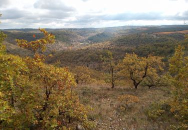
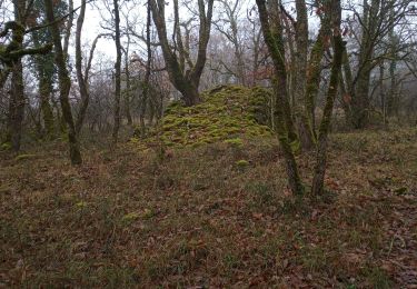
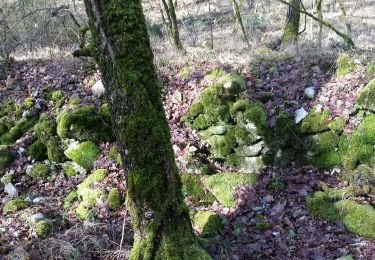
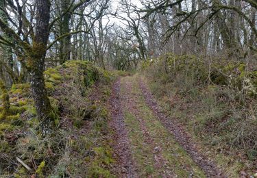
Ruta Senderismo de 22 km a descubrir en Occitania, Lot, Luzech. Esta ruta ha sido propuesta por RandoVal.
Descripción
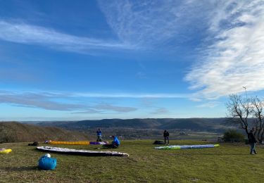
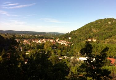
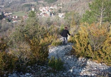
Boucle dans les collines du Lot et les boucles de la rivière d'Olt, stationnement et départ au parking de l'écluse à Luzech, sens anti-horaire.
Localización
País:
France
Región :
Occitania
Departamento/provincia :
Lot
Municipio :
Luzech
Localidad:
Unknown
Salida:(Dec)
Salida:(UTM)
363871 ; 4926408 (31T) N.
Comentarios
Excursiones cerca
![Excursión Senderismo Saint-Vincent-Rive-d'Olt - St Vincent-rive d’Holt (Lot) - Photo](https://media.geolcdn.com/t/375/260/ext.jpg?maxdim=2&url=https%3A%2F%2Fstatic1.geolcdn.com%2Fsiteimages%2Fupload%2Ffiles%2F1553511878bg_sport_marche.png)
![Senderismo Senderismo](https://static1.geolcdn.com/sitytour/trail-icons/101.png)
St Vincent-rive d’Holt (Lot)
Senderismo
Difícil
(1)
Saint-Vincent-Rive-d'Olt,
Occitania,
Lot,
France
![](/images/other/stat-length.png)
11,6 km | 17,4 km-effort
3h 57min
![](https://static1.geolcdn.com/siteimages/upload/files/16400158638029165_repeat_loop_refresh_sync_direction_icon.png)
Sí
![Excursión Senderismo Crayssac - Crayssac Cévennes - Photo](https://media.geolcdn.com/t/375/260/f07bb3de-4c60-4431-b846-5572eb8ab419.jpg&format=jpg&maxdim=2)
![Senderismo Senderismo](https://static1.geolcdn.com/sitytour/trail-icons/101.png)
Crayssac Cévennes
Senderismo
Muy fácil
Crayssac,
Occitania,
Lot,
France
![](/images/other/stat-length.png)
6,3 km | 9,1 km-effort
1h 43min
![](https://static1.geolcdn.com/siteimages/upload/files/16400158638029165_repeat_loop_refresh_sync_direction_icon.png)
No
![Excursión Senderismo Luzech - De Luzech à Castelfranc - Photo](https://media.geolcdn.com/t/375/260/ext.jpg?maxdim=2&url=https%3A%2F%2Fservices.sitytrail.com%2FGeolivesWS%2FDownloadMedia.ashx%3FTrailID%3D316982%26Media%3D16106_3.jpg)
![Senderismo Senderismo](https://static1.geolcdn.com/sitytour/trail-icons/101.png)
De Luzech à Castelfranc
Senderismo
Muy difícil
Luzech,
Occitania,
Lot,
France
![](/images/other/stat-length.png)
24 km | 32 km-effort
5h 0min
![](https://static1.geolcdn.com/siteimages/upload/files/16400158638029165_repeat_loop_refresh_sync_direction_icon.png)
Sí
![Excursión Senderismo Saint-Vincent-Rive-d'Olt - Point de vue sur le cingle de Luzech - Photo](https://media.geolcdn.com/t/375/260/ext.jpg?maxdim=2&url=https%3A%2F%2Fservices.sitytrail.com%2FGeolivesWS%2FDownloadMedia.ashx%3FTrailID%3D104694%26Media%3D8100_5.jpg)
![Senderismo Senderismo](https://static1.geolcdn.com/sitytour/trail-icons/101.png)
Point de vue sur le cingle de Luzech
Senderismo
Difícil
(1)
Saint-Vincent-Rive-d'Olt,
Occitania,
Lot,
France
![](/images/other/stat-length.png)
4,6 km | 7,3 km-effort
1h 30min
![](https://static1.geolcdn.com/siteimages/upload/files/16400158638029165_repeat_loop_refresh_sync_direction_icon.png)
Sí
![Excursión Senderismo Luzech - LUZECH - Photo](https://media.geolcdn.com/t/375/260/9b21fca2-bfb8-4fba-9ee0-71949b40b188.jpg&format=jpg&maxdim=2)
![Senderismo Senderismo](https://static1.geolcdn.com/sitytour/trail-icons/101.png)
![Excursión Senderismo Douelle - Douelle_Mader/Combe de Vadaillac/les Roubines 6 - Photo](https://media.geolcdn.com/t/375/260/18f1e74a-9791-4007-90e2-e99aec771378.jpg&format=jpg&maxdim=2)
![Senderismo Senderismo](https://static1.geolcdn.com/sitytour/trail-icons/101.png)
Douelle_Mader/Combe de Vadaillac/les Roubines 6
Senderismo
Fácil
Douelle,
Occitania,
Lot,
France
![](/images/other/stat-length.png)
6 km | 8,9 km-effort
2h 8min
![](https://static1.geolcdn.com/siteimages/upload/files/16400158638029165_repeat_loop_refresh_sync_direction_icon.png)
Sí
![Excursión Senderismo Luzech - Fages_Pech-vert_Foulquet 6,5 - Photo](https://media.geolcdn.com/t/375/260/338f1118-5eea-4e57-9527-5664443760c4.jpg&format=jpg&maxdim=2)
![Senderismo Senderismo](https://static1.geolcdn.com/sitytour/trail-icons/101.png)
Fages_Pech-vert_Foulquet 6,5
Senderismo
Muy fácil
Luzech,
Occitania,
Lot,
France
![](/images/other/stat-length.png)
6,5 km | 8,9 km-effort
2h 7min
![](https://static1.geolcdn.com/siteimages/upload/files/16400158638029165_repeat_loop_refresh_sync_direction_icon.png)
Sí
![Excursión Senderismo Castelfranc - Castelfranc Tindout 2019 02 08 - Photo](https://media.geolcdn.com/t/375/260/e80082af-b8d1-43d9-93e0-f745cfe9929d.jpg&format=jpg&maxdim=2)
![Senderismo Senderismo](https://static1.geolcdn.com/sitytour/trail-icons/101.png)
Castelfranc Tindout 2019 02 08
Senderismo
Fácil
Castelfranc,
Occitania,
Lot,
France
![](/images/other/stat-length.png)
3,3 km | 4,6 km-effort
1h 42min
![](https://static1.geolcdn.com/siteimages/upload/files/16400158638029165_repeat_loop_refresh_sync_direction_icon.png)
Sí
![Excursión Senderismo Castelfranc - Castelfranc Tindout photos - Photo](https://media.geolcdn.com/t/375/260/efe0a7fb-1925-40d4-8fb0-59e40660d7aa.jpg&format=jpg&maxdim=2)
![Senderismo Senderismo](https://static1.geolcdn.com/sitytour/trail-icons/101.png)
Castelfranc Tindout photos
Senderismo
Fácil
Castelfranc,
Occitania,
Lot,
France
![](/images/other/stat-length.png)
5 km | 6,9 km-effort
2h 1min
![](https://static1.geolcdn.com/siteimages/upload/files/16400158638029165_repeat_loop_refresh_sync_direction_icon.png)
Sí