![](/images/other/stat-length.png)
La Vallée de la Varenne , vu du haut de Torcy
crocheval
Usuario
![Longitud](/images/other/stat-length.png)
Longitud
4,5 km
![Altitud máxima](https://static1.geolcdn.com/siteimages/upload/files/1508320355ic_sort_altitude_max_24dp.png)
Altitud máxima
159 m
![Desnivel positivo](https://static1.geolcdn.com/siteimages/upload/files/1508320355ic_sort_den_pos_24dp.png)
Desnivel positivo
133 m
![Km-Effort](/images/other/stat-length.png)
Km-Effort
6,3 km
![Altitud mínima](https://static1.geolcdn.com/siteimages/upload/files/1508320355ic_sort_altitude_min_24dp.png)
Altitud mínima
34 m
![Desnivel negativo](https://static1.geolcdn.com/siteimages/upload/files/1508320355ic_sort_den_neg_24dp.png)
Desnivel negativo
134 m
![Boucle](https://static1.geolcdn.com/siteimages/upload/files/16400158638029165_repeat_loop_refresh_sync_direction_icon.png)
Boucle
Sí
Fecha de creación :
2021-05-31 09:28:01.836
Última modificación :
2021-05-31 09:36:52.973
![Senderismo](https://static1.geolcdn.com/sitytour/trail-icons/101.png)
1h25
Dificultad : Medio
![Escanee este código QR para abrir la excursión en la aplicación SityTrail](https://capi.geolives.com/qq0zvz2zws4bq2lad0pu/sitytour/trails/2808683/qr.png?size=200)
Aplicación GPS de excursión GRATIS
A propósito
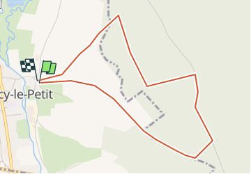
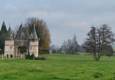
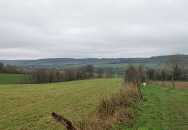
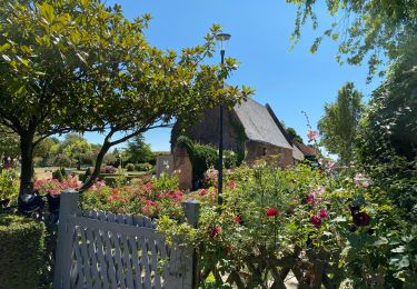
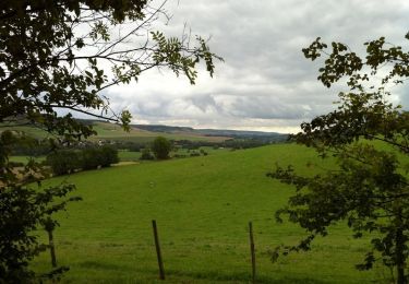
Ruta Senderismo de 4,5 km a descubrir en Normandía, Sena-Marítimo, Torcy-le-Petit. Esta ruta ha sido propuesta por crocheval.
Descripción
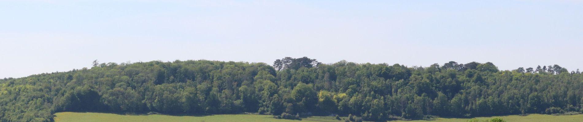
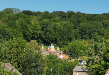
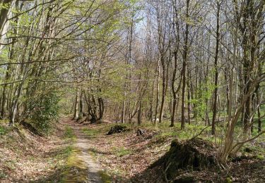
Super balade, bien ombragé. Incursion dans la forêt domaniale, pour mieux découvrir la vallée de la varenne, ainsi que Torcy par une vue extraordinaire des étangs et des alentours.
Localización
País:
France
Región :
Normandía
Departamento/provincia :
Sena-Marítimo
Municipio :
Torcy-le-Petit
Localidad:
Unknown
Salida:(Dec)
Salida:(UTM)
368872 ; 5519704 (31U) N.
Comentarios
Excursiones cerca
![Excursión Senderismo Freulleville - Val de Ricarville - Photo](https://media.geolcdn.com/t/375/260/ext.jpg?maxdim=2&url=https%3A%2F%2Fstatic1.geolcdn.com%2Fsiteimages%2Fupload%2Ffiles%2F1553511878bg_sport_marche.png)
![Senderismo Senderismo](https://static1.geolcdn.com/sitytour/trail-icons/101.png)
Val de Ricarville
Senderismo
Medio
(1)
Freulleville,
Normandía,
Sena-Marítimo,
France
![](/images/other/stat-length.png)
12,9 km | 15,3 km-effort
3h 45min
![](https://static1.geolcdn.com/siteimages/upload/files/16400158638029165_repeat_loop_refresh_sync_direction_icon.png)
Sí
![Excursión Senderismo Freulleville - Avenue verte Freulleville - Photo](https://media.geolcdn.com/t/375/260/ext.jpg?maxdim=2&url=https%3A%2F%2Fstatic1.geolcdn.com%2Fsiteimages%2Fupload%2Ffiles%2F1553511878bg_sport_marche.png)
![Senderismo Senderismo](https://static1.geolcdn.com/sitytour/trail-icons/101.png)
Avenue verte Freulleville
Senderismo
Fácil
(1)
Freulleville,
Normandía,
Sena-Marítimo,
France
![](/images/other/stat-length.png)
8,6 km | 10,4 km-effort
2h 16min
![](https://static1.geolcdn.com/siteimages/upload/files/16400158638029165_repeat_loop_refresh_sync_direction_icon.png)
Sí
![Excursión Bici de montaña Freulleville - fumechon - Photo](https://media.geolcdn.com/t/375/260/ext.jpg?maxdim=2&url=https%3A%2F%2Fstatic1.geolcdn.com%2Fsiteimages%2Fupload%2Ffiles%2F1524743154velo.jpg)
![Bici de montaña Bici de montaña](https://static1.geolcdn.com/sitytour/trail-icons/202.png)
fumechon
Bici de montaña
Muy difícil
(1)
Freulleville,
Normandía,
Sena-Marítimo,
France
![](/images/other/stat-length.png)
48 km | 57 km-effort
3h 13min
![](https://static1.geolcdn.com/siteimages/upload/files/16400158638029165_repeat_loop_refresh_sync_direction_icon.png)
Sí
![Excursión Senderismo Muchedent - muchedent - Photo](https://media.geolcdn.com/t/375/260/e2b1ed44-7292-458f-830f-8bdc38fb79e5.jpg&format=jpg&maxdim=2)
![Senderismo Senderismo](https://static1.geolcdn.com/sitytour/trail-icons/101.png)
muchedent
Senderismo
Difícil
Muchedent,
Normandía,
Sena-Marítimo,
France
![](/images/other/stat-length.png)
9,5 km | 12 km-effort
1h 35min
![](https://static1.geolcdn.com/siteimages/upload/files/16400158638029165_repeat_loop_refresh_sync_direction_icon.png)
Sí
![Excursión Senderismo Freulleville - forêt d'eawy torcy - Photo](https://media.geolcdn.com/t/375/260/6312d56a-96b5-462e-a737-70631a638906.jpg&format=jpg&maxdim=2)
![Senderismo Senderismo](https://static1.geolcdn.com/sitytour/trail-icons/101.png)
forêt d'eawy torcy
Senderismo
Medio
Freulleville,
Normandía,
Sena-Marítimo,
France
![](/images/other/stat-length.png)
8,8 km | 11,1 km-effort
1h 36min
![](https://static1.geolcdn.com/siteimages/upload/files/16400158638029165_repeat_loop_refresh_sync_direction_icon.png)
Sí
![Excursión Senderismo Dampierre-Saint-Nicolas - dampierre st Nicolas bois de pimont - Photo](https://media.geolcdn.com/t/375/260/d23f809e-36cd-4a25-be10-657a5437f97f.jpg&format=jpg&maxdim=2)
![Senderismo Senderismo](https://static1.geolcdn.com/sitytour/trail-icons/101.png)
dampierre st Nicolas bois de pimont
Senderismo
Muy fácil
Dampierre-Saint-Nicolas,
Normandía,
Sena-Marítimo,
France
![](/images/other/stat-length.png)
7,1 km | 9,1 km-effort
1h 17min
![](https://static1.geolcdn.com/siteimages/upload/files/16400158638029165_repeat_loop_refresh_sync_direction_icon.png)
Sí
![Excursión Senderismo Meulers - meulers bois de Pimont freuleville - Photo](https://media.geolcdn.com/t/375/260/49c24700-2425-4af0-8517-c4fdb64a3fd2.jpg&format=jpg&maxdim=2)
![Senderismo Senderismo](https://static1.geolcdn.com/sitytour/trail-icons/101.png)
meulers bois de Pimont freuleville
Senderismo
Muy fácil
Meulers,
Normandía,
Sena-Marítimo,
France
![](/images/other/stat-length.png)
8,2 km | 10,1 km-effort
1h 42min
![](https://static1.geolcdn.com/siteimages/upload/files/16400158638029165_repeat_loop_refresh_sync_direction_icon.png)
Sí
![Excursión Cicloturismo Freulleville - Arques - Offranville - Photo](https://media.geolcdn.com/t/375/260/61992817-3764-44b2-baee-7506d7f39c85.jpg&format=jpg&maxdim=2)
![Cicloturismo Cicloturismo](https://static1.geolcdn.com/sitytour/trail-icons/204.png)
Arques - Offranville
Cicloturismo
Medio
Freulleville,
Normandía,
Sena-Marítimo,
France
![](/images/other/stat-length.png)
19,9 km | 23 km-effort
1h 23min
![](https://static1.geolcdn.com/siteimages/upload/files/16400158638029165_repeat_loop_refresh_sync_direction_icon.png)
No
![Excursión Senderismo Meulers - Balade à Meulers - Photo](https://media.geolcdn.com/t/375/260/ext.jpg?maxdim=2&url=https%3A%2F%2Fservices.sitytrail.com%2FGeolivesWS%2FDownloadMedia.ashx%3FTrailID%3D172485%26Media%3D13843_1.jpg)
![Senderismo Senderismo](https://static1.geolcdn.com/sitytour/trail-icons/101.png)
Balade à Meulers
Senderismo
Fácil
Meulers,
Normandía,
Sena-Marítimo,
France
![](/images/other/stat-length.png)
13,5 km | 17,9 km-effort
2h 49min
![](https://static1.geolcdn.com/siteimages/upload/files/16400158638029165_repeat_loop_refresh_sync_direction_icon.png)
Sí