![](/images/other/stat-length.png)
ITILAR011V5035JF
Licianus2
Usuario
![Longitud](/images/other/stat-length.png)
![Altitud máxima](https://static1.geolcdn.com/siteimages/upload/files/1508320355ic_sort_altitude_max_24dp.png)
![Desnivel positivo](https://static1.geolcdn.com/siteimages/upload/files/1508320355ic_sort_den_pos_24dp.png)
![Km-Effort](/images/other/stat-length.png)
![Altitud mínima](https://static1.geolcdn.com/siteimages/upload/files/1508320355ic_sort_altitude_min_24dp.png)
![Desnivel negativo](https://static1.geolcdn.com/siteimages/upload/files/1508320355ic_sort_den_neg_24dp.png)
![Boucle](https://static1.geolcdn.com/siteimages/upload/files/16400158638029165_repeat_loop_refresh_sync_direction_icon.png)
![Senderismo](https://static1.geolcdn.com/sitytour/trail-icons/101.png)
2h27
Dificultad : Medio
![Escanee este código QR para abrir la excursión en la aplicación SityTrail](https://capi.geolives.com/qq0zvz2zws4bq2lad0pu/sitytour/trails/2807483/qr.png?size=200)
Aplicación GPS de excursión GRATIS
A propósito
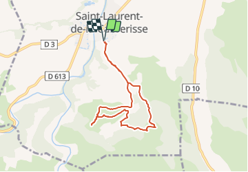
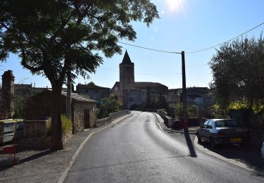
Ruta Senderismo de 7,2 km a descubrir en Occitania, Aude, Saint-Laurent-de-la-Cabrerisse. Esta ruta ha sido propuesta por Licianus2.
Descripción
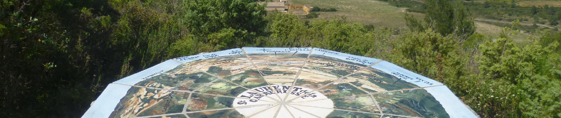
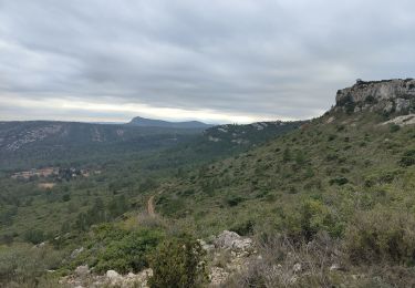
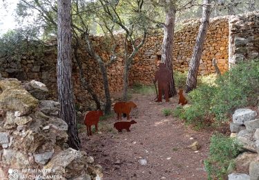
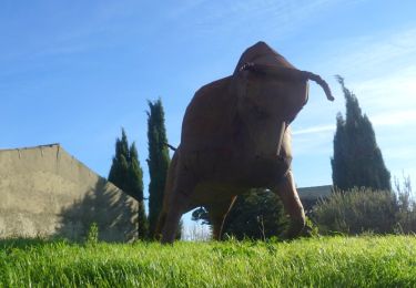
Petite boucle qui vous mènera jusqu'à la "Roca dansaïra", un curieux rocher qui danse, du moins selon la légende, un sentier botanique très complet et une table d'orientation offrant un magnifique panorama à 360°, tel est le programme de cette randonnée sans difficulté qui s'effectue dans la douce senteur des pins. Sans oublier les nombreux passages en crête qui ménagent de jolis points de vue sur les villages alentour, le vignoble des Corbières et, en toute fin de parcours, les grands sommets d'Occitanie.
Départ du cimetière par un chemin goudronné puis, montée jusqu'à la table d'orientation par le petit sentier botanique avec, au passage, un AR de 500 m à la Roca dansaïra. Après la table escaliers sur un dénivelé de 50 m avant retour par le chemin du départ, Mi-ombre mi-soleil. Première partie avec une montée régulière assez longue.
Localización
Comentarios
Excursiones cerca
![Excursión Senderismo Talairan - Chemin du facteur + Gourg - Photo](https://media.geolcdn.com/t/375/260/61360f1d-7778-4bb9-99e7-d9ef4319aa20.jpg&format=jpg&maxdim=2)
![Senderismo Senderismo](https://static1.geolcdn.com/sitytour/trail-icons/101.png)
Senderismo
![](/images/other/stat-length.png)
![](https://static1.geolcdn.com/siteimages/upload/files/16400158638029165_repeat_loop_refresh_sync_direction_icon.png)
![Excursión A pie Saint-Laurent-de-la-Cabrerisse - Le cirque de Viviès St Laurent de la Cabrerisse - Photo](https://media.geolcdn.com/t/375/260/ext.jpg?maxdim=2&url=https%3A%2F%2Fstatic1.geolcdn.com%2Fsiteimages%2Fupload%2Ffiles%2F1545311037marcheuse_200dpi.jpg)
![A pie A pie](https://static1.geolcdn.com/sitytour/trail-icons/100.png)
A pie
![](/images/other/stat-length.png)
![](https://static1.geolcdn.com/siteimages/upload/files/16400158638029165_repeat_loop_refresh_sync_direction_icon.png)
![Excursión Senderismo Fabrezan - François et Nathalie 1 - Photo](https://media.geolcdn.com/t/375/260/ext.jpg?maxdim=2&url=https%3A%2F%2Fstatic1.geolcdn.com%2Fsiteimages%2Fupload%2Ffiles%2F1553511878bg_sport_marche.png)
![Senderismo Senderismo](https://static1.geolcdn.com/sitytour/trail-icons/101.png)
Senderismo
![](/images/other/stat-length.png)
![](https://static1.geolcdn.com/siteimages/upload/files/16400158638029165_repeat_loop_refresh_sync_direction_icon.png)
![Excursión Senderismo Saint-Laurent-de-la-Cabrerisse - Saint Laurent de la Cabrerisse - Photo](https://media.geolcdn.com/t/375/260/9193cc34-8575-4894-a2de-4b6fce4876bb.jpg&format=jpg&maxdim=2)
![Senderismo Senderismo](https://static1.geolcdn.com/sitytour/trail-icons/101.png)
Senderismo
![](/images/other/stat-length.png)
![](https://static1.geolcdn.com/siteimages/upload/files/16400158638029165_repeat_loop_refresh_sync_direction_icon.png)
![Excursión Senderismo Coustouge - Coustouge Fontjoncouge - Photo](https://media.geolcdn.com/t/375/260/0e4a9282-9b3b-40d9-aa68-7fe0d2769990.jpg&format=jpg&maxdim=2)
![Senderismo Senderismo](https://static1.geolcdn.com/sitytour/trail-icons/101.png)
Senderismo
![](/images/other/stat-length.png)
![](https://static1.geolcdn.com/siteimages/upload/files/16400158638029165_repeat_loop_refresh_sync_direction_icon.png)
![Excursión Senderismo Tournissan - 11 les terres rouges 01/10/23 - Photo](https://media.geolcdn.com/t/375/260/9f3344cf-8c19-4760-9958-711db8054a56.jpg&format=jpg&maxdim=2)
![Senderismo Senderismo](https://static1.geolcdn.com/sitytour/trail-icons/101.png)
Senderismo
![](/images/other/stat-length.png)
![](https://static1.geolcdn.com/siteimages/upload/files/16400158638029165_repeat_loop_refresh_sync_direction_icon.png)
![Excursión A pie Saint-Laurent-de-la-Cabrerisse - Le Cirque De Viviès - Photo](https://media.geolcdn.com/t/375/260/4947ff3a-b691-4890-865d-de0986754cd3.jpeg&format=jpg&maxdim=2)
![A pie A pie](https://static1.geolcdn.com/sitytour/trail-icons/100.png)
A pie
![](/images/other/stat-length.png)
![](https://static1.geolcdn.com/siteimages/upload/files/16400158638029165_repeat_loop_refresh_sync_direction_icon.png)
![Senderismo Senderismo](https://static1.geolcdn.com/sitytour/trail-icons/101.png)
Senderismo
![](/images/other/stat-length.png)
![](https://static1.geolcdn.com/siteimages/upload/files/16400158638029165_repeat_loop_refresh_sync_direction_icon.png)
![Senderismo Senderismo](https://static1.geolcdn.com/sitytour/trail-icons/101.png)
Senderismo
![](/images/other/stat-length.png)
![](https://static1.geolcdn.com/siteimages/upload/files/16400158638029165_repeat_loop_refresh_sync_direction_icon.png)