![](/images/other/stat-length.png)
![Excursión Senderismo Naucelle - naucelle - Photo](https://media.geolcdn.com/t/1900/400/ext.pjpeg?maxdim=2&url=https%3A%2F%2Fstatic1.geolcdn.com%2Fsiteimages%2Fupload%2Ffiles%2F1553511878bg_sport_marche.png)
naucelle
Frayssinet
Usuario
![Longitud](/images/other/stat-length.png)
Longitud
23 km
![Altitud máxima](https://static1.geolcdn.com/siteimages/upload/files/1508320355ic_sort_altitude_max_24dp.png)
Altitud máxima
494 m
![Desnivel positivo](https://static1.geolcdn.com/siteimages/upload/files/1508320355ic_sort_den_pos_24dp.png)
Desnivel positivo
679 m
![Km-Effort](/images/other/stat-length.png)
Km-Effort
32 km
![Altitud mínima](https://static1.geolcdn.com/siteimages/upload/files/1508320355ic_sort_altitude_min_24dp.png)
Altitud mínima
304 m
![Desnivel negativo](https://static1.geolcdn.com/siteimages/upload/files/1508320355ic_sort_den_neg_24dp.png)
Desnivel negativo
680 m
![Boucle](https://static1.geolcdn.com/siteimages/upload/files/16400158638029165_repeat_loop_refresh_sync_direction_icon.png)
Boucle
Sí
Fecha de creación :
2021-05-23 06:16:02.836
Última modificación :
2021-05-23 16:23:28.365
![Senderismo](https://static1.geolcdn.com/sitytour/trail-icons/101.png)
5h36
Dificultad : Muy difícil
![Escanee este código QR para abrir la excursión en la aplicación SityTrail](https://capi.geolives.com/qq0zvz2zws4bq2lad0pu/sitytour/trails/2798205/qr.png?size=200)
Aplicación GPS de excursión GRATIS
A propósito
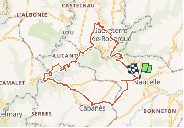
Ruta Senderismo de 23 km a descubrir en Occitania, Aveyron, Naucelle. Esta ruta ha sido propuesta por Frayssinet.
Descripción
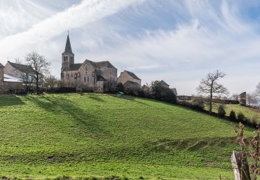
Départ de Naucelle, vers la Chapelle de Villelongue (musée de la résistance). Passage au moulin de Galie.
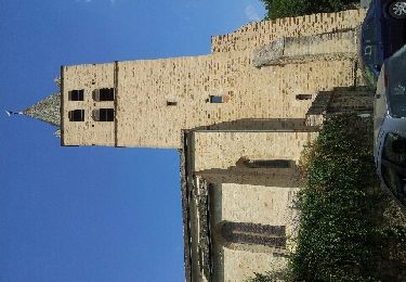
Montée vers Sauveterre en passant près d'Albagnac.
Retour classique vers Naucelle.
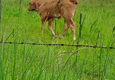
Ferme de Lamas et Anes vers le village de La Prade basse.
Localización
País:
France
Región :
Occitania
Departamento/provincia :
Aveyron
Municipio :
Naucelle
Localidad:
Unknown
Salida:(Dec)
Salida:(UTM)
447033 ; 4894197 (31T) N.
Comentarios
Excursiones cerca
![Excursión A pie Quins - Quins 1 - Photo](https://media.geolcdn.com/t/375/260/ext.jpg?maxdim=2&url=https%3A%2F%2Fmedia.geolcdn.com%2Ff%2F71b85827-9f81-4d3c-b003-417d266e763f.jpeg)
![A pie A pie](https://static1.geolcdn.com/sitytour/trail-icons/100.png)
![Excursión A pie Quins - Quins 2 - Photo](https://media.geolcdn.com/t/375/260/ext.jpg?maxdim=2&url=https%3A%2F%2Fmedia.geolcdn.com%2Ff%2F71b85827-9f81-4d3c-b003-417d266e763f.jpeg)
![A pie A pie](https://static1.geolcdn.com/sitytour/trail-icons/100.png)
![Excursión Senderismo Sauveterre-de-Rouergue - la gazonne sauveterre la gazonne modifiée - Photo](https://media.geolcdn.com/t/375/260/ext.jpg?maxdim=2&url=https%3A%2F%2Fmedia.geolcdn.com%2Ff%2Ff3101ce2-aeb3-4913-bb3e-79304ad58973.jpg)
![Senderismo Senderismo](https://static1.geolcdn.com/sitytour/trail-icons/101.png)
la gazonne sauveterre la gazonne modifiée
Senderismo
Difícil
Sauveterre-de-Rouergue,
Occitania,
Aveyron,
France
![](/images/other/stat-length.png)
9,8 km | 13,5 km-effort
2h 37min
![](https://static1.geolcdn.com/siteimages/upload/files/16400158638029165_repeat_loop_refresh_sync_direction_icon.png)
Sí
![Excursión Senderismo Sauveterre-de-Rouergue - Sauveterre de Rouergue, au coeur du Ségala - Photo](https://media.geolcdn.com/t/375/260/ext.jpg?maxdim=2&url=https%3A%2F%2Fservices.sitytrail.com%2FGeolivesWS%2FDownloadMedia.ashx%3FTrailID%3D104126%26Media%3D7196_6.jpg)
![Senderismo Senderismo](https://static1.geolcdn.com/sitytour/trail-icons/101.png)
Sauveterre de Rouergue, au coeur du Ségala
Senderismo
Difícil
Sauveterre-de-Rouergue,
Occitania,
Aveyron,
France
![](/images/other/stat-length.png)
15,1 km | 22 km-effort
4h 45min
![](https://static1.geolcdn.com/siteimages/upload/files/16400158638029165_repeat_loop_refresh_sync_direction_icon.png)
Sí
![Excursión Senderismo Naucelle - Naucelle - Photo](https://media.geolcdn.com/t/375/260/ext.jpg?maxdim=2&url=https%3A%2F%2Fmedia.geolcdn.com%2Ff%2F816e6f2e-257d-4632-8a2c-1f988e32190f.jpg)
![Senderismo Senderismo](https://static1.geolcdn.com/sitytour/trail-icons/101.png)
Naucelle
Senderismo
Muy difícil
(1)
Naucelle,
Occitania,
Aveyron,
France
![](/images/other/stat-length.png)
15 km | 21 km-effort
4h 52min
![](https://static1.geolcdn.com/siteimages/upload/files/16400158638029165_repeat_loop_refresh_sync_direction_icon.png)
Sí
![Excursión Senderismo Naucelle - 2012-09-09 17h04m18 - Photo](https://media.geolcdn.com/t/375/260/ext.jpg?maxdim=2&url=https%3A%2F%2Fservices.sitytrail.com%2FGeolivesWS%2FDownloadMedia.ashx%3FTrailID%3D152846%26Media%3D20120909142702.jpeg)
![Senderismo Senderismo](https://static1.geolcdn.com/sitytour/trail-icons/101.png)
2012-09-09 17h04m18
Senderismo
Fácil
(1)
Naucelle,
Occitania,
Aveyron,
France
![](/images/other/stat-length.png)
11,7 km | 15,9 km-effort
4h 4min
![](https://static1.geolcdn.com/siteimages/upload/files/16400158638029165_repeat_loop_refresh_sync_direction_icon.png)
Sí
![Excursión Senderismo Sauveterre-de-Rouergue - autour de sauveterre version courte - Photo](https://media.geolcdn.com/t/375/260/ext.jpg?maxdim=2&url=https%3A%2F%2Fstatic1.geolcdn.com%2Fsiteimages%2Fupload%2Ffiles%2F1553511878bg_sport_marche.png)
![Senderismo Senderismo](https://static1.geolcdn.com/sitytour/trail-icons/101.png)
autour de sauveterre version courte
Senderismo
Medio
Sauveterre-de-Rouergue,
Occitania,
Aveyron,
France
![](/images/other/stat-length.png)
7,3 km | 10,1 km-effort
2h 18min
![](https://static1.geolcdn.com/siteimages/upload/files/16400158638029165_repeat_loop_refresh_sync_direction_icon.png)
Sí
![Excursión Senderismo Sauveterre-de-Rouergue - la gazonne sauveterre la gazonne - Photo](https://media.geolcdn.com/t/375/260/ext.jpg?maxdim=2&url=https%3A%2F%2Fstatic1.geolcdn.com%2Fsiteimages%2Fupload%2Ffiles%2F1553511878bg_sport_marche.png)
![Senderismo Senderismo](https://static1.geolcdn.com/sitytour/trail-icons/101.png)
la gazonne sauveterre la gazonne
Senderismo
Difícil
Sauveterre-de-Rouergue,
Occitania,
Aveyron,
France
![](/images/other/stat-length.png)
9,3 km | 13,6 km-effort
3h 5min
![](https://static1.geolcdn.com/siteimages/upload/files/16400158638029165_repeat_loop_refresh_sync_direction_icon.png)
Sí
![Excursión Senderismo Naucelle - Naucelle a La salvetat - Photo](https://media.geolcdn.com/t/375/260/ext.jpg?maxdim=2&url=https%3A%2F%2Fstatic1.geolcdn.com%2Fsiteimages%2Fupload%2Ffiles%2F1553511878bg_sport_marche.png)
![Senderismo Senderismo](https://static1.geolcdn.com/sitytour/trail-icons/101.png)
Naucelle a La salvetat
Senderismo
Fácil
Naucelle,
Occitania,
Aveyron,
France
![](/images/other/stat-length.png)
20 km | 28 km-effort
6h 25min
![](https://static1.geolcdn.com/siteimages/upload/files/16400158638029165_repeat_loop_refresh_sync_direction_icon.png)
Sí