![](/images/other/stat-length.png)
![Excursión Senderismo Val de Louyre et Caudeau - boucle des truffiers - Photo](https://media.geolcdn.com/t/1900/400/ext.pjpeg?maxdim=2&url=https%3A%2F%2Fstatic1.geolcdn.com%2Fsiteimages%2Fupload%2Ffiles%2F1553511878bg_sport_marche.png)
boucle des truffiers
fab0202
Usuario
![Longitud](/images/other/stat-length.png)
Longitud
10,9 km
![Altitud máxima](https://static1.geolcdn.com/siteimages/upload/files/1508320355ic_sort_altitude_max_24dp.png)
Altitud máxima
238 m
![Desnivel positivo](https://static1.geolcdn.com/siteimages/upload/files/1508320355ic_sort_den_pos_24dp.png)
Desnivel positivo
250 m
![Km-Effort](/images/other/stat-length.png)
Km-Effort
14,2 km
![Altitud mínima](https://static1.geolcdn.com/siteimages/upload/files/1508320355ic_sort_altitude_min_24dp.png)
Altitud mínima
136 m
![Desnivel negativo](https://static1.geolcdn.com/siteimages/upload/files/1508320355ic_sort_den_neg_24dp.png)
Desnivel negativo
241 m
![Boucle](https://static1.geolcdn.com/siteimages/upload/files/16400158638029165_repeat_loop_refresh_sync_direction_icon.png)
Boucle
No
Fecha de creación :
2021-05-09 07:34:24.332
Última modificación :
2021-05-09 10:00:05.932
![Senderismo](https://static1.geolcdn.com/sitytour/trail-icons/101.png)
2h12
Dificultad : Fácil
![Escanee este código QR para abrir la excursión en la aplicación SityTrail](https://capi.geolives.com/qq0zvz2zws4bq2lad0pu/sitytour/trails/2779027/qr.png?size=200)
Aplicación GPS de excursión GRATIS
A propósito
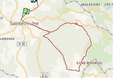
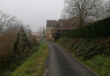
Ruta Senderismo de 10,9 km a descubrir en Nueva Aquitania, Dordogne, Val de Louyre et Caudeau. Esta ruta ha sido propuesta por fab0202.
Descripción
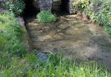
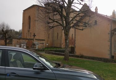
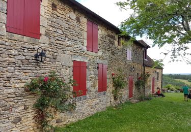
belle rando entre campagne et forêt avec de belles maisons anciennes et joli village de saint alvere
Localización
País:
France
Región :
Nueva Aquitania
Departamento/provincia :
Dordogne
Municipio :
Val de Louyre et Caudeau
Localidad:
Sainte-Alvère
Salida:(Dec)
Salida:(UTM)
327235 ; 4979508 (31T) N.
Comentarios
Excursiones cerca
![Excursión Senderismo Paunat - Boucle Paunat - Limeuil - Photo](https://media.geolcdn.com/t/375/260/ext.jpg?maxdim=2&url=https%3A%2F%2Fstatic1.geolcdn.com%2Fsiteimages%2Fupload%2Ffiles%2F1553511878bg_sport_marche.png)
![Senderismo Senderismo](https://static1.geolcdn.com/sitytour/trail-icons/101.png)
Boucle Paunat - Limeuil
Senderismo
Medio
(2)
Paunat,
Nueva Aquitania,
Dordogne,
France
![](/images/other/stat-length.png)
18,8 km | 25 km-effort
3h 35min
![](https://static1.geolcdn.com/siteimages/upload/files/16400158638029165_repeat_loop_refresh_sync_direction_icon.png)
Sí
![Excursión Senderismo Val de Louyre et Caudeau - Pezuls 10,5km - Photo](https://media.geolcdn.com/t/375/260/cfc4edfc-9c4e-4535-a833-4e2846665bcb.jpg&format=jpg&maxdim=2)
![Senderismo Senderismo](https://static1.geolcdn.com/sitytour/trail-icons/101.png)
Pezuls 10,5km
Senderismo
Medio
Val de Louyre et Caudeau,
Nueva Aquitania,
Dordogne,
France
![](/images/other/stat-length.png)
10,5 km | 13,3 km-effort
1h 54min
![](https://static1.geolcdn.com/siteimages/upload/files/16400158638029165_repeat_loop_refresh_sync_direction_icon.png)
Sí
![Excursión Senderismo Paunat - swwpaunat - Photo](https://media.geolcdn.com/t/375/260/f9e2cd8b-e827-4468-80c1-df4e7ec2b287.jpg&format=jpg&maxdim=2)
![Senderismo Senderismo](https://static1.geolcdn.com/sitytour/trail-icons/101.png)
swwpaunat
Senderismo
Medio
Paunat,
Nueva Aquitania,
Dordogne,
France
![](/images/other/stat-length.png)
10,5 km | 14,2 km-effort
2h 40min
![](https://static1.geolcdn.com/siteimages/upload/files/16400158638029165_repeat_loop_refresh_sync_direction_icon.png)
Sí
![Excursión Senderismo Val de Louyre et Caudeau - boucle boissiere - Photo](https://media.geolcdn.com/t/375/260/ext.jpg?maxdim=2&url=https%3A%2F%2Fstatic1.geolcdn.com%2Fsiteimages%2Fupload%2Ffiles%2F1553511878bg_sport_marche.png)
![Senderismo Senderismo](https://static1.geolcdn.com/sitytour/trail-icons/101.png)
boucle boissiere
Senderismo
Fácil
Val de Louyre et Caudeau,
Nueva Aquitania,
Dordogne,
France
![](/images/other/stat-length.png)
13,1 km | 16,5 km-effort
2h 38min
![](https://static1.geolcdn.com/siteimages/upload/files/16400158638029165_repeat_loop_refresh_sync_direction_icon.png)
Sí
![Excursión A pie Val de Louyre et Caudeau - Boucle du Maquis - Photo](https://media.geolcdn.com/t/375/260/ext.jpg?maxdim=2&url=https%3A%2F%2Fstatic1.geolcdn.com%2Fsiteimages%2Fupload%2Ffiles%2F1545311037marcheuse_200dpi.jpg)
![A pie A pie](https://static1.geolcdn.com/sitytour/trail-icons/100.png)
Boucle du Maquis
A pie
Fácil
Val de Louyre et Caudeau,
Nueva Aquitania,
Dordogne,
France
![](/images/other/stat-length.png)
4,9 km | 6,4 km-effort
1h 27min
![](https://static1.geolcdn.com/siteimages/upload/files/16400158638029165_repeat_loop_refresh_sync_direction_icon.png)
Sí
![Excursión Senderismo Val de Louyre et Caudeau - Les Truffières st Avére - Photo](https://media.geolcdn.com/t/375/260/808166f7-2b5e-4f6e-af17-12c8d7c68ae5.jpg&format=jpg&maxdim=2)
![Senderismo Senderismo](https://static1.geolcdn.com/sitytour/trail-icons/101.png)
Les Truffières st Avére
Senderismo
Medio
(1)
Val de Louyre et Caudeau,
Nueva Aquitania,
Dordogne,
France
![](/images/other/stat-length.png)
8,4 km | 11 km-effort
3h 20min
![](https://static1.geolcdn.com/siteimages/upload/files/16400158638029165_repeat_loop_refresh_sync_direction_icon.png)
Sí
![Excursión Senderismo Paunat - Paunat 12,5km - Photo](https://media.geolcdn.com/t/375/260/8b8ef089-76d9-4c92-b8da-faca9b25c51e.jpg&format=jpg&maxdim=2)
![Senderismo Senderismo](https://static1.geolcdn.com/sitytour/trail-icons/101.png)
Paunat 12,5km
Senderismo
Fácil
Paunat,
Nueva Aquitania,
Dordogne,
France
![](/images/other/stat-length.png)
12,8 km | 16,4 km-effort
2h 45min
![](https://static1.geolcdn.com/siteimages/upload/files/16400158638029165_repeat_loop_refresh_sync_direction_icon.png)
Sí
![Excursión Senderismo Paunat - Boucle Paunat - Le Bugue - Photo](https://media.geolcdn.com/t/375/260/ext.jpg?maxdim=2&url=https%3A%2F%2Fstatic1.geolcdn.com%2Fsiteimages%2Fupload%2Ffiles%2F1553511878bg_sport_marche.png)
![Senderismo Senderismo](https://static1.geolcdn.com/sitytour/trail-icons/101.png)
Boucle Paunat - Le Bugue
Senderismo
Medio
Paunat,
Nueva Aquitania,
Dordogne,
France
![](/images/other/stat-length.png)
22 km | 30 km-effort
4h 13min
![](https://static1.geolcdn.com/siteimages/upload/files/16400158638029165_repeat_loop_refresh_sync_direction_icon.png)
Sí
![Excursión Senderismo Saint-Avit-de-Vialard - Boucle de Saint Avit de Vialard - Photo](https://media.geolcdn.com/t/375/260/ext.jpg?maxdim=2&url=https%3A%2F%2Fstatic1.geolcdn.com%2Fsiteimages%2Fupload%2Ffiles%2F1553511878bg_sport_marche.png)
![Senderismo Senderismo](https://static1.geolcdn.com/sitytour/trail-icons/101.png)
Boucle de Saint Avit de Vialard
Senderismo
Medio
(1)
Saint-Avit-de-Vialard,
Nueva Aquitania,
Dordogne,
France
![](/images/other/stat-length.png)
21 km | 29 km-effort
4h 5min
![](https://static1.geolcdn.com/siteimages/upload/files/16400158638029165_repeat_loop_refresh_sync_direction_icon.png)
Sí