![](/images/other/stat-length.png)
![Excursión Senderismo Thiviers - la boulinie - Photo](https://media.geolcdn.com/t/1900/400/ext.pjpeg?maxdim=2&url=https%3A%2F%2Fstatic1.geolcdn.com%2Fsiteimages%2Fupload%2Ffiles%2F1553511878bg_sport_marche.png)
la boulinie
Patricew
Usuario
![Longitud](/images/other/stat-length.png)
Longitud
9,8 km
![Altitud máxima](https://static1.geolcdn.com/siteimages/upload/files/1508320355ic_sort_altitude_max_24dp.png)
Altitud máxima
259 m
![Desnivel positivo](https://static1.geolcdn.com/siteimages/upload/files/1508320355ic_sort_den_pos_24dp.png)
Desnivel positivo
161 m
![Km-Effort](/images/other/stat-length.png)
Km-Effort
12 km
![Altitud mínima](https://static1.geolcdn.com/siteimages/upload/files/1508320355ic_sort_altitude_min_24dp.png)
Altitud mínima
157 m
![Desnivel negativo](https://static1.geolcdn.com/siteimages/upload/files/1508320355ic_sort_den_neg_24dp.png)
Desnivel negativo
160 m
![Boucle](https://static1.geolcdn.com/siteimages/upload/files/16400158638029165_repeat_loop_refresh_sync_direction_icon.png)
Boucle
Sí
Fecha de creación :
2021-04-18 14:07:58.778
Última modificación :
2021-04-21 12:19:43.747
![Senderismo](https://static1.geolcdn.com/sitytour/trail-icons/101.png)
1h54
Dificultad : Fácil
![Escanee este código QR para abrir la excursión en la aplicación SityTrail](https://capi.geolives.com/qq0zvz2zws4bq2lad0pu/sitytour/trails/2752822/qr.png?size=200)
Aplicación GPS de excursión GRATIS
A propósito
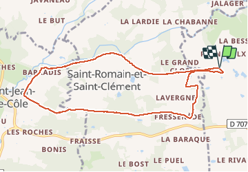
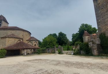
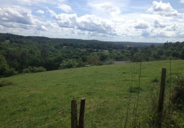
Ruta Senderismo de 9,8 km a descubrir en Nueva Aquitania, Dordogne, Thiviers. Esta ruta ha sido propuesta por Patricew.
Descripción
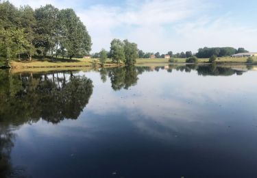
belle randonnée de 10 km assez facile
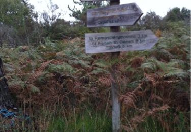
Départ voie verte, allez jusqu'à Saint Jean de Cole par voie verte, suivre le parcours
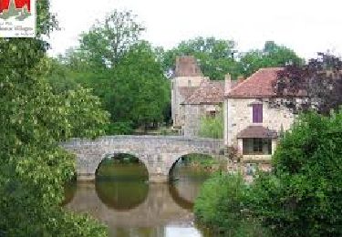
Pas de problème particulier
Localización
País:
France
Región :
Nueva Aquitania
Departamento/provincia :
Dordogne
Municipio :
Thiviers
Localidad:
Unknown
Salida:(Dec)
Salida:(UTM)
335008 ; 5032479 (31T) N.
Comentarios
Excursiones cerca
![Excursión Senderismo Saint-Jean-de-Côle - Saint-Jean de colle la côte 12 km - Photo](https://media.geolcdn.com/t/375/260/b7af3448-8976-4374-bf55-0b6f9de554da.jpg&format=jpg&maxdim=2)
![Senderismo Senderismo](https://static1.geolcdn.com/sitytour/trail-icons/101.png)
Saint-Jean de colle la côte 12 km
Senderismo
Fácil
(1)
Saint-Jean-de-Côle,
Nueva Aquitania,
Dordogne,
France
![](/images/other/stat-length.png)
12 km | 14,4 km-effort
2h 51min
![](https://static1.geolcdn.com/siteimages/upload/files/16400158638029165_repeat_loop_refresh_sync_direction_icon.png)
Sí
![Excursión Bici de montaña Thiviers - Thiviers vtt - Photo](https://media.geolcdn.com/t/375/260/df34d907-768b-4b26-a7b5-5ec7cdc86a99.jpg&format=jpg&maxdim=2)
![Bici de montaña Bici de montaña](https://static1.geolcdn.com/sitytour/trail-icons/202.png)
Thiviers vtt
Bici de montaña
Muy fácil
Thiviers,
Nueva Aquitania,
Dordogne,
France
![](/images/other/stat-length.png)
48 km | 58 km-effort
6h 2min
![](https://static1.geolcdn.com/siteimages/upload/files/16400158638029165_repeat_loop_refresh_sync_direction_icon.png)
Sí
![Excursión Senderismo Saint-Jean-de-Côle - Saint jean de Côle/St Martin - Photo](https://media.geolcdn.com/t/375/260/8665702b-ffe2-48bb-a76f-45247ee7e571.jpg&format=jpg&maxdim=2)
![Senderismo Senderismo](https://static1.geolcdn.com/sitytour/trail-icons/101.png)
Saint jean de Côle/St Martin
Senderismo
Saint-Jean-de-Côle,
Nueva Aquitania,
Dordogne,
France
![](/images/other/stat-length.png)
12 km | 15,3 km-effort
3h 23min
![](https://static1.geolcdn.com/siteimages/upload/files/16400158638029165_repeat_loop_refresh_sync_direction_icon.png)
Sí
![Excursión Senderismo Eyzerac - La Servolle 2 - Photo](https://media.geolcdn.com/t/375/260/ext.jpg?maxdim=2&url=https%3A%2F%2Fservices.sitytrail.com%2FGeolivesWS%2FDownloadMedia.ashx%3FTrailID%3D226050%26Media%3D20131008110344.jpg)
![Senderismo Senderismo](https://static1.geolcdn.com/sitytour/trail-icons/101.png)
La Servolle 2
Senderismo
Fácil
Eyzerac,
Nueva Aquitania,
Dordogne,
France
![](/images/other/stat-length.png)
12,4 km | 14,9 km-effort
3h 16min
![](https://static1.geolcdn.com/siteimages/upload/files/16400158638029165_repeat_loop_refresh_sync_direction_icon.png)
Sí
![Excursión Senderismo Saint-Jean-de-Côle - St-Jean de Côle - St-Martin - Photo](https://media.geolcdn.com/t/375/260/143ff9ac-a165-4b59-9523-935f63a9a082.jpg&format=jpg&maxdim=2)
![Senderismo Senderismo](https://static1.geolcdn.com/sitytour/trail-icons/101.png)
St-Jean de Côle - St-Martin
Senderismo
Medio
Saint-Jean-de-Côle,
Nueva Aquitania,
Dordogne,
France
![](/images/other/stat-length.png)
5,9 km | 7,3 km-effort
1h 29min
![](https://static1.geolcdn.com/siteimages/upload/files/16400158638029165_repeat_loop_refresh_sync_direction_icon.png)
Sí
![Senderismo Senderismo](https://static1.geolcdn.com/sitytour/trail-icons/101.png)
St Martin de Fressengeas
Senderismo
Medio
(1)
Saint-Martin-de-Fressengeas,
Nueva Aquitania,
Dordogne,
France
![](/images/other/stat-length.png)
12,6 km | 16,7 km-effort
4h 46min
![](https://static1.geolcdn.com/siteimages/upload/files/16400158638029165_repeat_loop_refresh_sync_direction_icon.png)
Sí
![Excursión Senderismo Saint-Jean-de-Côle - Saint Jean de Côle - Photo](https://media.geolcdn.com/t/375/260/97f1191d-d6a8-4caf-b34c-213f3218b637.jpg&format=jpg&maxdim=2)
![Senderismo Senderismo](https://static1.geolcdn.com/sitytour/trail-icons/101.png)
Saint Jean de Côle
Senderismo
Difícil
Saint-Jean-de-Côle,
Nueva Aquitania,
Dordogne,
France
![](/images/other/stat-length.png)
13 km | 15,6 km-effort
3h 32min
![](https://static1.geolcdn.com/siteimages/upload/files/16400158638029165_repeat_loop_refresh_sync_direction_icon.png)
Sí
![Excursión Senderismo Saint-Jean-de-Côle - 24 Saint-Jean-de-Côle - Photo](https://media.geolcdn.com/t/375/260/ext.jpg?maxdim=2&url=https%3A%2F%2Fservices.sitytrail.com%2FGeolivesWS%2FDownloadMedia.ashx%3FTrailID%3D752771%26Media%3D20170514153645.jpg)
![Senderismo Senderismo](https://static1.geolcdn.com/sitytour/trail-icons/101.png)
24 Saint-Jean-de-Côle
Senderismo
Fácil
Saint-Jean-de-Côle,
Nueva Aquitania,
Dordogne,
France
![](/images/other/stat-length.png)
16,3 km | 20 km-effort
4h 21min
![](https://static1.geolcdn.com/siteimages/upload/files/16400158638029165_repeat_loop_refresh_sync_direction_icon.png)
No
![Excursión sport Saint-Martin-de-Fressengeas - Ràndo Bernard saint Martin de fressengeas - Photo](https://media.geolcdn.com/t/375/260/ext.jpg?maxdim=2&url=https%3A%2F%2Fsecurestorage.geolives.com%2Fsitytour%2Ftrail-bg%2Fdefault.jpg)
Ràndo Bernard saint Martin de fressengeas
sport
Muy fácil
Saint-Martin-de-Fressengeas,
Nueva Aquitania,
Dordogne,
France
![](/images/other/stat-length.png)
9,1 km | 11,8 km-effort
Desconocido
![](https://static1.geolcdn.com/siteimages/upload/files/16400158638029165_repeat_loop_refresh_sync_direction_icon.png)
Sí