![](/images/other/stat-length.png)
![Excursión Senderismo Lèves - Entraînement Corse numéro trois - Photo](https://media.geolcdn.com/t/1900/400/ext.pjpeg?maxdim=2&url=https%3A%2F%2Fstatic1.geolcdn.com%2Fsiteimages%2Fupload%2Ffiles%2F1553511878bg_sport_marche.png)
Entraînement Corse numéro trois
ezola
Usuario
![Longitud](/images/other/stat-length.png)
Longitud
18,6 km
![Altitud máxima](https://static1.geolcdn.com/siteimages/upload/files/1508320355ic_sort_altitude_max_24dp.png)
Altitud máxima
163 m
![Desnivel positivo](https://static1.geolcdn.com/siteimages/upload/files/1508320355ic_sort_den_pos_24dp.png)
Desnivel positivo
252 m
![Km-Effort](/images/other/stat-length.png)
Km-Effort
22 km
![Altitud mínima](https://static1.geolcdn.com/siteimages/upload/files/1508320355ic_sort_altitude_min_24dp.png)
Altitud mínima
120 m
![Desnivel negativo](https://static1.geolcdn.com/siteimages/upload/files/1508320355ic_sort_den_neg_24dp.png)
Desnivel negativo
234 m
![Boucle](https://static1.geolcdn.com/siteimages/upload/files/16400158638029165_repeat_loop_refresh_sync_direction_icon.png)
Boucle
No
Fecha de creación :
2021-04-14 08:34:08.0
Última modificación :
2021-04-14 13:24:14.98
![Senderismo](https://static1.geolcdn.com/sitytour/trail-icons/101.png)
3h04
Dificultad : Medio
![Escanee este código QR para abrir la excursión en la aplicación SityTrail](https://capi.geolives.com/qq0zvz2zws4bq2lad0pu/sitytour/trails/2746975/qr.png?size=200)
Aplicación GPS de excursión GRATIS
A propósito
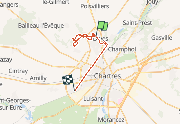
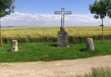
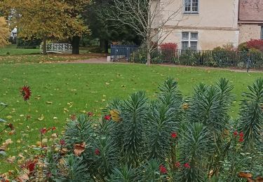
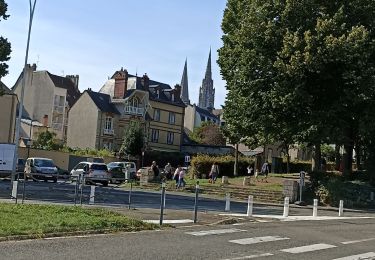
Ruta Senderismo de 18,6 km a descubrir en Centro, Eure-y-Loir, Lèves. Esta ruta ha sido propuesta por ezola.
Descripción
Départ parking de lève et Seresville l’aller retour
Rajouter 2,05 km au parcours oublié de mettre le crono départ
Localización
País:
France
Región :
Centro
Departamento/provincia :
Eure-y-Loir
Municipio :
Lèves
Localidad:
Unknown
Salida:(Dec)
Salida:(UTM)
387056 ; 5370688 (31U) N.
Comentarios
Excursiones cerca
![Excursión Senderismo Chartres - balade autour cathédrale de Chartres - Photo](https://media.geolcdn.com/t/375/260/ext.jpg?maxdim=2&url=https%3A%2F%2Fmedia.geolcdn.com%2Ff%2F589e1a6c-9aee-41e4-b0c1-21e1dc04e42e.jpg)
![Senderismo Senderismo](https://static1.geolcdn.com/sitytour/trail-icons/101.png)
balade autour cathédrale de Chartres
Senderismo
Fácil
Chartres,
Centro,
Eure-y-Loir,
France
![](/images/other/stat-length.png)
5,3 km | 6,1 km-effort
2h 31min
![](https://static1.geolcdn.com/siteimages/upload/files/16400158638029165_repeat_loop_refresh_sync_direction_icon.png)
Sí
![Excursión Senderismo Saint-Prest - St prèst>> Soulaires>>jouy >> St prest - Photo](https://media.geolcdn.com/t/375/260/ext.jpg?maxdim=2&url=https%3A%2F%2Fmedia.geolcdn.com%2Ff%2Fea64a9c0-2691-49ad-9b96-29e6fbe97de4.jpg)
![Senderismo Senderismo](https://static1.geolcdn.com/sitytour/trail-icons/101.png)
St prèst>> Soulaires>>jouy >> St prest
Senderismo
Muy difícil
Saint-Prest,
Centro,
Eure-y-Loir,
France
![](/images/other/stat-length.png)
21 km | 24 km-effort
4h 46min
![](https://static1.geolcdn.com/siteimages/upload/files/16400158638029165_repeat_loop_refresh_sync_direction_icon.png)
Sí
![Excursión Senderismo Gasville-Oisème - proj 2020_20190716Oiseme - Photo](https://media.geolcdn.com/t/375/260/ext.jpg?maxdim=2&url=https%3A%2F%2Fstatic1.geolcdn.com%2Fsiteimages%2Fupload%2Ffiles%2F1553511878bg_sport_marche.png)
![Senderismo Senderismo](https://static1.geolcdn.com/sitytour/trail-icons/101.png)
proj 2020_20190716Oiseme
Senderismo
Muy fácil
(1)
Gasville-Oisème,
Centro,
Eure-y-Loir,
France
![](/images/other/stat-length.png)
10,8 km | 12,7 km-effort
2h 35min
![](https://static1.geolcdn.com/siteimages/upload/files/16400158638029165_repeat_loop_refresh_sync_direction_icon.png)
Sí
![Excursión Bici de montaña Mainvilliers - Les planeurs de la base des planeurs d''Armenonville - Chartres - Photo](https://media.geolcdn.com/t/375/260/ext.jpg?maxdim=2&url=https%3A%2F%2Fservices.sitytrail.com%2FGeolivesWS%2FDownloadMedia.ashx%3FTrailID%3D172818%26Media%3D14251_6.jpg)
![Bici de montaña Bici de montaña](https://static1.geolcdn.com/sitytour/trail-icons/202.png)
Les planeurs de la base des planeurs d''Armenonville - Chartres
Bici de montaña
Medio
(1)
Mainvilliers,
Centro,
Eure-y-Loir,
France
![](/images/other/stat-length.png)
53 km | 60 km-effort
4h 0min
![](https://static1.geolcdn.com/siteimages/upload/files/16400158638029165_repeat_loop_refresh_sync_direction_icon.png)
Sí
![Excursión Senderismo Chartres - 2023 Chartres tour de ville - Photo](https://media.geolcdn.com/t/375/260/ext.jpg?maxdim=2&url=https%3A%2F%2Fmedia.geolcdn.com%2Ff%2Fdc0d9c93-9da7-45cc-94c6-fd51d08d97c6.jpg)
![Senderismo Senderismo](https://static1.geolcdn.com/sitytour/trail-icons/101.png)
2023 Chartres tour de ville
Senderismo
Fácil
Chartres,
Centro,
Eure-y-Loir,
France
![](/images/other/stat-length.png)
11,3 km | 12,4 km-effort
1h 58min
![](https://static1.geolcdn.com/siteimages/upload/files/16400158638029165_repeat_loop_refresh_sync_direction_icon.png)
Sí
![Excursión Marcha nórdica Chartres - Chartres Stade GP vers St prest - Photo](https://media.geolcdn.com/t/375/260/ext.jpg?maxdim=2&url=https%3A%2F%2Fmedia.geolcdn.com%2Ff%2F38bd2996-8114-4e41-ad68-81ce046a739f.jpg)
![Marcha nórdica Marcha nórdica](https://static1.geolcdn.com/sitytour/trail-icons/102.png)
Chartres Stade GP vers St prest
Marcha nórdica
Fácil
Chartres,
Centro,
Eure-y-Loir,
France
![](/images/other/stat-length.png)
12,9 km | 14,4 km-effort
2h 27min
![](https://static1.geolcdn.com/siteimages/upload/files/16400158638029165_repeat_loop_refresh_sync_direction_icon.png)
Sí
![Excursión Senderismo Chartres - Chartres est/place drouaise - Photo](https://media.geolcdn.com/t/375/260/ext.jpg?maxdim=2&url=https%3A%2F%2Fmedia.geolcdn.com%2Ff%2Feeb37de2-c160-49f1-85d6-69fc93e43e2f.jpg)
![Senderismo Senderismo](https://static1.geolcdn.com/sitytour/trail-icons/101.png)
Chartres est/place drouaise
Senderismo
Fácil
Chartres,
Centro,
Eure-y-Loir,
France
![](/images/other/stat-length.png)
3,8 km | 4,2 km-effort
42min
![](https://static1.geolcdn.com/siteimages/upload/files/16400158638029165_repeat_loop_refresh_sync_direction_icon.png)
No
![Excursión Senderismo Chartres - Le tour de Chartres - Photo](https://media.geolcdn.com/t/375/260/ext.jpg?maxdim=2&url=https%3A%2F%2Fmedia.geolcdn.com%2Ff%2F09d0a82b-a8be-4e4f-9fca-c4af537351a5.jpg)
![Senderismo Senderismo](https://static1.geolcdn.com/sitytour/trail-icons/101.png)
Le tour de Chartres
Senderismo
Fácil
Chartres,
Centro,
Eure-y-Loir,
France
![](/images/other/stat-length.png)
11,6 km | 12,9 km-effort
2h 20min
![](https://static1.geolcdn.com/siteimages/upload/files/16400158638029165_repeat_loop_refresh_sync_direction_icon.png)
Sí
![Excursión Marcha nórdica Chartres - Pl.Drouaise - Photo](https://media.geolcdn.com/t/375/260/ext.jpg?maxdim=2&url=https%3A%2F%2Fmedia.geolcdn.com%2Ff%2F9a782b84-d1d8-4a07-b1f4-c2cbc8c766a4.jpg)
![Marcha nórdica Marcha nórdica](https://static1.geolcdn.com/sitytour/trail-icons/102.png)
Pl.Drouaise
Marcha nórdica
Fácil
Chartres,
Centro,
Eure-y-Loir,
France
![](/images/other/stat-length.png)
10,1 km | 11,2 km-effort
1h 49min
![](https://static1.geolcdn.com/siteimages/upload/files/16400158638029165_repeat_loop_refresh_sync_direction_icon.png)
Sí