![](/images/other/stat-length.png)
![Excursión Senderismo Orelle - parking edf vers Bissorte arrêt les Cartillères - Photo](https://media.geolcdn.com/t/1900/400/80b9b62b-cb31-4ac9-87c8-19344c2d8ef0.jpg&format=pjpeg&maxdim=2)
parking edf vers Bissorte arrêt les Cartillères
yves12
Usuario
![Longitud](/images/other/stat-length.png)
![Altitud máxima](https://static1.geolcdn.com/siteimages/upload/files/1508320355ic_sort_altitude_max_24dp.png)
![Desnivel positivo](https://static1.geolcdn.com/siteimages/upload/files/1508320355ic_sort_den_pos_24dp.png)
![Km-Effort](/images/other/stat-length.png)
![Altitud mínima](https://static1.geolcdn.com/siteimages/upload/files/1508320355ic_sort_altitude_min_24dp.png)
![Desnivel negativo](https://static1.geolcdn.com/siteimages/upload/files/1508320355ic_sort_den_neg_24dp.png)
![Boucle](https://static1.geolcdn.com/siteimages/upload/files/16400158638029165_repeat_loop_refresh_sync_direction_icon.png)
![Senderismo](https://static1.geolcdn.com/sitytour/trail-icons/101.png)
6h22
Dificultad : Difícil
![Escanee este código QR para abrir la excursión en la aplicación SityTrail](https://capi.geolives.com/qq0zvz2zws4bq2lad0pu/sitytour/trails/2746085/qr.png?size=200)
Aplicación GPS de excursión GRATIS
A propósito
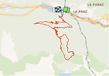
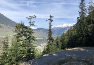
Ruta Senderismo de 13,3 km a descubrir en Auvergne-Rhône-Alpes, Saboya, Orelle. Esta ruta ha sido propuesta por yves12.
Descripción
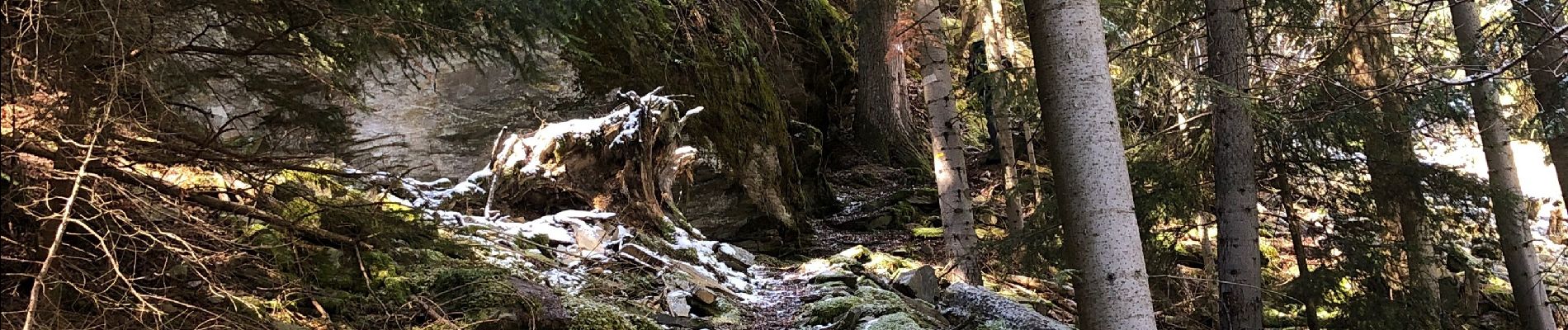
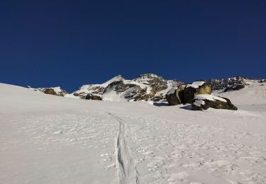
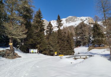
Il a refait pas mal de neige sur les hauteurs en ce mois d'avril 2021 et le sentier qui monte aux Prec est assez dangereux à cause de la neige fraîche qui s'est posé sur de la glace. Donc privilégier la route forestière t'en que la neige n'a pas fondue.On a fait une partie en chaussure puis en raquette. On est pas monté jusqu'au barrage de Bissorte à cause de la glace sous la neige, nous n'avons pas voulu prendre de risques inconsidérés !
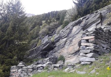
Si non de Super points de Vue et des Chamois.......
Localización
Comentarios
Excursiones cerca
![Excursión Esquí de fondo Saint-André - Tête noire en boucle - Photo](https://media.geolcdn.com/t/375/260/0bb3542f-e5da-45e0-a1b0-86c9b0c52fb3.jpg&format=jpg&maxdim=2)
![Esquí de fondo Esquí de fondo](https://static1.geolcdn.com/sitytour/trail-icons/503.png)
Esquí de fondo
![](/images/other/stat-length.png)
![](https://static1.geolcdn.com/siteimages/upload/files/16400158638029165_repeat_loop_refresh_sync_direction_icon.png)
![Excursión Raquetas de nieve Saint-André - l Orgere - Photo](https://media.geolcdn.com/t/375/260/68f383ec-1a93-4bdd-ac56-2814b85cf93a.jpg&format=jpg&maxdim=2)
![Raquetas de nieve Raquetas de nieve](https://static1.geolcdn.com/sitytour/trail-icons/504.png)
Raquetas de nieve
![](/images/other/stat-length.png)
![](https://static1.geolcdn.com/siteimages/upload/files/16400158638029165_repeat_loop_refresh_sync_direction_icon.png)
![Excursión Esquí de fondo Saint-André - col de chavière - Photo](https://media.geolcdn.com/t/375/260/86de67bd-405a-46b3-a93e-79698b2666e3.jpg&format=jpg&maxdim=2)
![Esquí de fondo Esquí de fondo](https://static1.geolcdn.com/sitytour/trail-icons/503.png)
Esquí de fondo
![](/images/other/stat-length.png)
![](https://static1.geolcdn.com/siteimages/upload/files/16400158638029165_repeat_loop_refresh_sync_direction_icon.png)
![Excursión Senderismo Saint-André - St André -Le Col - Le Villard et retour - Photo](https://media.geolcdn.com/t/375/260/c5392434-71ed-4b56-833f-ae8bca570fe0.jpg&format=jpg&maxdim=2)
![Senderismo Senderismo](https://static1.geolcdn.com/sitytour/trail-icons/101.png)
Senderismo
![](/images/other/stat-length.png)
![](https://static1.geolcdn.com/siteimages/upload/files/16400158638029165_repeat_loop_refresh_sync_direction_icon.png)
![Excursión Senderismo Saint-André - Pralognan - Plan du Clos - Photo](https://media.geolcdn.com/t/375/260/5ea4ee6f-d364-4747-b256-0a27656a1831.jpg&format=jpg&maxdim=2)
![Senderismo Senderismo](https://static1.geolcdn.com/sitytour/trail-icons/101.png)
Senderismo
![](/images/other/stat-length.png)
![](https://static1.geolcdn.com/siteimages/upload/files/16400158638029165_repeat_loop_refresh_sync_direction_icon.png)
![Excursión Raquetas de nieve Saint-André - Maurienne - saint André - vallon de Polsey - Photo](https://media.geolcdn.com/t/375/260/b3589df7-ac0b-475f-85c7-5b56994e40c0.jpg&format=jpg&maxdim=2)
![Raquetas de nieve Raquetas de nieve](https://static1.geolcdn.com/sitytour/trail-icons/504.png)
Raquetas de nieve
![](/images/other/stat-length.png)
![](https://static1.geolcdn.com/siteimages/upload/files/16400158638029165_repeat_loop_refresh_sync_direction_icon.png)
![Excursión Senderismo Orelle - 73 Maurienne Francoz Bonvillard Turraz Plan Py ND des Neiges Rochecombe - Photo](https://media.geolcdn.com/t/375/260/a86dc9d2-69f2-418a-9ddc-2594b82c3f81.jpg&format=jpg&maxdim=2)
![Senderismo Senderismo](https://static1.geolcdn.com/sitytour/trail-icons/101.png)
Senderismo
![](/images/other/stat-length.png)
![](https://static1.geolcdn.com/siteimages/upload/files/16400158638029165_repeat_loop_refresh_sync_direction_icon.png)
![Excursión Senderismo Orelle - Col de Rosuel - Photo](https://media.geolcdn.com/t/375/260/eab79a1d-a202-4fc7-948c-f1a84ad33ce7.jpg&format=jpg&maxdim=2)
![Senderismo Senderismo](https://static1.geolcdn.com/sitytour/trail-icons/101.png)
Senderismo
![](/images/other/stat-length.png)
![](https://static1.geolcdn.com/siteimages/upload/files/16400158638029165_repeat_loop_refresh_sync_direction_icon.png)
![Excursión Senderismo Orelle - Direction Bissorte - Photo](https://media.geolcdn.com/t/375/260/4f8374b5-8640-4bc0-97b9-9bbab28918c9.jpg&format=jpg&maxdim=2)
![Senderismo Senderismo](https://static1.geolcdn.com/sitytour/trail-icons/101.png)
Senderismo
![](/images/other/stat-length.png)
![](https://static1.geolcdn.com/siteimages/upload/files/16400158638029165_repeat_loop_refresh_sync_direction_icon.png)