![](/images/other/stat-length.png)
![Excursión Senderismo Lézignan-Corbières - LEZIGNAN La pinède par les éoliennes - Photo](https://media.geolcdn.com/t/1900/400/0c2d43da-86db-4ced-b9c3-8217ccc6dfd7.jpg&format=pjpeg&maxdim=2)
LEZIGNAN La pinède par les éoliennes
Licianus2
Usuario
![Longitud](/images/other/stat-length.png)
![Altitud máxima](https://static1.geolcdn.com/siteimages/upload/files/1508320355ic_sort_altitude_max_24dp.png)
![Desnivel positivo](https://static1.geolcdn.com/siteimages/upload/files/1508320355ic_sort_den_pos_24dp.png)
![Km-Effort](/images/other/stat-length.png)
![Altitud mínima](https://static1.geolcdn.com/siteimages/upload/files/1508320355ic_sort_altitude_min_24dp.png)
![Desnivel negativo](https://static1.geolcdn.com/siteimages/upload/files/1508320355ic_sort_den_neg_24dp.png)
![Boucle](https://static1.geolcdn.com/siteimages/upload/files/16400158638029165_repeat_loop_refresh_sync_direction_icon.png)
![Senderismo](https://static1.geolcdn.com/sitytour/trail-icons/101.png)
2h14
Dificultad : Medio
![Escanee este código QR para abrir la excursión en la aplicación SityTrail](https://capi.geolives.com/qq0zvz2zws4bq2lad0pu/sitytour/trails/2744719/qr.png?size=200)
Aplicación GPS de excursión GRATIS
A propósito
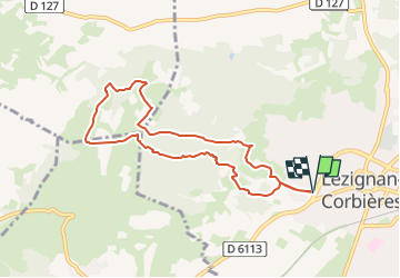
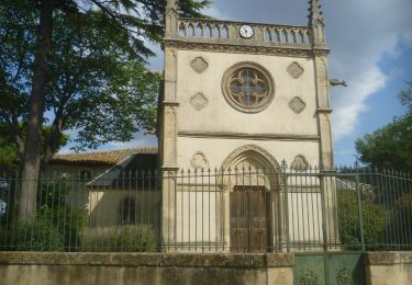
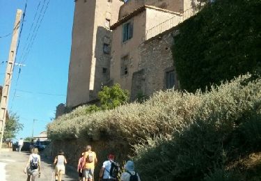
Ruta Senderismo de 8,5 km a descubrir en Occitania, Aude, Lézignan-Corbières. Esta ruta ha sido propuesta por Licianus2.
Descripción
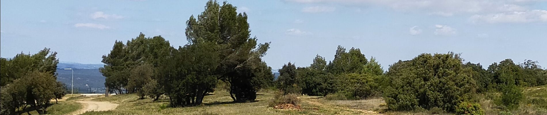
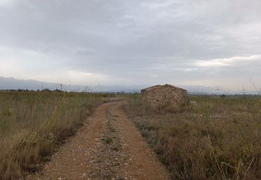
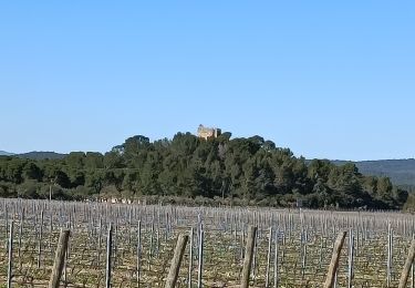
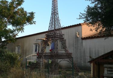
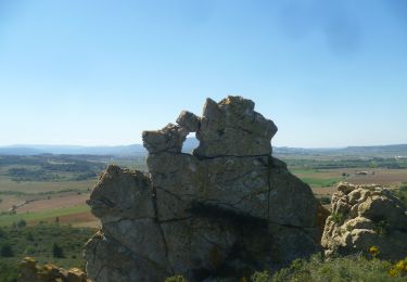
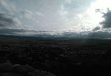
Départ face à la station Total Access, sortie de Lézignan Route de Carcassonne. Cette boucle emprunte pistes et sentiers sous la pinède jusqu'au éoliennes Relativement ombragée sur des chemins praticables, sans difficulté particulière.
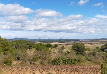
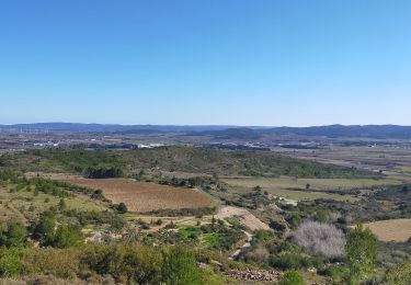
Ballade effectuée pendant le démontage des éoliennes de Lézignan obsolètes ( Les 4 de Conilhac restent en place). Les socles sont détruits sur une profondeur permettant le recouvrement par un mètre de terre végétale. Certaines ont donc ainsi complètement disparues. A terme, elles seront remplacées par des éoliennes de dernière génération.
Localización
Comentarios
Excursiones cerca
![Excursión Senderismo Lézignan-Corbières - La Roche Trouée (2) - Photo](https://media.geolcdn.com/t/375/260/26c1d966-bce5-454f-8bb9-55217d5081e5.jpg&format=jpg&maxdim=2)
![Senderismo Senderismo](https://static1.geolcdn.com/sitytour/trail-icons/101.png)
Senderismo
![](/images/other/stat-length.png)
![](https://static1.geolcdn.com/siteimages/upload/files/16400158638029165_repeat_loop_refresh_sync_direction_icon.png)
![Excursión Senderismo Lézignan-Corbières - Lézignan Corbières-Argens Minervois-Olonzac - Photo](https://media.geolcdn.com/t/375/260/6f6845e7-9549-4c29-a070-e1ffdd655148.jpg&format=jpg&maxdim=2)
![Senderismo Senderismo](https://static1.geolcdn.com/sitytour/trail-icons/101.png)
Senderismo
![](/images/other/stat-length.png)
![](https://static1.geolcdn.com/siteimages/upload/files/16400158638029165_repeat_loop_refresh_sync_direction_icon.png)
![Excursión Senderismo Lézignan-Corbières - Lézignan Corbières - Fontarèche- Relais des Corbières - Photo](https://media.geolcdn.com/t/375/260/5886abe1-3fe5-40bd-b548-3f7c4ae5c568.jpg&format=jpg&maxdim=2)
![Senderismo Senderismo](https://static1.geolcdn.com/sitytour/trail-icons/101.png)
Senderismo
![](/images/other/stat-length.png)
![](https://static1.geolcdn.com/siteimages/upload/files/16400158638029165_repeat_loop_refresh_sync_direction_icon.png)
![Senderismo Senderismo](https://static1.geolcdn.com/sitytour/trail-icons/101.png)
Senderismo
![](/images/other/stat-length.png)
![](https://static1.geolcdn.com/siteimages/upload/files/16400158638029165_repeat_loop_refresh_sync_direction_icon.png)
![Excursión Senderismo Escales - ESCALES - La tour Romane - Photo](https://media.geolcdn.com/t/375/260/dfcd4544-fef2-456a-b32a-8ca1903f77b4.jpg&format=jpg&maxdim=2)
![Senderismo Senderismo](https://static1.geolcdn.com/sitytour/trail-icons/101.png)
Senderismo
![](/images/other/stat-length.png)
![](https://static1.geolcdn.com/siteimages/upload/files/16400158638029165_repeat_loop_refresh_sync_direction_icon.png)
![Excursión Senderismo Conilhac-Corbières - CONILHAC Les Eoliennes - Photo](https://media.geolcdn.com/t/375/260/61a6f362-e725-47d8-be5f-e8d8f9b00380.jpg&format=jpg&maxdim=2)
![Senderismo Senderismo](https://static1.geolcdn.com/sitytour/trail-icons/101.png)
Senderismo
![](/images/other/stat-length.png)
![](https://static1.geolcdn.com/siteimages/upload/files/16400158638029165_repeat_loop_refresh_sync_direction_icon.png)
![Senderismo Senderismo](https://static1.geolcdn.com/sitytour/trail-icons/101.png)
Senderismo
![](/images/other/stat-length.png)
![](https://static1.geolcdn.com/siteimages/upload/files/16400158638029165_repeat_loop_refresh_sync_direction_icon.png)
![Excursión Senderismo Conilhac-Corbières - CONILHAC - lausines - Photo](https://media.geolcdn.com/t/375/260/eabb2449-16e0-4bf7-bb9c-bc1f8dc0926e.jpg&format=jpg&maxdim=2)
![Senderismo Senderismo](https://static1.geolcdn.com/sitytour/trail-icons/101.png)
Senderismo
![](/images/other/stat-length.png)
![](https://static1.geolcdn.com/siteimages/upload/files/16400158638029165_repeat_loop_refresh_sync_direction_icon.png)
![Excursión Senderismo Argens-Minervois - agens - Photo](https://media.geolcdn.com/t/375/260/ext.jpg?maxdim=2&url=https%3A%2F%2Fservices.sitytrail.com%2FGeolivesWS%2FDownloadMedia.ashx%3FTrailID%3D454557%26Media%3Dfix__20150805101532.jpg)
![Senderismo Senderismo](https://static1.geolcdn.com/sitytour/trail-icons/101.png)
Senderismo
![](/images/other/stat-length.png)
![](https://static1.geolcdn.com/siteimages/upload/files/16400158638029165_repeat_loop_refresh_sync_direction_icon.png)