![](/images/other/stat-length.png)
![Excursión Bici de montaña Notre-Dame-de-Londres - Ultra draille - Photo](https://media.geolcdn.com/t/1900/400/ext.pjpeg?maxdim=2&url=https%3A%2F%2Fstatic1.geolcdn.com%2Fsiteimages%2Fupload%2Ffiles%2F1524743154velo.jpg)
Ultra draille
ARVIEU
Usuario
![Longitud](/images/other/stat-length.png)
Longitud
30 km
![Altitud máxima](https://static1.geolcdn.com/siteimages/upload/files/1508320355ic_sort_altitude_max_24dp.png)
Altitud máxima
338 m
![Desnivel positivo](https://static1.geolcdn.com/siteimages/upload/files/1508320355ic_sort_den_pos_24dp.png)
Desnivel positivo
609 m
![Km-Effort](/images/other/stat-length.png)
Km-Effort
38 km
![Altitud mínima](https://static1.geolcdn.com/siteimages/upload/files/1508320355ic_sort_altitude_min_24dp.png)
Altitud mínima
132 m
![Desnivel negativo](https://static1.geolcdn.com/siteimages/upload/files/1508320355ic_sort_den_neg_24dp.png)
Desnivel negativo
607 m
![Boucle](https://static1.geolcdn.com/siteimages/upload/files/16400158638029165_repeat_loop_refresh_sync_direction_icon.png)
Boucle
Sí
Fecha de creación :
2021-04-05 16:18:38.841
Última modificación :
2021-04-05 16:21:26.722
![Bici de montaña](https://static1.geolcdn.com/sitytour/trail-icons/202.png)
3h20
Dificultad : Difícil
![Escanee este código QR para abrir la excursión en la aplicación SityTrail](https://capi.geolives.com/qq0zvz2zws4bq2lad0pu/sitytour/trails/2736470/qr.png?size=200)
Aplicación GPS de excursión GRATIS
A propósito
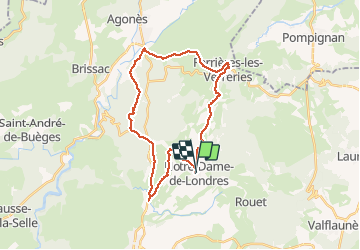
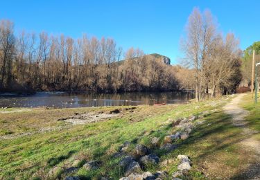
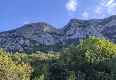
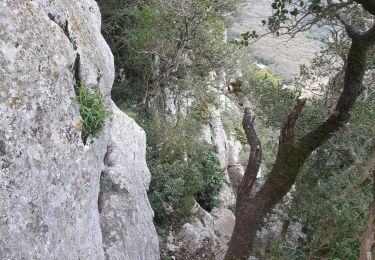
Ruta Bici de montaña de 30 km a descubrir en Occitania, Hérault, Notre-Dame-de-Londres. Esta ruta ha sido propuesta por ARVIEU.
Descripción
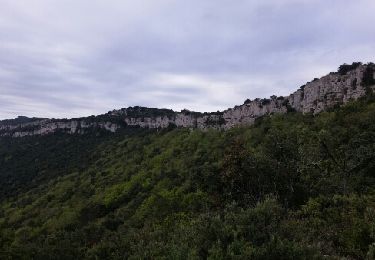
départ de Notre Dame de Londres, via la Cardonille, Saint Bauzille de Putois, Ferrière les Verreries
Localización
País:
France
Región :
Occitania
Departamento/provincia :
Hérault
Municipio :
Notre-Dame-de-Londres
Localidad:
Unknown
Salida:(Dec)
Salida:(UTM)
562351 ; 4852851 (31T) N.
Comentarios
Excursiones cerca
![Excursión Senderismo Valflaunès - l hortus - Photo](https://media.geolcdn.com/t/375/260/ext.jpg?maxdim=2&url=https%3A%2F%2Fservices.sitytrail.com%2FGeolivesWS%2FDownloadMedia.ashx%3FTrailID%3D557567%26Media%3Dfix__20160417104921.jpg)
![Senderismo Senderismo](https://static1.geolcdn.com/sitytour/trail-icons/101.png)
l hortus
Senderismo
Medio
(2)
Valflaunès,
Occitania,
Hérault,
France
![](/images/other/stat-length.png)
9,9 km | 15,1 km-effort
2h 26min
![](https://static1.geolcdn.com/siteimages/upload/files/16400158638029165_repeat_loop_refresh_sync_direction_icon.png)
Sí
![Excursión Senderismo Mas-de-Londres - face nord pic Saint Loup - Photo](https://media.geolcdn.com/t/375/260/ext.jpg?maxdim=2&url=https%3A%2F%2Fmedia.geolcdn.com%2Ff%2Fd1059764-52a0-4b94-ba59-729039d80717.jpg)
![Senderismo Senderismo](https://static1.geolcdn.com/sitytour/trail-icons/101.png)
face nord pic Saint Loup
Senderismo
Difícil
Mas-de-Londres,
Occitania,
Hérault,
France
![](/images/other/stat-length.png)
3,8 km | 9,4 km-effort
2h 0min
![](https://static1.geolcdn.com/siteimages/upload/files/16400158638029165_repeat_loop_refresh_sync_direction_icon.png)
Sí
![Excursión Senderismo Mas-de-Londres - LL34-Pic St Loup par arête ouest - Photo](https://media.geolcdn.com/t/375/260/ext.jpg?maxdim=2&url=https%3A%2F%2Fstatic1.geolcdn.com%2Fsiteimages%2Fupload%2Ffiles%2F1553511878bg_sport_marche.png)
![Senderismo Senderismo](https://static1.geolcdn.com/sitytour/trail-icons/101.png)
LL34-Pic St Loup par arête ouest
Senderismo
Medio
(4)
Mas-de-Londres,
Occitania,
Hérault,
France
![](/images/other/stat-length.png)
10,5 km | 17,9 km-effort
5h 10min
![](https://static1.geolcdn.com/siteimages/upload/files/16400158638029165_repeat_loop_refresh_sync_direction_icon.png)
Sí
![Excursión Senderismo Notre-Dame-de-Londres - Ravin des Arc 01 - Photo](https://media.geolcdn.com/t/375/260/ext.jpg?maxdim=2&url=https%3A%2F%2Fstatic1.geolcdn.com%2Fsiteimages%2Fupload%2Ffiles%2F1553511878bg_sport_marche.png)
![Senderismo Senderismo](https://static1.geolcdn.com/sitytour/trail-icons/101.png)
Ravin des Arc 01
Senderismo
Medio
(3)
Notre-Dame-de-Londres,
Occitania,
Hérault,
France
![](/images/other/stat-length.png)
5,9 km | 8,6 km-effort
1h 53min
![](https://static1.geolcdn.com/siteimages/upload/files/16400158638029165_repeat_loop_refresh_sync_direction_icon.png)
Sí
![Excursión Senderismo Mas-de-Londres - pic st loup par la crete - Photo](https://media.geolcdn.com/t/375/260/ext.jpg?maxdim=2&url=https%3A%2F%2Fstatic1.geolcdn.com%2Fsiteimages%2Fupload%2Ffiles%2F1553511878bg_sport_marche.png)
![Senderismo Senderismo](https://static1.geolcdn.com/sitytour/trail-icons/101.png)
pic st loup par la crete
Senderismo
Muy fácil
(1)
Mas-de-Londres,
Occitania,
Hérault,
France
![](/images/other/stat-length.png)
14 km | 23 km-effort
6h 27min
![](https://static1.geolcdn.com/siteimages/upload/files/16400158638029165_repeat_loop_refresh_sync_direction_icon.png)
No
![Excursión Senderismo Mas-de-Londres - La Jasse Cazevieille par l’ubac - Photo](https://media.geolcdn.com/t/375/260/ext.jpg?maxdim=2&url=https%3A%2F%2Fmedia.geolcdn.com%2Ff%2F9a13e1f3-2499-4387-bf75-45d970603d81.jpg)
![Senderismo Senderismo](https://static1.geolcdn.com/sitytour/trail-icons/101.png)
La Jasse Cazevieille par l’ubac
Senderismo
Medio
Mas-de-Londres,
Occitania,
Hérault,
France
![](/images/other/stat-length.png)
12,6 km | 16 km-effort
3h 43min
![](https://static1.geolcdn.com/siteimages/upload/files/16400158638029165_repeat_loop_refresh_sync_direction_icon.png)
Sí
![Excursión Senderismo Notre-Dame-de-Londres - ND-de-Londres_Chutes_Lamalou - Photo](https://media.geolcdn.com/t/375/260/ext.jpg?maxdim=2&url=https%3A%2F%2Fmedia.geolcdn.com%2Ff%2Fcc86ec54-6797-4ec2-b4ff-89965130e43a.jpg)
![Senderismo Senderismo](https://static1.geolcdn.com/sitytour/trail-icons/101.png)
ND-de-Londres_Chutes_Lamalou
Senderismo
Medio
Notre-Dame-de-Londres,
Occitania,
Hérault,
France
![](/images/other/stat-length.png)
11,5 km | 14,2 km-effort
3h 30min
![](https://static1.geolcdn.com/siteimages/upload/files/16400158638029165_repeat_loop_refresh_sync_direction_icon.png)
Sí
![Excursión Senderismo Saint-Martin-de-Londres - Saint-Martin-de-Londres-la-jasse - Photo](https://media.geolcdn.com/t/375/260/ext.jpg?maxdim=2&url=https%3A%2F%2Fmedia.geolcdn.com%2Ff%2F42714f9a-1fe4-412e-91c6-2e130dc1d617.jpg)
![Senderismo Senderismo](https://static1.geolcdn.com/sitytour/trail-icons/101.png)
Saint-Martin-de-Londres-la-jasse
Senderismo
Medio
Saint-Martin-de-Londres,
Occitania,
Hérault,
France
![](/images/other/stat-length.png)
14,4 km | 17,1 km-effort
4h 16min
![](https://static1.geolcdn.com/siteimages/upload/files/16400158638029165_repeat_loop_refresh_sync_direction_icon.png)
Sí
![Excursión Senderismo Ferrières-les-Verreries - Le chemin des verriers - Photo](https://media.geolcdn.com/t/375/260/ext.jpg?maxdim=2&url=https%3A%2F%2Fmedia.geolcdn.com%2Ff%2Fe26a9862-069b-4355-bb2a-7a945e2baa7d.jpg)
![Senderismo Senderismo](https://static1.geolcdn.com/sitytour/trail-icons/101.png)
Le chemin des verriers
Senderismo
Difícil
Ferrières-les-Verreries,
Occitania,
Hérault,
France
![](/images/other/stat-length.png)
14,8 km | 17,6 km-effort
5h 1min
![](https://static1.geolcdn.com/siteimages/upload/files/16400158638029165_repeat_loop_refresh_sync_direction_icon.png)
Sí