


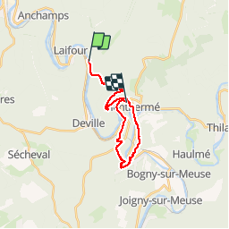

14,6 km | 23 km-effort


Usuario


Aplicación GPS de excursión GRATIS
 SityTrail
IGN / Institutos geográficos
SityTrail World
El mundo es suyo
Ruta Senderismo de 21 km a descubrir en Gran Este, Ardenas, Revin. Esta ruta ha sido propuesta por Eric_Alu.
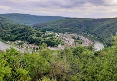
Petite commune Revin (Laifour )
Monthermé, St Remy Laval Dieu, Quatre fils Aymon, Chateau Regnault, Roches aux sept villages, Port Fluviale Monthermé.

Senderismo

Senderismo
Senderismo

Senderismo


Senderismo
Senderismo

Senderismo
Senderismo
trop pratique, complètement convaincu après 5 jours d'usage