![](/images/other/stat-length.png)
![Excursión Senderismo Pluherlin - Rochefort en terre - Photo](https://media.geolcdn.com/t/1900/400/f7e5a291-bcaa-4868-be57-1c1c8da9528f.jpg&format=pjpeg&maxdim=2)
Rochefort en terre
nolsim
Usuario
![Longitud](/images/other/stat-length.png)
Longitud
17,5 km
![Altitud máxima](https://static1.geolcdn.com/siteimages/upload/files/1508320355ic_sort_altitude_max_24dp.png)
Altitud máxima
87 m
![Desnivel positivo](https://static1.geolcdn.com/siteimages/upload/files/1508320355ic_sort_den_pos_24dp.png)
Desnivel positivo
296 m
![Km-Effort](/images/other/stat-length.png)
Km-Effort
21 km
![Altitud mínima](https://static1.geolcdn.com/siteimages/upload/files/1508320355ic_sort_altitude_min_24dp.png)
Altitud mínima
19 m
![Desnivel negativo](https://static1.geolcdn.com/siteimages/upload/files/1508320355ic_sort_den_neg_24dp.png)
Desnivel negativo
296 m
![Boucle](https://static1.geolcdn.com/siteimages/upload/files/16400158638029165_repeat_loop_refresh_sync_direction_icon.png)
Boucle
Sí
Fecha de creación :
2021-03-30 07:30:56.986
Última modificación :
2021-03-30 12:45:05.973
![Senderismo](https://static1.geolcdn.com/sitytour/trail-icons/101.png)
4h01
Dificultad : Medio
![Escanee este código QR para abrir la excursión en la aplicación SityTrail](https://capi.geolives.com/qq0zvz2zws4bq2lad0pu/sitytour/trails/2727902/qr.png?size=200)
Aplicación GPS de excursión GRATIS
A propósito
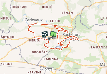
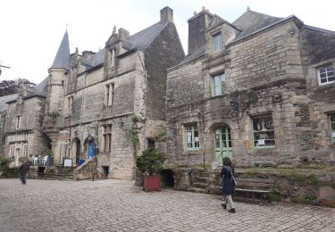
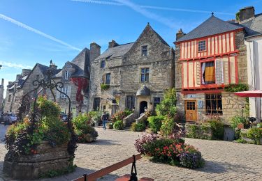
Ruta Senderismo de 17,5 km a descubrir en Bretaña, Morbihan, Pluherlin. Esta ruta ha sido propuesta por nolsim.
Descripción
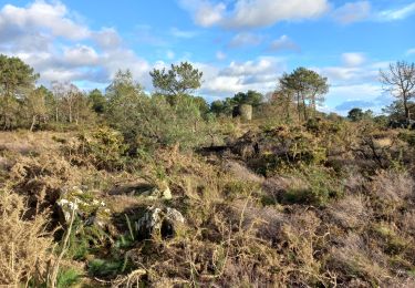
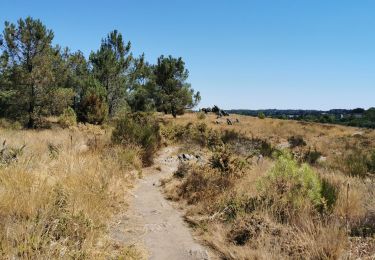
très belle randonnée aux paysages très variés
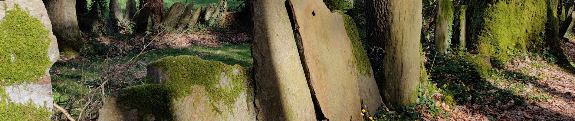
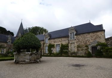
Localización
País:
France
Región :
Bretaña
Departamento/provincia :
Morbihan
Municipio :
Pluherlin
Localidad:
Unknown
Salida:(Dec)
Salida:(UTM)
547751 ; 5282705 (30T) N.
Comentarios
Excursiones cerca
![Excursión Bici de montaña Malansac - Rando VTT Malansac 2010 - Photo](https://media.geolcdn.com/t/375/260/ext.jpg?maxdim=2&url=https%3A%2F%2Fservices.sitytrail.com%2FGeolivesWS%2FDownloadMedia.ashx%3FTrailID%3D105587%26Media%3D9358_1.jpg)
![Bici de montaña Bici de montaña](https://static1.geolcdn.com/sitytour/trail-icons/202.png)
Rando VTT Malansac 2010
Bici de montaña
Difícil
(1)
Malansac,
Bretaña,
Morbihan,
France
![](/images/other/stat-length.png)
34 km | 40 km-effort
3h 0min
![](https://static1.geolcdn.com/siteimages/upload/files/16400158638029165_repeat_loop_refresh_sync_direction_icon.png)
Sí
![Excursión A pie Rochefort-en-Terre - Circuit de Rochefort - Photo](https://media.geolcdn.com/t/375/260/c9797295-9c5c-4d94-a3e1-5b520a62ca6b.jpeg&format=jpg&maxdim=2)
![A pie A pie](https://static1.geolcdn.com/sitytour/trail-icons/100.png)
Circuit de Rochefort
A pie
Fácil
Rochefort-en-Terre,
Bretaña,
Morbihan,
France
![](/images/other/stat-length.png)
7,5 km | 9,1 km-effort
2h 3min
![](https://static1.geolcdn.com/siteimages/upload/files/16400158638029165_repeat_loop_refresh_sync_direction_icon.png)
Sí
![Excursión Senderismo Rochefort-en-Terre - Rochefort en terre - Photo](https://media.geolcdn.com/t/375/260/ext.jpg?maxdim=2&url=https%3A%2F%2Fstatic1.geolcdn.com%2Fsiteimages%2Fupload%2Ffiles%2F1553511878bg_sport_marche.png)
![Senderismo Senderismo](https://static1.geolcdn.com/sitytour/trail-icons/101.png)
Rochefort en terre
Senderismo
Fácil
(1)
Rochefort-en-Terre,
Bretaña,
Morbihan,
France
![](/images/other/stat-length.png)
3,3 km | 4,1 km-effort
1h 25min
![](https://static1.geolcdn.com/siteimages/upload/files/16400158638029165_repeat_loop_refresh_sync_direction_icon.png)
Sí
![Excursión Senderismo Rochefort-en-Terre - Rochefort en terre - Photo](https://media.geolcdn.com/t/375/260/ext.jpg?maxdim=2&url=https%3A%2F%2Fstatic1.geolcdn.com%2Fsiteimages%2Fupload%2Ffiles%2F1553511878bg_sport_marche.png)
![Senderismo Senderismo](https://static1.geolcdn.com/sitytour/trail-icons/101.png)
Rochefort en terre
Senderismo
Fácil
(1)
Rochefort-en-Terre,
Bretaña,
Morbihan,
France
![](/images/other/stat-length.png)
14,2 km | 17,7 km-effort
3h 46min
![](https://static1.geolcdn.com/siteimages/upload/files/16400158638029165_repeat_loop_refresh_sync_direction_icon.png)
Sí
![Excursión Senderismo Pluherlin - GRP_Lanvaux_AH_08_Rochefort-Terre_Limerzel_20210515 - Photo](https://media.geolcdn.com/t/375/260/f476e017-5a16-48c2-9ee0-f5d72d4f165e.jpg&format=jpg&maxdim=2)
![Senderismo Senderismo](https://static1.geolcdn.com/sitytour/trail-icons/101.png)
GRP_Lanvaux_AH_08_Rochefort-Terre_Limerzel_20210515
Senderismo
Fácil
Pluherlin,
Bretaña,
Morbihan,
France
![](/images/other/stat-length.png)
13,5 km | 16,3 km-effort
3h 28min
![](https://static1.geolcdn.com/siteimages/upload/files/16400158638029165_repeat_loop_refresh_sync_direction_icon.png)
No
![Excursión sport Rochefort-en-Terre - 9322323-BACVTT - ASCENSION - REDON - Photo](https://media.geolcdn.com/t/375/260/ext.jpg?maxdim=2&url=https%3A%2F%2Fsecurestorage.geolives.com%2Fsitytour%2Ftrail-bg%2Fdefault.jpg)
9322323-BACVTT - ASCENSION - REDON
sport
Muy fácil
(1)
Rochefort-en-Terre,
Bretaña,
Morbihan,
France
![](/images/other/stat-length.png)
69 km | 81 km-effort
Desconocido
![](https://static1.geolcdn.com/siteimages/upload/files/16400158638029165_repeat_loop_refresh_sync_direction_icon.png)
Sí
![Excursión Senderismo Malansac - Les grées en Rochefort en terre - Photo](https://media.geolcdn.com/t/375/260/445cd185-a3f0-4ada-9bf0-5e895411e136.jpg&format=jpg&maxdim=2)
![Senderismo Senderismo](https://static1.geolcdn.com/sitytour/trail-icons/101.png)
Les grées en Rochefort en terre
Senderismo
Medio
Malansac,
Bretaña,
Morbihan,
France
![](/images/other/stat-length.png)
9,5 km | 12 km-effort
2h 26min
![](https://static1.geolcdn.com/siteimages/upload/files/16400158638029165_repeat_loop_refresh_sync_direction_icon.png)
Sí
![Excursión Senderismo Rochefort-en-Terre - Rochefort en terre - Photo](https://media.geolcdn.com/t/375/260/40e8d1b7-2929-4b56-b6f9-ada7953ea1db.jpg&format=jpg&maxdim=2)
![Senderismo Senderismo](https://static1.geolcdn.com/sitytour/trail-icons/101.png)
Rochefort en terre
Senderismo
Medio
Rochefort-en-Terre,
Bretaña,
Morbihan,
France
![](/images/other/stat-length.png)
5,3 km | 6,8 km-effort
1h 46min
![](https://static1.geolcdn.com/siteimages/upload/files/16400158638029165_repeat_loop_refresh_sync_direction_icon.png)
No
![Excursión Senderismo Malansac - rochefort en terre - Photo](https://media.geolcdn.com/t/375/260/024cd389-1c66-4c85-8c90-0502995ae01e.jpg&format=jpg&maxdim=2)
![Senderismo Senderismo](https://static1.geolcdn.com/sitytour/trail-icons/101.png)
rochefort en terre
Senderismo
Muy fácil
Malansac,
Bretaña,
Morbihan,
France
![](/images/other/stat-length.png)
16,4 km | 19,9 km-effort
4h 34min
![](https://static1.geolcdn.com/siteimages/upload/files/16400158638029165_repeat_loop_refresh_sync_direction_icon.png)
Sí