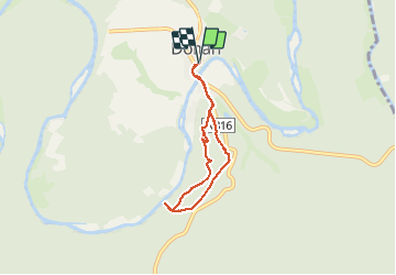
![](/images/other/stat-length.png)
![Excursión A pie Bouillon - SityTrail - Détails 23 Rocher Lecomte - Photo](https://media.geolcdn.com/t/1900/400/6429425e-e7ce-4932-a907-3c81f67f6013.jpg&format=pjpeg&maxdim=2)
SityTrail - Détails 23 Rocher Lecomte
Maison du Tourisme du Pays de Bouillon
Au Coeur de l'Ardenne Authentique - In het Hart van de Echte Ardennen GUIDE+
![Longitud](/images/other/stat-length.png)
![Altitud máxima](https://static1.geolcdn.com/siteimages/upload/files/1508320355ic_sort_altitude_max_24dp.png)
![Desnivel positivo](https://static1.geolcdn.com/siteimages/upload/files/1508320355ic_sort_den_pos_24dp.png)
![Km-Effort](/images/other/stat-length.png)
![Altitud mínima](https://static1.geolcdn.com/siteimages/upload/files/1508320355ic_sort_altitude_min_24dp.png)
![Desnivel negativo](https://static1.geolcdn.com/siteimages/upload/files/1508320355ic_sort_den_neg_24dp.png)
![Boucle](https://static1.geolcdn.com/siteimages/upload/files/16400158638029165_repeat_loop_refresh_sync_direction_icon.png)
![A pie](https://static1.geolcdn.com/sitytour/trail-icons/100.png)
1h40
Dificultad : Fácil
![Escanee este código QR para abrir la excursión en la aplicación SityTrail](https://capi.geolives.com/qq0zvz2zws4bq2lad0pu/sitytour/trails/2716642/qr.png?size=200)
Aplicación GPS de excursión GRATIS
A propósito
Ruta A pie de 4,9 km a descubrir en Valonia, Luxemburgo, Bouillon. Esta ruta ha sido propuesta por Maison du Tourisme du Pays de Bouillon.
Descripción
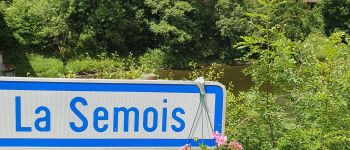
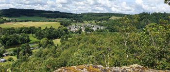
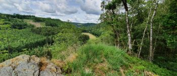
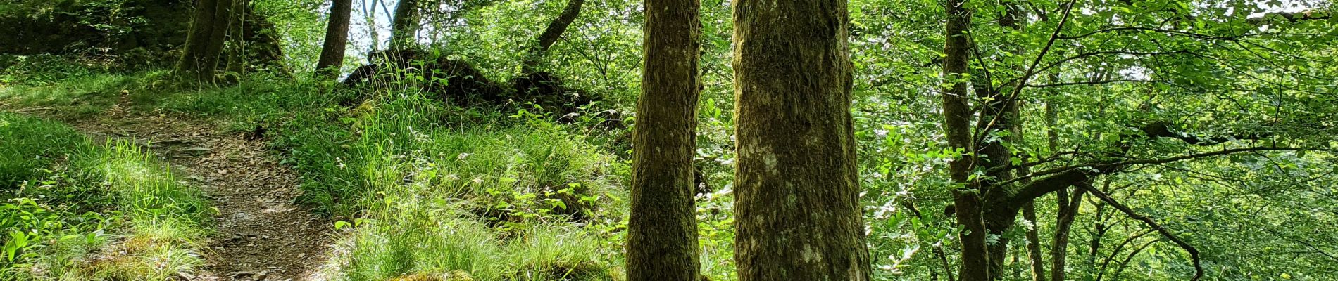
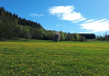
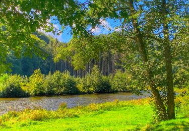
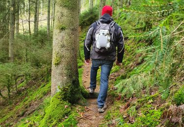
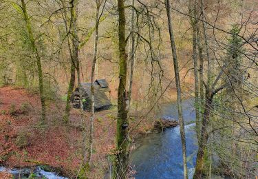
Très belle balade, magnifiée par la légende du Rocher Lecomte avec son très beau point de vue donnant sur le village de Dohan et la campagne environnante jusqu’aux hauteurs de Noirefontaine. On chemine entre crête et chemin plus large. Le rocher des Clappes est une curiosité géologique du quaternaire avec son impressionnante vue sur la vallée sauvage.
-----------------------------------------
Een zeer mooie wandeling, verfraaid door de legende van de Rocher Lecomte met zijn prachtig uitzichtpunt op het dorp Dohan en het omringende landschap tot aan de heuvels van Noirefontaine. We lopen langs een bergkam en bredere paden. De Rocher des Clappes is een geologische curiositeit uit het quartair tijdperk en biedt een indrukwekkend uitzicht over de ongeschonden vallei.
Localización
Comentarios
Excursiones cerca
![Excursión Otra actividad Bertrix - BX08 - Photo](https://media.geolcdn.com/t/375/260/ext.jpg?maxdim=2&url=https%3A%2F%2Fstatic1.geolcdn.com%2Fsiteimages%2Fupload%2Ffiles%2F1545311037marcheuse_200dpi.jpg)
![Otra actividad Otra actividad](https://static1.geolcdn.com/sitytour/trail-icons/900.png)
Otra actividad
![](/images/other/stat-length.png)
![](https://static1.geolcdn.com/siteimages/upload/files/16400158638029165_repeat_loop_refresh_sync_direction_icon.png)
![Excursión Senderismo Bouillon - GR16 SEMOIS 1 : Dohan - Photo](https://media.geolcdn.com/t/375/260/5a72d435-6e63-4e10-8243-a0a93e161c94.jpg&format=jpg&maxdim=2)
![Senderismo Senderismo](https://static1.geolcdn.com/sitytour/trail-icons/101.png)
Senderismo
![](/images/other/stat-length.png)
![](https://static1.geolcdn.com/siteimages/upload/files/16400158638029165_repeat_loop_refresh_sync_direction_icon.png)
![Excursión Otra actividad Bertrix - BX18 - Photo](https://media.geolcdn.com/t/375/260/ext.jpg?maxdim=2&url=https%3A%2F%2Fstatic1.geolcdn.com%2Fsiteimages%2Fupload%2Ffiles%2F1545311037marcheuse_200dpi.jpg)
![Otra actividad Otra actividad](https://static1.geolcdn.com/sitytour/trail-icons/900.png)
Otra actividad
![](/images/other/stat-length.png)
![](https://static1.geolcdn.com/siteimages/upload/files/16400158638029165_repeat_loop_refresh_sync_direction_icon.png)
![Excursión Senderismo Bouillon - 2024-09-15_08h33m03_Les Hayons Bouillon - Photo](https://media.geolcdn.com/t/375/260/3874a8c0-e0c6-48f9-a0a0-20d74c421487.jpg&format=jpg&maxdim=2)
![Senderismo Senderismo](https://static1.geolcdn.com/sitytour/trail-icons/101.png)
Senderismo
![](/images/other/stat-length.png)
![](https://static1.geolcdn.com/siteimages/upload/files/16400158638029165_repeat_loop_refresh_sync_direction_icon.png)
![Excursión A pie Bouillon - Promenade de la Roche percée 47 - Photo](https://media.geolcdn.com/t/375/260/ext.jpg?maxdim=2&url=https%3A%2F%2Fpivotmedia.tourismewallonie.be%2FOTH-A0-006F-1M95%2FOTH-A0-006F-1M95.jpg)
![A pie A pie](https://static1.geolcdn.com/sitytour/trail-icons/100.png)
A pie
![](/images/other/stat-length.png)
![](https://static1.geolcdn.com/siteimages/upload/files/16400158638029165_repeat_loop_refresh_sync_direction_icon.png)
![Excursión A pie Bouillon - Promenade de Viaumont - Rivage de Marion 40 - Photo](https://media.geolcdn.com/t/375/260/ext.jpg?maxdim=2&url=https%3A%2F%2Fpivotmedia.tourismewallonie.be%2FOTH-A0-005O-332J%2FOTH-A0-005O-332J.jpg)
![A pie A pie](https://static1.geolcdn.com/sitytour/trail-icons/100.png)
A pie
![](/images/other/stat-length.png)
![](https://static1.geolcdn.com/siteimages/upload/files/16400158638029165_repeat_loop_refresh_sync_direction_icon.png)
![Excursión A pie Bouillon - Promenade du Rocher Lecomte 42 - Photo](https://media.geolcdn.com/t/375/260/ext.jpg?maxdim=2&url=https%3A%2F%2Fpivotmedia.tourismewallonie.be%2FOTH-A0-005W-1VH6%2FOTH-A0-005W-1VH6.jpg)
![A pie A pie](https://static1.geolcdn.com/sitytour/trail-icons/100.png)
A pie
![](/images/other/stat-length.png)
![](https://static1.geolcdn.com/siteimages/upload/files/16400158638029165_repeat_loop_refresh_sync_direction_icon.png)
![Excursión A pie Bouillon - Promenade de la Dampirée et de la Saurpire 43 - Photo](https://media.geolcdn.com/t/375/260/ext.jpg?maxdim=2&url=https%3A%2F%2Fpivotmedia.tourismewallonie.be%2FOTH-A0-005W-1T5L%2FOTH-A0-005W-1T5L.jpg)
![A pie A pie](https://static1.geolcdn.com/sitytour/trail-icons/100.png)
A pie
![](/images/other/stat-length.png)
![](https://static1.geolcdn.com/siteimages/upload/files/16400158638029165_repeat_loop_refresh_sync_direction_icon.png)
![Excursión A pie Bouillon - AU FIL DE L'EAU DES ALEINES ALISNA asbl - Photo](https://media.geolcdn.com/t/375/260/ext.jpg?maxdim=2&url=https%3A%2F%2Fpivotmedia.tourismewallonie.be%2FOTH-A0-0061-1FBG%2FOTH-A0-0061-1FBG.jpg)
![A pie A pie](https://static1.geolcdn.com/sitytour/trail-icons/100.png)
A pie
![](/images/other/stat-length.png)
![](https://static1.geolcdn.com/siteimages/upload/files/16400158638029165_repeat_loop_refresh_sync_direction_icon.png)