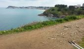
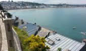
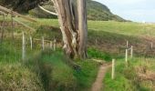
![](/images/other/stat-length.png)
![Excursión Senderismo Erquy - GR 34 étape 15 - Photo](https://media.geolcdn.com/t/1900/400/ext.pjpeg?maxdim=2&url=https%3A%2F%2Fservices.sitytrail.com%2FGeolivesWS%2FDownloadMedia.ashx%3FTrailID%3D271046%26Media%3Dfix__20140421161239.jpg)
GR 34 étape 15
lagardienne
Usuario
![Longitud](/images/other/stat-length.png)
Longitud
30 km
![Altitud máxima](https://static1.geolcdn.com/siteimages/upload/files/1508320355ic_sort_altitude_max_24dp.png)
Altitud máxima
83 m
![Desnivel positivo](https://static1.geolcdn.com/siteimages/upload/files/1508320355ic_sort_den_pos_24dp.png)
Desnivel positivo
632 m
![Km-Effort](/images/other/stat-length.png)
Km-Effort
38 km
![Altitud mínima](https://static1.geolcdn.com/siteimages/upload/files/1508320355ic_sort_altitude_min_24dp.png)
Altitud mínima
0 m
![Desnivel negativo](https://static1.geolcdn.com/siteimages/upload/files/1508320355ic_sort_den_neg_24dp.png)
Desnivel negativo
586 m
![Boucle](https://static1.geolcdn.com/siteimages/upload/files/16400158638029165_repeat_loop_refresh_sync_direction_icon.png)
Boucle
No
Fecha de creación :
2014-12-10 00:00:00.0
Última modificación :
2014-12-10 00:00:00.0
![Senderismo](https://static1.geolcdn.com/sitytour/trail-icons/101.png)
8h06
Dificultad : Fácil
![Escanee este código QR para abrir la excursión en la aplicación SityTrail](https://capi.geolives.com/qq0zvz2zws4bq2lad0pu/sitytour/trails/271046/qr.png?size=200)
Aplicación GPS de excursión GRATIS
A propósito
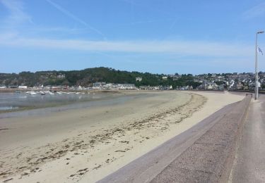
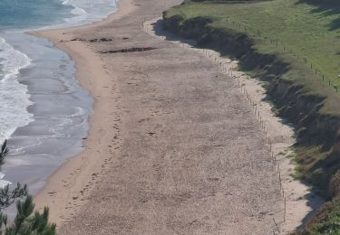
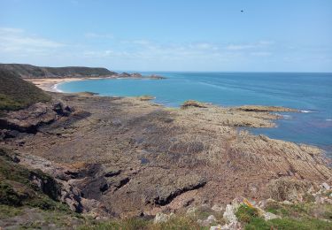
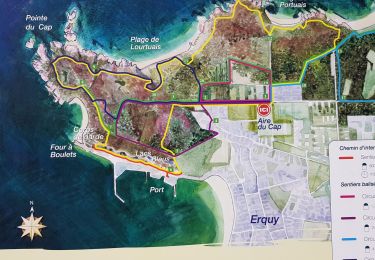
Ruta Senderismo de 30 km a descubrir en Bretaña, Côtes-d'Armor, Erquy. Esta ruta ha sido propuesta por lagardienne.
Descripción
Bientôt sur le jardindelolo.fr le récit de mon périple sur le GR 34, étape par étape avec commentaires et photos.
Localización
País:
France
Región :
Bretaña
Departamento/provincia :
Côtes-d'Armor
Municipio :
Erquy
Localidad:
Unknown
Salida:(Dec)
Salida:(UTM)
540672 ; 5386739 (30U) N.
Comentarios
Excursiones cerca
![Excursión Senderismo Erquy - Tour du Cap d''Erquy - Photo](https://media.geolcdn.com/t/375/260/6485fa67-2fed-4d4f-8749-6eb0f328b98b.jpg&format=jpg&maxdim=2)
![Senderismo Senderismo](https://static1.geolcdn.com/sitytour/trail-icons/101.png)
Tour du Cap d''Erquy
Senderismo
Medio
(1)
Erquy,
Bretaña,
Côtes-d'Armor,
France
![](/images/other/stat-length.png)
19,4 km | 24 km-effort
5h 24min
![](https://static1.geolcdn.com/siteimages/upload/files/16400158638029165_repeat_loop_refresh_sync_direction_icon.png)
Sí
![Excursión Senderismo Erquy - Erquy - 3.1km 50m 1h00 - 2017 06 22 - Photo](https://media.geolcdn.com/t/375/260/f1762648-9675-40fc-8b6f-f9ba25589aab.jpg&format=jpg&maxdim=2)
![Senderismo Senderismo](https://static1.geolcdn.com/sitytour/trail-icons/101.png)
Erquy - 3.1km 50m 1h00 - 2017 06 22
Senderismo
Muy fácil
Erquy,
Bretaña,
Côtes-d'Armor,
France
![](/images/other/stat-length.png)
3,1 km | 3,6 km-effort
45min
![](https://static1.geolcdn.com/siteimages/upload/files/16400158638029165_repeat_loop_refresh_sync_direction_icon.png)
Sí
![Excursión Senderismo Erquy - GR_34_BG_13_Erquy_Pleneuf-Val-Andre_20230819 - Photo](https://media.geolcdn.com/t/375/260/89ae597d-a66d-43f8-b940-7aa601d4c3de.jpg&format=jpg&maxdim=2)
![Senderismo Senderismo](https://static1.geolcdn.com/sitytour/trail-icons/101.png)
GR_34_BG_13_Erquy_Pleneuf-Val-Andre_20230819
Senderismo
Medio
Erquy,
Bretaña,
Côtes-d'Armor,
France
![](/images/other/stat-length.png)
17,2 km | 22 km-effort
4h 36min
![](https://static1.geolcdn.com/siteimages/upload/files/16400158638029165_repeat_loop_refresh_sync_direction_icon.png)
No
![Excursión Senderismo Erquy - Cap d'Erquy 3.7.23 - Photo](https://media.geolcdn.com/t/375/260/16ce8f05-b6ce-4867-9ff5-66cfc2a896f6.jpg&format=jpg&maxdim=2)
![Senderismo Senderismo](https://static1.geolcdn.com/sitytour/trail-icons/101.png)
Cap d'Erquy 3.7.23
Senderismo
Fácil
Erquy,
Bretaña,
Côtes-d'Armor,
France
![](/images/other/stat-length.png)
7,3 km | 9,2 km-effort
2h 20min
![](https://static1.geolcdn.com/siteimages/upload/files/16400158638029165_repeat_loop_refresh_sync_direction_icon.png)
Sí
![Excursión Senderismo Erquy - ILOT ST MICHEL FOND CAP FREHEL - Photo](https://media.geolcdn.com/t/375/260/d0d87639-8755-416c-9e9c-9932002c14dd.jpg&format=jpg&maxdim=2)
![Senderismo Senderismo](https://static1.geolcdn.com/sitytour/trail-icons/101.png)
ILOT ST MICHEL FOND CAP FREHEL
Senderismo
Difícil
Erquy,
Bretaña,
Côtes-d'Armor,
France
![](/images/other/stat-length.png)
3,5 km | 3,8 km-effort
2h 16min
![](https://static1.geolcdn.com/siteimages/upload/files/16400158638029165_repeat_loop_refresh_sync_direction_icon.png)
Sí
![Excursión Senderismo Erquy - CAP D'ERQUY - Photo](https://media.geolcdn.com/t/375/260/447534fd-609d-4795-8f40-8260c0c6a6be.jpg&format=jpg&maxdim=2)
![Senderismo Senderismo](https://static1.geolcdn.com/sitytour/trail-icons/101.png)
CAP D'ERQUY
Senderismo
Medio
Erquy,
Bretaña,
Côtes-d'Armor,
France
![](/images/other/stat-length.png)
4,5 km | 5,2 km-effort
2h 0min
![](https://static1.geolcdn.com/siteimages/upload/files/16400158638029165_repeat_loop_refresh_sync_direction_icon.png)
Sí
![Excursión Senderismo Erquy - Erquil - Photo](https://media.geolcdn.com/t/375/260/3500ee67-cf40-48aa-824a-8cc36a0b4ccc.jpg&format=jpg&maxdim=2)
![Senderismo Senderismo](https://static1.geolcdn.com/sitytour/trail-icons/101.png)
Erquil
Senderismo
Muy fácil
Erquy,
Bretaña,
Côtes-d'Armor,
France
![](/images/other/stat-length.png)
9,2 km | 11,6 km-effort
2h 40min
![](https://static1.geolcdn.com/siteimages/upload/files/16400158638029165_repeat_loop_refresh_sync_direction_icon.png)
Sí
![Excursión Senderismo Erquy - LE CAP D'ERQUY DEPUIS LE CAMPING LA VALLEE - Photo](https://media.geolcdn.com/t/375/260/844bcf38-4939-4501-9740-44824bba3a6f.jpg&format=jpg&maxdim=2)
![Senderismo Senderismo](https://static1.geolcdn.com/sitytour/trail-icons/101.png)
LE CAP D'ERQUY DEPUIS LE CAMPING LA VALLEE
Senderismo
Muy difícil
Erquy,
Bretaña,
Côtes-d'Armor,
France
![](/images/other/stat-length.png)
15,8 km | 19,9 km-effort
3h 43min
![](https://static1.geolcdn.com/siteimages/upload/files/16400158638029165_repeat_loop_refresh_sync_direction_icon.png)
Sí
![Excursión Senderismo Erquy - 201908 promenade Erquy - Photo](https://media.geolcdn.com/t/375/260/7c3acd72-1f5c-4646-969c-4dac89fe4c23.jpg&format=jpg&maxdim=2)
![Senderismo Senderismo](https://static1.geolcdn.com/sitytour/trail-icons/101.png)
201908 promenade Erquy
Senderismo
Muy fácil
Erquy,
Bretaña,
Côtes-d'Armor,
France
![](/images/other/stat-length.png)
6,3 km | 8,2 km-effort
3h 39min
![](https://static1.geolcdn.com/siteimages/upload/files/16400158638029165_repeat_loop_refresh_sync_direction_icon.png)
No