![](/images/other/stat-length.png)
![Excursión Senderismo Lucenay - Lucenay (69) - 9 km/D. 293 m - Photo](https://media.geolcdn.com/t/1900/400/254a565e-f5d9-499f-843a-96c57ffc0308.jpg&format=pjpeg&maxdim=2)
Lucenay (69) - 9 km/D. 293 m
Thomasdanielle
Usuario
![Longitud](/images/other/stat-length.png)
Longitud
8,8 km
![Altitud máxima](https://static1.geolcdn.com/siteimages/upload/files/1508320355ic_sort_altitude_max_24dp.png)
Altitud máxima
392 m
![Desnivel positivo](https://static1.geolcdn.com/siteimages/upload/files/1508320355ic_sort_den_pos_24dp.png)
Desnivel positivo
292 m
![Km-Effort](/images/other/stat-length.png)
Km-Effort
12,7 km
![Altitud mínima](https://static1.geolcdn.com/siteimages/upload/files/1508320355ic_sort_altitude_min_24dp.png)
Altitud mínima
210 m
![Desnivel negativo](https://static1.geolcdn.com/siteimages/upload/files/1508320355ic_sort_den_neg_24dp.png)
Desnivel negativo
292 m
![Boucle](https://static1.geolcdn.com/siteimages/upload/files/16400158638029165_repeat_loop_refresh_sync_direction_icon.png)
Boucle
Sí
Fecha de creación :
2021-03-11 08:51:12.0
Última modificación :
2021-03-11 15:27:34.375
![Senderismo](https://static1.geolcdn.com/sitytour/trail-icons/101.png)
2h50
Dificultad : Desconocido
![Escanee este código QR para abrir la excursión en la aplicación SityTrail](https://capi.geolives.com/qq0zvz2zws4bq2lad0pu/sitytour/trails/2703460/qr.png?size=200)
Aplicación GPS de excursión GRATIS
A propósito
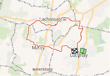
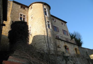
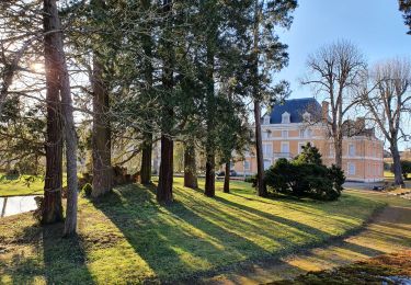
Ruta Senderismo de 8,8 km a descubrir en Auvergne-Rhône-Alpes, Ródano, Lucenay. Esta ruta ha sido propuesta por Thomasdanielle.
Descripción
D/A : Parking de la mairie
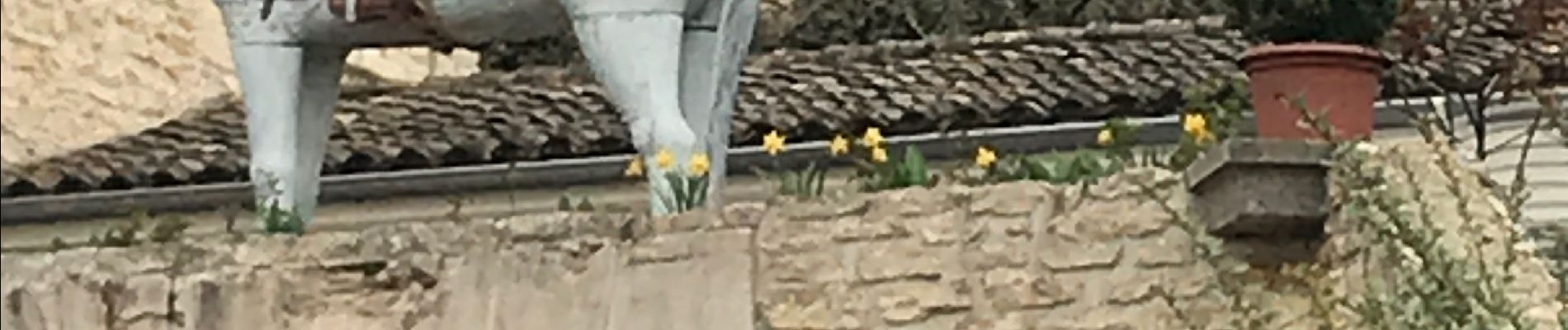
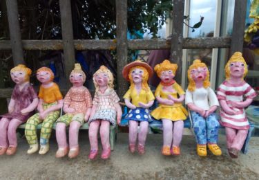
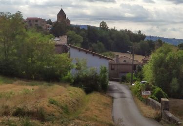
A Marcy ne pas passer à côté des magnifiques mûrs peints (photos ci-jointes)
Localización
País:
France
Región :
Auvergne-Rhône-Alpes
Departamento/provincia :
Ródano
Municipio :
Lucenay
Localidad:
Unknown
Salida:(Dec)
Salida:(UTM)
631969 ; 5085570 (31T) N.
Comentarios
Excursiones cerca
![Excursión A pie Saint-Jean-des-Vignes - De Bagnols à Lozanne - Photo](https://media.geolcdn.com/t/375/260/0483cf43-fc67-45ae-bc2f-363ddcb48e98.jpeg&format=jpg&maxdim=2)
![A pie A pie](https://static1.geolcdn.com/sitytour/trail-icons/100.png)
De Bagnols à Lozanne
A pie
Fácil
Saint-Jean-des-Vignes,
Auvergne-Rhône-Alpes,
Ródano,
France
![](/images/other/stat-length.png)
4 km | 5 km-effort
1h 7min
![](https://static1.geolcdn.com/siteimages/upload/files/16400158638029165_repeat_loop_refresh_sync_direction_icon.png)
No
![Excursión Senderismo Saint-Jean-des-Vignes - A_ST JEAN DES VIGNES 69380 Pierre Folle - Fontainebleau - Photo](https://media.geolcdn.com/t/375/260/ext.jpg?maxdim=2&url=https%3A%2F%2Fstatic1.geolcdn.com%2Fsiteimages%2Fupload%2Ffiles%2F1553511878bg_sport_marche.png)
![Senderismo Senderismo](https://static1.geolcdn.com/sitytour/trail-icons/101.png)
A_ST JEAN DES VIGNES 69380 Pierre Folle - Fontainebleau
Senderismo
Fácil
(1)
Saint-Jean-des-Vignes,
Auvergne-Rhône-Alpes,
Ródano,
France
![](/images/other/stat-length.png)
8 km | 11 km-effort
3h 0min
![](https://static1.geolcdn.com/siteimages/upload/files/16400158638029165_repeat_loop_refresh_sync_direction_icon.png)
Sí
![Excursión Senderismo Morancé - morance - Photo](https://media.geolcdn.com/t/375/260/ext.jpg?maxdim=2&url=https%3A%2F%2Fstatic1.geolcdn.com%2Fsiteimages%2Fupload%2Ffiles%2F1553511878bg_sport_marche.png)
![Senderismo Senderismo](https://static1.geolcdn.com/sitytour/trail-icons/101.png)
morance
Senderismo
Muy fácil
(1)
Morancé,
Auvergne-Rhône-Alpes,
Ródano,
France
![](/images/other/stat-length.png)
7,9 km | 9,7 km-effort
1h 46min
![](https://static1.geolcdn.com/siteimages/upload/files/16400158638029165_repeat_loop_refresh_sync_direction_icon.png)
Sí
![Excursión Paseo ecuestre Les Chères - 5 nov formation - Photo](https://media.geolcdn.com/t/375/260/ext.jpg?maxdim=2&url=https%3A%2F%2Fstatic1.geolcdn.com%2Fsiteimages%2Fupload%2Ffiles%2F1524743154cheval.jpg)
![Paseo ecuestre Paseo ecuestre](https://static1.geolcdn.com/sitytour/trail-icons/301.png)
5 nov formation
Paseo ecuestre
Fácil
(2)
Les Chères,
Auvergne-Rhône-Alpes,
Ródano,
France
![](/images/other/stat-length.png)
13,6 km | 15 km-effort
1h 58min
![](https://static1.geolcdn.com/siteimages/upload/files/16400158638029165_repeat_loop_refresh_sync_direction_icon.png)
Sí
![Excursión Senderismo Charnay - Charnay/Châtillon/Chessy (12 km - D. 330 m) - Photo](https://media.geolcdn.com/t/375/260/1a2d3b7e-3e2e-464b-b810-b35fd7c37452.jpeg&format=jpg&maxdim=2)
![Senderismo Senderismo](https://static1.geolcdn.com/sitytour/trail-icons/101.png)
Charnay/Châtillon/Chessy (12 km - D. 330 m)
Senderismo
Fácil
Charnay,
Auvergne-Rhône-Alpes,
Ródano,
France
![](/images/other/stat-length.png)
12,5 km | 16,9 km-effort
3h 7min
![](https://static1.geolcdn.com/siteimages/upload/files/16400158638029165_repeat_loop_refresh_sync_direction_icon.png)
Sí
![Excursión A pie Chazay-d'Azergues - Tour des Pierres Dorées en Beaujolais - Photo](https://media.geolcdn.com/t/375/260/85e178bb-7e2d-451d-ad36-673bc672e36a.jpeg&format=jpg&maxdim=2)
![A pie A pie](https://static1.geolcdn.com/sitytour/trail-icons/100.png)
Tour des Pierres Dorées en Beaujolais
A pie
Fácil
Chazay-d'Azergues,
Auvergne-Rhône-Alpes,
Ródano,
France
![](/images/other/stat-length.png)
7,6 km | 10,2 km-effort
2h 19min
![](https://static1.geolcdn.com/siteimages/upload/files/16400158638029165_repeat_loop_refresh_sync_direction_icon.png)
No
![Excursión Senderismo Châtillon - Châtillon - La vallée de l'Azergues - Photo](https://media.geolcdn.com/t/375/260/4cdce229-584e-4928-b1f1-7fe54f3e81d4.jpg&format=jpg&maxdim=2)
![Senderismo Senderismo](https://static1.geolcdn.com/sitytour/trail-icons/101.png)
Châtillon - La vallée de l'Azergues
Senderismo
Fácil
Châtillon,
Auvergne-Rhône-Alpes,
Ródano,
France
![](/images/other/stat-length.png)
4,2 km | 5,5 km-effort
1h 33min
![](https://static1.geolcdn.com/siteimages/upload/files/16400158638029165_repeat_loop_refresh_sync_direction_icon.png)
Sí
![Excursión Senderismo Saint-Jean-des-Vignes - Saint-Jean-des-Vignes - De Saint-Jean à Pierre Folle - Photo](https://media.geolcdn.com/t/375/260/09c240b5-53a5-4d13-9478-c40ff2324f7d.jpg&format=jpg&maxdim=2)
![Senderismo Senderismo](https://static1.geolcdn.com/sitytour/trail-icons/101.png)
Saint-Jean-des-Vignes - De Saint-Jean à Pierre Folle
Senderismo
Fácil
Saint-Jean-des-Vignes,
Auvergne-Rhône-Alpes,
Ródano,
France
![](/images/other/stat-length.png)
3,3 km | 4,2 km-effort
1h 19min
![](https://static1.geolcdn.com/siteimages/upload/files/16400158638029165_repeat_loop_refresh_sync_direction_icon.png)
Sí
![Excursión Senderismo Saint-Jean-des-Vignes - Bouche de Saint Jean des Vignes à Saint Pierre - Photo](https://media.geolcdn.com/t/375/260/c8452eaa-5f97-45f9-ba95-9c3bdeb1e359.jpg&format=jpg&maxdim=2)
![Senderismo Senderismo](https://static1.geolcdn.com/sitytour/trail-icons/101.png)
Bouche de Saint Jean des Vignes à Saint Pierre
Senderismo
Fácil
Saint-Jean-des-Vignes,
Auvergne-Rhône-Alpes,
Ródano,
France
![](/images/other/stat-length.png)
6,3 km | 8,5 km-effort
2h 2min
![](https://static1.geolcdn.com/siteimages/upload/files/16400158638029165_repeat_loop_refresh_sync_direction_icon.png)
Sí