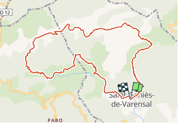
![](/images/other/stat-length.png)
![Excursión Senderismo Saint-Geniès-de-Varensal - marcou - Photo](https://media.geolcdn.com/t/1900/400/ext.pjpeg?maxdim=2&url=https%3A%2F%2Fstatic1.geolcdn.com%2Fsiteimages%2Fupload%2Ffiles%2F1553511878bg_sport_marche.png)
marcou
Frayssinet
Usuario
![Longitud](/images/other/stat-length.png)
![Altitud máxima](https://static1.geolcdn.com/siteimages/upload/files/1508320355ic_sort_altitude_max_24dp.png)
![Desnivel positivo](https://static1.geolcdn.com/siteimages/upload/files/1508320355ic_sort_den_pos_24dp.png)
![Km-Effort](/images/other/stat-length.png)
![Altitud mínima](https://static1.geolcdn.com/siteimages/upload/files/1508320355ic_sort_altitude_min_24dp.png)
![Desnivel negativo](https://static1.geolcdn.com/siteimages/upload/files/1508320355ic_sort_den_neg_24dp.png)
![Boucle](https://static1.geolcdn.com/siteimages/upload/files/16400158638029165_repeat_loop_refresh_sync_direction_icon.png)
![Senderismo](https://static1.geolcdn.com/sitytour/trail-icons/101.png)
6h17
Dificultad : Fácil
![Escanee este código QR para abrir la excursión en la aplicación SityTrail](https://capi.geolives.com/qq0zvz2zws4bq2lad0pu/sitytour/trails/2685457/qr.png?size=200)
Aplicación GPS de excursión GRATIS
A propósito
Ruta Senderismo de 13,6 km a descubrir en Occitania, Hérault, Saint-Geniès-de-Varensal. Esta ruta ha sido propuesta por Frayssinet.
Descripción
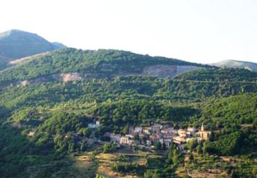
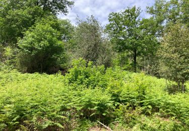
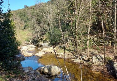
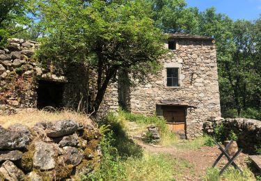
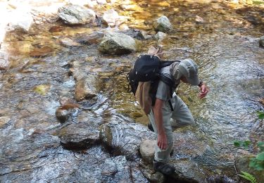
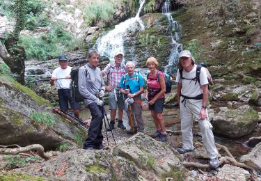
Croix de Marcou , par la vallée d'orques. (Résurgence, moulin d'orques)
Circuit difficile, après de très fortes pluies (absence de passerelles).
Non balisé du départ jusqu'au village de La Fau. Quelques cairns subsistent, mais cette partie semble hélas abandonnée, sauf peut-être par les chasseurs.
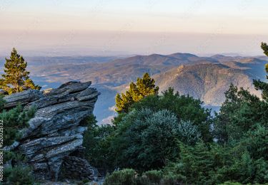
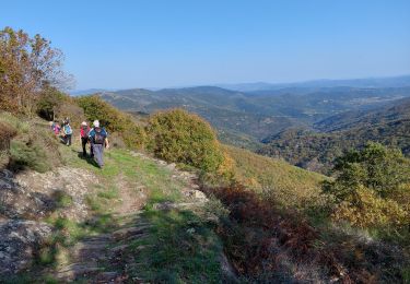
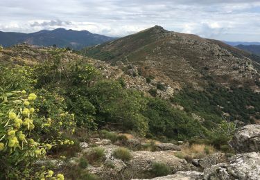
Magnifique circuit.
Bâton conseillé.
Localización
Comentarios
Excursiones cerca
![Excursión Senderismo Saint-Gervais-sur-Mare - Les Nières et ses anciennes découvertes de houille - Photo](https://media.geolcdn.com/t/375/260/ext.jpg?maxdim=2&url=https%3A%2F%2Fservices.sitytrail.com%2FGeolivesWS%2FDownloadMedia.ashx%3FTrailID%3D108891%26Media%3D2468_1.jpg)
![Senderismo Senderismo](https://static1.geolcdn.com/sitytour/trail-icons/101.png)
Senderismo
![](/images/other/stat-length.png)
![](https://static1.geolcdn.com/siteimages/upload/files/16400158638029165_repeat_loop_refresh_sync_direction_icon.png)
![Excursión Senderismo Saint-Gervais-sur-Mare - Tour du Caroux Arsel - Photo](https://media.geolcdn.com/t/375/260/38436cc7-eed3-45cf-a5b1-a12f25d9e4ac.jpeg&format=jpg&maxdim=2)
![Senderismo Senderismo](https://static1.geolcdn.com/sitytour/trail-icons/101.png)
Senderismo
![](/images/other/stat-length.png)
![](https://static1.geolcdn.com/siteimages/upload/files/16400158638029165_repeat_loop_refresh_sync_direction_icon.png)
![Excursión Senderismo Rosis - Les cinq cols - Photo](https://media.geolcdn.com/t/375/260/10f3b19b-e07b-4b83-a9da-a43d19300d46.jpg&format=jpg&maxdim=2)
![Senderismo Senderismo](https://static1.geolcdn.com/sitytour/trail-icons/101.png)
![Excursión Senderismo Saint-Gervais-sur-Mare - St Gervais / Mecle - Photo](https://media.geolcdn.com/t/375/260/44a3a381-c5a0-422f-9207-70c1fc116558.jpg&format=jpg&maxdim=2)
![Senderismo Senderismo](https://static1.geolcdn.com/sitytour/trail-icons/101.png)
Senderismo
![](/images/other/stat-length.png)
![](https://static1.geolcdn.com/siteimages/upload/files/16400158638029165_repeat_loop_refresh_sync_direction_icon.png)
![Excursión Senderismo Rosis - Andabre - Portail de Roquandouïre - Caissenols-le-Haut - Photo](https://media.geolcdn.com/t/375/260/a7f312f0-5400-4beb-b0c0-92123c0aa91f.jpg&format=jpg&maxdim=2)
![Senderismo Senderismo](https://static1.geolcdn.com/sitytour/trail-icons/101.png)
Senderismo
![](/images/other/stat-length.png)
![](https://static1.geolcdn.com/siteimages/upload/files/16400158638029165_repeat_loop_refresh_sync_direction_icon.png)
![Excursión Senderismo Saint-Gervais-sur-Mare - compeyre arsel - Photo](https://media.geolcdn.com/t/375/260/6d5dd05e-d2b6-47cc-acd4-44d9ab3855de.jpg&format=jpg&maxdim=2)
![Senderismo Senderismo](https://static1.geolcdn.com/sitytour/trail-icons/101.png)
Senderismo
![](/images/other/stat-length.png)
![](https://static1.geolcdn.com/siteimages/upload/files/16400158638029165_repeat_loop_refresh_sync_direction_icon.png)
![Excursión Senderismo Rosis - Col de lourdTigas - Photo](https://media.geolcdn.com/t/375/260/f2da17c1-c586-4087-b4a8-a530c958ee71.jpg&format=jpg&maxdim=2)
![Senderismo Senderismo](https://static1.geolcdn.com/sitytour/trail-icons/101.png)
Senderismo
![](/images/other/stat-length.png)
![](https://static1.geolcdn.com/siteimages/upload/files/16400158638029165_repeat_loop_refresh_sync_direction_icon.png)
![Excursión Senderismo Saint-Gervais-sur-Mare - de compter au col aussieres - Photo](https://media.geolcdn.com/t/375/260/4602b779-ce6c-42c8-974b-8dd2fe531ba4.jpg&format=jpg&maxdim=2)
![Senderismo Senderismo](https://static1.geolcdn.com/sitytour/trail-icons/101.png)
Senderismo
![](/images/other/stat-length.png)
![](https://static1.geolcdn.com/siteimages/upload/files/16400158638029165_repeat_loop_refresh_sync_direction_icon.png)
![Excursión Senderismo Saint-Geniès-de-Varensal - col du Marcou a partir de Plaisance - Photo](https://media.geolcdn.com/t/375/260/07d3e210-25c8-483d-a597-9b676b29012c.jpg&format=jpg&maxdim=2)
![Senderismo Senderismo](https://static1.geolcdn.com/sitytour/trail-icons/101.png)
Senderismo
![](/images/other/stat-length.png)
![](https://static1.geolcdn.com/siteimages/upload/files/16400158638029165_repeat_loop_refresh_sync_direction_icon.png)