![](/images/other/stat-length.png)
![Excursión Senderismo Middelkerke - lombardsijde westende - Photo](https://media.geolcdn.com/t/1900/400/ae309809-06ac-438d-baf9-a69f192d5c83.jpg&format=pjpeg&maxdim=2)
lombardsijde westende
Alain Dufrasne
Usuario
![Longitud](/images/other/stat-length.png)
Longitud
10,7 km
![Altitud máxima](https://static1.geolcdn.com/siteimages/upload/files/1508320355ic_sort_altitude_max_24dp.png)
Altitud máxima
16 m
![Desnivel positivo](https://static1.geolcdn.com/siteimages/upload/files/1508320355ic_sort_den_pos_24dp.png)
Desnivel positivo
45 m
![Km-Effort](/images/other/stat-length.png)
Km-Effort
11,3 km
![Altitud mínima](https://static1.geolcdn.com/siteimages/upload/files/1508320355ic_sort_altitude_min_24dp.png)
Altitud mínima
-3 m
![Desnivel negativo](https://static1.geolcdn.com/siteimages/upload/files/1508320355ic_sort_den_neg_24dp.png)
Desnivel negativo
46 m
![Boucle](https://static1.geolcdn.com/siteimages/upload/files/16400158638029165_repeat_loop_refresh_sync_direction_icon.png)
Boucle
Sí
Fecha de creación :
2021-02-24 14:56:22.044
Última modificación :
2021-02-24 17:44:59.491
![Senderismo](https://static1.geolcdn.com/sitytour/trail-icons/101.png)
2h23
Dificultad : Fácil
![Escanee este código QR para abrir la excursión en la aplicación SityTrail](https://capi.geolives.com/qq0zvz2zws4bq2lad0pu/sitytour/trails/2683880/qr.png?size=200)
Aplicación GPS de excursión GRATIS
A propósito
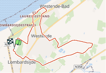
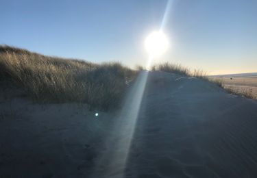
Ruta Senderismo de 10,7 km a descubrir en Flandes, Flandes Occidental, Middelkerke. Esta ruta ha sido propuesta por Alain Dufrasne.
Descripción
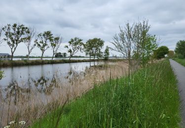
arrière pays à plat. magnifique paysage.
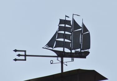
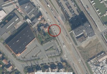
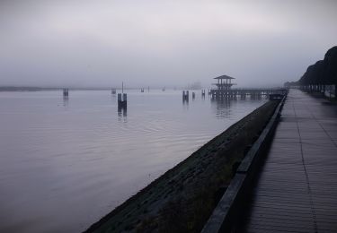
Localización
País:
Belgium
Región :
Flandes
Departamento/provincia :
Flandes Occidental
Municipio :
Middelkerke
Localidad:
Lombardsijde
Salida:(Dec)
Salida:(UTM)
482699 ; 5666980 (31U) N.
Comentarios
Excursiones cerca
![Senderismo Senderismo](https://static1.geolcdn.com/sitytour/trail-icons/101.png)
20230504 - Nieuwpoort 8.7 Km
Senderismo
Fácil
Koksijde,
Flandes,
Flandes Occidental,
Belgium
![](/images/other/stat-length.png)
8,7 km | 9,2 km-effort
2h 10min
![](https://static1.geolcdn.com/siteimages/upload/files/16400158638029165_repeat_loop_refresh_sync_direction_icon.png)
Sí
![Senderismo Senderismo](https://static1.geolcdn.com/sitytour/trail-icons/101.png)
20230504 - Nieuwpoort 8 Km
Senderismo
Fácil
Koksijde,
Flandes,
Flandes Occidental,
Belgium
![](/images/other/stat-length.png)
8 km | 8,6 km-effort
2h 29min
![](https://static1.geolcdn.com/siteimages/upload/files/16400158638029165_repeat_loop_refresh_sync_direction_icon.png)
Sí
![Senderismo Senderismo](https://static1.geolcdn.com/sitytour/trail-icons/101.png)
20230503 - Sunparks Oostduinkerke 7.6 Km
Senderismo
Fácil
Koksijde,
Flandes,
Flandes Occidental,
Belgium
![](/images/other/stat-length.png)
7,6 km | 8,4 km-effort
2h 13min
![](https://static1.geolcdn.com/siteimages/upload/files/16400158638029165_repeat_loop_refresh_sync_direction_icon.png)
Sí
![Excursión Senderismo Nieuwpoort - 20230430 - Nieuwpoort 10 Km - Photo](https://media.geolcdn.com/t/375/260/6594e450-9d70-498e-a6a1-346583e8bdc9.jpg&format=jpg&maxdim=2)
![Senderismo Senderismo](https://static1.geolcdn.com/sitytour/trail-icons/101.png)
20230430 - Nieuwpoort 10 Km
Senderismo
Fácil
Nieuwpoort,
Flandes,
Flandes Occidental,
Belgium
![](/images/other/stat-length.png)
10 km | 11 km-effort
4h 21min
![](https://static1.geolcdn.com/siteimages/upload/files/16400158638029165_repeat_loop_refresh_sync_direction_icon.png)
Sí
![Excursión Senderismo Nieuwpoort - w-belgie-nieuwpoort-via-knooppunten - Photo](https://media.geolcdn.com/t/375/260/ext.jpg?maxdim=2&url=https%3A%2F%2Fstatic1.geolcdn.com%2Fsiteimages%2Fupload%2Ffiles%2F1553511878bg_sport_marche.png)
![Senderismo Senderismo](https://static1.geolcdn.com/sitytour/trail-icons/101.png)
w-belgie-nieuwpoort-via-knooppunten
Senderismo
Muy fácil
(1)
Nieuwpoort,
Flandes,
Flandes Occidental,
Belgium
![](/images/other/stat-length.png)
11,5 km | 12,6 km-effort
Desconocido
![](https://static1.geolcdn.com/siteimages/upload/files/16400158638029165_repeat_loop_refresh_sync_direction_icon.png)
Sí
![Excursión Senderismo Nieuwpoort - Nieuwpoort langs Ganzepoot - 7 km RT - Photo](https://media.geolcdn.com/t/375/260/ext.jpg?maxdim=2&url=https%3A%2F%2Fstatic1.geolcdn.com%2Fsiteimages%2Fupload%2Ffiles%2F1553511878bg_sport_marche.png)
![Senderismo Senderismo](https://static1.geolcdn.com/sitytour/trail-icons/101.png)
Nieuwpoort langs Ganzepoot - 7 km RT
Senderismo
Muy fácil
(1)
Nieuwpoort,
Flandes,
Flandes Occidental,
Belgium
![](/images/other/stat-length.png)
6,6 km | 6,9 km-effort
Desconocido
![](https://static1.geolcdn.com/siteimages/upload/files/16400158638029165_repeat_loop_refresh_sync_direction_icon.png)
Sí
![Excursión Senderismo Nieuwpoort - sgr kust (gr régional côte) day 2/4 - Photo](https://media.geolcdn.com/t/375/260/e20cd972-f06d-465c-9b20-979044ab28a8.jpg&format=jpg&maxdim=2)
![Senderismo Senderismo](https://static1.geolcdn.com/sitytour/trail-icons/101.png)
sgr kust (gr régional côte) day 2/4
Senderismo
Muy difícil
Nieuwpoort,
Flandes,
Flandes Occidental,
Belgium
![](/images/other/stat-length.png)
27 km | 30 km-effort
6h 58min
![](https://static1.geolcdn.com/siteimages/upload/files/16400158638029165_repeat_loop_refresh_sync_direction_icon.png)
No
![Excursión Senderismo Nieuwpoort - Nieuport 080523 - Photo](https://media.geolcdn.com/t/375/260/efbc9a2a-dc1d-4f40-9615-7f3e10af18cc.jpg&format=jpg&maxdim=2)
![Senderismo Senderismo](https://static1.geolcdn.com/sitytour/trail-icons/101.png)
Nieuport 080523
Senderismo
Fácil
Nieuwpoort,
Flandes,
Flandes Occidental,
Belgium
![](/images/other/stat-length.png)
6,1 km | 6,3 km-effort
1h 41min
![](https://static1.geolcdn.com/siteimages/upload/files/16400158638029165_repeat_loop_refresh_sync_direction_icon.png)
Sí
![Excursión Senderismo Koksijde - Ostduinkerke bray-dunes - Photo](https://media.geolcdn.com/t/375/260/13172454-2d76-4776-87fe-8c506445dec0.jpg&format=jpg&maxdim=2)
![Senderismo Senderismo](https://static1.geolcdn.com/sitytour/trail-icons/101.png)
Ostduinkerke bray-dunes
Senderismo
Medio
Koksijde,
Flandes,
Flandes Occidental,
Belgium
![](/images/other/stat-length.png)
24 km | 25 km-effort
5h 2min
![](https://static1.geolcdn.com/siteimages/upload/files/16400158638029165_repeat_loop_refresh_sync_direction_icon.png)
No