![](/images/other/stat-length.png)
![Excursión Senderismo Rixensart - Les randonnées de Julien 1 - Photo](https://media.geolcdn.com/t/1900/400/ext.pjpeg?maxdim=2&url=https%3A%2F%2Fstatic1.geolcdn.com%2Fsiteimages%2Fupload%2Ffiles%2F1553511878bg_sport_marche.png)
Les randonnées de Julien 1
jthoreau
Usuario
![Longitud](/images/other/stat-length.png)
Longitud
7,7 km
![Altitud máxima](https://static1.geolcdn.com/siteimages/upload/files/1508320355ic_sort_altitude_max_24dp.png)
Altitud máxima
93 m
![Desnivel positivo](https://static1.geolcdn.com/siteimages/upload/files/1508320355ic_sort_den_pos_24dp.png)
Desnivel positivo
137 m
![Km-Effort](/images/other/stat-length.png)
Km-Effort
9,5 km
![Altitud mínima](https://static1.geolcdn.com/siteimages/upload/files/1508320355ic_sort_altitude_min_24dp.png)
Altitud mínima
41 m
![Desnivel negativo](https://static1.geolcdn.com/siteimages/upload/files/1508320355ic_sort_den_neg_24dp.png)
Desnivel negativo
137 m
![Boucle](https://static1.geolcdn.com/siteimages/upload/files/16400158638029165_repeat_loop_refresh_sync_direction_icon.png)
Boucle
Sí
Fecha de creación :
2021-02-15 14:44:31.754
Última modificación :
2021-02-15 16:45:15.278
![Senderismo](https://static1.geolcdn.com/sitytour/trail-icons/101.png)
1h59
Dificultad : Muy fácil
![Escanee este código QR para abrir la excursión en la aplicación SityTrail](https://capi.geolives.com/qq0zvz2zws4bq2lad0pu/sitytour/trails/2672069/qr.png?size=200)
Aplicación GPS de excursión GRATIS
A propósito
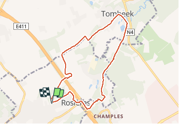
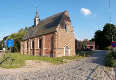
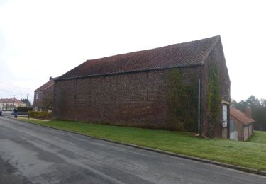
Ruta Senderismo de 7,7 km a descubrir en Valonia, Brabante Valón, Rixensart. Esta ruta ha sido propuesta por jthoreau.
Descripción
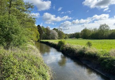
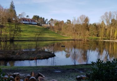
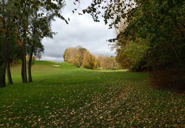
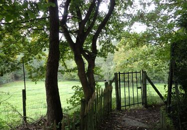
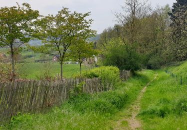
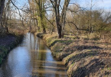
Parcours dans la vallée de la Lasne entre Rosières et Tombeek. Champs et bois alternent en passant par le village de Tombeek.
Localización
País:
Belgium
Región :
Valonia
Departamento/provincia :
Brabante Valón
Municipio :
Rixensart
Localidad:
Rosières
Salida:(Dec)
Salida:(UTM)
609010 ; 5621387 (31U) N.
Comentarios
Excursiones cerca
![Excursión Senderismo Rixensart - Balade de Rixensart au lac de Genval - Photo](https://media.geolcdn.com/t/375/260/ext.jpg?maxdim=2&url=https%3A%2F%2Fservices.sitytrail.com%2FGeolivesWS%2FDownloadMedia.ashx%3FTrailID%3D486338%26Media%3D5e34c7a6-42f3-4c4e-bd52-3a98cd84457e.JPG)
![Senderismo Senderismo](https://static1.geolcdn.com/sitytour/trail-icons/101.png)
Balade de Rixensart au lac de Genval
Senderismo
Fácil
(2)
Rixensart,
Valonia,
Brabante Valón,
Belgium
![](/images/other/stat-length.png)
10,8 km | 13,3 km-effort
2h 52min
![](https://static1.geolcdn.com/siteimages/upload/files/16400158638029165_repeat_loop_refresh_sync_direction_icon.png)
Sí
![Senderismo Senderismo](https://static1.geolcdn.com/sitytour/trail-icons/101.png)
#230220 - Terlanen, Schaatbroekbos, GR579
Senderismo
Medio
(2)
Overijse,
Flandes,
Brabante Flamenco,
Belgium
![](/images/other/stat-length.png)
7,2 km | 8,4 km-effort
1h 55min
![](https://static1.geolcdn.com/siteimages/upload/files/16400158638029165_repeat_loop_refresh_sync_direction_icon.png)
Sí
![Excursión Senderismo La Hulpe - Genval 0222 - Photo](https://media.geolcdn.com/t/375/260/ce137dda-b7be-44e8-80c8-fd5c067d3d98.jpg&format=jpg&maxdim=2)
![Senderismo Senderismo](https://static1.geolcdn.com/sitytour/trail-icons/101.png)
Genval 0222
Senderismo
Medio
(1)
La Hulpe,
Valonia,
Brabante Valón,
Belgium
![](/images/other/stat-length.png)
10,3 km | 12,1 km-effort
2h 21min
![](https://static1.geolcdn.com/siteimages/upload/files/16400158638029165_repeat_loop_refresh_sync_direction_icon.png)
Sí
![Senderismo Senderismo](https://static1.geolcdn.com/sitytour/trail-icons/101.png)
#201030 - Wavre, Bois ste Anne, Golf, Parc des Saules et Orangerie
Senderismo
Medio
(2)
Wavre,
Valonia,
Brabante Valón,
Belgium
![](/images/other/stat-length.png)
7,7 km | 9,4 km-effort
1h 57min
![](https://static1.geolcdn.com/siteimages/upload/files/16400158638029165_repeat_loop_refresh_sync_direction_icon.png)
Sí
![Senderismo Senderismo](https://static1.geolcdn.com/sitytour/trail-icons/101.png)
#201015 - Lasne, Chapelle-St-Lambert, Renipont et Odrimont***
Senderismo
Medio
(7)
Lasne,
Valonia,
Brabante Valón,
Belgium
![](/images/other/stat-length.png)
7,1 km | 8,8 km-effort
1h 54min
![](https://static1.geolcdn.com/siteimages/upload/files/16400158638029165_repeat_loop_refresh_sync_direction_icon.png)
Sí
![Excursión Senderismo Huldenberg - Terlanen - Up and Down - Photo](https://media.geolcdn.com/t/375/260/527cae95-1063-4642-b0e4-15ade4f0fc04.jpg&format=jpg&maxdim=2)
![Senderismo Senderismo](https://static1.geolcdn.com/sitytour/trail-icons/101.png)
Terlanen - Up and Down
Senderismo
Medio
(2)
Huldenberg,
Flandes,
Brabante Flamenco,
Belgium
![](/images/other/stat-length.png)
8,4 km | 10,7 km-effort
2h 25min
![](https://static1.geolcdn.com/siteimages/upload/files/16400158638029165_repeat_loop_refresh_sync_direction_icon.png)
Sí
![Excursión Senderismo Wavre - Wavre Downtown - Photo](https://media.geolcdn.com/t/375/260/a5de658a-88b1-453f-aab0-8b7ba61a9015.jpg&format=jpg&maxdim=2)
![Senderismo Senderismo](https://static1.geolcdn.com/sitytour/trail-icons/101.png)
Wavre Downtown
Senderismo
Difícil
(1)
Wavre,
Valonia,
Brabante Valón,
Belgium
![](/images/other/stat-length.png)
11,5 km | 13,2 km-effort
3h 0min
![](https://static1.geolcdn.com/siteimages/upload/files/16400158638029165_repeat_loop_refresh_sync_direction_icon.png)
Sí
![Excursión A pie Overijse - Justius Lipsius wandelpad - Photo](https://media.geolcdn.com/t/375/260/0639cadf-6a16-467a-9190-89cc619ee2c7.jpeg&format=jpg&maxdim=2)
![A pie A pie](https://static1.geolcdn.com/sitytour/trail-icons/100.png)
Justius Lipsius wandelpad
A pie
Fácil
(1)
Overijse,
Flandes,
Brabante Flamenco,
Belgium
![](/images/other/stat-length.png)
10,2 km | 12,4 km-effort
2h 49min
![](https://static1.geolcdn.com/siteimages/upload/files/16400158638029165_repeat_loop_refresh_sync_direction_icon.png)
Sí
![Excursión A pie Overijse - Terlanen Wandelpad - Photo](https://media.geolcdn.com/t/375/260/fe2b433f-78dd-4821-b737-85f3aea85018.jpeg&format=jpg&maxdim=2)
![A pie A pie](https://static1.geolcdn.com/sitytour/trail-icons/100.png)
Terlanen Wandelpad
A pie
Fácil
Overijse,
Flandes,
Brabante Flamenco,
Belgium
![](/images/other/stat-length.png)
6,6 km | 7,9 km-effort
1h 47min
![](https://static1.geolcdn.com/siteimages/upload/files/16400158638029165_repeat_loop_refresh_sync_direction_icon.png)
Sí