![](/images/other/stat-length.png)
![Excursión Senderismo Berlare - Schellebelle Kalkenae - Photo](https://media.geolcdn.com/t/1900/400/ext.pjpeg?maxdim=2&url=https%3A%2F%2Fstatic1.geolcdn.com%2Fsiteimages%2Fupload%2Ffiles%2F1553511878bg_sport_marche.png)
Schellebelle Kalkenae
© OpenStreetMap contributors
![Senderismo](https://static1.geolcdn.com/sitytour/trail-icons/101.png)
Senderismo
3h38
Dificultad : Fácil
![Longitud](/images/other/stat-length.png)
Longitud
15,3 km
![Altitud máxima](https://static1.geolcdn.com/siteimages/upload/files/1508320355ic_sort_altitude_max_24dp.png)
Altitud máxima
10 m
![Desnivel positivo](https://static1.geolcdn.com/siteimages/upload/files/1508320355ic_sort_den_pos_24dp.png)
Desnivel positivo
72 m
![Km-Effort](/images/other/stat-length.png)
Km-Effort
16,2 km
![Altitud mínima](https://static1.geolcdn.com/siteimages/upload/files/1508320355ic_sort_altitude_min_24dp.png)
Altitud mínima
-2 m
![Desnivel negativo](https://static1.geolcdn.com/siteimages/upload/files/1508320355ic_sort_den_neg_24dp.png)
Desnivel negativo
72 m
![Boucle](https://static1.geolcdn.com/siteimages/upload/files/16400158638029165_repeat_loop_refresh_sync_direction_icon.png)
Boucle
Sí
Fecha de creación :
2021-02-11 10:01:36.0
Última modificación :
2021-02-11 14:01:01.305
![Senderismo](https://static1.geolcdn.com/sitytour/trail-icons/101.png)
3h38
Dificultad : Fácil
![Escanee este código QR para abrir la excursión en la aplicación SityTrail](https://capi.geolives.com/qq0zvz2zws4bq2lad0pu/sitytour/trails/2667410/qr.png?size=200)
Aplicación GPS de excursión GRATIS
A propósito
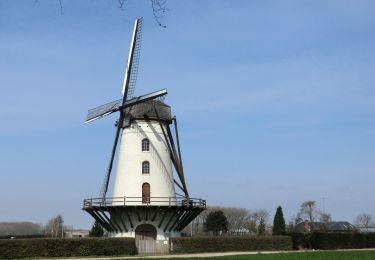
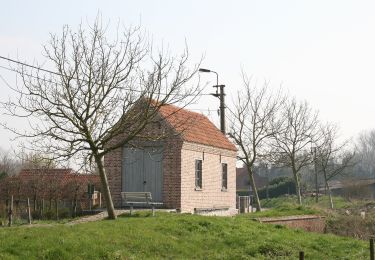
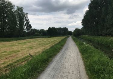
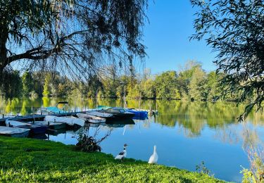
Ruta Senderismo de 15,3 km a descubrir en Flandes, Provincia de Flandes Oriental, Berlare. Esta ruta ha sido propuesta por mhvuv8gk3n@privaterelay.appleid.com.
Descripción
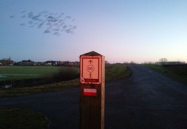
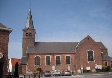
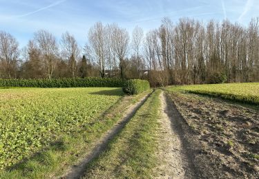
Parkeren aan de kerk van Uitbergen Berlare. Mooie paden dwars door velden en stuk langs de Zeeschelde
Localización
País:
Belgium
Región :
Flandes
Departamento/provincia :
Provincia de Flandes Oriental
Municipio :
Berlare
Localidad:
Uitbergen
Salida:(Dec)
Salida:(UTM)
567340 ; 5652116 (31U) N.
Comentarios
Excursiones cerca
![Excursión A pie Wichelen - GR128 Wichelen-Moorsel - Photo](https://media.geolcdn.com/t/375/260/0bfeb446-8ee2-4ed5-bd25-8ba2d6f0c64c.jpg&format=jpg&maxdim=2)
![A pie A pie](https://static1.geolcdn.com/sitytour/trail-icons/100.png)
GR128 Wichelen-Moorsel
A pie
Difícil
(1)
Wichelen,
Flandes,
Provincia de Flandes Oriental,
Belgium
![](/images/other/stat-length.png)
36 km | 40 km-effort
9h 4min
![](https://static1.geolcdn.com/siteimages/upload/files/16400158638029165_repeat_loop_refresh_sync_direction_icon.png)
No
![Excursión A pie Lede - Vier Uiterstenroute (lus 2) - Photo](https://media.geolcdn.com/t/375/260/dec8c8f1-45f4-4ed7-a5fe-d27258bcb11b.jpeg&format=jpg&maxdim=2)
![A pie A pie](https://static1.geolcdn.com/sitytour/trail-icons/100.png)
Vier Uiterstenroute (lus 2)
A pie
Fácil
Lede,
Flandes,
Provincia de Flandes Oriental,
Belgium
![](/images/other/stat-length.png)
11,7 km | 12,8 km-effort
2h 54min
![](https://static1.geolcdn.com/siteimages/upload/files/16400158638029165_repeat_loop_refresh_sync_direction_icon.png)
Sí
![Excursión A pie Lede - Vier Uiterstenroute (lus 1) - Photo](https://media.geolcdn.com/t/375/260/3380711b-8c9b-4e97-9c4e-bbe2104acea4.jpeg&format=jpg&maxdim=2)
![A pie A pie](https://static1.geolcdn.com/sitytour/trail-icons/100.png)
Vier Uiterstenroute (lus 1)
A pie
Fácil
Lede,
Flandes,
Provincia de Flandes Oriental,
Belgium
![](/images/other/stat-length.png)
9,7 km | 10,6 km-effort
2h 24min
![](https://static1.geolcdn.com/siteimages/upload/files/16400158638029165_repeat_loop_refresh_sync_direction_icon.png)
Sí
![Excursión Senderismo Wichelen - schellebelle Wetteren 16,9 km - Photo](https://media.geolcdn.com/t/375/260/255478e0-bd82-4f1b-aeb6-64f29243c28b.jpg&format=jpg&maxdim=2)
![Senderismo Senderismo](https://static1.geolcdn.com/sitytour/trail-icons/101.png)
schellebelle Wetteren 16,9 km
Senderismo
Medio
Wichelen,
Flandes,
Provincia de Flandes Oriental,
Belgium
![](/images/other/stat-length.png)
16,9 km | 18,3 km-effort
4h 58min
![](https://static1.geolcdn.com/siteimages/upload/files/16400158638029165_repeat_loop_refresh_sync_direction_icon.png)
Sí
![Excursión A pie Berlare - Bareldonkpad nr 16 - Photo](https://media.geolcdn.com/t/375/260/ef2ab241-3be4-4b98-96f6-9e8b90d7008e.jpeg&format=jpg&maxdim=2)
![A pie A pie](https://static1.geolcdn.com/sitytour/trail-icons/100.png)
Bareldonkpad nr 16
A pie
Fácil
Berlare,
Flandes,
Provincia de Flandes Oriental,
Belgium
![](/images/other/stat-length.png)
11,7 km | 12,8 km-effort
2h 54min
![](https://static1.geolcdn.com/siteimages/upload/files/16400158638029165_repeat_loop_refresh_sync_direction_icon.png)
Sí
![Excursión Senderismo Wichelen - Wetteren 20 km - Photo](https://media.geolcdn.com/t/375/260/8df5fcfc-ceaa-48dc-9cff-acd780b58773.jpg&format=jpg&maxdim=2)
![Senderismo Senderismo](https://static1.geolcdn.com/sitytour/trail-icons/101.png)
Wetteren 20 km
Senderismo
Fácil
Wichelen,
Flandes,
Provincia de Flandes Oriental,
Belgium
![](/images/other/stat-length.png)
20 km | 22 km-effort
4h 52min
![](https://static1.geolcdn.com/siteimages/upload/files/16400158638029165_repeat_loop_refresh_sync_direction_icon.png)
Sí
![Excursión Senderismo Berlare - Donk 18 km - Photo](https://media.geolcdn.com/t/375/260/ext.jpg?maxdim=2&url=https%3A%2F%2Fservices.sitytrail.com%2FGeolivesWS%2FDownloadMedia.ashx%3FTrailID%3D962643%26Media%3D20180510141949.jpg)
![Senderismo Senderismo](https://static1.geolcdn.com/sitytour/trail-icons/101.png)
Donk 18 km
Senderismo
Muy fácil
Berlare,
Flandes,
Provincia de Flandes Oriental,
Belgium
![](/images/other/stat-length.png)
18,4 km | 20 km-effort
4h 7min
![](https://static1.geolcdn.com/siteimages/upload/files/16400158638029165_repeat_loop_refresh_sync_direction_icon.png)
Sí
![Excursión Senderismo Berlare - donkmeer_wandelroute - Photo](https://media.geolcdn.com/t/375/260/0c89e2c9-0c2e-4a25-9f57-4a3ecb0855b8.jpeg&format=jpg&maxdim=2)
![Senderismo Senderismo](https://static1.geolcdn.com/sitytour/trail-icons/101.png)
donkmeer_wandelroute
Senderismo
Fácil
Berlare,
Flandes,
Provincia de Flandes Oriental,
Belgium
![](/images/other/stat-length.png)
4,6 km | 4,9 km-effort
1h 7min
![](https://static1.geolcdn.com/siteimages/upload/files/16400158638029165_repeat_loop_refresh_sync_direction_icon.png)
Sí
![Excursión A pie Berlare - Donkmeer Route - Photo](https://media.geolcdn.com/t/375/260/ext.jpg?maxdim=2&url=https%3A%2F%2Fstatic1.geolcdn.com%2Fsiteimages%2Fupload%2Ffiles%2F1545311037marcheuse_200dpi.jpg)
![A pie A pie](https://static1.geolcdn.com/sitytour/trail-icons/100.png)
Donkmeer Route
A pie
Fácil
Berlare,
Flandes,
Provincia de Flandes Oriental,
Belgium
![](/images/other/stat-length.png)
3,8 km | 4,2 km-effort
56min
![](https://static1.geolcdn.com/siteimages/upload/files/16400158638029165_repeat_loop_refresh_sync_direction_icon.png)
Sí