


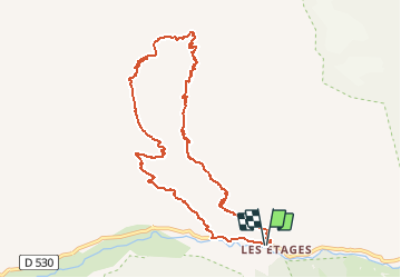

6,3 km | 11,2 km-effort


Usuario


Aplicación GPS de excursión GRATIS
 SityTrail
IGN / Institutos geográficos
SityTrail World
El mundo es suyo
Ruta A pie de 11 km a descubrir en Auvergne-Rhône-Alpes, Isère, Saint-Christophe-en-Oisans. Esta ruta ha sido propuesta por evefrancois@orange.fr.
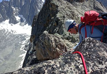
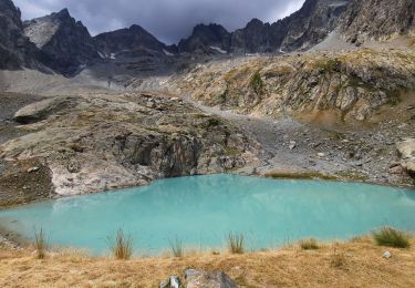
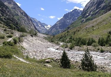
montée vers massif du soreiller, objectif, aiguille Dibona, retour autre vallon par l'ouest

Senderismo

Senderismo

Senderismo

Senderismo

Senderismo

Senderismo
Senderismo
Senderismo
Senderismo