![](/images/other/stat-length.png)
![Excursión Senderismo Le Pouget - Herault - Le Pouget Le dolmen de Gallardet et le fosse des Yeux 10km 97m - Photo](https://media.geolcdn.com/t/1900/400/ext.pjpeg?maxdim=2&url=https%3A%2F%2Fstatic1.geolcdn.com%2Fsiteimages%2Fupload%2Ffiles%2F1553511878bg_sport_marche.png)
Herault - Le Pouget Le dolmen de Gallardet et le fosse des Yeux 10km 97m
RandoVal
Usuario
![Longitud](/images/other/stat-length.png)
Longitud
10,4 km
![Altitud máxima](https://static1.geolcdn.com/siteimages/upload/files/1508320355ic_sort_altitude_max_24dp.png)
Altitud máxima
130 m
![Desnivel positivo](https://static1.geolcdn.com/siteimages/upload/files/1508320355ic_sort_den_pos_24dp.png)
Desnivel positivo
164 m
![Km-Effort](/images/other/stat-length.png)
Km-Effort
12,6 km
![Altitud mínima](https://static1.geolcdn.com/siteimages/upload/files/1508320355ic_sort_altitude_min_24dp.png)
Altitud mínima
59 m
![Desnivel negativo](https://static1.geolcdn.com/siteimages/upload/files/1508320355ic_sort_den_neg_24dp.png)
Desnivel negativo
162 m
![Boucle](https://static1.geolcdn.com/siteimages/upload/files/16400158638029165_repeat_loop_refresh_sync_direction_icon.png)
Boucle
Sí
Fecha de creación :
2020-12-27 07:17:21.479
Última modificación :
2020-12-27 14:02:16.485
![Senderismo](https://static1.geolcdn.com/sitytour/trail-icons/101.png)
--
Dificultad : Desconocido
![Escanee este código QR para abrir la excursión en la aplicación SityTrail](https://capi.geolives.com/qq0zvz2zws4bq2lad0pu/sitytour/trails/2626078/qr.png?size=200)
Aplicación GPS de excursión GRATIS
A propósito
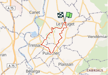
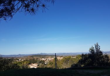
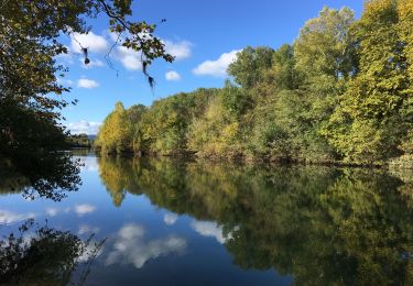
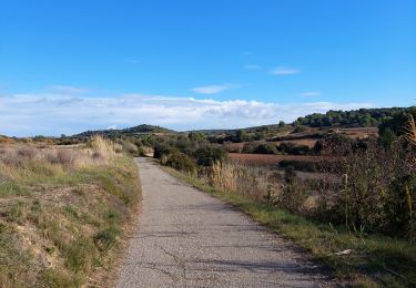
Ruta Senderismo de 10,4 km a descubrir en Occitania, Hérault, Le Pouget. Esta ruta ha sido propuesta por RandoVal.
Descripción
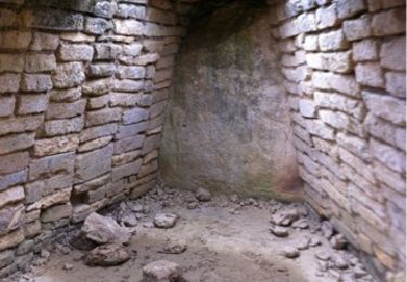
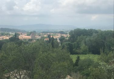
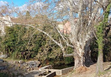
Petite balade de demi-journée, stationnement et départ au parking du théâtre de verdure du Pouget, sens horaire. promenade entre vignes et villages, à voir le dolmen du Pas de Gallardet.
Localización
País:
France
Región :
Occitania
Departamento/provincia :
Hérault
Municipio :
Le Pouget
Localidad:
Unknown
Salida:(Dec)
Salida:(UTM)
542275 ; 4826840 (31T) N.
Comentarios
Excursiones cerca
![Excursión Senderismo Le Pouget - Randonnée du dolmen de Pouget et plus - Photo](https://media.geolcdn.com/t/375/260/ext.jpg?maxdim=2&url=https%3A%2F%2Fservices.sitytrail.com%2FGeolivesWS%2FDownloadMedia.ashx%3FTrailID%3D227927%26Media%3D20131019153354.jpg)
![Senderismo Senderismo](https://static1.geolcdn.com/sitytour/trail-icons/101.png)
Randonnée du dolmen de Pouget et plus
Senderismo
Fácil
(10)
Le Pouget,
Occitania,
Hérault,
France
![](/images/other/stat-length.png)
9,6 km | 11,4 km-effort
2h 29min
![](https://static1.geolcdn.com/siteimages/upload/files/16400158638029165_repeat_loop_refresh_sync_direction_icon.png)
No
![Excursión Senderismo Saint-Bauzille-de-la-Sylve - saint Bauzille de la sylve, le télégraphe, le prêche negre, Le pièce blanc! - Photo](https://media.geolcdn.com/t/375/260/ext.jpg?maxdim=2&url=https%3A%2F%2Fservices.sitytrail.com%2FGeolivesWS%2FDownloadMedia.ashx%3FTrailID%3D976179%26Media%3D20180529142413.jpg)
![Senderismo Senderismo](https://static1.geolcdn.com/sitytour/trail-icons/101.png)
saint Bauzille de la sylve, le télégraphe, le prêche negre, Le pièce blanc!
Senderismo
Medio
(2)
Saint-Bauzille-de-la-Sylve,
Occitania,
Hérault,
France
![](/images/other/stat-length.png)
15,8 km | 21 km-effort
4h 55min
![](https://static1.geolcdn.com/siteimages/upload/files/16400158638029165_repeat_loop_refresh_sync_direction_icon.png)
Sí
![Excursión Senderismo Tressan - tressan - Photo](https://media.geolcdn.com/t/375/260/ext.jpg?maxdim=2&url=https%3A%2F%2Fstatic1.geolcdn.com%2Fsiteimages%2Fupload%2Ffiles%2F1553511878bg_sport_marche.png)
![Senderismo Senderismo](https://static1.geolcdn.com/sitytour/trail-icons/101.png)
tressan
Senderismo
Difícil
(1)
Tressan,
Occitania,
Hérault,
France
![](/images/other/stat-length.png)
11,8 km | 14,9 km-effort
3h 23min
![](https://static1.geolcdn.com/siteimages/upload/files/16400158638029165_repeat_loop_refresh_sync_direction_icon.png)
Sí
![Excursión Senderismo Pouzols - Dolmen du Pouget - Photo](https://media.geolcdn.com/t/375/260/910de136-dc13-4d0d-b0c0-a1d7d9279bef.jpg&format=jpg&maxdim=2)
![Senderismo Senderismo](https://static1.geolcdn.com/sitytour/trail-icons/101.png)
Dolmen du Pouget
Senderismo
Medio
Pouzols,
Occitania,
Hérault,
France
![](/images/other/stat-length.png)
19 km | 23 km-effort
5h 30min
![](https://static1.geolcdn.com/siteimages/upload/files/16400158638029165_repeat_loop_refresh_sync_direction_icon.png)
Sí
![Excursión Senderismo Saint-Bauzille-de-la-Sylve - Télégraphe de Saint Bauzille de la Sylve - Photo](https://media.geolcdn.com/t/375/260/f5c38370-225d-4fe4-8b81-8c5f66714ceb.jpg&format=jpg&maxdim=2)
![Senderismo Senderismo](https://static1.geolcdn.com/sitytour/trail-icons/101.png)
Télégraphe de Saint Bauzille de la Sylve
Senderismo
Muy fácil
Saint-Bauzille-de-la-Sylve,
Occitania,
Hérault,
France
![](/images/other/stat-length.png)
4,5 km | 6,3 km-effort
1h 0min
![](https://static1.geolcdn.com/siteimages/upload/files/16400158638029165_repeat_loop_refresh_sync_direction_icon.png)
Sí
![Excursión Senderismo Pouzols - Les Rouviels - Photo](https://media.geolcdn.com/t/375/260/17897a90-345b-4c52-bfe9-3c3ff0142f39.jpg&format=jpg&maxdim=2)
![Senderismo Senderismo](https://static1.geolcdn.com/sitytour/trail-icons/101.png)
![Excursión Senderismo Aumelas - cabrials - Photo](https://media.geolcdn.com/t/375/260/0887d7a4-1df1-4cdd-9157-48f29289d576.jpg&format=jpg&maxdim=2)
![Senderismo Senderismo](https://static1.geolcdn.com/sitytour/trail-icons/101.png)
cabrials
Senderismo
Fácil
(1)
Aumelas,
Occitania,
Hérault,
France
![](/images/other/stat-length.png)
11,8 km | 15,6 km-effort
2h 29min
![](https://static1.geolcdn.com/siteimages/upload/files/16400158638029165_repeat_loop_refresh_sync_direction_icon.png)
Sí
![Excursión Senderismo Saint-Bauzille-de-la-Sylve - saint Bauzille de la sylve, le télégraphe, le prêche negre, Le pièce blanc! - Photo](https://media.geolcdn.com/t/375/260/ext.jpg?maxdim=2&url=https%3A%2F%2Fservices.sitytrail.com%2FGeolivesWS%2FDownloadMedia.ashx%3FTrailID%3D976112%26Media%3D20180529142413.jpg)
![Senderismo Senderismo](https://static1.geolcdn.com/sitytour/trail-icons/101.png)
saint Bauzille de la sylve, le télégraphe, le prêche negre, Le pièce blanc!
Senderismo
Medio
Saint-Bauzille-de-la-Sylve,
Occitania,
Hérault,
France
![](/images/other/stat-length.png)
15,8 km | 21 km-effort
4h 55min
![](https://static1.geolcdn.com/siteimages/upload/files/16400158638029165_repeat_loop_refresh_sync_direction_icon.png)
Sí
![Excursión Senderismo Popian - Popian, entre fontaines et lavoirs - Photo](https://media.geolcdn.com/t/375/260/ext.jpg?maxdim=2&url=https%3A%2F%2Fservices.sitytrail.com%2FGeolivesWS%2FDownloadMedia.ashx%3FTrailID%3D971689%26Media%3D20180522144328.jpg)
![Senderismo Senderismo](https://static1.geolcdn.com/sitytour/trail-icons/101.png)
Popian, entre fontaines et lavoirs
Senderismo
Fácil
(1)
Popian,
Occitania,
Hérault,
France
![](/images/other/stat-length.png)
12,9 km | 15,6 km-effort
3h 51min
![](https://static1.geolcdn.com/siteimages/upload/files/16400158638029165_repeat_loop_refresh_sync_direction_icon.png)
Sí