![](/images/other/stat-length.png)
![Excursión Senderismo Chatou - Le tour des ponts : Chatou et Bezons - Photo](https://media.geolcdn.com/t/1900/400/f80b4ea5-ff9f-4491-b2eb-2feda3b3addb.jpg&format=pjpeg&maxdim=2)
Le tour des ponts : Chatou et Bezons
guesnon
Usuario
![Longitud](/images/other/stat-length.png)
Longitud
13,2 km
![Altitud máxima](https://static1.geolcdn.com/siteimages/upload/files/1508320355ic_sort_altitude_max_24dp.png)
Altitud máxima
40 m
![Desnivel positivo](https://static1.geolcdn.com/siteimages/upload/files/1508320355ic_sort_den_pos_24dp.png)
Desnivel positivo
129 m
![Km-Effort](/images/other/stat-length.png)
Km-Effort
14,9 km
![Altitud mínima](https://static1.geolcdn.com/siteimages/upload/files/1508320355ic_sort_altitude_min_24dp.png)
Altitud mínima
16 m
![Desnivel negativo](https://static1.geolcdn.com/siteimages/upload/files/1508320355ic_sort_den_neg_24dp.png)
Desnivel negativo
128 m
![Boucle](https://static1.geolcdn.com/siteimages/upload/files/16400158638029165_repeat_loop_refresh_sync_direction_icon.png)
Boucle
Sí
Fecha de creación :
2020-12-05 13:52:00.0
Última modificación :
2020-12-05 16:25:59.52
![Senderismo](https://static1.geolcdn.com/sitytour/trail-icons/101.png)
2h33
Dificultad : Fácil
![Escanee este código QR para abrir la excursión en la aplicación SityTrail](https://capi.geolives.com/qq0zvz2zws4bq2lad0pu/sitytour/trails/2613514/qr.png?size=200)
Aplicación GPS de excursión GRATIS
A propósito
Ruta Senderismo de 13,2 km a descubrir en Isla de Francia, Yvelines, Chatou. Esta ruta ha sido propuesta por guesnon.
Descripción
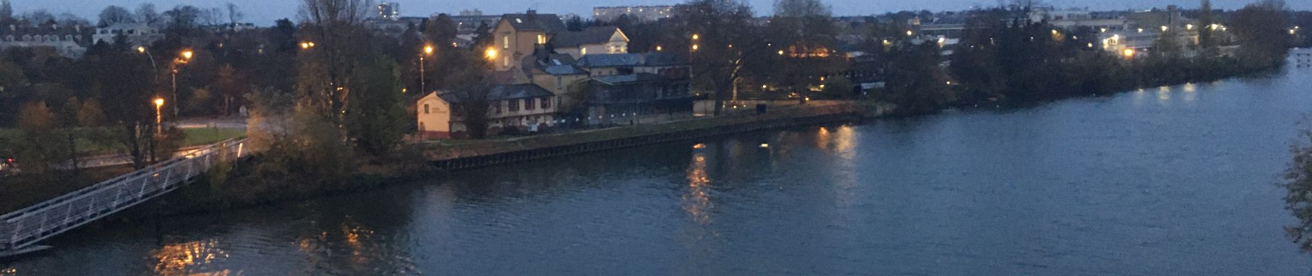
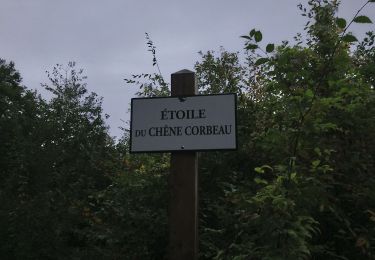
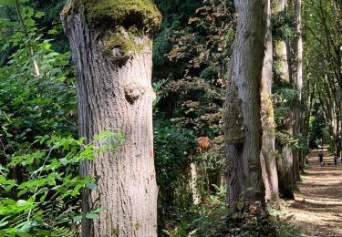
En suivant les bords de Seine entre les ponts de Chatou et de Bezon, côté Chatou à l’aller et Rueil au retour.
Localización
País:
France
Región :
Isla de Francia
Departamento/provincia :
Yvelines
Municipio :
Chatou
Localidad:
Unknown
Salida:(Dec)
Salida:(UTM)
438389 ; 5416290 (31U) N.
Comentarios
Excursiones cerca
![Excursión Senderismo Rueil-Malmaison - St Germain en Laye - Rueil Malmaison 28 km Inversee - Photo](https://media.geolcdn.com/t/375/260/b687f904-9338-4fa0-aef2-9bacff37d877.jpg&format=jpg&maxdim=2)
![Senderismo Senderismo](https://static1.geolcdn.com/sitytour/trail-icons/101.png)
St Germain en Laye - Rueil Malmaison 28 km Inversee
Senderismo
Fácil
(1)
Rueil-Malmaison,
Isla de Francia,
Altos del Sena,
France
![](/images/other/stat-length.png)
28 km | 32 km-effort
6h 0min
![](https://static1.geolcdn.com/siteimages/upload/files/16400158638029165_repeat_loop_refresh_sync_direction_icon.png)
No
![Excursión Senderismo Saint-Germain-en-Laye - circuit MA 271019 - Photo](https://media.geolcdn.com/t/375/260/ec0c3cc2-4262-481e-ac4c-e608d5354784.jpg&format=jpg&maxdim=2)
![Senderismo Senderismo](https://static1.geolcdn.com/sitytour/trail-icons/101.png)
circuit MA 271019
Senderismo
Muy fácil
(1)
Saint-Germain-en-Laye,
Isla de Francia,
Yvelines,
France
![](/images/other/stat-length.png)
4,7 km | 5,2 km-effort
1h 3min
![](https://static1.geolcdn.com/siteimages/upload/files/16400158638029165_repeat_loop_refresh_sync_direction_icon.png)
Sí
![Excursión Senderismo Bougival - Bougival-Saint-cucufa reel - Photo](https://media.geolcdn.com/t/375/260/f8214235-f5e3-4ba5-8084-044ba7cbf132.jpeg&format=jpg&maxdim=2)
![Senderismo Senderismo](https://static1.geolcdn.com/sitytour/trail-icons/101.png)
Bougival-Saint-cucufa reel
Senderismo
(1)
Bougival,
Isla de Francia,
Yvelines,
France
![](/images/other/stat-length.png)
7,7 km | 10,3 km-effort
2h 29min
![](https://static1.geolcdn.com/siteimages/upload/files/16400158638029165_repeat_loop_refresh_sync_direction_icon.png)
Sí
![Excursión Senderismo Marly-le-Roi - Boucle 25 km Marly le Roi - Chambourcy - Photo](https://media.geolcdn.com/t/375/260/1fe661ec-cb67-45eb-bf71-8b90e4b33a5d.jpg&format=jpg&maxdim=2)
![Senderismo Senderismo](https://static1.geolcdn.com/sitytour/trail-icons/101.png)
Boucle 25 km Marly le Roi - Chambourcy
Senderismo
Medio
Marly-le-Roi,
Isla de Francia,
Yvelines,
France
![](/images/other/stat-length.png)
25 km | 32 km-effort
7h 15min
![](https://static1.geolcdn.com/siteimages/upload/files/16400158638029165_repeat_loop_refresh_sync_direction_icon.png)
Sí
![Excursión Senderismo Le Mesnil-le-Roi - RS 5 km porte chene corbeau - Photo](https://media.geolcdn.com/t/375/260/ext.jpg?maxdim=2&url=https%3A%2F%2Fstatic1.geolcdn.com%2Fsiteimages%2Fupload%2Ffiles%2F1553511878bg_sport_marche.png)
![Senderismo Senderismo](https://static1.geolcdn.com/sitytour/trail-icons/101.png)
RS 5 km porte chene corbeau
Senderismo
Fácil
(1)
Le Mesnil-le-Roi,
Isla de Francia,
Yvelines,
France
![](/images/other/stat-length.png)
5,2 km | 5,8 km-effort
1h 18min
![](https://static1.geolcdn.com/siteimages/upload/files/16400158638029165_repeat_loop_refresh_sync_direction_icon.png)
Sí
![Excursión A pie Rueil-Malmaison - SityTrail - 3850997 - rando-chatou (1) - Photo](https://media.geolcdn.com/t/375/260/c514a42a-e126-47ef-85f0-d75f60d63c7a.jpg&format=jpg&maxdim=2)
![A pie A pie](https://static1.geolcdn.com/sitytour/trail-icons/100.png)
SityTrail - 3850997 - rando-chatou (1)
A pie
Medio
Rueil-Malmaison,
Isla de Francia,
Altos del Sena,
France
![](/images/other/stat-length.png)
32 km | 37 km-effort
8h 22min
![](https://static1.geolcdn.com/siteimages/upload/files/16400158638029165_repeat_loop_refresh_sync_direction_icon.png)
No
![Excursión Senderismo Saint-Germain-en-Laye - 20230824 5S 5KM - Photo](https://media.geolcdn.com/t/375/260/ext.jpg?maxdim=2&url=https%3A%2F%2Fstatic1.geolcdn.com%2Fsiteimages%2Fupload%2Ffiles%2F1553511878bg_sport_marche.png)
![Senderismo Senderismo](https://static1.geolcdn.com/sitytour/trail-icons/101.png)
20230824 5S 5KM
Senderismo
Medio
(1)
Saint-Germain-en-Laye,
Isla de Francia,
Yvelines,
France
![](/images/other/stat-length.png)
5,5 km | 6,3 km-effort
1h 25min
![](https://static1.geolcdn.com/siteimages/upload/files/16400158638029165_repeat_loop_refresh_sync_direction_icon.png)
Sí
![Excursión Senderismo Saint-Germain-en-Laye - SityTrail - 202230519 RS 5km - Photo](https://media.geolcdn.com/t/375/260/ext.jpg?maxdim=2&url=https%3A%2F%2Fstatic1.geolcdn.com%2Fsiteimages%2Fupload%2Ffiles%2F1553511878bg_sport_marche.png)
![Senderismo Senderismo](https://static1.geolcdn.com/sitytour/trail-icons/101.png)
SityTrail - 202230519 RS 5km
Senderismo
Fácil
(1)
Saint-Germain-en-Laye,
Isla de Francia,
Yvelines,
France
![](/images/other/stat-length.png)
5 km | 5,6 km-effort
1h 16min
![](https://static1.geolcdn.com/siteimages/upload/files/16400158638029165_repeat_loop_refresh_sync_direction_icon.png)
Sí
![Excursión Senderismo Saint-Germain-en-Laye - Audax St Germain en Laye - Paris Tour Eiffel - Photo](https://media.geolcdn.com/t/375/260/5e15adf7-e627-4ac0-b5fd-8bf0b40406ac.jpg&format=jpg&maxdim=2)
![Senderismo Senderismo](https://static1.geolcdn.com/sitytour/trail-icons/101.png)
Audax St Germain en Laye - Paris Tour Eiffel
Senderismo
Fácil
Saint-Germain-en-Laye,
Isla de Francia,
Yvelines,
France
![](/images/other/stat-length.png)
29 km | 35 km-effort
4h 59min
![](https://static1.geolcdn.com/siteimages/upload/files/16400158638029165_repeat_loop_refresh_sync_direction_icon.png)
No