![](/images/other/stat-length.png)
![Excursión Senderismo Waimes - Aux sources de la Warchenne - Photo](https://media.geolcdn.com/t/1900/400/ext.pjpeg?maxdim=2&url=https%3A%2F%2Fstatic1.geolcdn.com%2Fsiteimages%2Fupload%2Ffiles%2F1553511878bg_sport_marche.png)
Aux sources de la Warchenne
moniquebvin
Usuario
![Longitud](/images/other/stat-length.png)
![Altitud máxima](https://static1.geolcdn.com/siteimages/upload/files/1508320355ic_sort_altitude_max_24dp.png)
![Desnivel positivo](https://static1.geolcdn.com/siteimages/upload/files/1508320355ic_sort_den_pos_24dp.png)
![Km-Effort](/images/other/stat-length.png)
![Altitud mínima](https://static1.geolcdn.com/siteimages/upload/files/1508320355ic_sort_altitude_min_24dp.png)
![Desnivel negativo](https://static1.geolcdn.com/siteimages/upload/files/1508320355ic_sort_den_neg_24dp.png)
![Boucle](https://static1.geolcdn.com/siteimages/upload/files/16400158638029165_repeat_loop_refresh_sync_direction_icon.png)
![Senderismo](https://static1.geolcdn.com/sitytour/trail-icons/101.png)
2h00
Dificultad : Muy fácil
![Escanee este código QR para abrir la excursión en la aplicación SityTrail](https://capi.geolives.com/qq0zvz2zws4bq2lad0pu/sitytour/trails/2602032/qr.png?size=200)
Aplicación GPS de excursión GRATIS
A propósito
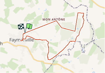
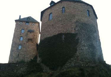
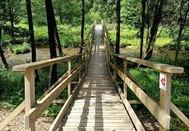
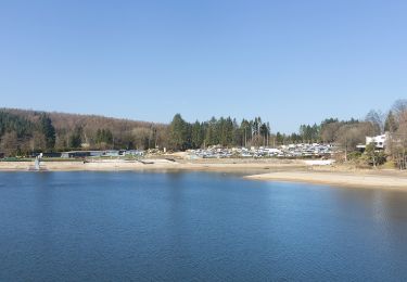
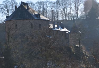
Ruta Senderismo de 9,1 km a descubrir en Valonia, Lieja, Waimes. Esta ruta ha sido propuesta por moniquebvin.
Descripción
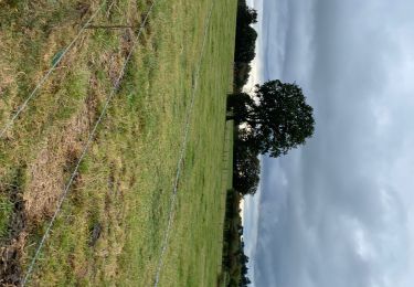
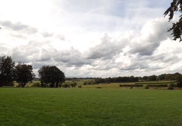
Circuit officiel départ et arrivée à l'église de Faymonville. Balisage: rectangles bleus. Quasi totalité du parcours sur petites routes asphaltees. Joli parcours campagnard. Pour les poussettes et chaises roulantes, possibilité d'emprunter le Ravel plus tôt lorsque le chemin le frôle entre Thier et Hasse pour éviter une zone de chemins parfois boueux.
Localización
Comentarios
Excursiones cerca
![Excursión Senderismo Waimes - 2023-11-10_22h16m17_t119964214_sur les versants de la warchenne w10.gpx.xml - Photo](https://media.geolcdn.com/t/375/260/ca458986-945b-4d88-aa31-13c1465e60e5.jpg&format=jpg&maxdim=2)
![Senderismo Senderismo](https://static1.geolcdn.com/sitytour/trail-icons/101.png)
Senderismo
![](/images/other/stat-length.png)
![](https://static1.geolcdn.com/siteimages/upload/files/16400158638029165_repeat_loop_refresh_sync_direction_icon.png)
![Excursión Senderismo Waimes - Waimes 21 km - Photo](https://media.geolcdn.com/t/375/260/ae7b64e4-00bf-4852-8640-e3d490be341c.jpg&format=jpg&maxdim=2)
![Senderismo Senderismo](https://static1.geolcdn.com/sitytour/trail-icons/101.png)
![Excursión Senderismo Waimes - autour d outrewarche - Photo](https://media.geolcdn.com/t/375/260/24e94693-f32d-413a-bd88-27a7125a5718.jpg&format=jpg&maxdim=2)
![Senderismo Senderismo](https://static1.geolcdn.com/sitytour/trail-icons/101.png)
Senderismo
![](/images/other/stat-length.png)
![](https://static1.geolcdn.com/siteimages/upload/files/16400158638029165_repeat_loop_refresh_sync_direction_icon.png)
![Excursión Senderismo Waimes - ROBERTVILLE ... par le Château de REINHARDSTEIN. - Photo](https://media.geolcdn.com/t/375/260/97f54fe4-d67d-4cf5-8933-573ab6ce439e.jpg&format=jpg&maxdim=2)
![Senderismo Senderismo](https://static1.geolcdn.com/sitytour/trail-icons/101.png)
Senderismo
![](/images/other/stat-length.png)
![](https://static1.geolcdn.com/siteimages/upload/files/16400158638029165_repeat_loop_refresh_sync_direction_icon.png)
![Excursión Senderismo Waimes - Robertville. Reinhardstein - Photo](https://media.geolcdn.com/t/375/260/ext.jpg?maxdim=2&url=https%3A%2F%2Fservices.sitytrail.com%2FGeolivesWS%2FDownloadMedia.ashx%3FTrailID%3D94288%26Media%3D20111112151951.jpg)
![Senderismo Senderismo](https://static1.geolcdn.com/sitytour/trail-icons/101.png)
Senderismo
![](/images/other/stat-length.png)
![](https://static1.geolcdn.com/siteimages/upload/files/16400158638029165_repeat_loop_refresh_sync_direction_icon.png)
![Excursión Senderismo Amel - La rivière d'or (9km) - Photo](https://media.geolcdn.com/t/375/260/eac006de-c0aa-46b2-933f-e559c8a45d2b.jpg&format=jpg&maxdim=2)
![Senderismo Senderismo](https://static1.geolcdn.com/sitytour/trail-icons/101.png)
Senderismo
![](/images/other/stat-length.png)
![](https://static1.geolcdn.com/siteimages/upload/files/16400158638029165_repeat_loop_refresh_sync_direction_icon.png)
![Excursión A pie Waimes - Balade de rêve 17 - Du lac aux sources de Quareu - Photo](https://media.geolcdn.com/t/375/260/0b2e3a09-8094-4f48-a5e9-a165be516240.jpeg&format=jpg&maxdim=2)
![A pie A pie](https://static1.geolcdn.com/sitytour/trail-icons/100.png)
A pie
![](/images/other/stat-length.png)
![](https://static1.geolcdn.com/siteimages/upload/files/16400158638029165_repeat_loop_refresh_sync_direction_icon.png)
![Senderismo Senderismo](https://static1.geolcdn.com/sitytour/trail-icons/101.png)
Senderismo
![](/images/other/stat-length.png)
![](https://static1.geolcdn.com/siteimages/upload/files/16400158638029165_repeat_loop_refresh_sync_direction_icon.png)
![Excursión Senderismo Waimes - #200731 - Lac de Robertville - Photo](https://media.geolcdn.com/t/375/260/ext.jpg?maxdim=2&url=https%3A%2F%2Fstatic1.geolcdn.com%2Fsiteimages%2Fupload%2Ffiles%2F1553511878bg_sport_marche.png)
![Senderismo Senderismo](https://static1.geolcdn.com/sitytour/trail-icons/101.png)
Senderismo
![](/images/other/stat-length.png)
![](https://static1.geolcdn.com/siteimages/upload/files/16400158638029165_repeat_loop_refresh_sync_direction_icon.png)
attention fin de circuit non enregistré sur la carte