![](/images/other/stat-length.png)
Mont Brune depuis Toudon
aris
Usuario
![Longitud](/images/other/stat-length.png)
Longitud
14,7 km
![Altitud máxima](https://static1.geolcdn.com/siteimages/upload/files/1508320355ic_sort_altitude_max_24dp.png)
Altitud máxima
1501 m
![Desnivel positivo](https://static1.geolcdn.com/siteimages/upload/files/1508320355ic_sort_den_pos_24dp.png)
Desnivel positivo
972 m
![Km-Effort](/images/other/stat-length.png)
Km-Effort
28 km
![Altitud mínima](https://static1.geolcdn.com/siteimages/upload/files/1508320355ic_sort_altitude_min_24dp.png)
Altitud mínima
984 m
![Desnivel negativo](https://static1.geolcdn.com/siteimages/upload/files/1508320355ic_sort_den_neg_24dp.png)
Desnivel negativo
968 m
![Boucle](https://static1.geolcdn.com/siteimages/upload/files/16400158638029165_repeat_loop_refresh_sync_direction_icon.png)
Boucle
Sí
Fecha de creación :
2020-10-25 07:22:30.684
Última modificación :
2020-10-25 15:26:34.673
![Senderismo](https://static1.geolcdn.com/sitytour/trail-icons/101.png)
5h53
Dificultad : Medio
![Escanee este código QR para abrir la excursión en la aplicación SityTrail](https://capi.geolives.com/qq0zvz2zws4bq2lad0pu/sitytour/trails/2587570/qr.png?size=200)
Aplicación GPS de excursión GRATIS
A propósito
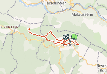
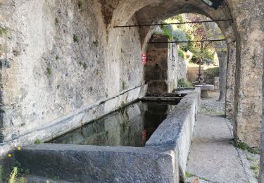
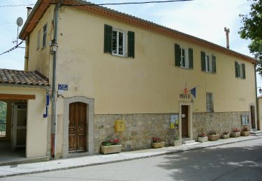
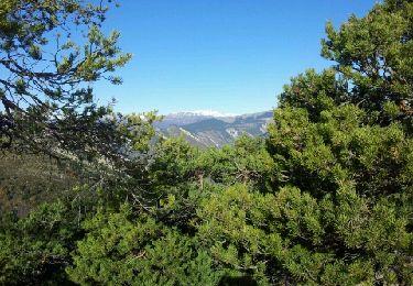
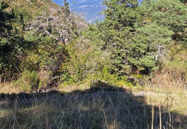
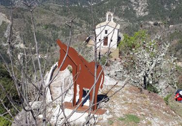
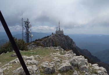
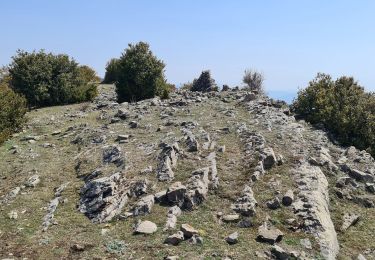
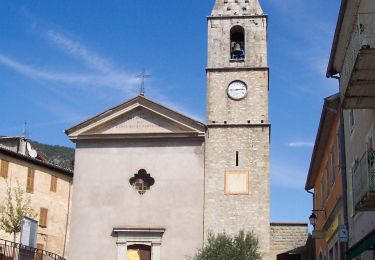
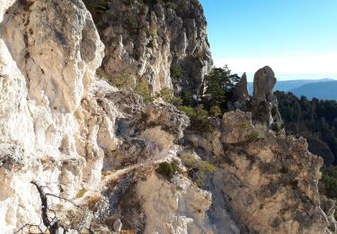
Ruta Senderismo de 14,7 km a descubrir en Provenza-Alpes-Costa Azul, Alpes Marítimos, Toudon. Esta ruta ha sido propuesta por aris.
Descripción
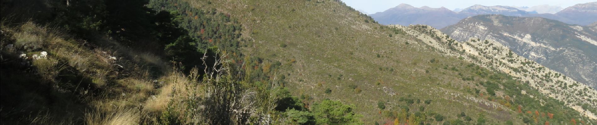
Randonnée facile qui offre de beaux panoramas sur la vallée du Var et le bord de Mer, l'Esteron et le Mercantour. En automne, les couleurs sont superbes.
Localización
País:
France
Región :
Provenza-Alpes-Costa Azul
Departamento/provincia :
Alpes Marítimos
Municipio :
Toudon
Localidad:
Unknown
Salida:(Dec)
Salida:(UTM)
348785 ; 4862808 (32T) N.
Comentarios
Excursiones cerca
![Excursión Senderismo Toudon - FFR - la Cime des Colettes - Photo](https://media.geolcdn.com/t/375/260/5c77e34d-ba93-4b2e-bc78-7f26fc9a91ff.jpg&format=jpg&maxdim=2)
![Senderismo Senderismo](https://static1.geolcdn.com/sitytour/trail-icons/101.png)
FFR - la Cime des Colettes
Senderismo
Difícil
(1)
Toudon,
Provenza-Alpes-Costa Azul,
Alpes Marítimos,
France
![](/images/other/stat-length.png)
7,9 km | 15 km-effort
3h 23min
![](https://static1.geolcdn.com/siteimages/upload/files/16400158638029165_repeat_loop_refresh_sync_direction_icon.png)
Sí
![Excursión A pie Toudon - Cime des Collettes - Photo](https://media.geolcdn.com/t/375/260/fd183395-f287-4a75-ab4d-8f82bd86c556.jpeg&format=jpg&maxdim=2)
![A pie A pie](https://static1.geolcdn.com/sitytour/trail-icons/100.png)
Cime des Collettes
A pie
Fácil
Toudon,
Provenza-Alpes-Costa Azul,
Alpes Marítimos,
France
![](/images/other/stat-length.png)
7 km | 13,4 km-effort
3h 3min
![](https://static1.geolcdn.com/siteimages/upload/files/16400158638029165_repeat_loop_refresh_sync_direction_icon.png)
Sí
![Excursión Senderismo Toudon - cime des Colettes - Photo](https://media.geolcdn.com/t/375/260/ext.jpg?maxdim=2&url=https%3A%2F%2Fservices.sitytrail.com%2FGeolivesWS%2FDownloadMedia.ashx%3FTrailID%3D234784%26Media%3Dfix__20131128111641.jpg)
![Senderismo Senderismo](https://static1.geolcdn.com/sitytour/trail-icons/101.png)
cime des Colettes
Senderismo
Medio
(1)
Toudon,
Provenza-Alpes-Costa Azul,
Alpes Marítimos,
France
![](/images/other/stat-length.png)
7,7 km | 14,6 km-effort
3h 40min
![](https://static1.geolcdn.com/siteimages/upload/files/16400158638029165_repeat_loop_refresh_sync_direction_icon.png)
No
![Excursión Senderismo Revest-les-Roches - Balme de Vial - Photo](https://media.geolcdn.com/t/375/260/73ac1471-1060-4737-8ded-c7a6c570aa13.jpg&format=jpg&maxdim=2)
![Senderismo Senderismo](https://static1.geolcdn.com/sitytour/trail-icons/101.png)
Balme de Vial
Senderismo
Medio
Revest-les-Roches,
Provenza-Alpes-Costa Azul,
Alpes Marítimos,
France
![](/images/other/stat-length.png)
7,4 km | 14,6 km-effort
5h 1min
![](https://static1.geolcdn.com/siteimages/upload/files/16400158638029165_repeat_loop_refresh_sync_direction_icon.png)
No
![Excursión Senderismo La Tour - Pic charvet, son Fort, Chapelle St Antoine, Tournefort - Photo](https://media.geolcdn.com/t/375/260/f393b76f-0e11-49af-9bd1-d986a17cd1fb.jpg&format=jpg&maxdim=2)
![Senderismo Senderismo](https://static1.geolcdn.com/sitytour/trail-icons/101.png)
Pic charvet, son Fort, Chapelle St Antoine, Tournefort
Senderismo
Fácil
La Tour,
Provenza-Alpes-Costa Azul,
Alpes Marítimos,
France
![](/images/other/stat-length.png)
12,8 km | 23 km-effort
5h 10min
![](https://static1.geolcdn.com/siteimages/upload/files/16400158638029165_repeat_loop_refresh_sync_direction_icon.png)
Sí
![Excursión Senderismo Revest-les-Roches - Mont Vial 1550m 18-04-22 - Photo](https://media.geolcdn.com/t/375/260/d6f644e7-05d3-4637-b742-d9794d83f920.jpg&format=jpg&maxdim=2)
![Senderismo Senderismo](https://static1.geolcdn.com/sitytour/trail-icons/101.png)
Mont Vial 1550m 18-04-22
Senderismo
Medio
Revest-les-Roches,
Provenza-Alpes-Costa Azul,
Alpes Marítimos,
France
![](/images/other/stat-length.png)
9,7 km | 19,1 km-effort
3h 30min
![](https://static1.geolcdn.com/siteimages/upload/files/16400158638029165_repeat_loop_refresh_sync_direction_icon.png)
Sí
![Excursión Senderismo Pierrefeu - mont brune - Photo](https://media.geolcdn.com/t/375/260/aaa7df74-5173-4c01-a387-0027aa66640a.jpg&format=jpg&maxdim=2)
![Senderismo Senderismo](https://static1.geolcdn.com/sitytour/trail-icons/101.png)
mont brune
Senderismo
Difícil
Pierrefeu,
Provenza-Alpes-Costa Azul,
Alpes Marítimos,
France
![](/images/other/stat-length.png)
8 km | 13,7 km-effort
3h 13min
![](https://static1.geolcdn.com/siteimages/upload/files/16400158638029165_repeat_loop_refresh_sync_direction_icon.png)
Sí
![Excursión A pie Villars-sur-Var - Chapelle Saint-Jean - Photo](https://media.geolcdn.com/t/375/260/d00b81a8-2e28-44d5-b86a-fc3ec125a764.jpeg&format=jpg&maxdim=2)
![A pie A pie](https://static1.geolcdn.com/sitytour/trail-icons/100.png)
Chapelle Saint-Jean
A pie
Fácil
Villars-sur-Var,
Provenza-Alpes-Costa Azul,
Alpes Marítimos,
France
![](/images/other/stat-length.png)
5 km | 9,7 km-effort
2h 12min
![](https://static1.geolcdn.com/siteimages/upload/files/16400158638029165_repeat_loop_refresh_sync_direction_icon.png)
Sí
![Excursión Senderismo Toudon - Baisse des Colettes et Mt Brune de Toudon - Photo](https://media.geolcdn.com/t/375/260/20f8a02d-71d1-45f3-9a82-b8f740ad91d7.jpg&format=jpg&maxdim=2)
![Senderismo Senderismo](https://static1.geolcdn.com/sitytour/trail-icons/101.png)
Baisse des Colettes et Mt Brune de Toudon
Senderismo
Medio
(1)
Toudon,
Provenza-Alpes-Costa Azul,
Alpes Marítimos,
France
![](/images/other/stat-length.png)
13,3 km | 24 km-effort
4h 39min
![](https://static1.geolcdn.com/siteimages/upload/files/16400158638029165_repeat_loop_refresh_sync_direction_icon.png)
Sí