![](/images/other/stat-length.png)
![Excursión Senderismo Faverolles-sur-Cher - Faverolles-sur-Cher l'Audronnière - les Raimbaudières le Port le Cher - 6.4km 50m 1h35 - 2020 10 04 - Photo](https://media.geolcdn.com/t/1900/400/f011b49a-c98e-461a-9255-6b51cf3fa752.jpg&format=pjpeg&maxdim=2)
Faverolles-sur-Cher l'Audronnière - les Raimbaudières le Port le Cher - 6.4km 50m 1h35 - 2020 10 04
Orcal37
Usuario GUIDE
![Longitud](/images/other/stat-length.png)
Longitud
6,4 km
![Altitud máxima](https://static1.geolcdn.com/siteimages/upload/files/1508320355ic_sort_altitude_max_24dp.png)
Altitud máxima
84 m
![Desnivel positivo](https://static1.geolcdn.com/siteimages/upload/files/1508320355ic_sort_den_pos_24dp.png)
Desnivel positivo
52 m
![Km-Effort](/images/other/stat-length.png)
Km-Effort
7,1 km
![Altitud mínima](https://static1.geolcdn.com/siteimages/upload/files/1508320355ic_sort_altitude_min_24dp.png)
Altitud mínima
55 m
![Desnivel negativo](https://static1.geolcdn.com/siteimages/upload/files/1508320355ic_sort_den_neg_24dp.png)
Desnivel negativo
55 m
![Boucle](https://static1.geolcdn.com/siteimages/upload/files/16400158638029165_repeat_loop_refresh_sync_direction_icon.png)
Boucle
Sí
Fecha de creación :
2020-10-04 14:38:32.809
Última modificación :
2024-09-09 16:42:56.732
![Senderismo](https://static1.geolcdn.com/sitytour/trail-icons/101.png)
1h35
Dificultad : Fácil
![Escanee este código QR para abrir la excursión en la aplicación SityTrail](https://capi.geolives.com/qq0zvz2zws4bq2lad0pu/sitytour/trails/2568835/qr.png?size=200)
Aplicación GPS de excursión GRATIS
A propósito
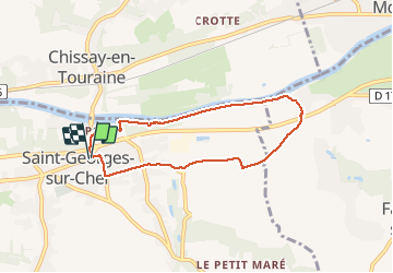
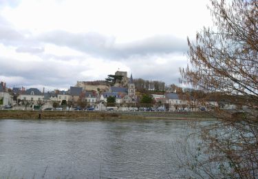
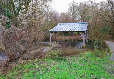
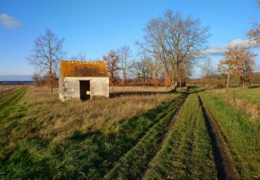
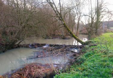
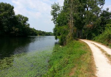
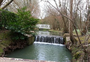
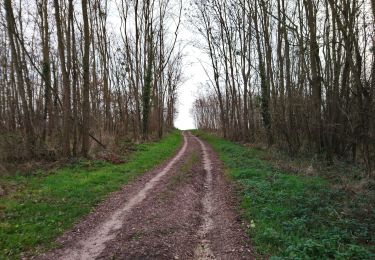
Ruta Senderismo de 6,4 km a descubrir en Centro, Loir y Cher, Faverolles-sur-Cher. Esta ruta ha sido propuesta por Orcal37.
Descripción
Faverolles-sur-Cher l'Audronnière - les Raimbaudières (Saint-Georges-sur-Cher) le Port - le Cher - 6.4km 50m 1h35 - 2020 10 04
Localización
País:
France
Región :
Centro
Departamento/provincia :
Loir y Cher
Municipio :
Faverolles-sur-Cher
Localidad:
Unknown
Salida:(Dec)
Salida:(UTM)
361435 ; 5243672 (31T) N.
Comentarios
Excursiones cerca
![Excursión Senderismo Chissay-en-Touraine - Chissay-en-Touraine - Zig zag Beaune les Durdents - 18.2km 330m 3h50 - 2024 08 14 - Photo](https://media.geolcdn.com/t/375/260/30944a30-b41f-4f9d-8ec2-2b86a26d941c.jpg&format=jpg&maxdim=2)
![Senderismo Senderismo](https://static1.geolcdn.com/sitytour/trail-icons/101.png)
Chissay-en-Touraine - Zig zag Beaune les Durdents - 18.2km 330m 3h50 - 2024 0...
Senderismo
Medio
Chissay-en-Touraine,
Centro,
Loir y Cher,
France
![](/images/other/stat-length.png)
17,8 km | 22 km-effort
3h 50min
![](https://static1.geolcdn.com/siteimages/upload/files/16400158638029165_repeat_loop_refresh_sync_direction_icon.png)
Sí
![Excursión Senderismo Saint-Georges-sur-Cher - Saint-Georges-sur-Cher - GRP Forêt Montrichard - 17.6km 165m 3h40 - 2023 12 27 - Photo](https://media.geolcdn.com/t/375/260/880c30e7-b6b6-4502-9fce-27a680430128.jpg&format=jpg&maxdim=2)
![Senderismo Senderismo](https://static1.geolcdn.com/sitytour/trail-icons/101.png)
Saint-Georges-sur-Cher - GRP Forêt Montrichard - 17.6km 165m 3h40 - 2023 12 27
Senderismo
Fácil
Saint-Georges-sur-Cher,
Centro,
Loir y Cher,
France
![](/images/other/stat-length.png)
17,7 km | 19,8 km-effort
3h 40min
![](https://static1.geolcdn.com/siteimages/upload/files/16400158638029165_repeat_loop_refresh_sync_direction_icon.png)
Sí
![Excursión Senderismo Faverolles-sur-Cher - Montrichard - GR41 Forêt GRP - 13.9km 220m 3h30 - 2022 03 03 - Photo](https://media.geolcdn.com/t/375/260/e0906f58-3286-4bdf-8af8-a43f3b5ae1bb.jpg&format=jpg&maxdim=2)
![Senderismo Senderismo](https://static1.geolcdn.com/sitytour/trail-icons/101.png)
Montrichard - GR41 Forêt GRP - 13.9km 220m 3h30 - 2022 03 03
Senderismo
Fácil
Faverolles-sur-Cher,
Centro,
Loir y Cher,
France
![](/images/other/stat-length.png)
13,9 km | 16,9 km-effort
3h 30min
![](https://static1.geolcdn.com/siteimages/upload/files/16400158638029165_repeat_loop_refresh_sync_direction_icon.png)
Sí
![Excursión Senderismo Saint-Georges-sur-Cher - Saint-Georges-sur-Cher - Vrigny la Rabotière - 5.8km 50m 1h25 - 2021 12 26 - Photo](https://media.geolcdn.com/t/375/260/bf0f4dfb-3021-439f-aae4-efd12cf3a4f1.jpg&format=jpg&maxdim=2)
![Senderismo Senderismo](https://static1.geolcdn.com/sitytour/trail-icons/101.png)
Saint-Georges-sur-Cher - Vrigny la Rabotière - 5.8km 50m 1h25 - 2021 12 26
Senderismo
Fácil
Saint-Georges-sur-Cher,
Centro,
Loir y Cher,
France
![](/images/other/stat-length.png)
5,8 km | 6,5 km-effort
1h 25min
![](https://static1.geolcdn.com/siteimages/upload/files/16400158638029165_repeat_loop_refresh_sync_direction_icon.png)
Sí
![Excursión Senderismo Saint-Georges-sur-Cher - Saint-Georges-sur-Cher - les Magasins Montfourgon le Moulin du Porteau - 10km 110m 2h25 - 2021 01 02 - Photo](https://media.geolcdn.com/t/375/260/f115f6ef-46e3-4de7-a2db-116f89709983.jpg&format=jpg&maxdim=2)
![Senderismo Senderismo](https://static1.geolcdn.com/sitytour/trail-icons/101.png)
Saint-Georges-sur-Cher - les Magasins Montfourgon le Moulin du Porteau - 10km...
Senderismo
Fácil
Saint-Georges-sur-Cher,
Centro,
Loir y Cher,
France
![](/images/other/stat-length.png)
10,1 km | 11,6 km-effort
2h 25min
![](https://static1.geolcdn.com/siteimages/upload/files/16400158638029165_repeat_loop_refresh_sync_direction_icon.png)
Sí
![Excursión Senderismo Saint-Georges-sur-Cher - Saint-Georges-sur-Cher - barrage de castors de Chézelles - 9.9km 130m 2h10 - 2020 12 26 - Photo](https://media.geolcdn.com/t/375/260/9d6a7779-3dab-4c71-aee3-1f28b204988e.jpg&format=jpg&maxdim=2)
![Senderismo Senderismo](https://static1.geolcdn.com/sitytour/trail-icons/101.png)
Saint-Georges-sur-Cher - barrage de castors de Chézelles - 9.9km 130m 2h10 - ...
Senderismo
Muy fácil
Saint-Georges-sur-Cher,
Centro,
Loir y Cher,
France
![](/images/other/stat-length.png)
9,9 km | 11,7 km-effort
2h 10min
![](https://static1.geolcdn.com/siteimages/upload/files/16400158638029165_repeat_loop_refresh_sync_direction_icon.png)
Sí
![Excursión Senderismo Montrichard Val de Cher - Bourré - 05 07 2015 - Photo](https://media.geolcdn.com/t/375/260/14a9fe51-420d-4253-b672-5c69abdb22ce.jpg&format=jpg&maxdim=2)
![Senderismo Senderismo](https://static1.geolcdn.com/sitytour/trail-icons/101.png)
Bourré - 05 07 2015
Senderismo
Fácil
Montrichard Val de Cher,
Centro,
Loir y Cher,
France
![](/images/other/stat-length.png)
7,3 km | 9 km-effort
2h 0min
![](https://static1.geolcdn.com/siteimages/upload/files/16400158638029165_repeat_loop_refresh_sync_direction_icon.png)
Sí
![Excursión Senderismo Saint-Georges-sur-Cher - Saint-Georges-sur-Cher - Photo](https://media.geolcdn.com/t/375/260/ext.jpg?maxdim=2&url=https%3A%2F%2Fservices.sitytrail.com%2FGeolivesWS%2FDownloadMedia.ashx%3FTrailID%3D258187%26Media%3Dfix__20140316093314.jpg)
![Senderismo Senderismo](https://static1.geolcdn.com/sitytour/trail-icons/101.png)
Saint-Georges-sur-Cher
Senderismo
Fácil
Saint-Georges-sur-Cher,
Centro,
Loir y Cher,
France
![](/images/other/stat-length.png)
12,4 km | 14,1 km-effort
2h 30min
![](https://static1.geolcdn.com/siteimages/upload/files/16400158638029165_repeat_loop_refresh_sync_direction_icon.png)
Sí
![Excursión Senderismo Saint-Georges-sur-Cher - Saint-Georges-sur-Cher - Vallée Pitrou et Moulins - 6.9km 65m 1h35 - 2023 12 27 - Photo](https://media.geolcdn.com/t/375/260/79e82643-2c56-48db-b98c-d0a5031be52a.jpg&format=jpg&maxdim=2)
![Senderismo Senderismo](https://static1.geolcdn.com/sitytour/trail-icons/101.png)
Saint-Georges-sur-Cher - Vallée Pitrou et Moulins - 6.9km 65m 1h35 - 2023 12 27
Senderismo
Fácil
Saint-Georges-sur-Cher,
Centro,
Loir y Cher,
France
![](/images/other/stat-length.png)
6,9 km | 7,8 km-effort
1h 35min
![](https://static1.geolcdn.com/siteimages/upload/files/16400158638029165_repeat_loop_refresh_sync_direction_icon.png)
Sí