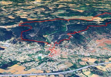
![](/images/other/stat-length.png)
![Excursión Senderismo Pignans - Pignan - ND des Anges. - Photo](https://media.geolcdn.com/t/1900/400/b83aa379-e097-4e5b-b7c8-a0c2fca7e0dc.jpg&format=pjpeg&maxdim=2)
Pignan - ND des Anges.
Daniel.BRUN-PICARD
Usuario
![Longitud](/images/other/stat-length.png)
![Altitud máxima](https://static1.geolcdn.com/siteimages/upload/files/1508320355ic_sort_altitude_max_24dp.png)
![Desnivel positivo](https://static1.geolcdn.com/siteimages/upload/files/1508320355ic_sort_den_pos_24dp.png)
![Km-Effort](/images/other/stat-length.png)
![Altitud mínima](https://static1.geolcdn.com/siteimages/upload/files/1508320355ic_sort_altitude_min_24dp.png)
![Desnivel negativo](https://static1.geolcdn.com/siteimages/upload/files/1508320355ic_sort_den_neg_24dp.png)
![Boucle](https://static1.geolcdn.com/siteimages/upload/files/16400158638029165_repeat_loop_refresh_sync_direction_icon.png)
![Senderismo](https://static1.geolcdn.com/sitytour/trail-icons/101.png)
3h58
Dificultad : Medio
![Escanee este código QR para abrir la excursión en la aplicación SityTrail](https://capi.geolives.com/qq0zvz2zws4bq2lad0pu/sitytour/trails/2560522/qr.png?size=200)
Aplicación GPS de excursión GRATIS
A propósito
Ruta Senderismo de 14,2 km a descubrir en Provenza-Alpes-Costa Azul, Var, Pignans. Esta ruta ha sido propuesta por Daniel.BRUN-PICARD.
Descripción
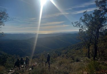
Randonnée effectuée avec le Touring-Club du Var.
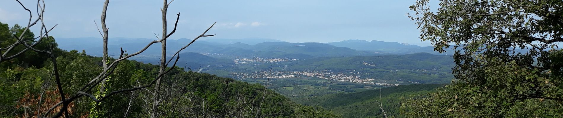
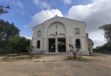
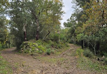
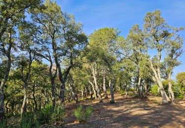
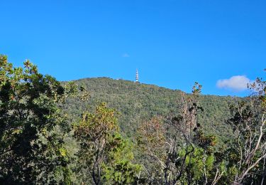
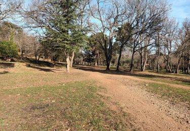
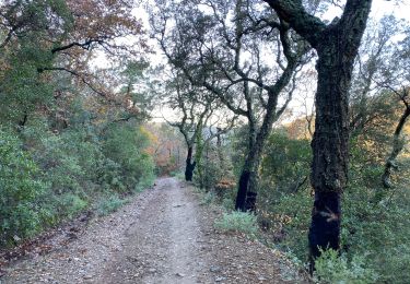
Belle randonnée d'automne, à travers les forêts de chêne-liège et de châtaigniers. La montée est longue, raide, avec peu de replats. La descente peut être glissante par temps humide. Porter de bonnes chaussures et emporter suffisamment d'eau, la potabilité de celle de la source du sanctuaire n'étant pas garantie.
Localización
Comentarios
Excursiones cerca
![Excursión Senderismo Gonfaron - CVI7-GonfaronNG-291121 - Photo](https://media.geolcdn.com/t/375/260/2df2772b-e3d9-4738-9a0c-a1cefdfdedfb.jpg&format=jpg&maxdim=2)
![Senderismo Senderismo](https://static1.geolcdn.com/sitytour/trail-icons/101.png)
Senderismo
![](/images/other/stat-length.png)
![](https://static1.geolcdn.com/siteimages/upload/files/16400158638029165_repeat_loop_refresh_sync_direction_icon.png)
![Excursión Senderismo Gonfaron - notre dame des anges - Photo](https://media.geolcdn.com/t/375/260/ext.jpg?maxdim=2&url=https%3A%2F%2Fstatic1.geolcdn.com%2Fsiteimages%2Fupload%2Ffiles%2F1553511878bg_sport_marche.png)
![Senderismo Senderismo](https://static1.geolcdn.com/sitytour/trail-icons/101.png)
Senderismo
![](/images/other/stat-length.png)
![](https://static1.geolcdn.com/siteimages/upload/files/16400158638029165_repeat_loop_refresh_sync_direction_icon.png)
![Excursión Senderismo Pignans - Notre dame des anges - Pignans - Photo](https://media.geolcdn.com/t/375/260/3efd77dc-a15a-46eb-ae10-dfa680f5a77b.jpg&format=jpg&maxdim=2)
![Senderismo Senderismo](https://static1.geolcdn.com/sitytour/trail-icons/101.png)
Senderismo
![](/images/other/stat-length.png)
![](https://static1.geolcdn.com/siteimages/upload/files/16400158638029165_repeat_loop_refresh_sync_direction_icon.png)
![Excursión Senderismo Pignans - Notre dame des anges - Photo](https://media.geolcdn.com/t/375/260/2ba6fe69-92d6-4549-bffc-0d3d1a48bcbf.jpg&format=jpg&maxdim=2)
![Senderismo Senderismo](https://static1.geolcdn.com/sitytour/trail-icons/101.png)
Senderismo
![](/images/other/stat-length.png)
![](https://static1.geolcdn.com/siteimages/upload/files/16400158638029165_repeat_loop_refresh_sync_direction_icon.png)
![Excursión Senderismo Pignans - Notre Dame des Anges 768m 26.11.23 - Photo](https://media.geolcdn.com/t/375/260/b48b5baa-4718-4c0d-9436-2b24eea7e7ff.jpg&format=jpg&maxdim=2)
![Senderismo Senderismo](https://static1.geolcdn.com/sitytour/trail-icons/101.png)
Senderismo
![](/images/other/stat-length.png)
![](https://static1.geolcdn.com/siteimages/upload/files/16400158638029165_repeat_loop_refresh_sync_direction_icon.png)
![Excursión Senderismo Pignans - Notre Dame des Anges - Photo](https://media.geolcdn.com/t/375/260/e767da4f-d41a-4a4e-a0d1-bb0cec7011f0.jpg&format=jpg&maxdim=2)
![Senderismo Senderismo](https://static1.geolcdn.com/sitytour/trail-icons/101.png)
Senderismo
![](/images/other/stat-length.png)
![](https://static1.geolcdn.com/siteimages/upload/files/16400158638029165_repeat_loop_refresh_sync_direction_icon.png)
![Excursión Senderismo Pignans - Balade dans les Maures - Photo](https://media.geolcdn.com/t/375/260/3b8d08a5-3ef8-47ce-8ab4-2f42efb4fa30.jpg&format=jpg&maxdim=2)
![Senderismo Senderismo](https://static1.geolcdn.com/sitytour/trail-icons/101.png)
Senderismo
![](/images/other/stat-length.png)
![](https://static1.geolcdn.com/siteimages/upload/files/16400158638029165_repeat_loop_refresh_sync_direction_icon.png)
![Excursión Senderismo Pignans - ND des Anges-Pignans-17-03-23 - Photo](https://media.geolcdn.com/t/375/260/36913bca-5606-4f4a-99d9-76ae8b894d72.jpg&format=jpg&maxdim=2)
![Senderismo Senderismo](https://static1.geolcdn.com/sitytour/trail-icons/101.png)
Senderismo
![](/images/other/stat-length.png)
![](https://static1.geolcdn.com/siteimages/upload/files/16400158638029165_repeat_loop_refresh_sync_direction_icon.png)
![Excursión Senderismo Pignans - Sainte Marie des Anges 15,8 km - Photo](https://media.geolcdn.com/t/375/260/bd142653-ff17-4743-8bd8-82c0056ff5b9.jpg&format=jpg&maxdim=2)
![Senderismo Senderismo](https://static1.geolcdn.com/sitytour/trail-icons/101.png)
Senderismo
![](/images/other/stat-length.png)
![](https://static1.geolcdn.com/siteimages/upload/files/16400158638029165_repeat_loop_refresh_sync_direction_icon.png)