![](/images/other/stat-length.png)
![Excursión Senderismo Mont Lozère et Goulet - Stevenson J7 (Chasseradès au Bleymard) 19 950m +550m - Photo](https://media.geolcdn.com/t/1900/400/ext.pjpeg?maxdim=2&url=https%3A%2F%2Fstatic1.geolcdn.com%2Fsiteimages%2Fupload%2Ffiles%2F1553511878bg_sport_marche.png)
Stevenson J7 (Chasseradès au Bleymard) 19 950m +550m
DanielROLLET
Usuario
![Longitud](/images/other/stat-length.png)
Longitud
19,9 km
![Altitud máxima](https://static1.geolcdn.com/siteimages/upload/files/1508320355ic_sort_altitude_max_24dp.png)
Altitud máxima
1413 m
![Desnivel positivo](https://static1.geolcdn.com/siteimages/upload/files/1508320355ic_sort_den_pos_24dp.png)
Desnivel positivo
550 m
![Km-Effort](/images/other/stat-length.png)
Km-Effort
28 km
![Altitud mínima](https://static1.geolcdn.com/siteimages/upload/files/1508320355ic_sort_altitude_min_24dp.png)
Altitud mínima
1062 m
![Desnivel negativo](https://static1.geolcdn.com/siteimages/upload/files/1508320355ic_sort_den_neg_24dp.png)
Desnivel negativo
637 m
![Boucle](https://static1.geolcdn.com/siteimages/upload/files/16400158638029165_repeat_loop_refresh_sync_direction_icon.png)
Boucle
No
Fecha de creación :
2020-09-10 13:02:33.035
Última modificación :
2020-09-28 19:48:17.415
![Senderismo](https://static1.geolcdn.com/sitytour/trail-icons/101.png)
6h15
Dificultad : Medio
![Escanee este código QR para abrir la excursión en la aplicación SityTrail](https://capi.geolives.com/qq0zvz2zws4bq2lad0pu/sitytour/trails/2545528/qr.png?size=200)
Aplicación GPS de excursión GRATIS
A propósito
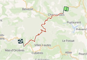
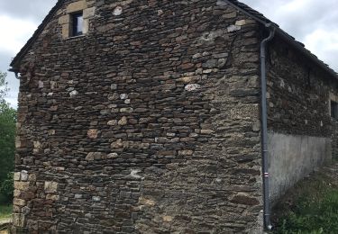
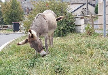
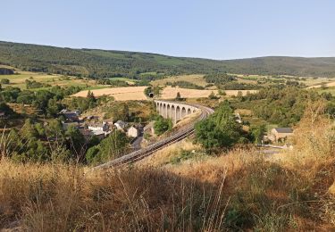
Ruta Senderismo de 19,9 km a descubrir en Occitania, Lozère, Mont Lozère et Goulet. Esta ruta ha sido propuesta por DanielROLLET.
Descripción
2020 09 19 - 08:00 à 14:15 compris arrêts dont un aux Alpiers (pique-nique au gîte)
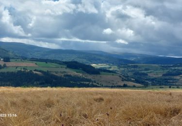
Fortes pluies, orages et éclairs tout le trajet
Départ Chasseradès gîte les Sous-Bois de jade / Arrivée Gîte le Poulitou (Bien)
Localización
País:
France
Región :
Occitania
Departamento/provincia :
Lozère
Municipio :
Mont Lozère et Goulet
Localidad:
Chasseradès
Salida:(Dec)
Salida:(UTM)
567186 ; 4933646 (31T) N.
Comentarios
Excursiones cerca
![Excursión Senderismo La Bastide-Puylaurent - la bastide saint Laurent _ Le Bleymard - Photo](https://media.geolcdn.com/t/375/260/ext.jpg?maxdim=2&url=https%3A%2F%2Fservices.sitytrail.com%2FGeolivesWS%2FDownloadMedia.ashx%3FTrailID%3D463471%26Media%3Dfix__20150818152203.jpg)
![Senderismo Senderismo](https://static1.geolcdn.com/sitytour/trail-icons/101.png)
la bastide saint Laurent _ Le Bleymard
Senderismo
Difícil
(1)
La Bastide-Puylaurent,
Occitania,
Lozère,
France
![](/images/other/stat-length.png)
33 km | 46 km-effort
6h 59min
![](https://static1.geolcdn.com/siteimages/upload/files/16400158638029165_repeat_loop_refresh_sync_direction_icon.png)
No
![Excursión Senderismo Mont Lozère et Goulet - Stevenson étape 7 - Photo](https://media.geolcdn.com/t/375/260/ca5e79f2-b988-472d-b1a4-865ced3314e1.jpg&format=jpg&maxdim=2)
![Senderismo Senderismo](https://static1.geolcdn.com/sitytour/trail-icons/101.png)
Stevenson étape 7
Senderismo
Difícil
Mont Lozère et Goulet,
Occitania,
Lozère,
France
![](/images/other/stat-length.png)
20 km | 28 km-effort
4h 57min
![](https://static1.geolcdn.com/siteimages/upload/files/16400158638029165_repeat_loop_refresh_sync_direction_icon.png)
No
![Excursión Senderismo Mont Lozère et Goulet - Stevenson Chasseradès - Le Bleymard - Photo](https://media.geolcdn.com/t/375/260/084f4a90-f605-49e0-8cc1-95e8aee0296f.jpg&format=jpg&maxdim=2)
![Senderismo Senderismo](https://static1.geolcdn.com/sitytour/trail-icons/101.png)
Stevenson Chasseradès - Le Bleymard
Senderismo
Muy difícil
Mont Lozère et Goulet,
Occitania,
Lozère,
France
![](/images/other/stat-length.png)
21 km | 29 km-effort
5h 4min
![](https://static1.geolcdn.com/siteimages/upload/files/16400158638029165_repeat_loop_refresh_sync_direction_icon.png)
No
![Excursión Senderismo La Bastide-Puylaurent - Etape 5 Bastide Puy Laurent/ le Bleymard - Photo](https://media.geolcdn.com/t/375/260/11c1d804-2ed7-4698-a8c0-5175b4d6e991.jpg&format=jpg&maxdim=2)
![Senderismo Senderismo](https://static1.geolcdn.com/sitytour/trail-icons/101.png)
Etape 5 Bastide Puy Laurent/ le Bleymard
Senderismo
Difícil
La Bastide-Puylaurent,
Occitania,
Lozère,
France
![](/images/other/stat-length.png)
30 km | 42 km-effort
7h 18min
![](https://static1.geolcdn.com/siteimages/upload/files/16400158638029165_repeat_loop_refresh_sync_direction_icon.png)
No
![Excursión Senderismo Mont Lozère et Goulet - le Bleymard - Photo](https://media.geolcdn.com/t/375/260/a7e52d95-c918-4024-aa49-8bd4f60cbf65.jpg&format=jpg&maxdim=2)
![Senderismo Senderismo](https://static1.geolcdn.com/sitytour/trail-icons/101.png)
le Bleymard
Senderismo
Muy difícil
Mont Lozère et Goulet,
Occitania,
Lozère,
France
![](/images/other/stat-length.png)
17,3 km | 25 km-effort
5h 14min
![](https://static1.geolcdn.com/siteimages/upload/files/16400158638029165_repeat_loop_refresh_sync_direction_icon.png)
No
![Excursión Senderismo La Bastide-Puylaurent - Chasséradès - Photo](https://media.geolcdn.com/t/375/260/99dcd61e-1413-422b-97ac-4dc748f0e62e.jpg&format=jpg&maxdim=2)
![Senderismo Senderismo](https://static1.geolcdn.com/sitytour/trail-icons/101.png)
Chasséradès
Senderismo
Difícil
(1)
La Bastide-Puylaurent,
Occitania,
Lozère,
France
![](/images/other/stat-length.png)
12 km | 16,8 km-effort
8h 54min
![](https://static1.geolcdn.com/siteimages/upload/files/16400158638029165_repeat_loop_refresh_sync_direction_icon.png)
No
![Excursión Senderismo Mont Lozère et Goulet - Chasserades Bleymard - Photo](https://media.geolcdn.com/t/375/260/116a16c1-813e-45da-b910-05ff52927fe4.jpg&format=jpg&maxdim=2)
![Senderismo Senderismo](https://static1.geolcdn.com/sitytour/trail-icons/101.png)
Chasserades Bleymard
Senderismo
Difícil
Mont Lozère et Goulet,
Occitania,
Lozère,
France
![](/images/other/stat-length.png)
20 km | 28 km-effort
6h 57min
![](https://static1.geolcdn.com/siteimages/upload/files/16400158638029165_repeat_loop_refresh_sync_direction_icon.png)
No
![Excursión Senderismo Mont Lozère et Goulet - arsel chasserades au bleymard - Photo](https://media.geolcdn.com/t/375/260/93179cba-083a-4533-8ddb-80481acfe8eb.jpg&format=jpg&maxdim=2)
![Senderismo Senderismo](https://static1.geolcdn.com/sitytour/trail-icons/101.png)
arsel chasserades au bleymard
Senderismo
Muy fácil
Mont Lozère et Goulet,
Occitania,
Lozère,
France
![](/images/other/stat-length.png)
14,1 km | 21 km-effort
6h 14min
![](https://static1.geolcdn.com/siteimages/upload/files/16400158638029165_repeat_loop_refresh_sync_direction_icon.png)
No
![Excursión Bici de montaña Mont Lozère et Goulet - Chasserades Finiels 2020 - Photo](https://media.geolcdn.com/t/375/260/6b5f0140-2a52-469f-ac07-12640915fb18.jpg&format=jpg&maxdim=2)
![Bici de montaña Bici de montaña](https://static1.geolcdn.com/sitytour/trail-icons/202.png)
Chasserades Finiels 2020
Bici de montaña
Difícil
Mont Lozère et Goulet,
Occitania,
Lozère,
France
![](/images/other/stat-length.png)
48 km | 67 km-effort
5h 36min
![](https://static1.geolcdn.com/siteimages/upload/files/16400158638029165_repeat_loop_refresh_sync_direction_icon.png)
No