![](/images/other/stat-length.png)
![Excursión Senderismo Lacanau - Boucle_Batejen - Photo](https://media.geolcdn.com/t/1900/400/250f4d9b-7a4b-4c93-bbc3-ea93f187a4f8.jpg&format=pjpeg&maxdim=2)
Boucle_Batejen
bouscat110
Usuario
![Longitud](/images/other/stat-length.png)
Longitud
4 km
![Altitud máxima](https://static1.geolcdn.com/siteimages/upload/files/1508320355ic_sort_altitude_max_24dp.png)
Altitud máxima
31 m
![Desnivel positivo](https://static1.geolcdn.com/siteimages/upload/files/1508320355ic_sort_den_pos_24dp.png)
Desnivel positivo
32 m
![Km-Effort](/images/other/stat-length.png)
Km-Effort
4,4 km
![Altitud mínima](https://static1.geolcdn.com/siteimages/upload/files/1508320355ic_sort_altitude_min_24dp.png)
Altitud mínima
13 m
![Desnivel negativo](https://static1.geolcdn.com/siteimages/upload/files/1508320355ic_sort_den_neg_24dp.png)
Desnivel negativo
33 m
![Boucle](https://static1.geolcdn.com/siteimages/upload/files/16400158638029165_repeat_loop_refresh_sync_direction_icon.png)
Boucle
Sí
Fecha de creación :
2020-09-03 13:32:18.124
Última modificación :
2020-09-04 05:30:04.043
![Senderismo](https://static1.geolcdn.com/sitytour/trail-icons/101.png)
1h05
Dificultad : Muy fácil
![Escanee este código QR para abrir la excursión en la aplicación SityTrail](https://capi.geolives.com/qq0zvz2zws4bq2lad0pu/sitytour/trails/2536908/qr.png?size=200)
Aplicación GPS de excursión GRATIS
A propósito
Ruta Senderismo de 4 km a descubrir en Nueva Aquitania, Gironda, Lacanau. Esta ruta ha sido propuesta por bouscat110.
Descripción
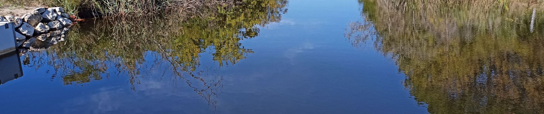
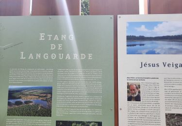
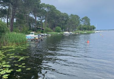
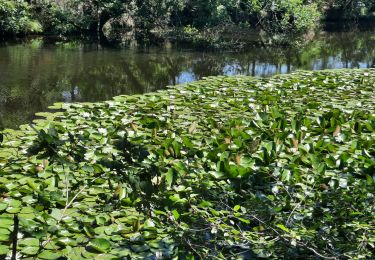
Petite boucle autour de l ' étang de Batejen. Sur une partie du parcours emprintant un chemin de St Jacques on est obligé de contourner une plantation de pins qui enferme cette portion?
Localización
País:
France
Región :
Nueva Aquitania
Departamento/provincia :
Gironda
Municipio :
Lacanau
Localidad:
Unknown
Salida:(Dec)
Salida:(UTM)
648248 ; 4976138 (30T) N.
Comentarios
Excursiones cerca
![Excursión Senderismo Le Porge - boucle au porge 13km - Photo](https://media.geolcdn.com/t/375/260/0072f8a7-4553-4d25-9ae2-44f3863ac428.jpg&format=jpg&maxdim=2)
![Senderismo Senderismo](https://static1.geolcdn.com/sitytour/trail-icons/101.png)
boucle au porge 13km
Senderismo
Difícil
Le Porge,
Nueva Aquitania,
Gironda,
France
![](/images/other/stat-length.png)
12,5 km | 14 km-effort
3h 27min
![](https://static1.geolcdn.com/siteimages/upload/files/16400158638029165_repeat_loop_refresh_sync_direction_icon.png)
Sí
![Excursión Senderismo Lacanau - Longaris - ocean AR - Photo](https://media.geolcdn.com/t/375/260/a9218101-ba63-43f4-b447-99315bb9c72e.jpg&format=jpg&maxdim=2)
![Senderismo Senderismo](https://static1.geolcdn.com/sitytour/trail-icons/101.png)
Longaris - ocean AR
Senderismo
Lacanau,
Nueva Aquitania,
Gironda,
France
![](/images/other/stat-length.png)
19,9 km | 22 km-effort
4h 23min
![](https://static1.geolcdn.com/siteimages/upload/files/16400158638029165_repeat_loop_refresh_sync_direction_icon.png)
Sí
![Excursión Senderismo Le Porge - boucle Le Porge 9,5 km - Photo](https://media.geolcdn.com/t/375/260/4ef5b240-d66e-42bd-abd9-eae35a351b83.jpg&format=jpg&maxdim=2)
![Senderismo Senderismo](https://static1.geolcdn.com/sitytour/trail-icons/101.png)
boucle Le Porge 9,5 km
Senderismo
Medio
Le Porge,
Nueva Aquitania,
Gironda,
France
![](/images/other/stat-length.png)
9,5 km | 10,1 km-effort
2h 11min
![](https://static1.geolcdn.com/siteimages/upload/files/16400158638029165_repeat_loop_refresh_sync_direction_icon.png)
No
![Excursión Senderismo Lacanau - Longarisse Bernos - Photo](https://media.geolcdn.com/t/375/260/ext.jpg?maxdim=2&url=https%3A%2F%2Fstatic1.geolcdn.com%2Fsiteimages%2Fupload%2Ffiles%2F1553511878bg_sport_marche.png)
![Senderismo Senderismo](https://static1.geolcdn.com/sitytour/trail-icons/101.png)
Longarisse Bernos
Senderismo
Lacanau,
Nueva Aquitania,
Gironda,
France
![](/images/other/stat-length.png)
10,2 km | 11,3 km-effort
2h 56min
![](https://static1.geolcdn.com/siteimages/upload/files/16400158638029165_repeat_loop_refresh_sync_direction_icon.png)
Sí
![Excursión Senderismo Lacanau - longarisse - Photo](https://media.geolcdn.com/t/375/260/ext.jpg?maxdim=2&url=https%3A%2F%2Fstatic1.geolcdn.com%2Fsiteimages%2Fupload%2Ffiles%2F1553511878bg_sport_marche.png)
![Senderismo Senderismo](https://static1.geolcdn.com/sitytour/trail-icons/101.png)
longarisse
Senderismo
Muy fácil
(1)
Lacanau,
Nueva Aquitania,
Gironda,
France
![](/images/other/stat-length.png)
18,8 km | 21 km-effort
6h 9min
![](https://static1.geolcdn.com/siteimages/upload/files/16400158638029165_repeat_loop_refresh_sync_direction_icon.png)
Sí
![Excursión Otra actividad Lacanau - longarisse - Photo](https://media.geolcdn.com/t/375/260/ext.jpg?maxdim=2&url=https%3A%2F%2Fstatic1.geolcdn.com%2Fsiteimages%2Fupload%2Ffiles%2F1545311037marcheuse_200dpi.jpg)
![Otra actividad Otra actividad](https://static1.geolcdn.com/sitytour/trail-icons/900.png)
longarisse
Otra actividad
Muy fácil
Lacanau,
Nueva Aquitania,
Gironda,
France
![](/images/other/stat-length.png)
19,4 km | 22 km-effort
6h 3min
![](https://static1.geolcdn.com/siteimages/upload/files/16400158638029165_repeat_loop_refresh_sync_direction_icon.png)
Sí
![Excursión Senderismo Lacanau - longarisse CP - Photo](https://media.geolcdn.com/t/375/260/ext.jpg?maxdim=2&url=https%3A%2F%2Fstatic1.geolcdn.com%2Fsiteimages%2Fupload%2Ffiles%2F1553511878bg_sport_marche.png)
![Senderismo Senderismo](https://static1.geolcdn.com/sitytour/trail-icons/101.png)
longarisse CP
Senderismo
Muy difícil
Lacanau,
Nueva Aquitania,
Gironda,
France
![](/images/other/stat-length.png)
19,8 km | 22 km-effort
5h 0min
![](https://static1.geolcdn.com/siteimages/upload/files/16400158638029165_repeat_loop_refresh_sync_direction_icon.png)
Sí
![Excursión Senderismo Lacanau - 200204 - Photo](https://media.geolcdn.com/t/375/260/ext.jpg?maxdim=2&url=https%3A%2F%2Fstatic1.geolcdn.com%2Fsiteimages%2Fupload%2Ffiles%2F1553511878bg_sport_marche.png)
![Senderismo Senderismo](https://static1.geolcdn.com/sitytour/trail-icons/101.png)
200204
Senderismo
Muy fácil
Lacanau,
Nueva Aquitania,
Gironda,
France
![](/images/other/stat-length.png)
6,8 km | 7,4 km-effort
1h 52min
![](https://static1.geolcdn.com/siteimages/upload/files/16400158638029165_repeat_loop_refresh_sync_direction_icon.png)
Sí
![Excursión Otra actividad Lacanau - 2017-09-07 2 - Photo](https://media.geolcdn.com/t/375/260/ext.jpg?maxdim=2&url=https%3A%2F%2Fstatic1.geolcdn.com%2Fsiteimages%2Fupload%2Ffiles%2F1545311037marcheuse_200dpi.jpg)
![Otra actividad Otra actividad](https://static1.geolcdn.com/sitytour/trail-icons/900.png)
2017-09-07 2
Otra actividad
Muy fácil
Lacanau,
Nueva Aquitania,
Gironda,
France
![](/images/other/stat-length.png)
5,3 km | 5,7 km-effort
1h 15min
![](https://static1.geolcdn.com/siteimages/upload/files/16400158638029165_repeat_loop_refresh_sync_direction_icon.png)
No