![](/images/other/stat-length.png)
![Excursión Senderismo Bourville - Bourville - Test du départ du circuit - Photo](https://media.geolcdn.com/t/1900/400/7aef1b4c-5c0f-4ee4-851d-b1bd3dbf0990.jpg&format=pjpeg&maxdim=2)
Bourville - Test du départ du circuit
MichelRando7656
Usuario
![Longitud](/images/other/stat-length.png)
Longitud
3,5 km
![Altitud máxima](https://static1.geolcdn.com/siteimages/upload/files/1508320355ic_sort_altitude_max_24dp.png)
Altitud máxima
102 m
![Desnivel positivo](https://static1.geolcdn.com/siteimages/upload/files/1508320355ic_sort_den_pos_24dp.png)
Desnivel positivo
54 m
![Km-Effort](/images/other/stat-length.png)
Km-Effort
4,2 km
![Altitud mínima](https://static1.geolcdn.com/siteimages/upload/files/1508320355ic_sort_altitude_min_24dp.png)
Altitud mínima
64 m
![Desnivel negativo](https://static1.geolcdn.com/siteimages/upload/files/1508320355ic_sort_den_neg_24dp.png)
Desnivel negativo
48 m
![Boucle](https://static1.geolcdn.com/siteimages/upload/files/16400158638029165_repeat_loop_refresh_sync_direction_icon.png)
Boucle
Sí
Fecha de creación :
2020-08-27 13:29:39.955
Última modificación :
2020-08-27 14:52:53.35
![Senderismo](https://static1.geolcdn.com/sitytour/trail-icons/101.png)
1h22
Dificultad : Medio
![Escanee este código QR para abrir la excursión en la aplicación SityTrail](https://capi.geolives.com/qq0zvz2zws4bq2lad0pu/sitytour/trails/2529614/qr.png?size=200)
Aplicación GPS de excursión GRATIS
A propósito
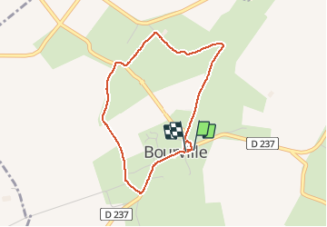
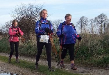
Ruta Senderismo de 3,5 km a descubrir en Normandía, Sena-Marítimo, Bourville. Esta ruta ha sido propuesta por MichelRando7656.
Descripción
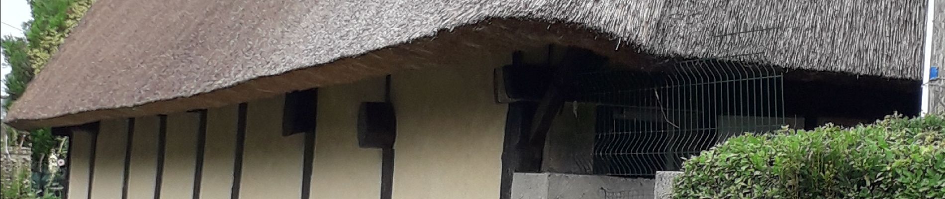
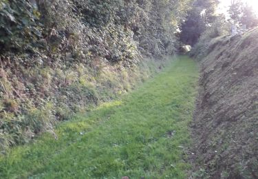
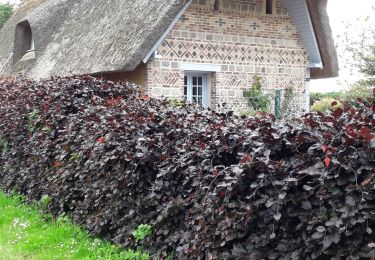
Beaux chemins de terre et d'herbe. Quelques parties caillouteuses mais peu de goudron sur cette partie .
Voir la suite.
Localización
País:
France
Región :
Normandía
Departamento/provincia :
Sena-Marítimo
Municipio :
Bourville
Localidad:
Unknown
Salida:(Dec)
Salida:(UTM)
343300 ; 5518123 (31U) N.
Comentarios
Excursiones cerca
![Excursión Senderismo Fultot - Fultot - N°25 -secteur Doudeville -76- Recp - Photo](https://media.geolcdn.com/t/375/260/87ee1e90-c5fc-4e04-9097-92be6e364874.jpg&format=jpg&maxdim=2)
![Senderismo Senderismo](https://static1.geolcdn.com/sitytour/trail-icons/101.png)
Fultot - N°25 -secteur Doudeville -76- Recp
Senderismo
Medio
Fultot,
Normandía,
Sena-Marítimo,
France
![](/images/other/stat-length.png)
13,1 km | 14,9 km-effort
3h 44min
![](https://static1.geolcdn.com/siteimages/upload/files/16400158638029165_repeat_loop_refresh_sync_direction_icon.png)
Sí
![Excursión Senderismo Canville-les-Deux-Églises - Canvillesles-deux-Eglises - Photo](https://media.geolcdn.com/t/375/260/a325fefe-7830-4921-a1fb-fc453a9c4634.jpg&format=jpg&maxdim=2)
![Senderismo Senderismo](https://static1.geolcdn.com/sitytour/trail-icons/101.png)
Canvillesles-deux-Eglises
Senderismo
Medio
Canville-les-Deux-Églises,
Normandía,
Sena-Marítimo,
France
![](/images/other/stat-length.png)
10,4 km | 11,3 km-effort
3h 22min
![](https://static1.geolcdn.com/siteimages/upload/files/16400158638029165_repeat_loop_refresh_sync_direction_icon.png)
No
![Excursión Senderismo Ermenouville - Ermenouvillle - Le Mesnil Geoffroy - Photo](https://media.geolcdn.com/t/375/260/5bb1fe76-5828-4c00-8543-c120e4c71a2a.jpg&format=jpg&maxdim=2)
![Senderismo Senderismo](https://static1.geolcdn.com/sitytour/trail-icons/101.png)
Ermenouvillle - Le Mesnil Geoffroy
Senderismo
Muy fácil
Ermenouville,
Normandía,
Sena-Marítimo,
France
![](/images/other/stat-length.png)
15,3 km | 17,2 km-effort
5h 26min
![](https://static1.geolcdn.com/siteimages/upload/files/16400158638029165_repeat_loop_refresh_sync_direction_icon.png)
Sí
![Excursión Senderismo Ermenouville - Ermenouville . Château de Mesnil-Geoffroy - Photo](https://media.geolcdn.com/t/375/260/7a0d7ca8-1cee-4dbe-ad74-2fd526e4e0b8.jpg&format=jpg&maxdim=2)
![Senderismo Senderismo](https://static1.geolcdn.com/sitytour/trail-icons/101.png)
Ermenouville . Château de Mesnil-Geoffroy
Senderismo
Muy fácil
Ermenouville,
Normandía,
Sena-Marítimo,
France
![](/images/other/stat-length.png)
13,4 km | 0 m-effort
3h 56min
![](https://static1.geolcdn.com/siteimages/upload/files/16400158638029165_repeat_loop_refresh_sync_direction_icon.png)
No
![Excursión Otra actividad Fultot - Le chemin de l'école Fultot - Photo](https://media.geolcdn.com/t/375/260/ext.jpg?maxdim=2&url=https%3A%2F%2Fservices.sitytrail.com%2FGeolivesWS%2FDownloadMedia.ashx%3FTrailID%3D317517%26Media%3D16757_5.jpg)
![Otra actividad Otra actividad](https://static1.geolcdn.com/sitytour/trail-icons/900.png)
Le chemin de l'école Fultot
Otra actividad
Medio
Fultot,
Normandía,
Sena-Marítimo,
France
![](/images/other/stat-length.png)
9,5 km | 10,4 km-effort
1h 0min
![](https://static1.geolcdn.com/siteimages/upload/files/16400158638029165_repeat_loop_refresh_sync_direction_icon.png)
Sí
![Excursión Senderismo Fultot - Le chemin de l'école Fultot - Photo](https://media.geolcdn.com/t/375/260/ext.jpg?maxdim=2&url=https%3A%2F%2Fservices.sitytrail.com%2FGeolivesWS%2FDownloadMedia.ashx%3FTrailID%3D317516%26Media%3D16757_5.jpg)
![Senderismo Senderismo](https://static1.geolcdn.com/sitytour/trail-icons/101.png)
Le chemin de l'école Fultot
Senderismo
Medio
Fultot,
Normandía,
Sena-Marítimo,
France
![](/images/other/stat-length.png)
9,5 km | 10,4 km-effort
2h 30min
![](https://static1.geolcdn.com/siteimages/upload/files/16400158638029165_repeat_loop_refresh_sync_direction_icon.png)
Sí
![Excursión Otra actividad Fontaine-le-Dun - Terre du sucre - Fontaine-le-Dun - Photo](https://media.geolcdn.com/t/375/260/ext.jpg?maxdim=2&url=https%3A%2F%2Fservices.sitytrail.com%2FGeolivesWS%2FDownloadMedia.ashx%3FTrailID%3D317502%26Media%3D16738_6.jpg)
![Otra actividad Otra actividad](https://static1.geolcdn.com/sitytour/trail-icons/900.png)
Terre du sucre - Fontaine-le-Dun
Otra actividad
Medio
Fontaine-le-Dun,
Normandía,
Sena-Marítimo,
France
![](/images/other/stat-length.png)
11,1 km | 13,2 km-effort
1h 15min
![](https://static1.geolcdn.com/siteimages/upload/files/16400158638029165_repeat_loop_refresh_sync_direction_icon.png)
Sí
![Excursión Senderismo Fontaine-le-Dun - Terre du sucre - Fontaine-le-Dun - Photo](https://media.geolcdn.com/t/375/260/ext.jpg?maxdim=2&url=https%3A%2F%2Fservices.sitytrail.com%2FGeolivesWS%2FDownloadMedia.ashx%3FTrailID%3D317501%26Media%3D16738_6.jpg)
![Senderismo Senderismo](https://static1.geolcdn.com/sitytour/trail-icons/101.png)
Terre du sucre - Fontaine-le-Dun
Senderismo
Medio
Fontaine-le-Dun,
Normandía,
Sena-Marítimo,
France
![](/images/other/stat-length.png)
11,1 km | 13,2 km-effort
2h 30min
![](https://static1.geolcdn.com/siteimages/upload/files/16400158638029165_repeat_loop_refresh_sync_direction_icon.png)
Sí
![Excursión Otra actividad Le Mesnil-Durdent - Les Amouhoques - Le Mesmil-Durdent - Photo](https://media.geolcdn.com/t/375/260/ext.jpg?maxdim=2&url=https%3A%2F%2Fservices.sitytrail.com%2FGeolivesWS%2FDownloadMedia.ashx%3FTrailID%3D317494%26Media%3D16728_5.jpg)
![Otra actividad Otra actividad](https://static1.geolcdn.com/sitytour/trail-icons/900.png)
Les Amouhoques - Le Mesmil-Durdent
Otra actividad
Difícil
Le Mesnil-Durdent,
Normandía,
Sena-Marítimo,
France
![](/images/other/stat-length.png)
18,9 km | 22 km-effort
2h 0min
![](https://static1.geolcdn.com/siteimages/upload/files/16400158638029165_repeat_loop_refresh_sync_direction_icon.png)
Sí