![](/images/other/stat-length.png)
![Excursión Senderismo Viuz-en-Sallaz - Viuz-Les Brasses-Vernant-Viuz - Photo](https://media.geolcdn.com/t/1900/400/34dcd57e-15ca-4ca3-ab02-fc2bad27ee19.jpg&format=pjpeg&maxdim=2)
Viuz-Les Brasses-Vernant-Viuz
Kargil
Usuario GUIDE
![Longitud](/images/other/stat-length.png)
![Altitud máxima](https://static1.geolcdn.com/siteimages/upload/files/1508320355ic_sort_altitude_max_24dp.png)
![Desnivel positivo](https://static1.geolcdn.com/siteimages/upload/files/1508320355ic_sort_den_pos_24dp.png)
![Km-Effort](/images/other/stat-length.png)
![Altitud mínima](https://static1.geolcdn.com/siteimages/upload/files/1508320355ic_sort_altitude_min_24dp.png)
![Desnivel negativo](https://static1.geolcdn.com/siteimages/upload/files/1508320355ic_sort_den_neg_24dp.png)
![Boucle](https://static1.geolcdn.com/siteimages/upload/files/16400158638029165_repeat_loop_refresh_sync_direction_icon.png)
![Senderismo](https://static1.geolcdn.com/sitytour/trail-icons/101.png)
4h09
Dificultad : Medio
![Escanee este código QR para abrir la excursión en la aplicación SityTrail](https://capi.geolives.com/qq0zvz2zws4bq2lad0pu/sitytour/trails/2524936/qr.png?size=200)
Aplicación GPS de excursión GRATIS
A propósito
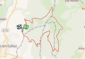
Ruta Senderismo de 12,1 km a descubrir en Auvergne-Rhône-Alpes, Alta Saboya, Viuz-en-Sallaz. Esta ruta ha sido propuesta por Kargil.
Descripción
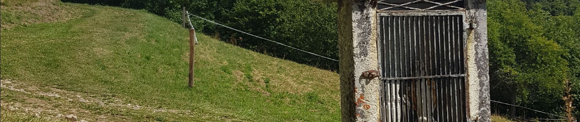
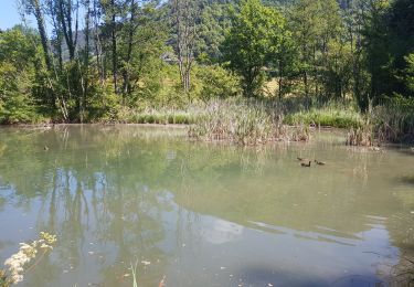
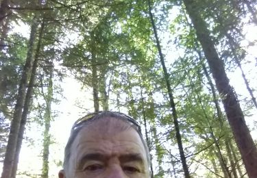
Montée abrupte avec quelques paliers sans grand intérêt autre que l'entrainement, le trail.
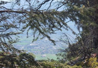
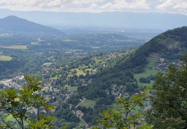
Belle vue au sommet.
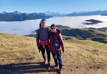
Descente agréable sur sentiers confortables avec montée 200m en intermédiaire pour rejoindre les chalets de Vernant et se diriger vers Viuz.
Localización
Comentarios
Excursiones cerca
![Excursión Senderismo La Tour - 17-04-2022 Le tour de Saint Jean de Tholomé - Photo](https://media.geolcdn.com/t/375/260/afe0a2c8-09a9-438d-add3-0f8a286a78fb.jpg&format=jpg&maxdim=2)
![Senderismo Senderismo](https://static1.geolcdn.com/sitytour/trail-icons/101.png)
Senderismo
![](/images/other/stat-length.png)
![](https://static1.geolcdn.com/siteimages/upload/files/16400158638029165_repeat_loop_refresh_sync_direction_icon.png)
![Excursión Senderismo Onnion - la pointe de miribelle - Photo](https://media.geolcdn.com/t/375/260/f20e3184-1b4e-419f-9856-9f36a9a88049.jpg&format=jpg&maxdim=2)
![Senderismo Senderismo](https://static1.geolcdn.com/sitytour/trail-icons/101.png)
Senderismo
![](/images/other/stat-length.png)
![](https://static1.geolcdn.com/siteimages/upload/files/16400158638029165_repeat_loop_refresh_sync_direction_icon.png)
![Excursión Senderismo Ville-en-Sallaz - 2020-07 Lac du Môle - Saint Jeoire - Photo](https://media.geolcdn.com/t/375/260/4ade7828-b272-4802-b721-df9a5ba1cac5.jpg&format=jpg&maxdim=2)
![Senderismo Senderismo](https://static1.geolcdn.com/sitytour/trail-icons/101.png)
Senderismo
![](/images/other/stat-length.png)
![](https://static1.geolcdn.com/siteimages/upload/files/16400158638029165_repeat_loop_refresh_sync_direction_icon.png)
![Excursión Bici de montaña Peillonnex - Crêtes de Vouan Ludran descente Foron de Viuz - Photo](https://media.geolcdn.com/t/375/260/ext.jpg?maxdim=2&url=https%3A%2F%2Fstatic1.geolcdn.com%2Fsiteimages%2Fupload%2Ffiles%2F1524743154velo.jpg)
![Bici de montaña Bici de montaña](https://static1.geolcdn.com/sitytour/trail-icons/202.png)
Bici de montaña
![](/images/other/stat-length.png)
![](https://static1.geolcdn.com/siteimages/upload/files/16400158638029165_repeat_loop_refresh_sync_direction_icon.png)
![Excursión Carrera Saint-Jean-de-Tholome - Sortie Longue GR1 - 17/04 - Photo](https://media.geolcdn.com/t/375/260/ext.jpg?maxdim=2&url=https%3A%2F%2Fstatic1.geolcdn.com%2Fsiteimages%2Fupload%2Ffiles%2F1524743154running.jpg)
![Carrera Carrera](https://static1.geolcdn.com/sitytour/trail-icons/103.png)
Carrera
![](/images/other/stat-length.png)
![](https://static1.geolcdn.com/siteimages/upload/files/16400158638029165_repeat_loop_refresh_sync_direction_icon.png)
![Excursión Senderismo Saint-André-de-Boëge - 2021.09.24 Molière - Photo](https://media.geolcdn.com/t/375/260/00b5061b-5e1e-472a-9057-8d523759e272.jpg&format=jpg&maxdim=2)
![Senderismo Senderismo](https://static1.geolcdn.com/sitytour/trail-icons/101.png)
Senderismo
![](/images/other/stat-length.png)
![](https://static1.geolcdn.com/siteimages/upload/files/16400158638029165_repeat_loop_refresh_sync_direction_icon.png)
![Excursión Senderismo Viuz-en-Sallaz - Boisinges - Crêtes de Vouan_25.07.2021 - Photo](https://media.geolcdn.com/t/375/260/63e31eaa-4938-4cc2-88e4-e3de10ed1069.jpg&format=jpg&maxdim=2)
![Senderismo Senderismo](https://static1.geolcdn.com/sitytour/trail-icons/101.png)
Senderismo
![](/images/other/stat-length.png)
![](https://static1.geolcdn.com/siteimages/upload/files/16400158638029165_repeat_loop_refresh_sync_direction_icon.png)
![Excursión Bici de montaña Ville-en-Sallaz - VTT(74) -Tour N°13-Tour du Môle 39km 1350m+ - Photo](https://media.geolcdn.com/t/375/260/c09e81bd-f7b0-464f-9e21-98ca654d8434.jpg&format=jpg&maxdim=2)
![Bici de montaña Bici de montaña](https://static1.geolcdn.com/sitytour/trail-icons/202.png)
Bici de montaña
![](/images/other/stat-length.png)
![](https://static1.geolcdn.com/siteimages/upload/files/16400158638029165_repeat_loop_refresh_sync_direction_icon.png)
![Excursión Bici de montaña Onnion - VTT(74)-N°9 - Tour d'Hirmentaz - 28 km 1065 m+ - Photo](https://media.geolcdn.com/t/375/260/12ecc564-da95-41c9-a8fe-81f81f650c48.jpg&format=jpg&maxdim=2)
![Bici de montaña Bici de montaña](https://static1.geolcdn.com/sitytour/trail-icons/202.png)
Bici de montaña
![](/images/other/stat-length.png)
![](https://static1.geolcdn.com/siteimages/upload/files/16400158638029165_repeat_loop_refresh_sync_direction_icon.png)