![](/images/other/stat-length.png)
![Excursión Senderismo Saint-Jeures - 43200_StJeur-LeMousse_200817-pieds - Photo](https://media.geolcdn.com/t/1900/400/ext.pjpeg?maxdim=2&url=https%3A%2F%2Fstatic1.geolcdn.com%2Fsiteimages%2Fupload%2Ffiles%2F1553511878bg_sport_marche.png)
43200_StJeur-LeMousse_200817-pieds
adye
Usuario
![Longitud](/images/other/stat-length.png)
Longitud
5,2 km
![Altitud máxima](https://static1.geolcdn.com/siteimages/upload/files/1508320355ic_sort_altitude_max_24dp.png)
Altitud máxima
1051 m
![Desnivel positivo](https://static1.geolcdn.com/siteimages/upload/files/1508320355ic_sort_den_pos_24dp.png)
Desnivel positivo
112 m
![Km-Effort](/images/other/stat-length.png)
Km-Effort
6,7 km
![Altitud mínima](https://static1.geolcdn.com/siteimages/upload/files/1508320355ic_sort_altitude_min_24dp.png)
Altitud mínima
955 m
![Desnivel negativo](https://static1.geolcdn.com/siteimages/upload/files/1508320355ic_sort_den_neg_24dp.png)
Desnivel negativo
114 m
![Boucle](https://static1.geolcdn.com/siteimages/upload/files/16400158638029165_repeat_loop_refresh_sync_direction_icon.png)
Boucle
Sí
Fecha de creación :
2020-08-17 07:51:41.234
Última modificación :
2020-08-17 19:07:48.59
![Senderismo](https://static1.geolcdn.com/sitytour/trail-icons/101.png)
1h15
Dificultad : Fácil
![Carrera](https://static1.geolcdn.com/sitytour/trail-icons/103.png)
35m
Dificultad : Fácil
![Escanee este código QR para abrir la excursión en la aplicación SityTrail](https://capi.geolives.com/qq0zvz2zws4bq2lad0pu/sitytour/trails/2518272/qr.png?size=200)
Aplicación GPS de excursión GRATIS
A propósito
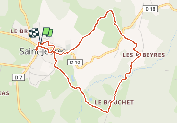
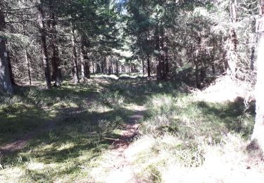
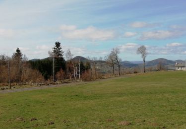
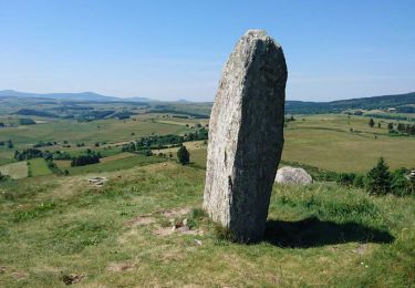
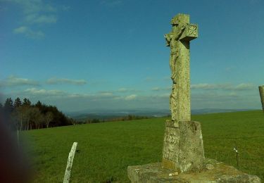
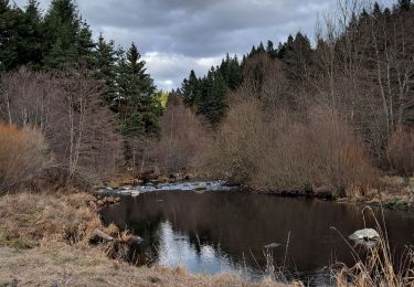
Ruta Senderismo de 5,2 km a descubrir en Auvergne-Rhône-Alpes, Alto Loira, Saint-Jeures. Esta ruta ha sido propuesta por adye.
Descripción
Balade familiale autour de Saint Jeur et le long de son ruisseau Le Mousse. Peu de route, chemins de randonnées faciles et avec ombre.
Localización
País:
France
Región :
Auvergne-Rhône-Alpes
Departamento/provincia :
Alto Loira
Municipio :
Saint-Jeures
Localidad:
Unknown
Salida:(Dec)
Salida:(UTM)
594799 ; 4994386 (31T) N.
Comentarios
Excursiones cerca
![Excursión Senderismo Araules - Suc de Lizieux - Photo](https://media.geolcdn.com/t/375/260/3244aa12-5792-460e-ba20-16eff7ba3ca0.jpg&format=jpg&maxdim=2)
![Senderismo Senderismo](https://static1.geolcdn.com/sitytour/trail-icons/101.png)
Suc de Lizieux
Senderismo
Medio
Araules,
Auvergne-Rhône-Alpes,
Alto Loira,
France
![](/images/other/stat-length.png)
4,6 km | 6,9 km-effort
1h 38min
![](https://static1.geolcdn.com/siteimages/upload/files/16400158638029165_repeat_loop_refresh_sync_direction_icon.png)
Sí
![Excursión Senderismo Chenereilles - Chenereilles, Lac de la Valette - Photo](https://media.geolcdn.com/t/375/260/388ebbcb-d8d6-4d0c-9d4d-f65e45105430.jpg&format=jpg&maxdim=2)
![Senderismo Senderismo](https://static1.geolcdn.com/sitytour/trail-icons/101.png)
Chenereilles, Lac de la Valette
Senderismo
Medio
Chenereilles,
Auvergne-Rhône-Alpes,
Alto Loira,
France
![](/images/other/stat-length.png)
18,7 km | 24 km-effort
4h 15min
![](https://static1.geolcdn.com/siteimages/upload/files/16400158638029165_repeat_loop_refresh_sync_direction_icon.png)
Sí
![Excursión Senderismo Chenereilles - Chenereilles, le château de Joux - Photo](https://media.geolcdn.com/t/375/260/bc72b279-cf9e-4b33-b880-67c7750c5c1c.jpg&format=jpg&maxdim=2)
![Senderismo Senderismo](https://static1.geolcdn.com/sitytour/trail-icons/101.png)
Chenereilles, le château de Joux
Senderismo
Medio
Chenereilles,
Auvergne-Rhône-Alpes,
Alto Loira,
France
![](/images/other/stat-length.png)
12,3 km | 16,6 km-effort
3h 5min
![](https://static1.geolcdn.com/siteimages/upload/files/16400158638029165_repeat_loop_refresh_sync_direction_icon.png)
Sí
![Excursión Senderismo Araules - le sentier de Bonas - Photo](https://media.geolcdn.com/t/375/260/d68ee2be-74cb-4667-89e5-08e6c8a501e3.jpg&format=jpg&maxdim=2)
![Senderismo Senderismo](https://static1.geolcdn.com/sitytour/trail-icons/101.png)
le sentier de Bonas
Senderismo
Fácil
Araules,
Auvergne-Rhône-Alpes,
Alto Loira,
France
![](/images/other/stat-length.png)
6,8 km | 9,5 km-effort
1h 57min
![](https://static1.geolcdn.com/siteimages/upload/files/16400158638029165_repeat_loop_refresh_sync_direction_icon.png)
Sí
![Excursión Senderismo Yssingeaux - 43 Yssingeaux 3sucs 9km 300m - Photo](https://media.geolcdn.com/t/375/260/447ecca4-c317-418d-bcbf-8909e30f2a3d.jpg&format=jpg&maxdim=2)
![Senderismo Senderismo](https://static1.geolcdn.com/sitytour/trail-icons/101.png)
43 Yssingeaux 3sucs 9km 300m
Senderismo
Muy fácil
Yssingeaux,
Auvergne-Rhône-Alpes,
Alto Loira,
France
![](/images/other/stat-length.png)
9,2 km | 13,5 km-effort
2h 59min
![](https://static1.geolcdn.com/siteimages/upload/files/16400158638029165_repeat_loop_refresh_sync_direction_icon.png)
Sí
![Excursión Senderismo Araules - Tence-170620 - PicLisieux - Photo](https://media.geolcdn.com/t/375/260/ext.jpg?maxdim=2&url=https%3A%2F%2Fservices.sitytrail.com%2FGeolivesWS%2FDownloadMedia.ashx%3FTrailID%3D776323%26Media%3D23dfef1f-c30a-4947-bbbf-c2a486ff054a.jpg)
![Senderismo Senderismo](https://static1.geolcdn.com/sitytour/trail-icons/101.png)
Tence-170620 - PicLisieux
Senderismo
Medio
Araules,
Auvergne-Rhône-Alpes,
Alto Loira,
France
![](/images/other/stat-length.png)
5,2 km | 7,6 km-effort
1h 50min
![](https://static1.geolcdn.com/siteimages/upload/files/16400158638029165_repeat_loop_refresh_sync_direction_icon.png)
Sí
![Excursión Bici de montaña Saint-Jeures - Les champs de St Jeures - Photo](https://media.geolcdn.com/t/375/260/ext.jpg?maxdim=2&url=https%3A%2F%2Fservices.sitytrail.com%2FGeolivesWS%2FDownloadMedia.ashx%3FTrailID%3D129689%26Media%3D13222_4.jpg)
![Bici de montaña Bici de montaña](https://static1.geolcdn.com/sitytour/trail-icons/202.png)
Les champs de St Jeures
Bici de montaña
Fácil
Saint-Jeures,
Auvergne-Rhône-Alpes,
Alto Loira,
France
![](/images/other/stat-length.png)
11,6 km | 15,2 km-effort
1h 30min
![](https://static1.geolcdn.com/siteimages/upload/files/16400158638029165_repeat_loop_refresh_sync_direction_icon.png)
Sí
![Excursión Senderismo Saint-Jeures - Les champs de St Jeures - Photo](https://media.geolcdn.com/t/375/260/ext.jpg?maxdim=2&url=https%3A%2F%2Fservices.sitytrail.com%2FGeolivesWS%2FDownloadMedia.ashx%3FTrailID%3D129688%26Media%3D13222_4.jpg)
![Senderismo Senderismo](https://static1.geolcdn.com/sitytour/trail-icons/101.png)
Les champs de St Jeures
Senderismo
Fácil
Saint-Jeures,
Auvergne-Rhône-Alpes,
Alto Loira,
France
![](/images/other/stat-length.png)
11,6 km | 15,2 km-effort
2h 30min
![](https://static1.geolcdn.com/siteimages/upload/files/16400158638029165_repeat_loop_refresh_sync_direction_icon.png)
Sí
![Excursión Senderismo Mazet-Saint-Voy - Salettes et Mazalibran - Photo](https://media.geolcdn.com/t/375/260/42cfbe72-4434-4356-970f-aa668c703a3b.jpg&format=jpg&maxdim=2)
![Senderismo Senderismo](https://static1.geolcdn.com/sitytour/trail-icons/101.png)
Salettes et Mazalibran
Senderismo
Medio
Mazet-Saint-Voy,
Auvergne-Rhône-Alpes,
Alto Loira,
France
![](/images/other/stat-length.png)
8,8 km | 11,9 km-effort
2h 30min
![](https://static1.geolcdn.com/siteimages/upload/files/16400158638029165_repeat_loop_refresh_sync_direction_icon.png)
Sí