![](/images/other/stat-length.png)
![Excursión Senderismo Sauxillanges - Sauxillanges_Civadoux - Photo](https://media.geolcdn.com/t/1900/400/75e3c30d-603a-45a5-aa00-06a4bab0ed78.jpg&format=pjpeg&maxdim=2)
Sauxillanges_Civadoux
jagarnier
Usuario GUIDE
![Longitud](/images/other/stat-length.png)
![Altitud máxima](https://static1.geolcdn.com/siteimages/upload/files/1508320355ic_sort_altitude_max_24dp.png)
![Desnivel positivo](https://static1.geolcdn.com/siteimages/upload/files/1508320355ic_sort_den_pos_24dp.png)
![Km-Effort](/images/other/stat-length.png)
![Altitud mínima](https://static1.geolcdn.com/siteimages/upload/files/1508320355ic_sort_altitude_min_24dp.png)
![Desnivel negativo](https://static1.geolcdn.com/siteimages/upload/files/1508320355ic_sort_den_neg_24dp.png)
![Boucle](https://static1.geolcdn.com/siteimages/upload/files/16400158638029165_repeat_loop_refresh_sync_direction_icon.png)
![Senderismo](https://static1.geolcdn.com/sitytour/trail-icons/101.png)
4h00
Dificultad : Difícil
![Escanee este código QR para abrir la excursión en la aplicación SityTrail](https://capi.geolives.com/qq0zvz2zws4bq2lad0pu/sitytour/trails/2514259/qr.png?size=200)
Aplicación GPS de excursión GRATIS
A propósito
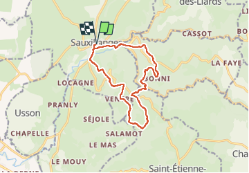
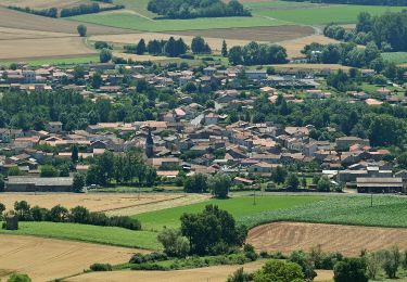
Ruta Senderismo de 13,1 km a descubrir en Auvergne-Rhône-Alpes, Puy-de-Dôme, Sauxillanges. Esta ruta ha sido propuesta por jagarnier.
Descripción
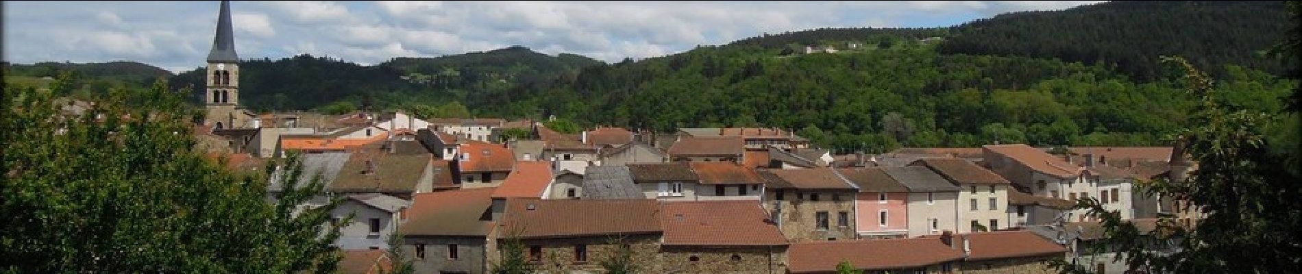
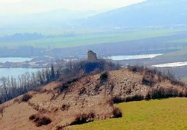
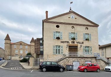
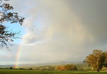
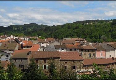
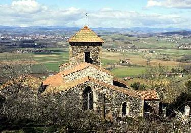
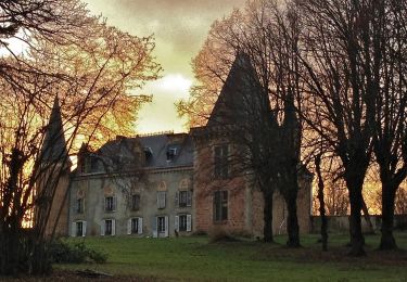
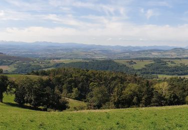
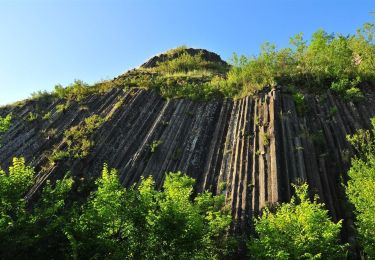
Au cours de cette randonnée, vous découvrirez les vestiges d’un grand prieuré clunisien où quatre papes séjournèrent. Le circuit se poursuit dans les gorges étroites de la vallée de Chaméane avec des vues sur la chaîne des Puys, le Sancy, le Cézallier, la vallée de l’Allier et le Forez.
Localización
Comentarios
Excursiones cerca
![Excursión Senderismo Brenat - Brenat_Tour_Gevillat - Photo](https://media.geolcdn.com/t/375/260/2b9dba0d-44c9-4336-a13d-50587f665150.jpg&format=jpg&maxdim=2)
![Senderismo Senderismo](https://static1.geolcdn.com/sitytour/trail-icons/101.png)
Senderismo
![](/images/other/stat-length.png)
![](https://static1.geolcdn.com/siteimages/upload/files/16400158638029165_repeat_loop_refresh_sync_direction_icon.png)
![Excursión A pie Sauxillanges - La Vallee de Civadoux - Photo](https://media.geolcdn.com/t/375/260/b4f7319b-3713-42b9-8b0d-6d7343ec86a5.jpeg&format=jpg&maxdim=2)
![A pie A pie](https://static1.geolcdn.com/sitytour/trail-icons/100.png)
A pie
![](/images/other/stat-length.png)
![](https://static1.geolcdn.com/siteimages/upload/files/16400158638029165_repeat_loop_refresh_sync_direction_icon.png)
![Excursión A pie Usson - Le Pic d'Usson - Photo](https://media.geolcdn.com/t/375/260/6a96298d-c1d0-4fd4-b2cd-7460048c5b43.jpeg&format=jpg&maxdim=2)
![A pie A pie](https://static1.geolcdn.com/sitytour/trail-icons/100.png)
A pie
![](/images/other/stat-length.png)
![](https://static1.geolcdn.com/siteimages/upload/files/16400158638029165_repeat_loop_refresh_sync_direction_icon.png)
![Excursión A pie Brenat - La Tour de Gevillat - Photo](https://media.geolcdn.com/t/375/260/12927b2d-86e8-4e4a-bbac-13d0164d4024.jpeg&format=jpg&maxdim=2)
![A pie A pie](https://static1.geolcdn.com/sitytour/trail-icons/100.png)
A pie
![](/images/other/stat-length.png)
![](https://static1.geolcdn.com/siteimages/upload/files/16400158638029165_repeat_loop_refresh_sync_direction_icon.png)
![Excursión Senderismo Sauxillanges - Sauxillanges_Sites_Clunisiens - Photo](https://media.geolcdn.com/t/375/260/a2cc4fc4-47d3-4c2f-b17d-a6b74f3d59dd.jpg&format=jpg&maxdim=2)
![Senderismo Senderismo](https://static1.geolcdn.com/sitytour/trail-icons/101.png)
Senderismo
![](/images/other/stat-length.png)
![](https://static1.geolcdn.com/siteimages/upload/files/16400158638029165_repeat_loop_refresh_sync_direction_icon.png)
![Excursión Senderismo Sauxillanges - Sauxillanges_Sentier_Claire - Photo](https://media.geolcdn.com/t/375/260/4ec33cda-8370-4996-a4fb-500774cc2d23.jpg&format=jpg&maxdim=2)
![Senderismo Senderismo](https://static1.geolcdn.com/sitytour/trail-icons/101.png)
Senderismo
![](/images/other/stat-length.png)
![](https://static1.geolcdn.com/siteimages/upload/files/16400158638029165_repeat_loop_refresh_sync_direction_icon.png)
![Excursión A pie Saint-Étienne-sur-Usson - La Ronde des Suquets - Photo](https://media.geolcdn.com/t/375/260/e7260daa-6a55-4a8a-b4e2-940285e94803.jpeg&format=jpg&maxdim=2)
![A pie A pie](https://static1.geolcdn.com/sitytour/trail-icons/100.png)
A pie
![](/images/other/stat-length.png)
![](https://static1.geolcdn.com/siteimages/upload/files/16400158638029165_repeat_loop_refresh_sync_direction_icon.png)
![Excursión Senderismo Sauxillanges - Sauxillanges_Le-Civadoux_T - Photo](https://media.geolcdn.com/t/375/260/0187ade0-2acc-4e72-9833-2644992b0db7.jpg&format=jpg&maxdim=2)
![Senderismo Senderismo](https://static1.geolcdn.com/sitytour/trail-icons/101.png)
Senderismo
![](/images/other/stat-length.png)
![](https://static1.geolcdn.com/siteimages/upload/files/16400158638029165_repeat_loop_refresh_sync_direction_icon.png)
![Excursión Senderismo Saint-Rémy-de-Chargnat - St_Remy_Pic_Usson - Photo](https://media.geolcdn.com/t/375/260/04fb18f3-77d1-43e8-809b-31619340b4d8.jpg&format=jpg&maxdim=2)
![Senderismo Senderismo](https://static1.geolcdn.com/sitytour/trail-icons/101.png)
Senderismo
![](/images/other/stat-length.png)
![](https://static1.geolcdn.com/siteimages/upload/files/16400158638029165_repeat_loop_refresh_sync_direction_icon.png)