


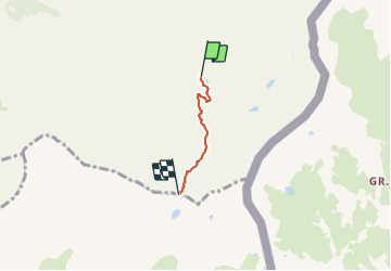

13,1 km | 23 km-effort

Usuario


Aplicación GPS de excursión GRATIS
 SityTrail
IGN / Institutos geográficos
SityTrail World
El mundo es suyo
Ruta Senderismo de 2,3 km a descubrir en Provenza-Alpes-Costa Azul, Altos Alpes, Saint-Véran. Esta ruta ha sido propuesta por astro45.
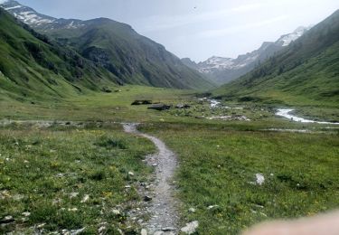
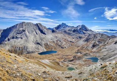
Montée au col de la Noire depuis le refuge de la Blanche.
Belle vue sur le lac de la Noire.
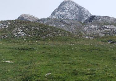
Possibilité de monter au Pic de la Farneiréta.


Senderismo
Senderismo

Senderismo

Senderismo

Senderismo

Senderismo
Senderismo
Senderismo

Senderismo