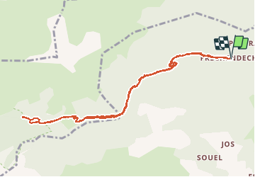
![](/images/other/stat-length.png)
![Excursión Senderismo Sentein - Chapelle de l'Isard - Photo](https://media.geolcdn.com/t/1900/400/bcce5884-5763-4071-85df-dc0701096c24.jpg&format=pjpeg&maxdim=2)
Chapelle de l'Isard
GuyVachet
Usuario
![Longitud](/images/other/stat-length.png)
![Altitud máxima](https://static1.geolcdn.com/siteimages/upload/files/1508320355ic_sort_altitude_max_24dp.png)
![Desnivel positivo](https://static1.geolcdn.com/siteimages/upload/files/1508320355ic_sort_den_pos_24dp.png)
![Km-Effort](/images/other/stat-length.png)
![Altitud mínima](https://static1.geolcdn.com/siteimages/upload/files/1508320355ic_sort_altitude_min_24dp.png)
![Desnivel negativo](https://static1.geolcdn.com/siteimages/upload/files/1508320355ic_sort_den_neg_24dp.png)
![Boucle](https://static1.geolcdn.com/siteimages/upload/files/16400158638029165_repeat_loop_refresh_sync_direction_icon.png)
![Senderismo](https://static1.geolcdn.com/sitytour/trail-icons/101.png)
8h00
Dificultad : Medio
![Escanee este código QR para abrir la excursión en la aplicación SityTrail](https://capi.geolives.com/qq0zvz2zws4bq2lad0pu/sitytour/trails/2505986/qr.png?size=200)
Aplicación GPS de excursión GRATIS
A propósito
Ruta Senderismo de 12,4 km a descubrir en Occitania, Ariège, Sentein. Esta ruta ha sido propuesta por GuyVachet.
Descripción
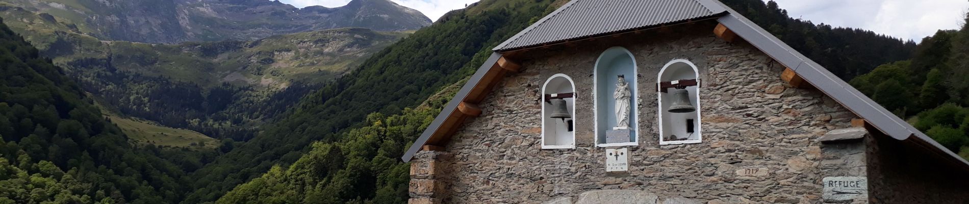
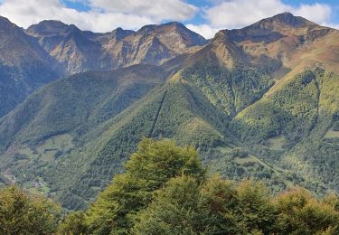
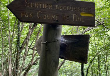
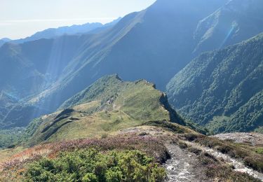
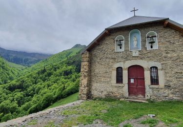
Aller-Retour pour la chapelle de l’Izard et en montant un peu plus haut, la sapinière et le ruisseau de la réserve biologique. L'itinéraire très rapidement en forêt rejoint le GR de Pays Tour du Biros en remontant l'Isard. Le sentier bien marqué est sans difficulté car il reste large la plupart du temps ce qui permet de s'affranchir du devers. La chapelle en cours de restauration est située en sortie de forêt et il est intéressant de poursuivre un peu pour remonter le cours du ruisseau jusqu'à une petite cascade à condition d'être équipé pour marcher dans l'eau et entre les rochers. Retour par le même itinéraire.
Localización
Comentarios
Excursiones cerca
![Excursión Senderismo Sentein - M008-Frechendech à Etang ARAING - Photo](https://media.geolcdn.com/t/375/260/ext.jpg?maxdim=2&url=https%3A%2F%2Fstatic1.geolcdn.com%2Fsiteimages%2Fupload%2Ffiles%2F1553511878bg_sport_marche.png)
![Senderismo Senderismo](https://static1.geolcdn.com/sitytour/trail-icons/101.png)
Senderismo
![](/images/other/stat-length.png)
![](https://static1.geolcdn.com/siteimages/upload/files/16400158638029165_repeat_loop_refresh_sync_direction_icon.png)
![Excursión Senderismo Sentein - Araing Crabère - Photo](https://media.geolcdn.com/t/375/260/ext.jpg?maxdim=2&url=https%3A%2F%2Fstatic1.geolcdn.com%2Fsiteimages%2Fupload%2Ffiles%2F1553511878bg_sport_marche.png)
![Senderismo Senderismo](https://static1.geolcdn.com/sitytour/trail-icons/101.png)
Senderismo
![](/images/other/stat-length.png)
![](https://static1.geolcdn.com/siteimages/upload/files/16400158638029165_repeat_loop_refresh_sync_direction_icon.png)
![Excursión Senderismo Bonac-Irazein - Pic de Courbayran et cabane de Roques - Photo](https://media.geolcdn.com/t/375/260/aea92664-82b8-439f-8945-426d5859ad83.jpg&format=jpg&maxdim=2)
![Senderismo Senderismo](https://static1.geolcdn.com/sitytour/trail-icons/101.png)
Senderismo
![](/images/other/stat-length.png)
![](https://static1.geolcdn.com/siteimages/upload/files/16400158638029165_repeat_loop_refresh_sync_direction_icon.png)
![Excursión Senderismo Bonac-Irazein - tunnels du Biros ou sentier Decauville - Photo](https://media.geolcdn.com/t/375/260/2ced53d3-2fbe-4fc5-97f5-bde97ee00210.jpg&format=jpg&maxdim=2)
![Senderismo Senderismo](https://static1.geolcdn.com/sitytour/trail-icons/101.png)
Senderismo
![](/images/other/stat-length.png)
![](https://static1.geolcdn.com/siteimages/upload/files/16400158638029165_repeat_loop_refresh_sync_direction_icon.png)
![Excursión Senderismo Bonac-Irazein - Sentier du port d’Orle - col du Tuc - Photo](https://media.geolcdn.com/t/375/260/74662a78-0f2f-48cd-8c55-5df1361685fc.jpg&format=jpg&maxdim=2)
![Senderismo Senderismo](https://static1.geolcdn.com/sitytour/trail-icons/101.png)
Senderismo
![](/images/other/stat-length.png)
![](https://static1.geolcdn.com/siteimages/upload/files/16400158638029165_repeat_loop_refresh_sync_direction_icon.png)
![Excursión Senderismo Sentein - 2022 TRANSPYRÉNÉEN :l’Etand d’Araing -Eylie le haut. - Photo](https://media.geolcdn.com/t/375/260/921982b0-b1e6-43fb-bc0c-df86f0ecf11d.jpg&format=jpg&maxdim=2)
![Senderismo Senderismo](https://static1.geolcdn.com/sitytour/trail-icons/101.png)
Senderismo
![](/images/other/stat-length.png)
![](https://static1.geolcdn.com/siteimages/upload/files/16400158638029165_repeat_loop_refresh_sync_direction_icon.png)
![Excursión Senderismo Balacet - Pic de l'Arraing - Photo](https://media.geolcdn.com/t/375/260/d786b34b-d7df-4e3d-872e-cbcf51d1d34e.jpg&format=jpg&maxdim=2)
![Senderismo Senderismo](https://static1.geolcdn.com/sitytour/trail-icons/101.png)
Senderismo
![](/images/other/stat-length.png)
![](https://static1.geolcdn.com/siteimages/upload/files/16400158638029165_repeat_loop_refresh_sync_direction_icon.png)
![Excursión Senderismo Sentein - Cabane d'Illau et chapelle de l'izard - Photo](https://media.geolcdn.com/t/375/260/c0706c8c-fa40-4518-8b57-65ce31db604f.jpg&format=jpg&maxdim=2)
![Senderismo Senderismo](https://static1.geolcdn.com/sitytour/trail-icons/101.png)
Senderismo
![](/images/other/stat-length.png)
![](https://static1.geolcdn.com/siteimages/upload/files/16400158638029165_repeat_loop_refresh_sync_direction_icon.png)
![Excursión Senderismo Antras - Le tour du Mail des Morères - Photo](https://media.geolcdn.com/t/375/260/ext.jpg?maxdim=2&url=https%3A%2F%2Fstatic1.geolcdn.com%2Fsiteimages%2Fupload%2Ffiles%2F1553511878bg_sport_marche.png)
![Senderismo Senderismo](https://static1.geolcdn.com/sitytour/trail-icons/101.png)
Senderismo
![](/images/other/stat-length.png)
![](https://static1.geolcdn.com/siteimages/upload/files/16400158638029165_repeat_loop_refresh_sync_direction_icon.png)