![](/images/other/stat-length.png)
![Excursión Senderismo Bethmale - etang d'Ayes - Photo](https://media.geolcdn.com/t/1900/400/052267e9-e4cc-421b-a8f2-94488e79f75e.jpg&format=pjpeg&maxdim=2)
etang d'Ayes
GuyVachet
Usuario
![Longitud](/images/other/stat-length.png)
![Altitud máxima](https://static1.geolcdn.com/siteimages/upload/files/1508320355ic_sort_altitude_max_24dp.png)
![Desnivel positivo](https://static1.geolcdn.com/siteimages/upload/files/1508320355ic_sort_den_pos_24dp.png)
![Km-Effort](/images/other/stat-length.png)
![Altitud mínima](https://static1.geolcdn.com/siteimages/upload/files/1508320355ic_sort_altitude_min_24dp.png)
![Desnivel negativo](https://static1.geolcdn.com/siteimages/upload/files/1508320355ic_sort_den_neg_24dp.png)
![Boucle](https://static1.geolcdn.com/siteimages/upload/files/16400158638029165_repeat_loop_refresh_sync_direction_icon.png)
![Senderismo](https://static1.geolcdn.com/sitytour/trail-icons/101.png)
6h49
Dificultad : Medio
![Escanee este código QR para abrir la excursión en la aplicación SityTrail](https://capi.geolives.com/qq0zvz2zws4bq2lad0pu/sitytour/trails/2504990/qr.png?size=200)
Aplicación GPS de excursión GRATIS
A propósito
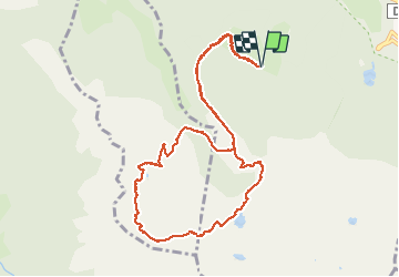
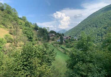
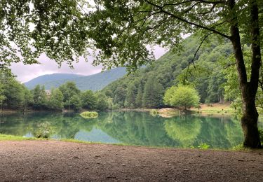
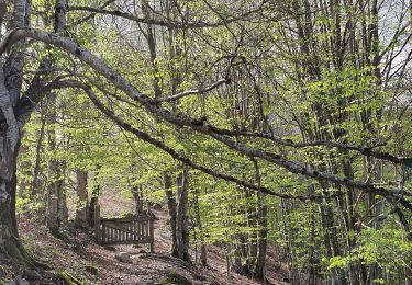
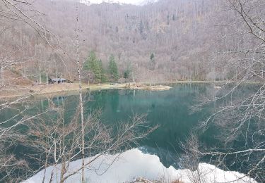
Ruta Senderismo de 11,6 km a descubrir en Occitania, Ariège, Bethmale. Esta ruta ha sido propuesta por GuyVachet.
Descripción
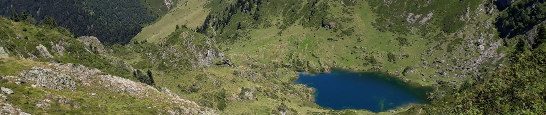
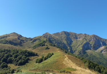
Boucle sous le Pic de Crabère dans la forêt de Bethmale par le cirque de Campuls et retour par l’étang d’Ayes. Au début, l’itinéraire emprunte une large piste forestière jusqu’à la Cabane de Campuls et à partir de là, il devient plus sauvage avec un sentier peu marqué mais sans difficulté notable d’orientation. Dans cette partie, aux alentours de l’étang d’Estagnot, des troupeaux de vaches de la race Ariègeoise et des chevaux de Mérens peuvent être rencontrés : il s’agit alors de faire preuve d’un minimum de respect. Au pied du Pic de Crabère, le sentier retrouve le GR 10 pour redescendre à l’étang bien couru d’Ayes. La descente se poursuit jusqu’à la piste forestière empruntée au début.
Localización
Comentarios
Excursiones cerca
![Excursión Senderismo Arrien-en-Bethmale - Les granges de la Serre depuis Tournac-La Bouche. - Photo](https://media.geolcdn.com/t/375/260/00f09377-3bad-4290-954b-9b185ed107d2.jpg&format=jpg&maxdim=2)
![Senderismo Senderismo](https://static1.geolcdn.com/sitytour/trail-icons/101.png)
Senderismo
![](/images/other/stat-length.png)
![](https://static1.geolcdn.com/siteimages/upload/files/16400158638029165_repeat_loop_refresh_sync_direction_icon.png)
![Excursión Senderismo Bethmale - Bethmale - Photo](https://media.geolcdn.com/t/375/260/ext.jpg?maxdim=2&url=https%3A%2F%2Fservices.sitytrail.com%2FGeolivesWS%2FDownloadMedia.ashx%3FTrailID%3D205667%26Media%3Dfix__20130713122146.jpg)
![Senderismo Senderismo](https://static1.geolcdn.com/sitytour/trail-icons/101.png)
Senderismo
![](/images/other/stat-length.png)
![](https://static1.geolcdn.com/siteimages/upload/files/16400158638029165_repeat_loop_refresh_sync_direction_icon.png)
![Excursión Senderismo Bethmale - Circuit des cinq étangs (2237m) - Photo](https://media.geolcdn.com/t/375/260/ext.jpg?maxdim=2&url=https%3A%2F%2Fstatic1.geolcdn.com%2Fsiteimages%2Fupload%2Ffiles%2F1553511878bg_sport_marche.png)
![Senderismo Senderismo](https://static1.geolcdn.com/sitytour/trail-icons/101.png)
Senderismo
![](/images/other/stat-length.png)
![](https://static1.geolcdn.com/siteimages/upload/files/16400158638029165_repeat_loop_refresh_sync_direction_icon.png)
![Excursión Senderismo Bethmale - Cap de Bouirex - Photo](https://media.geolcdn.com/t/375/260/cd5f9d82-9db3-4878-a9ba-18a6e8856ce6.jpg&format=jpg&maxdim=2)
![Senderismo Senderismo](https://static1.geolcdn.com/sitytour/trail-icons/101.png)
Senderismo
![](/images/other/stat-length.png)
![](https://static1.geolcdn.com/siteimages/upload/files/16400158638029165_repeat_loop_refresh_sync_direction_icon.png)
![Excursión Senderismo Bordes-Uchentein - 2022 TRANSPYRÉNÉENNE - refuge du Valier -refuge d’Esbints - Photo](https://media.geolcdn.com/t/375/260/2e9343d2-a60c-4833-91b2-9c5dc0d9f716.jpg&format=jpg&maxdim=2)
![Senderismo Senderismo](https://static1.geolcdn.com/sitytour/trail-icons/101.png)
Senderismo
![](/images/other/stat-length.png)
![](https://static1.geolcdn.com/siteimages/upload/files/16400158638029165_repeat_loop_refresh_sync_direction_icon.png)
![Excursión Senderismo Bethmale - Col de la core - Photo](https://media.geolcdn.com/t/375/260/4994e3ec-bda9-4da3-924c-fcb0e68be84a.jpg&format=jpg&maxdim=2)
![Senderismo Senderismo](https://static1.geolcdn.com/sitytour/trail-icons/101.png)
Senderismo
![](/images/other/stat-length.png)
![](https://static1.geolcdn.com/siteimages/upload/files/16400158638029165_repeat_loop_refresh_sync_direction_icon.png)
![Excursión Senderismo Arrien-en-Bethmale - Les granges de la Serre depuis Tournac-Bouche. - Photo](https://media.geolcdn.com/t/375/260/7b3650fc-9802-48da-85b6-ffe6fc31c745.jpg&format=jpg&maxdim=2)
![Senderismo Senderismo](https://static1.geolcdn.com/sitytour/trail-icons/101.png)
Senderismo
![](/images/other/stat-length.png)
![](https://static1.geolcdn.com/siteimages/upload/files/16400158638029165_repeat_loop_refresh_sync_direction_icon.png)
![Excursión A pie Bordes-Uchentein - Étangs Long et Rond - Photo](https://media.geolcdn.com/t/375/260/a3cac1de-06a6-41d0-ac66-ed9400aa294d.jpeg&format=jpg&maxdim=2)
![A pie A pie](https://static1.geolcdn.com/sitytour/trail-icons/100.png)
A pie
![](/images/other/stat-length.png)
![](https://static1.geolcdn.com/siteimages/upload/files/16400158638029165_repeat_loop_refresh_sync_direction_icon.png)
![Excursión Senderismo Bethmale - refuge Salvador - Photo](https://media.geolcdn.com/t/375/260/41221468-6f9e-4614-8cc9-9cc4dfd6562d.jpg&format=jpg&maxdim=2)
![Senderismo Senderismo](https://static1.geolcdn.com/sitytour/trail-icons/101.png)
Senderismo
![](/images/other/stat-length.png)
![](https://static1.geolcdn.com/siteimages/upload/files/16400158638029165_repeat_loop_refresh_sync_direction_icon.png)