![](/images/other/stat-length.png)
![Excursión Senderismo Ieper - ypres 17 km - Photo](https://media.geolcdn.com/t/1900/400/ext.pjpeg?maxdim=2&url=https%3A%2F%2Fstatic1.geolcdn.com%2Fsiteimages%2Fupload%2Ffiles%2F1553511878bg_sport_marche.png)
ypres 17 km
rvapeldo
Usuario GUIDE
![Longitud](/images/other/stat-length.png)
Longitud
17,3 km
![Altitud máxima](https://static1.geolcdn.com/siteimages/upload/files/1508320355ic_sort_altitude_max_24dp.png)
Altitud máxima
67 m
![Desnivel positivo](https://static1.geolcdn.com/siteimages/upload/files/1508320355ic_sort_den_pos_24dp.png)
Desnivel positivo
168 m
![Km-Effort](/images/other/stat-length.png)
Km-Effort
19,5 km
![Altitud mínima](https://static1.geolcdn.com/siteimages/upload/files/1508320355ic_sort_altitude_min_24dp.png)
Altitud mínima
22 m
![Desnivel negativo](https://static1.geolcdn.com/siteimages/upload/files/1508320355ic_sort_den_neg_24dp.png)
Desnivel negativo
168 m
![Boucle](https://static1.geolcdn.com/siteimages/upload/files/16400158638029165_repeat_loop_refresh_sync_direction_icon.png)
Boucle
Sí
Fecha de creación :
2018-10-06 08:31:47.604
Última modificación :
2018-10-06 08:31:47.662
![Senderismo](https://static1.geolcdn.com/sitytour/trail-icons/101.png)
4h15
Dificultad : Muy fácil
![Escanee este código QR para abrir la excursión en la aplicación SityTrail](https://capi.geolives.com/qq0zvz2zws4bq2lad0pu/sitytour/trails/246482/qr.png?size=200)
Aplicación GPS de excursión GRATIS
A propósito
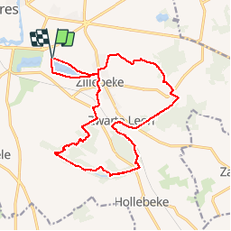
Ruta Senderismo de 17,3 km a descubrir en Flandes, Flandes Occidental, Ieper. Esta ruta ha sido propuesta por rvapeldo.
Descripción
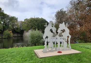
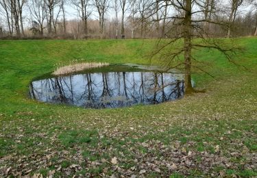
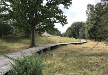
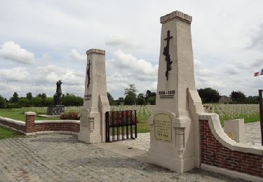
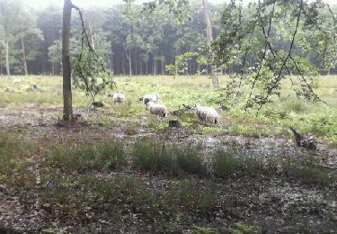
Balade au sud d'Ypres, dans des zones boisées, des collines légères et à travers quelques hauts lieux de la 1ère guerre mondiale (cimetières du Commenwealth, Cote 60 et 62).
Localización
País:
Belgium
Región :
Flandes
Departamento/provincia :
Flandes Occidental
Municipio :
Ieper
Localidad:
Ieper
Salida:(Dec)
Salida:(UTM)
493280 ; 5632058 (31U) N.
Comentarios
Excursiones cerca
![Excursión Senderismo Ieper - ypres- moitié des remparts - Photo](https://media.geolcdn.com/t/375/260/23ddc9d7-073a-4187-ba47-caf2213ec756.jpg&format=jpg&maxdim=2)
![Senderismo Senderismo](https://static1.geolcdn.com/sitytour/trail-icons/101.png)
ypres- moitié des remparts
Senderismo
Muy fácil
Ieper,
Flandes,
Flandes Occidental,
Belgium
![](/images/other/stat-length.png)
3,3 km | 3,6 km-effort
1h 9min
![](https://static1.geolcdn.com/siteimages/upload/files/16400158638029165_repeat_loop_refresh_sync_direction_icon.png)
No
![Excursión Senderismo Ieper - Palingbeek courte 8,4 - Photo](https://media.geolcdn.com/t/375/260/06feb11b-e53d-43cb-82a4-ec428dfd2584.jpg&format=jpg&maxdim=2)
![Senderismo Senderismo](https://static1.geolcdn.com/sitytour/trail-icons/101.png)
Palingbeek courte 8,4
Senderismo
Medio
(1)
Ieper,
Flandes,
Flandes Occidental,
Belgium
![](/images/other/stat-length.png)
8,2 km | 9,4 km-effort
1h 59min
![](https://static1.geolcdn.com/siteimages/upload/files/16400158638029165_repeat_loop_refresh_sync_direction_icon.png)
Sí
![Excursión Senderismo Ieper - Ypres Zillebeke vijver 17 km - Photo](https://media.geolcdn.com/t/375/260/04485afd-960b-4696-ac08-8378b35826a9.jpg&format=jpg&maxdim=2)
![Senderismo Senderismo](https://static1.geolcdn.com/sitytour/trail-icons/101.png)
Ypres Zillebeke vijver 17 km
Senderismo
Fácil
Ieper,
Flandes,
Flandes Occidental,
Belgium
![](/images/other/stat-length.png)
17,3 km | 19,7 km-effort
4h 34min
![](https://static1.geolcdn.com/siteimages/upload/files/16400158638029165_repeat_loop_refresh_sync_direction_icon.png)
Sí
![Excursión Senderismo Ieper - Ypres Yper 19 km - Photo](https://media.geolcdn.com/t/375/260/ext.jpg?maxdim=2&url=https%3A%2F%2Fservices.sitytrail.com%2FGeolivesWS%2FDownloadMedia.ashx%3FTrailID%3D1082648%26Media%3D20181209152922.jpg)
![Senderismo Senderismo](https://static1.geolcdn.com/sitytour/trail-icons/101.png)
Ypres Yper 19 km
Senderismo
Muy fácil
Ieper,
Flandes,
Flandes Occidental,
Belgium
![](/images/other/stat-length.png)
20 km | 22 km-effort
5h 4min
![](https://static1.geolcdn.com/siteimages/upload/files/16400158638029165_repeat_loop_refresh_sync_direction_icon.png)
Sí
![Excursión Motor Ieper - Eerste Wereldoorlog rond Ieper - Photo](https://media.geolcdn.com/t/375/260/ext.jpg?maxdim=2&url=https%3A%2F%2Fservices.sitytrail.com%2FGeolivesWS%2FDownloadMedia.ashx%3FTrailID%3D243034%26Media%3D9c182fe9-1bd5-41e5-8222-cea0f51d33d0.jpg)
![Motor Motor](https://static1.geolcdn.com/sitytour/trail-icons/400.png)
Eerste Wereldoorlog rond Ieper
Motor
Fácil
Ieper,
Flandes,
Flandes Occidental,
Belgium
![](/images/other/stat-length.png)
29 km | 31 km-effort
2h 0min
![](https://static1.geolcdn.com/siteimages/upload/files/16400158638029165_repeat_loop_refresh_sync_direction_icon.png)
Sí
![Excursión Carrera Ieper - gasthuisbossen - Photo](https://media.geolcdn.com/t/375/260/ext.jpg?maxdim=2&url=https%3A%2F%2Fservices.sitytrail.com%2FGeolivesWS%2FDownloadMedia.ashx%3FTrailID%3D199917%26Media%3D20130623101720.jpeg)
![Carrera Carrera](https://static1.geolcdn.com/sitytour/trail-icons/103.png)
gasthuisbossen
Carrera
Fácil
Ieper,
Flandes,
Flandes Occidental,
Belgium
![](/images/other/stat-length.png)
14,6 km | 17,2 km-effort
1h 27min
![](https://static1.geolcdn.com/siteimages/upload/files/16400158638029165_repeat_loop_refresh_sync_direction_icon.png)
Sí
![Excursión Senderismo Ieper - palingbeek 8.5km - Photo](https://media.geolcdn.com/t/375/260/8d9f189a-dff3-4658-8e25-4f99f6f79b94.jpg&format=jpg&maxdim=2)
![Senderismo Senderismo](https://static1.geolcdn.com/sitytour/trail-icons/101.png)
palingbeek 8.5km
Senderismo
Medio
Ieper,
Flandes,
Flandes Occidental,
Belgium
![](/images/other/stat-length.png)
8,6 km | 9,8 km-effort
2h 53min
![](https://static1.geolcdn.com/siteimages/upload/files/16400158638029165_repeat_loop_refresh_sync_direction_icon.png)
Sí
![Excursión Senderismo Ieper - piste synder - Photo](https://media.geolcdn.com/t/375/260/ext.jpg?maxdim=2&url=https%3A%2F%2Fstatic1.geolcdn.com%2Fsiteimages%2Fupload%2Ffiles%2F1553511878bg_sport_marche.png)
![Senderismo Senderismo](https://static1.geolcdn.com/sitytour/trail-icons/101.png)
piste synder
Senderismo
Fácil
(1)
Ieper,
Flandes,
Flandes Occidental,
Belgium
![](/images/other/stat-length.png)
1,5 km | 1,8 km-effort
29min
![](https://static1.geolcdn.com/siteimages/upload/files/16400158638029165_repeat_loop_refresh_sync_direction_icon.png)
Sí
![Excursión Senderismo Ieper - Oudevaartroute - Photo](https://media.geolcdn.com/t/375/260/67cadf35-30ae-42d7-9fcb-5ea58e83f547.jpg&format=jpg&maxdim=2)
![Senderismo Senderismo](https://static1.geolcdn.com/sitytour/trail-icons/101.png)
Oudevaartroute
Senderismo
Muy fácil
(1)
Ieper,
Flandes,
Flandes Occidental,
Belgium
![](/images/other/stat-length.png)
7 km | 7,6 km-effort
1h 58min
![](https://static1.geolcdn.com/siteimages/upload/files/16400158638029165_repeat_loop_refresh_sync_direction_icon.png)
Sí