![](/images/other/stat-length.png)
![Excursión Senderismo Sixt-Fer-à-Cheval - chalet du Trot - Photo](https://media.geolcdn.com/t/1900/400/ext.pjpeg?maxdim=2&url=https%3A%2F%2Fstatic1.geolcdn.com%2Fsiteimages%2Fupload%2Ffiles%2F1553511878bg_sport_marche.png)
chalet du Trot
pensionisten71
Usuario
![Longitud](/images/other/stat-length.png)
Longitud
10,9 km
![Altitud máxima](https://static1.geolcdn.com/siteimages/upload/files/1508320355ic_sort_altitude_max_24dp.png)
Altitud máxima
1611 m
![Desnivel positivo](https://static1.geolcdn.com/siteimages/upload/files/1508320355ic_sort_den_pos_24dp.png)
Desnivel positivo
760 m
![Km-Effort](/images/other/stat-length.png)
Km-Effort
21 km
![Altitud mínima](https://static1.geolcdn.com/siteimages/upload/files/1508320355ic_sort_altitude_min_24dp.png)
Altitud mínima
970 m
![Desnivel negativo](https://static1.geolcdn.com/siteimages/upload/files/1508320355ic_sort_den_neg_24dp.png)
Desnivel negativo
761 m
![Boucle](https://static1.geolcdn.com/siteimages/upload/files/16400158638029165_repeat_loop_refresh_sync_direction_icon.png)
Boucle
Sí
Fecha de creación :
2020-06-30 07:15:24.066
Última modificación :
2020-06-30 14:34:21.498
![Senderismo](https://static1.geolcdn.com/sitytour/trail-icons/101.png)
5h39
Dificultad : Medio
![Escanee este código QR para abrir la excursión en la aplicación SityTrail](https://capi.geolives.com/qq0zvz2zws4bq2lad0pu/sitytour/trails/2456377/qr.png?size=200)
Aplicación GPS de excursión GRATIS
A propósito
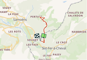
Ruta Senderismo de 10,9 km a descubrir en Auvergne-Rhône-Alpes, Alta Saboya, Sixt-Fer-à-Cheval. Esta ruta ha sido propuesta por pensionisten71.
Descripción
tracé de Gérald
on peut suivre le chemin de l'aller ou passer dans les alpages (terrain en dévers)
Localización
País:
France
Región :
Auvergne-Rhône-Alpes
Departamento/provincia :
Alta Saboya
Municipio :
Sixt-Fer-à-Cheval
Localidad:
Unknown
Salida:(Dec)
Salida:(UTM)
326462 ; 5103353 (32T) N.
Comentarios
Excursiones cerca
![Excursión Senderismo Sixt-Fer-à-Cheval - Lac d'Anterne - Photo](https://media.geolcdn.com/t/375/260/ext.jpg?maxdim=2&url=https%3A%2F%2Fservices.sitytrail.com%2FGeolivesWS%2FDownloadMedia.ashx%3FTrailID%3D219373%26Media%3Dfix__20130905155735.jpg)
![Senderismo Senderismo](https://static1.geolcdn.com/sitytour/trail-icons/101.png)
Lac d'Anterne
Senderismo
Medio
(1)
Sixt-Fer-à-Cheval,
Auvergne-Rhône-Alpes,
Alta Saboya,
France
![](/images/other/stat-length.png)
19,8 km | 37 km-effort
5h 9min
![](https://static1.geolcdn.com/siteimages/upload/files/16400158638029165_repeat_loop_refresh_sync_direction_icon.png)
Sí
![Excursión Senderismo Samoëns - Lac de Gers - Photo](https://media.geolcdn.com/t/375/260/4f8c7a90-c8a6-4a64-bc22-de3fbc680b52.jpg&format=jpg&maxdim=2)
![Senderismo Senderismo](https://static1.geolcdn.com/sitytour/trail-icons/101.png)
Lac de Gers
Senderismo
Fácil
(1)
Samoëns,
Auvergne-Rhône-Alpes,
Alta Saboya,
France
![](/images/other/stat-length.png)
6,7 km | 11,7 km-effort
2h 39min
![](https://static1.geolcdn.com/siteimages/upload/files/16400158638029165_repeat_loop_refresh_sync_direction_icon.png)
No
![Excursión Senderismo Samoëns - Samoens . gorges des tines - retour - Photo](https://media.geolcdn.com/t/375/260/9ca94656-f570-41a8-90f6-cc5f5e98fa82.jpg&format=jpg&maxdim=2)
![Senderismo Senderismo](https://static1.geolcdn.com/sitytour/trail-icons/101.png)
Samoens . gorges des tines - retour
Senderismo
Muy fácil
Samoëns,
Auvergne-Rhône-Alpes,
Alta Saboya,
France
![](/images/other/stat-length.png)
9,6 km | 12,9 km-effort
4h 1min
![](https://static1.geolcdn.com/siteimages/upload/files/16400158638029165_repeat_loop_refresh_sync_direction_icon.png)
Sí
![Excursión Senderismo Sixt-Fer-à-Cheval - Gorges des Tines - Gers - Samoens - Photo](https://media.geolcdn.com/t/375/260/62d4f53d-e161-4e86-b37e-5afda26819a6.jpg&format=jpg&maxdim=2)
![Senderismo Senderismo](https://static1.geolcdn.com/sitytour/trail-icons/101.png)
Gorges des Tines - Gers - Samoens
Senderismo
Difícil
(1)
Sixt-Fer-à-Cheval,
Auvergne-Rhône-Alpes,
Alta Saboya,
France
![](/images/other/stat-length.png)
18,6 km | 33 km-effort
5h 52min
![](https://static1.geolcdn.com/siteimages/upload/files/16400158638029165_repeat_loop_refresh_sync_direction_icon.png)
Sí
![Excursión Senderismo Sixt-Fer-à-Cheval - 2020-08-15 Marche Refuge Grenairon Le Mont Buet Les Fonts Salvagny - Photo](https://media.geolcdn.com/t/375/260/e7db8eb5-0ce5-4100-b4bb-95b4993ccdfd.jpg&format=jpg&maxdim=2)
![Senderismo Senderismo](https://static1.geolcdn.com/sitytour/trail-icons/101.png)
2020-08-15 Marche Refuge Grenairon Le Mont Buet Les Fonts Salvagny
Senderismo
Muy fácil
Sixt-Fer-à-Cheval,
Auvergne-Rhône-Alpes,
Alta Saboya,
France
![](/images/other/stat-length.png)
20 km | 40 km-effort
12h 24min
![](https://static1.geolcdn.com/siteimages/upload/files/16400158638029165_repeat_loop_refresh_sync_direction_icon.png)
No
![Excursión Senderismo Sixt-Fer-à-Cheval - J9GR5Nord - Photo](https://media.geolcdn.com/t/375/260/425bb134-0523-4921-89e1-6ba98a367abc.jpg&format=jpg&maxdim=2)
![Senderismo Senderismo](https://static1.geolcdn.com/sitytour/trail-icons/101.png)
J9GR5Nord
Senderismo
Muy difícil
Sixt-Fer-à-Cheval,
Auvergne-Rhône-Alpes,
Alta Saboya,
France
![](/images/other/stat-length.png)
16,8 km | 29 km-effort
6h 36min
![](https://static1.geolcdn.com/siteimages/upload/files/16400158638029165_repeat_loop_refresh_sync_direction_icon.png)
No
![Excursión Senderismo Sixt-Fer-à-Cheval - SIXT PASSY RESERVE: CHALETS DE SALES 2 - Photo](https://media.geolcdn.com/t/375/260/8dd95f56-4f3c-4299-950f-2399bed8a605.jpg&format=jpg&maxdim=2)
![Senderismo Senderismo](https://static1.geolcdn.com/sitytour/trail-icons/101.png)
SIXT PASSY RESERVE: CHALETS DE SALES 2
Senderismo
Medio
Sixt-Fer-à-Cheval,
Auvergne-Rhône-Alpes,
Alta Saboya,
France
![](/images/other/stat-length.png)
11,5 km | 21 km-effort
4h 50min
![](https://static1.geolcdn.com/siteimages/upload/files/16400158638029165_repeat_loop_refresh_sync_direction_icon.png)
Sí
![Excursión Senderismo Samoëns - les chalets du Bémont et cascade du Nant d Ant - Photo](https://media.geolcdn.com/t/375/260/70ac3ce4-77a9-4b40-b9e3-5a1ff6333052.jpg&format=jpg&maxdim=2)
![Senderismo Senderismo](https://static1.geolcdn.com/sitytour/trail-icons/101.png)
les chalets du Bémont et cascade du Nant d Ant
Senderismo
Medio
Samoëns,
Auvergne-Rhône-Alpes,
Alta Saboya,
France
![](/images/other/stat-length.png)
6,7 km | 10,5 km-effort
2h 10min
![](https://static1.geolcdn.com/siteimages/upload/files/16400158638029165_repeat_loop_refresh_sync_direction_icon.png)
No
![Excursión Senderismo Sixt-Fer-à-Cheval - SIXT PASSY RESERVE: LE BUET MONTEE VIA GRENAIRON - RETOUR PAR LES FONDS - Photo](https://media.geolcdn.com/t/375/260/37ee0cc7-a301-4565-b950-3c9eefd63255.jpg&format=jpg&maxdim=2)
![Senderismo Senderismo](https://static1.geolcdn.com/sitytour/trail-icons/101.png)
SIXT PASSY RESERVE: LE BUET MONTEE VIA GRENAIRON - RETOUR PAR LES FONDS
Senderismo
Muy difícil
Sixt-Fer-à-Cheval,
Auvergne-Rhône-Alpes,
Alta Saboya,
France
![](/images/other/stat-length.png)
26 km | 56 km-effort
8h 42min
![](https://static1.geolcdn.com/siteimages/upload/files/16400158638029165_repeat_loop_refresh_sync_direction_icon.png)
Sí