![](/images/other/stat-length.png)
![Excursión Senderismo Plaintel - Au bois des Mauriers. N 2 - Photo](https://media.geolcdn.com/t/1900/400/fbcf397a-65ed-44d6-9dc4-de1ae1163b15.jpg&format=pjpeg&maxdim=2)
Au bois des Mauriers. N 2
Alphe
Usuario
![Longitud](/images/other/stat-length.png)
![Altitud máxima](https://static1.geolcdn.com/siteimages/upload/files/1508320355ic_sort_altitude_max_24dp.png)
![Desnivel positivo](https://static1.geolcdn.com/siteimages/upload/files/1508320355ic_sort_den_pos_24dp.png)
![Km-Effort](/images/other/stat-length.png)
![Altitud mínima](https://static1.geolcdn.com/siteimages/upload/files/1508320355ic_sort_altitude_min_24dp.png)
![Desnivel negativo](https://static1.geolcdn.com/siteimages/upload/files/1508320355ic_sort_den_neg_24dp.png)
![Boucle](https://static1.geolcdn.com/siteimages/upload/files/16400158638029165_repeat_loop_refresh_sync_direction_icon.png)
![Senderismo](https://static1.geolcdn.com/sitytour/trail-icons/101.png)
1h55
Dificultad : Medio
![Escanee este código QR para abrir la excursión en la aplicación SityTrail](https://capi.geolives.com/qq0zvz2zws4bq2lad0pu/sitytour/trails/2445786/qr.png?size=200)
Aplicación GPS de excursión GRATIS
A propósito
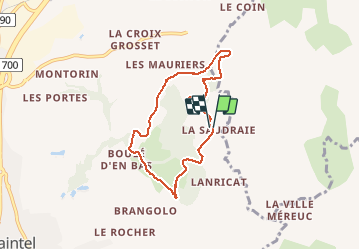
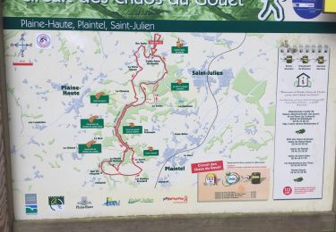
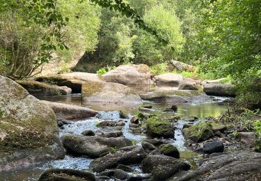
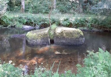
Ruta Senderismo de 6,5 km a descubrir en Bretaña, Côtes-d'Armor, Plaintel. Esta ruta ha sido propuesta por Alphe.
Descripción
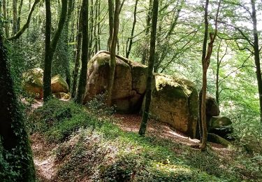
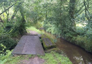
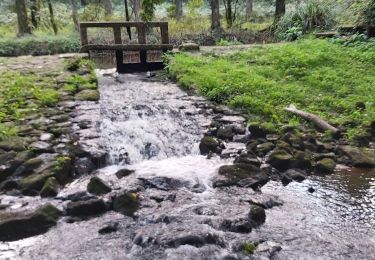
Au lavoir du Saudrais prendre le chemin qui mène au bois. Tout droit pendant 20 min( ne prendre aucun sentier à droite), en bas d'une descente prendre en épingle à droite jusqu'au panneau ch'min du pas d'Berbis et continuer en longeant le ruisseau jusque un large pont a traverser, puis nous arrivons sur une route, sur la droite puis traverser un village et prendre plus loin un chemin a droite qui mène a Quartier Chanet.(le ch'min d'la mare es laeups). Traverser le village et continuer par la route jusqu'à Beaumenard, après la première maison tourner à droite et continuer jusqu'au bois. suivre jusque sur le moulin et prendre de suite a gauche vers le Rocher de Margot, ensuite au panneau Chemin des fées tourner a gauche et continuer tout droit jusque là Saudrais.
Localización
Comentarios
Excursiones cerca
![Excursión Senderismo Plédran - En suivant l'URNE et en passant par le BOIS. - Photo](https://media.geolcdn.com/t/375/260/6ac5e845-12d0-4dac-9210-e8525380a84b.jpg&format=jpg&maxdim=2)
![Senderismo Senderismo](https://static1.geolcdn.com/sitytour/trail-icons/101.png)
Senderismo
![](/images/other/stat-length.png)
![](https://static1.geolcdn.com/siteimages/upload/files/16400158638029165_repeat_loop_refresh_sync_direction_icon.png)
![Excursión Cicloturismo Saint-Carreuc - 4 étapes en Bretagne à vélo - Photo](https://media.geolcdn.com/t/375/260/b73d1ea1-a210-439a-a2e4-05e8d782bfa8.jpg&format=jpg&maxdim=2)
![Cicloturismo Cicloturismo](https://static1.geolcdn.com/sitytour/trail-icons/204.png)
Cicloturismo
![](/images/other/stat-length.png)
![](https://static1.geolcdn.com/siteimages/upload/files/16400158638029165_repeat_loop_refresh_sync_direction_icon.png)
![Excursión Senderismo Plaintel - Les Mauriers par le chemin des fées. - Photo](https://media.geolcdn.com/t/375/260/dbc16f7f-f074-4434-9af8-4cba226f873f.jpg&format=jpg&maxdim=2)
![Senderismo Senderismo](https://static1.geolcdn.com/sitytour/trail-icons/101.png)
Senderismo
![](/images/other/stat-length.png)
![](https://static1.geolcdn.com/siteimages/upload/files/16400158638029165_repeat_loop_refresh_sync_direction_icon.png)
![Excursión Senderismo Saint-Julien - Bretagne - Saint-Julien - Circuit du Gouët - Photo](https://media.geolcdn.com/t/375/260/f736e7c3-658a-451c-b77e-ab0a790ef18e.jpg&format=jpg&maxdim=2)
![Senderismo Senderismo](https://static1.geolcdn.com/sitytour/trail-icons/101.png)
Senderismo
![](/images/other/stat-length.png)
![](https://static1.geolcdn.com/siteimages/upload/files/16400158638029165_repeat_loop_refresh_sync_direction_icon.png)
![Excursión Carrera Saint-Carreuc - la ville mereuc 1 - Photo](https://media.geolcdn.com/t/375/260/3ad00373-fe78-4964-915b-6e653e4b8a92.jpg&format=jpg&maxdim=2)
![Carrera Carrera](https://static1.geolcdn.com/sitytour/trail-icons/103.png)
Carrera
![](/images/other/stat-length.png)
![](https://static1.geolcdn.com/siteimages/upload/files/16400158638029165_repeat_loop_refresh_sync_direction_icon.png)
![Excursión Senderismo Saint-Julien - Halos du Gouet 21/09/2022 - Photo](https://media.geolcdn.com/t/375/260/8cdf0730-97d8-47a9-a8b5-c336b6e5a271.jpg&format=jpg&maxdim=2)
![Senderismo Senderismo](https://static1.geolcdn.com/sitytour/trail-icons/101.png)
Senderismo
![](/images/other/stat-length.png)
![](https://static1.geolcdn.com/siteimages/upload/files/16400158638029165_repeat_loop_refresh_sync_direction_icon.png)
![Excursión Senderismo Plaintel - Les chaos du gouet - Photo](https://media.geolcdn.com/t/375/260/d2824241-2300-4376-8f89-0eb477b3e02c.jpg&format=jpg&maxdim=2)
![Senderismo Senderismo](https://static1.geolcdn.com/sitytour/trail-icons/101.png)
Senderismo
![](/images/other/stat-length.png)
![](https://static1.geolcdn.com/siteimages/upload/files/16400158638029165_repeat_loop_refresh_sync_direction_icon.png)
![Excursión Senderismo Saint-Julien - clos du gouet - Photo](https://media.geolcdn.com/t/375/260/735dc627-cd60-4fc7-9b7c-a109d90f1a26.jpg&format=jpg&maxdim=2)
![Senderismo Senderismo](https://static1.geolcdn.com/sitytour/trail-icons/101.png)
Senderismo
![](/images/other/stat-length.png)
![](https://static1.geolcdn.com/siteimages/upload/files/16400158638029165_repeat_loop_refresh_sync_direction_icon.png)
![Excursión Bici de montaña Plaine-Haute - chaos du gouet - Photo](https://media.geolcdn.com/t/375/260/ext.jpg?maxdim=2&url=https%3A%2F%2Fstatic1.geolcdn.com%2Fsiteimages%2Fupload%2Ffiles%2F1524743154velo.jpg)
![Bici de montaña Bici de montaña](https://static1.geolcdn.com/sitytour/trail-icons/202.png)
Bici de montaña
![](/images/other/stat-length.png)
![](https://static1.geolcdn.com/siteimages/upload/files/16400158638029165_repeat_loop_refresh_sync_direction_icon.png)